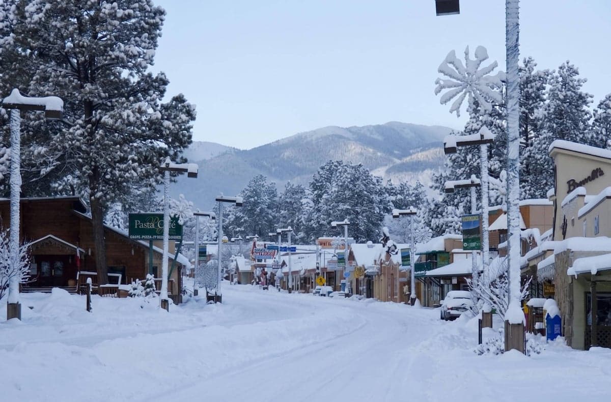
Strategic Assessment of Ruidoso, NM
Workable tactical position. Some exposure to population density or targets, but generally defensible in a crisis.
What does the Strategic Assessment tell us?
Our Strategic Assessment grades tactical survivability of an area. Major population centers, military targets, fallout zones, natural disasters, and border exposure all drive risk — lower exposure means a more defensible position in a crisis.
This is heavily inspired by Joel Skousen's Strategic Relocation book. Highly recommended you checkout the book ($)What does this tell us?
Our Strategic Assessment grades tactical survivability of an area. Major population centers, military targets, fallout zones, natural disasters, and border exposure all drive risk — lower exposure means a more defensible position in a crisis.
This is heavily inspired by Joel Skousen's Strategic Relocation book. Highly recommended you checkout the book ($)Strategic Pillars

Key Distances
Regional Safe Places
Below is our recommended "safe zones" in New Mexico and the surrounding area based on our strategic heuristics. For most people, it's unrealistic to live in a “safe zone” full-time due to work, family or other personal reasons. They tend to be more rural. However, many of these areas are perfect for second homes and retreat properties that double as a vacation home or even a short-term rental.

Important Note: For informational purposes only. This does not mean nothing bad ever happens in the green zones. Please use common sense. This is based on public data and modeled with AI. We tried to take a conservative approach but mistakes happen. We update this regularly as new information becomes available.
Solar Generator Recommendations
Backup power matters more here than in safer locations. We've picked three solar generators across budgets and capacity tiers — start with the budget unit if you only need a few essentials, or step up if you want to run a fridge and HVAC for days at a time.

Jackery Portable Power Station Explorer 300
Budget OptionPower on the Go: Weighing only 11 lbs, it's convenient to set up and store with book-sized foldable solar panels

BLUETTI Portable Power Station AC180
Designed for both indoor and outdoor scenarios, AC180 is highly capable as it has a robost capacity and continuous output power.

EF ECOFLOW DELTA Pro Ultra Power Station
Upgraded PickEcoFlow DELTA Pro Ultra is a whole-home energy system designed to grow with your family. Integrated with the Smart Home Panel 2, it scales to meet your evolving energy needs — keeping your home powered, intelligent, and secure through every stage of life.
We earn a commission, at no additional cost to you.
Strategic Assessment Analysis
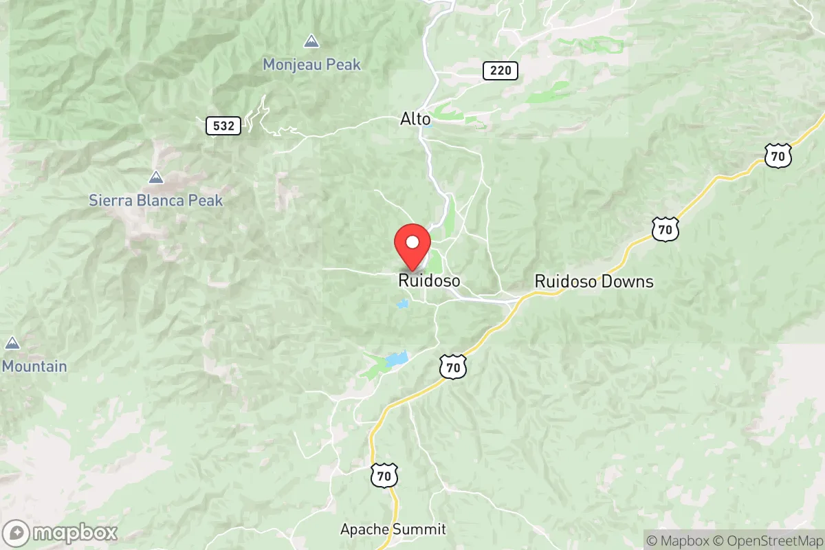
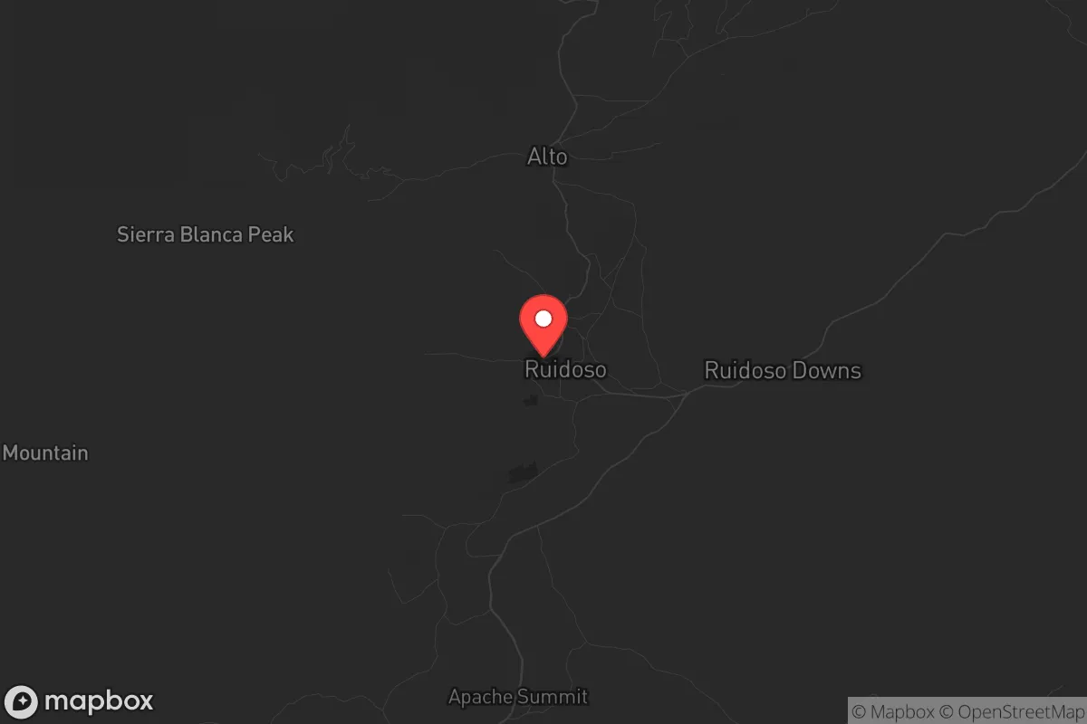
Ruidoso, New Mexico, sits at 6,900 feet in the Sierra Blanca range, offering a strategic combination of altitude, isolation, and natural resources that appeals to those prioritizing long-term resilience. Its location roughly 120 miles from El Paso and 200 miles from Albuquerque places it outside the immediate blast and fallout zones of major population centers, while its position within the Lincoln National Forest provides a buffer of rugged terrain and limited access roads. For a relocator concerned with civic unrest, mass casualty events, or large-scale disasters, Ruidoso presents a defensible high-ground option with a year-round population of roughly 8,000 that can expand significantly during tourist seasons—a factor that cuts both ways for security planning.
Geographic position and natural advantages for long-term security
Ruidoso’s elevation and topography are its primary strategic assets. The village is nestled in a canyon at the base of Sierra Blanca Peak (12,003 feet), with the surrounding Lincoln National Forest covering over 1.1 million acres of mixed conifer and ponderosa pine. This terrain creates natural chokepoints: only three main routes—Sudderth Drive (NM-48), Mechem Drive (NM-48 south), and the Grindstone Canyon road—provide vehicle access, making the area inherently defensible against large-scale movement. The high altitude also means cooler summers and reliable snowpack, which feeds the Rio Ruidoso and its tributaries. For a prepper, this translates to a consistent surface water source that doesn’t rely on deep aquifer pumping, though treatment and storage are still necessary. The forest itself offers abundant firewood, game (mule deer, elk, turkey), and building materials, but note that the 2022 McBride Fire burned over 6,000 acres and destroyed 207 homes, underscoring that wildfire is the primary natural threat here—not civil unrest.
Risks, exposures, and proximity to fallout-relevant landmarks
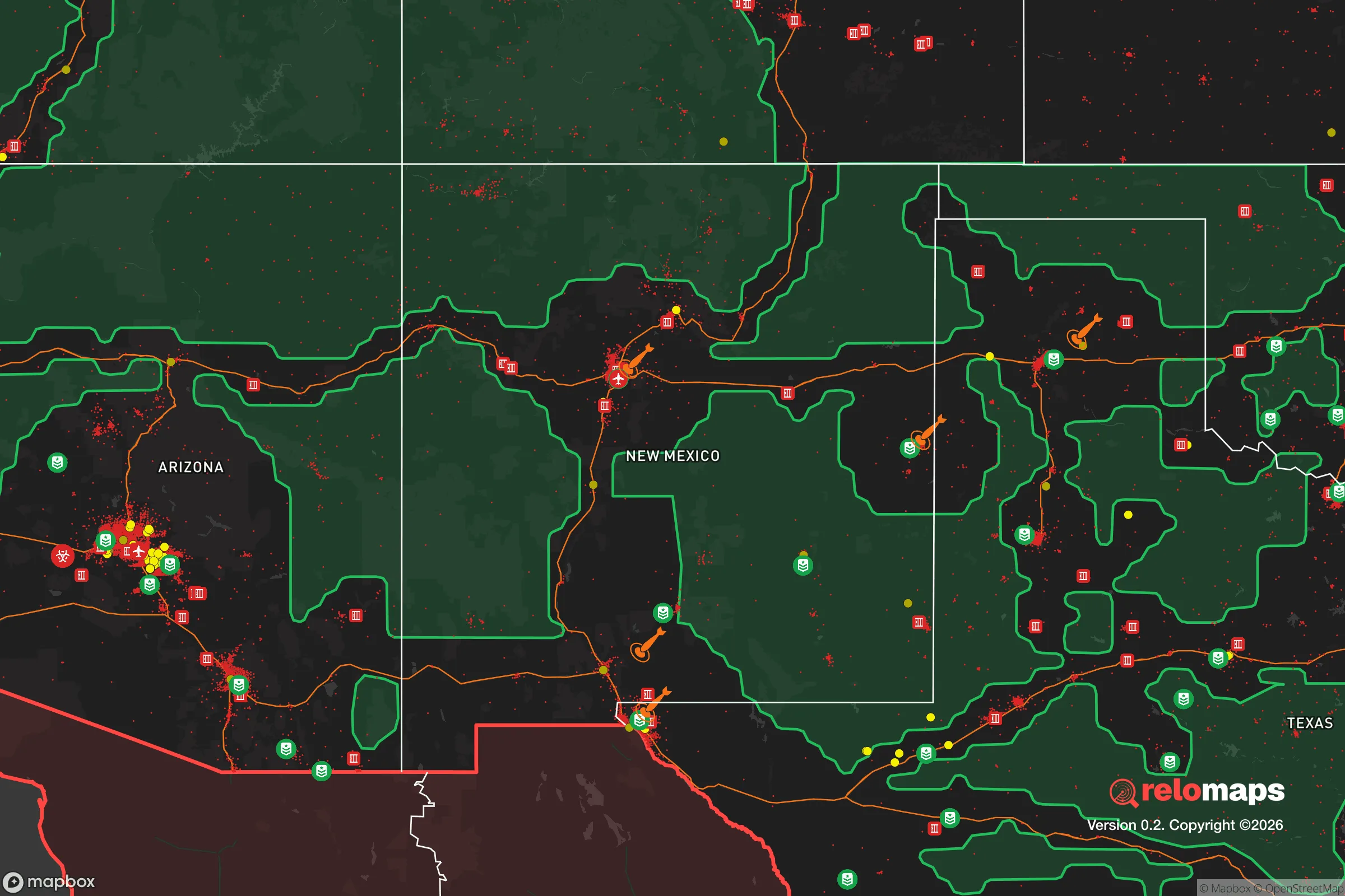
The most significant risk for Ruidoso is its proximity to Holloman Air Force Base, located 35 miles southwest near Alamogordo. Holloman is home to the 49th Wing, which operates MQ-9 Reaper drones and hosts the German Air Force Flying Training Center. In a conflict scenario involving strategic strikes, this base is a high-value target. The prevailing winds in the region blow from the southwest, meaning fallout from a strike on Holloman would likely travel northeast—directly toward Ruidoso. Additionally, White Sands Missile Range, 40 miles west, is a major testing facility for missile defense systems and conventional ordnance, adding another potential target. The Trinity Site, where the first atomic bomb was detonated, lies 60 miles north near Socorro; while not an active military installation, its historical significance makes it a possible symbolic target. For the survivalist, this means Ruidoso’s isolation is partially offset by its downwind position relative to two active military bases. A practical mitigation is to pre-position potassium iodide and have a sealed shelter plan, but the reality is that a direct hit on Holloman would likely render the area uninhabitable for weeks. The village itself has no industrial or nuclear facilities, so local fallout risks are limited to what drifts in from the southwest.
Practical resilience for a relocator: food, water, energy, and defensibility
Water is Ruidoso’s strongest resilience factor. The village draws from the Rio Ruidoso and the Grindstone Reservoir (a 50-acre impoundment), supplemented by several springs in the canyon. Annual precipitation averages 20 inches, with snowpack providing a natural reservoir through spring melt. For a relocator, installing a rainwater catchment system on a sloped roof is straightforward, and the forest service allows limited water collection permits. However, the municipal supply is vulnerable to wildfire ash contamination—after the 2022 McBride Fire, the village issued boil-water advisories for weeks. A private well is possible but expensive due to the rocky terrain; depths of 200-400 feet are common. Food resilience is moderate. The growing season is short (May to September) due to elevation, but cold-hardy crops like potatoes, kale, and root vegetables do well. Local game is plentiful, but hunting regulations are strict, and the forest service limits deer tags. For long-term food storage, the dry climate (average humidity 40%) is excellent for dehydrated goods, but summer monsoon humidity spikes can cause mold issues in basements. Energy is a mixed bag. The village is on the PNM grid, which has experienced rolling blackouts during winter storms (e.g., February 2021). Solar is viable—Ruidoso averages 280 sunny days per year—but snow accumulation on panels in winter requires manual clearing. Wind power is less reliable due to the canyon’s sheltering effect. Defensibility is high: the three main access roads can be monitored with minimal personnel, and the forest provides cover for perimeter security. The local sheriff’s office (Otero County) has a reputation for being pro-Second Amendment, and the village has no restrictive firearm ordinances. The nearest major hospital is Lincoln County Medical Center in Ruidoso Downs (5 miles), but it’s a small critical-access facility with limited trauma capability; for serious injuries, evacuation to El Paso or Albuquerque is required, which could be problematic during a grid-down event.
The overall strategic picture for Ruidoso is one of trade-offs. Its altitude, terrain, and water resources make it a strong candidate for a semi-autonomous retreat, especially for someone willing to invest in wildfire mitigation (defensible space, metal roofing, and a backup water pump). The proximity to Holloman AFB and White Sands is a genuine vulnerability that cannot be ignored—any relocator must have a plan for fallout sheltering or evacuation east toward Roswell or north toward Fort Sumner. The conservative lean of the local population (Otero County voted +24 R in 2024) aligns with a self-reliant mindset, and the village’s small size means fewer eyes on your activities. However, the tourist economy (horse racing, skiing, casinos) means that during peak seasons, the population can swell to 25,000, creating temporary supply chain strain and increased traffic on the choke points. For the survivalist, Ruidoso works best as a secondary location—a place to ride out a regional crisis rather than a full-time bug-out destination—provided you have a plan for the military base risk and the wildfire season. It’s not a fortress, but it’s a solid piece of high ground in a state that offers plenty of both.
* Values derived from national, state, county, city and local statistics and may differ in a specific area. Last updated: 2026-04-19T07:04:39.000Z
Narrative content on this page is AI-generated and may contain mistakes. Verify any details that matter before acting on them.
ReloMaps may earn a commission from affiliate links at no extra cost to you.