Photo: Wikipedia
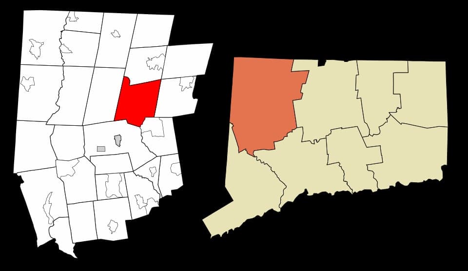
Strategic Assessment of Torrington, CT
Multiple tactical vulnerabilities. Population density, target proximity, or disaster risk are likely compounding. A retreat property and exit planning is required.
What does the Strategic Assessment tell us?
Our Strategic Assessment grades tactical survivability of an area. Major population centers, military targets, fallout zones, natural disasters, and border exposure all drive risk — lower exposure means a more defensible position in a crisis.
This is heavily inspired by Joel Skousen's Strategic Relocation book. Highly recommended you checkout the book ($)What does this tell us?
Our Strategic Assessment grades tactical survivability of an area. Major population centers, military targets, fallout zones, natural disasters, and border exposure all drive risk — lower exposure means a more defensible position in a crisis.
This is heavily inspired by Joel Skousen's Strategic Relocation book. Highly recommended you checkout the book ($)Strategic Pillars

Key Distances
Regional Safe Places
Below is our recommended "safe zones" in Connecticut and the surrounding area based on our strategic heuristics. For most people, it's unrealistic to live in a “safe zone” full-time due to work, family or other personal reasons. They tend to be more rural. However, many of these areas are perfect for second homes and retreat properties that double as a vacation home or even a short-term rental.


Important Note: For informational purposes only. This does not mean nothing bad ever happens in the green zones. Please use common sense. This is based on public data and modeled with AI. We tried to take a conservative approach but mistakes happen. We update this regularly as new information becomes available.
Solar Generator Recommendations
Backup power matters more here than in safer locations. We've picked three solar generators across budgets and capacity tiers — start with the budget unit if you only need a few essentials, or step up if you want to run a fridge and HVAC for days at a time.

Jackery Portable Power Station Explorer 300
Budget OptionPower on the Go: Weighing only 11 lbs, it's convenient to set up and store with book-sized foldable solar panels

BLUETTI Portable Power Station AC180
Designed for both indoor and outdoor scenarios, AC180 is highly capable as it has a robost capacity and continuous output power.

EF ECOFLOW DELTA Pro Ultra Power Station
Upgraded PickEcoFlow DELTA Pro Ultra is a whole-home energy system designed to grow with your family. Integrated with the Smart Home Panel 2, it scales to meet your evolving energy needs — keeping your home powered, intelligent, and secure through every stage of life.
We earn a commission, at no additional cost to you.
Strategic Assessment Analysis
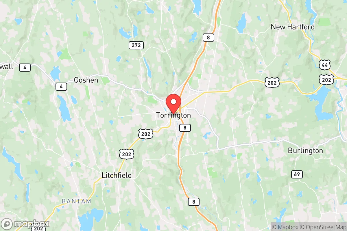
Torrington, Connecticut, offers a strategic paradox for the conservative prepper: it sits far enough from the major coastal population centers to avoid the immediate crush of a collapse event, yet it remains close enough to critical infrastructure and supply routes to be viable for long-term resupply and relocation. Nestled in the Litchfield Hills, this former industrial hub of roughly 35,000 people provides a blend of rural buffer and small-city utility that is increasingly rare in the Northeast. Its position along the Naugatuck River Valley, with the Appalachian Trail running just to the west, gives it natural chokepoints and defensible terrain that a savvy relocator can leverage.
Geographic position and natural defensive advantages
Torrington’s primary strategic asset is its location in the foothills of the Berkshire Mountains, roughly 25 miles west of Hartford and 30 miles east of the New York state line. This places it outside the immediate blast radius of any major metropolitan target—New York City is about 90 miles south, Boston about 130 miles east—while still being within a day’s drive of both. The terrain is hilly and wooded, with the Naugatuck River cutting through the center, providing natural barriers to rapid movement. The area’s elevation, averaging around 800 feet, offers good line-of-sight for observation and communication, and the surrounding state forests (Paugnut, Burr Pond, and Mohawk) create a green buffer that would slow any large-scale movement of people or vehicles. For a prepper, this means you can see trouble coming from a distance, and the road network—primarily Routes 8, 4, and 202—offers multiple egress routes if you need to bug out further north or west into the Adirondacks or the Catskills.
Risks, exposures, and proximity to fallout-relevant landmarks
The biggest risk for Torrington is its proximity to the New York City metro area and the Connecticut coastline, both of which are high-probability targets for a nuclear or EMP event. While Torrington itself is not a primary target, the fallout plume from a strike on New York City could drift north and east, depending on wind patterns, potentially contaminating the Naugatuck Valley. The Indian Point Energy Center in Buchanan, NY (about 60 miles southwest) is a known strategic target; a strike there would send a radioactive cloud over much of western Connecticut. Additionally, the Bradley International Airport in Windsor Locks (about 30 miles east) and the submarine base in Groton (about 70 miles southeast) are secondary targets that could draw fallout or create refugee flows. On the plus side, Torrington is far enough from these points that you’d have at least a few hours to hours to react before any ground-level effects. The real concern is the refugee wave from the I-84 and Route 8 corridors—if New York City or Hartford collapses, tens of thousands of people will pour north and west, and Torrington sits right in the funnel. You need to plan for a scenario where the town’s population doubles or triples overnight, straining food, water, and medical resources.
Practical resilience for a relocator: food, water, energy, and defensibility
For a relocator looking to set up a long-term homestead, Torrington offers a mixed bag. The water situation is decent: the Naugatuck River is perennial, and there are numerous small lakes and reservoirs (Burr Pond, Tyler Lake, Highland Lake) within a 15-minute drive. However, the river itself is industrial in its lower reaches—historic brass and chemical manufacturing left a legacy of heavy metal contamination in the sediment. You cannot rely on the Naugatuck for drinking water without serious filtration or distillation. Better to tap into a private well or a spring-fed pond on the higher ground east of town. The soil in the Litchfield Hills is rocky and acidic, typical of New England, so large-scale gardening will require raised beds and soil amendment. The growing season is short (about 150 days), but you can get a solid yield of cold-hardy crops like potatoes, kale, and root vegetables.
Energy is a bright spot. The area has good wind potential on the ridges, and solar works well on south-facing slopes, though winter cloud cover will cut production by 60-70%. Wood is abundant—the surrounding forests are mostly mixed hardwoods (oak, maple, birch), providing excellent fuel for heating and cooking. Every prepper in this region should have a wood stove and a chainsaw as a baseline. The local power grid is served by Eversource, which has a history of outages during winter storms; a backup generator or solar-battery system is non-negotiable. For defensibility, the terrain works in your favor. The hills and narrow valleys create natural chokepoints on the main roads, and the dense forest provides cover for perimeter security. The town itself has a small police force (about 50 officers) and a volunteer fire department, but in a collapse scenario, you’ll be relying on your own group and your neighbors. The local gun culture is present but not as pronounced as in rural Pennsylvania or the South; you can still buy firearms and ammunition at local shops like The Gun Store in Torrington, but expect higher prices and more regulation than in free states.
Medical resilience is a weak point. Charlotte Hungerford Hospital is a small community hospital with a Level III trauma center—adequate for routine emergencies but not for mass casualty events. If you have a chronic condition or need specialized care, you’ll need to plan for a 45-minute drive to Hartford or a 90-minute drive to New Haven. Stockpiling prescription medications and learning basic field medicine is essential. The local food supply is better than in the cities: there are several farms and farmers’ markets in the area (e.g., Litchfield County farmers’ markets), and the nearby towns of Goshen and Cornwall have active agricultural communities. But don’t count on the grocery stores—the two main supermarkets (Stop & Shop and Big Y) will empty out within 48 hours of a crisis. You need to establish direct relationships with local farmers and hunters now, not when the shelves are bare.
The overall strategic picture for a conservative relocator
Torrington is not a prepper paradise—it’s a compromise. You get the benefits of a rural buffer, defensible terrain, and decent natural resources, but you also inherit the risks of being in a blue state with high taxes, restrictive gun laws, and proximity to major target zones. The state’s political climate is a real concern: Connecticut has some of the strictest firearm regulations in the country, a high cost of living, and a tax burden that will eat into your prepping budget. If you’re looking for a place to ride out a long-term collapse while maintaining access to the Northeast’s economic and cultural resources, Torrington is a viable option. But if you’re serious about total self-sufficiency and political freedom, you’d be better off looking at New Hampshire, Vermont, or western Pennsylvania. The bottom line: Torrington works as a staging ground or a temporary refuge, not a final redoubt. It’s a place to wait out the first 90 days of a crisis, assess the situation, and then decide whether to dig in or move further north. Plan accordingly, and don’t get complacent just because the hills are pretty.
* Values derived from national, state, county, city and local statistics and may differ in a specific area. Last updated: 2026-04-19T08:11:33.000Z
Narrative content on this page is AI-generated and may contain mistakes. Verify any details that matter before acting on them.
ReloMaps may earn a commission from affiliate links at no extra cost to you.