
Photo: Wikipedia
Strategic Assessment of Goshen County
Deep buffer from population centers and strategic targets. Low natural disaster risk and minimal exposure to border or coastal threats.
What does the Strategic Assessment tell us?
Our Strategic Assessment grades tactical survivability of an area. Major population centers, military targets, fallout zones, natural disasters, and border exposure all drive risk — lower exposure means a more defensible position in a crisis.
This is heavily inspired by Joel Skousen's Strategic Relocation book. Highly recommended you checkout the book ($)What does this tell us?
Our Strategic Assessment grades tactical survivability of an area. Major population centers, military targets, fallout zones, natural disasters, and border exposure all drive risk — lower exposure means a more defensible position in a crisis.
This is heavily inspired by Joel Skousen's Strategic Relocation book. Highly recommended you checkout the book ($)Strategic Pillars

Key Distances
Strategic Assessment Analysis
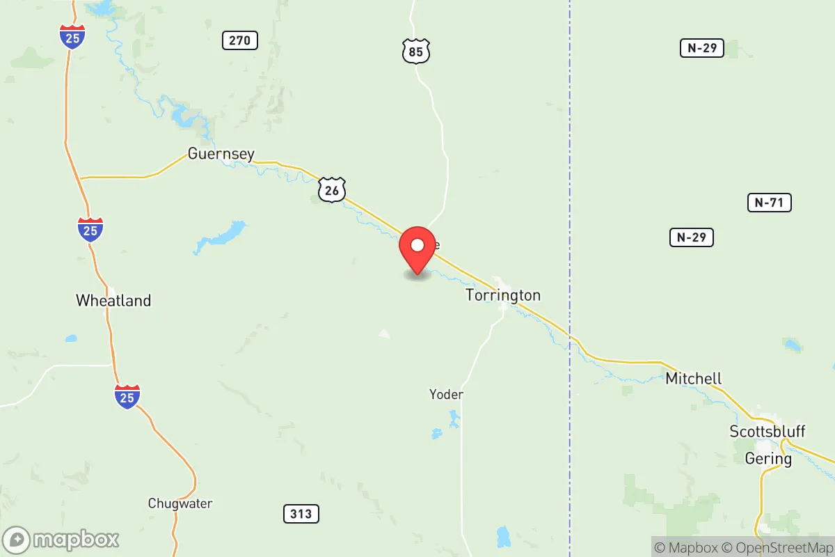
Goshen County, Wyoming, sits in a sweet spot that few relocation analysts talk about openly: far enough from the nation’s crumbling urban cores to dodge the worst of civic unrest, yet close enough to the Front Range’s logistical arteries to keep supply chains viable when things go sideways. With a population density of roughly four people per square mile and the North Platte River cutting through its heart, this county offers a blend of agricultural self-sufficiency and geographic isolation that appeals to those thinking beyond the next election cycle. The county seat of Torrington anchors a region where the nearest major metro—Cheyenne—is 80 miles west, and Denver’s sprawl sits a manageable but buffer-strong 150 miles south. For a relocator weighing fallout risks, food security, and defensibility, Goshen County presents a strategic option that rewards preparation without requiring a bunker mentality.
Geographic position and natural advantages for long-term security
Goshen County’s location along the Nebraska border places it in a corridor that historically served as a migration route—the Oregon Trail ran through here—and that same geography now offers a quiet escape from the Interstate-25 chaos that clogs Colorado and southern Wyoming. The county’s eastern edge touches the Nebraska Panhandle, meaning you’re not boxed in by a single state’s policies or disaster response failures. The North Platte River provides a reliable surface water source that doesn’t depend on municipal treatment plants, and the surrounding High Plains aquifer supports irrigation for the county’s 1,200+ farms and ranches. Torrington’s municipal water system draws from the river, but savvy relocators will note that private wells are common and legally straightforward to drill. The terrain is rolling prairie with occasional buttes—no dense forests to fuel wildfires, but enough elevation change to offer natural sightlines for security. Winter temperatures average in the teens, which discourages transient populations and forces a level of self-reliance that urban transplants often underestimate.
Risks, exposures, and proximity to fallout-relevant landmarks
No county is a fortress, and Goshen County has specific vulnerabilities that a prepper must acknowledge. The most immediate concern is the Fort Laramie National Historic Site, located just west of the county line—a tourist draw that could become a FEMA staging ground or a refugee choke point during a national emergency. More critically, the Union Pacific rail line runs through the southern part of the county, carrying hazardous materials from the Powder River Basin coal fields and, potentially, military logistics from F.E. Warren Air Force Base in Cheyenne, which houses ICBM silos. A strike on those silos—roughly 100 miles west—would produce fallout that could drift over Goshen County depending on wind patterns. The county’s proximity to Scottsbluff, Nebraska (just 30 miles east) introduces a small city of 15,000 that could become a secondary evacuation destination if Denver collapses, straining local resources. On the plus side, there are no refineries, nuclear power plants, or major chemical storage facilities within 50 miles. The Lusk Municipal Airport to the north is too small for heavy military traffic, and the county’s lack of interstate highway access (I-25 stays west, I-80 stays south) means mass migration flows will likely bypass it. The real risk is not a direct hit but the secondary wave of desperate people moving through rural corridors when urban systems fail.
Practical resilience for a relocator: food, water, energy, and defensibility
For a single individual or a family willing to put in the work, Goshen County offers a resilience profile that beats 90% of the country. Food production is the standout: the county is the top dry bean producer in Wyoming, with substantial corn, alfalfa, and wheat crops. Torrington hosts a Farmers Cooperative that supplies seed, fertilizer, and equipment, and the local 4-H and FFA programs mean a deep cultural knowledge of small-scale agriculture. A relocator with a quarter-acre garden and a few chickens can achieve meaningful food independence within one growing season. Water is the Achilles’ heel of the West, but Goshen County’s irrigation infrastructure—canals, ditches, and the Gering-Fort Laramie Irrigation District—provides a decentralized system that doesn’t rely on a single treatment plant. Private well drilling runs about $15–$25 per foot, with water typically found at 100–200 feet. Energy is less rosy: the grid is served by Rocky Mountain Power, which relies on coal and natural gas plants in the region. Solar is viable (the county averages 220 sunny days per year), but winter snow cover requires panel tilting. Backup propane is common, and wood heating is feasible if you own land with cottonwood or juniper stands. Defensibility comes from the county’s low population and wide-open spaces—you can see a vehicle approaching from miles away on most rural roads. The Goshen County Sheriff’s Office has a response time of 15–30 minutes in remote areas, so personal security is your responsibility. Neighbors are generally armed and self-reliant, which creates a de facto mutual-aid network that urbanites find jarring but effective.
The strategic picture for Goshen County is one of calculated trade-offs. You trade the convenience of urban infrastructure for a buffer against the chaos that follows systemic failure. The county’s agricultural base, water access, and low profile make it a strong candidate for a relocation that prioritizes long-term survival over short-term comfort. But the risks are real: fallout from F.E. Warren, pressure from Scottsbluff and Cheyenne during a crisis, and the harsh winter climate that will test anyone not accustomed to rural life. For the conservative-minded relocator who sees the current trajectory as unstable and wants a place where preparation actually matters, Goshen County offers a defensible, productive, and quiet corner of the map. It’s not a retreat from the world—it’s a position from which to ride out the storm and rebuild on your own terms.
* Values derived from national, state, county, city and local statistics and may differ in a specific area. Last updated: 2026-05-14T07:44:20.000Z
Narrative content on this page is AI-generated and may contain mistakes. Verify any details that matter before acting on them.
ReloMaps may earn a commission from affiliate links at no extra cost to you.