Photo: Wikipedia
Strategic Assessment of Bay City, MI
Meaningful friction. Expect exposure to either population pressure, blast zones, or natural disaster risk. Consider buying a retreat property.
What does the Strategic Assessment tell us?
Our Strategic Assessment grades tactical survivability of an area. Major population centers, military targets, fallout zones, natural disasters, and border exposure all drive risk — lower exposure means a more defensible position in a crisis.
This is heavily inspired by Joel Skousen's Strategic Relocation book. Highly recommended you checkout the book ($)What does this tell us?
Our Strategic Assessment grades tactical survivability of an area. Major population centers, military targets, fallout zones, natural disasters, and border exposure all drive risk — lower exposure means a more defensible position in a crisis.
This is heavily inspired by Joel Skousen's Strategic Relocation book. Highly recommended you checkout the book ($)Strategic Pillars

Key Distances
Regional Safe Places
Below is our recommended "safe zones" in Michigan and the surrounding area based on our strategic heuristics. For most people, it's unrealistic to live in a “safe zone” full-time due to work, family or other personal reasons. They tend to be more rural. However, many of these areas are perfect for second homes and retreat properties that double as a vacation home or even a short-term rental.


Important Note: For informational purposes only. This does not mean nothing bad ever happens in the green zones. Please use common sense. This is based on public data and modeled with AI. We tried to take a conservative approach but mistakes happen. We update this regularly as new information becomes available.
Solar Generator Recommendations
Backup power matters more here than in safer locations. We've picked three solar generators across budgets and capacity tiers — start with the budget unit if you only need a few essentials, or step up if you want to run a fridge and HVAC for days at a time.

Jackery Portable Power Station Explorer 300
Budget OptionPower on the Go: Weighing only 11 lbs, it's convenient to set up and store with book-sized foldable solar panels

BLUETTI Portable Power Station AC180
Designed for both indoor and outdoor scenarios, AC180 is highly capable as it has a robost capacity and continuous output power.

EF ECOFLOW DELTA Pro Ultra Power Station
Upgraded PickEcoFlow DELTA Pro Ultra is a whole-home energy system designed to grow with your family. Integrated with the Smart Home Panel 2, it scales to meet your evolving energy needs — keeping your home powered, intelligent, and secure through every stage of life.
We earn a commission, at no additional cost to you.
Strategic Assessment Analysis
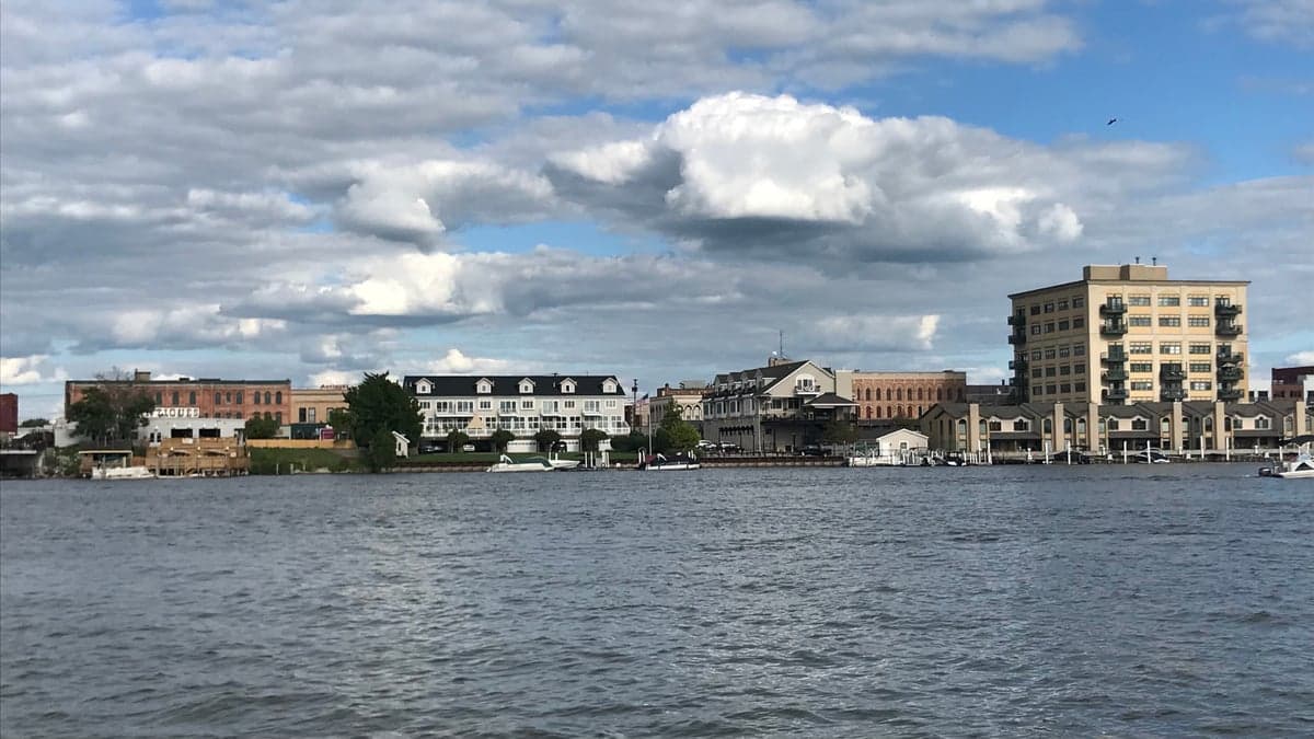
Bay City, Michigan, presents a mixed strategic picture for the conservative prepper or survivalist. Its location on the Saginaw Bay offers significant natural advantages, but its proximity to major industrial and population centers introduces real vulnerabilities. The city’s resilience is tied directly to its ability to leverage its position as a secondary hub—close enough to resources, far enough from the blast zones. For a relocator prioritizing self-sufficiency and security, Bay City is a candidate that demands careful, clear-eyed assessment, not blind optimism.
Geographic position and natural advantages for long-term survival
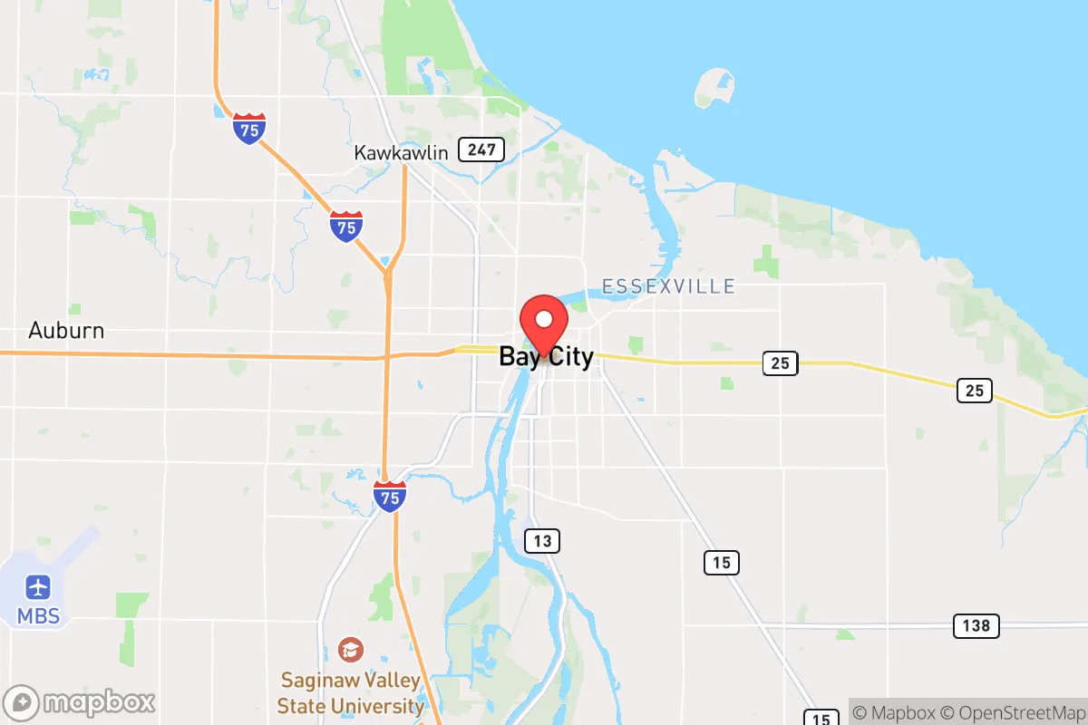
Bay City sits at the head of the Saginaw Bay, roughly 100 miles north of Detroit and 80 miles north of Flint. This placement is a double-edged sword. The primary advantage is access to the Great Lakes watershed—specifically the Saginaw River and the bay itself. Fresh water is the single most critical resource in any collapse scenario, and Bay City has it in abundance. The surrounding region, including the "Thumb" of Michigan, is agricultural, with significant farmland producing corn, soybeans, and sugar beets. This means a local food supply chain that, while not immune to disruption, is far more robust than in urban centers. The area's relatively low population density—Bay County has roughly 103,000 people spread over 631 square miles—reduces the immediate pressure of mass migration from a major city. The flat, open terrain is not ideal for defensible positions, but it does offer clear lines of sight and limited natural cover for potential threats. The proximity to Lake Huron also provides a potential waterborne escape route or supply corridor, though this requires boat access and fuel.
Risks, exposures, and proximity to fallout-relevant landmarks
The most significant risk for Bay City is its proximity to the Saginaw Valley's industrial corridor. The area is home to several chemical plants, refineries, and manufacturing facilities, particularly along the river. A major industrial accident, terrorist attack, or wartime strike on these facilities could produce toxic plumes or secondary hazards. More critically, Bay City is within the fallout zone of potential targets in Detroit, Flint, and the Saginaw area itself. The prevailing westerly winds mean that fallout from a Detroit-area event would likely be carried east over Lake Erie and Ontario, but a strike on Flint or Saginaw—both within 30 miles—could directly contaminate Bay City. The city's location on the bay also makes it a potential secondary target for naval or aerial strikes aimed at disrupting Great Lakes shipping. For the prepper, this means that while Bay City is not a primary target, it is not a safe distance from multiple high-value targets. The risk of civil unrest is moderate; the local economy is tied to manufacturing and healthcare, and while not booming, it is not in a state of collapse. However, the city's demographic and economic profile suggests that a major crisis could trigger localized unrest, particularly around resource distribution points.
Practical resilience for a relocator: food, water, energy, and defensibility
For a relocator, Bay City offers a workable but not ideal baseline for self-sufficiency. Water is the strongest asset. The Saginaw River and the bay provide virtually unlimited fresh water, but it requires treatment. Boiling, filtration, or chemical treatment is mandatory due to agricultural runoff and industrial discharge. Rainwater collection is viable, with the region averaging 30 inches of precipitation annually. Food is a mixed bag. Local agriculture is strong, but the growing season is short (roughly 140 days). A prepper would need to establish a greenhouse or cold-frame system to extend production. Hunting and fishing are viable—deer, waterfowl, and fish are abundant—but competition from other survivors would be high. Energy is a vulnerability. The grid is aging and reliant on natural gas and coal. Solar is feasible but limited by winter cloud cover; a backup generator with stored fuel is essential. Wood heating is practical, as the region has ample forested areas, but sourcing and processing firewood requires labor and tools. Defensibility is the weakest point. The flat terrain and dense residential layout of Bay City proper make it difficult to secure a single property against a determined group. The best strategy is to locate on the outskirts—rural Bay County or into Arenac County to the north—where you can establish a perimeter and maintain low visibility. The city itself offers limited defensible positions; a rural homestead with a well, solar panels, and a woodlot is the superior option. The local population is generally self-reliant and conservative-leaning, which can be an asset for forming a mutual assistance group, but it also means that many locals are already prepared and may not welcome newcomers.
The overall strategic picture for Bay City is one of cautious viability. It is not a fortress, nor is it a wasteland. It offers a realistic middle ground for a relocator who wants to be near water and farmland but is willing to accept the risks of industrial proximity and limited defensibility. The key is to avoid the city center and instead secure a rural property within 20 miles of the bay. This gives you access to the water and agricultural resources while reducing your exposure to the primary risks. Bay City is a place to build a resilient life, not a bunker. It requires active preparation, community building, and a clear-eyed understanding that no location is perfect. For the conservative prepper who values self-sufficiency and community over isolation, Bay City is a serious candidate—but only if you treat it as a base for active resilience, not a passive retreat.
* Values derived from national, state, county, city and local statistics and may differ in a specific area. Last updated: 2026-04-19T05:50:32.000Z
Narrative content on this page is AI-generated and may contain mistakes. Verify any details that matter before acting on them.
ReloMaps may earn a commission from affiliate links at no extra cost to you.