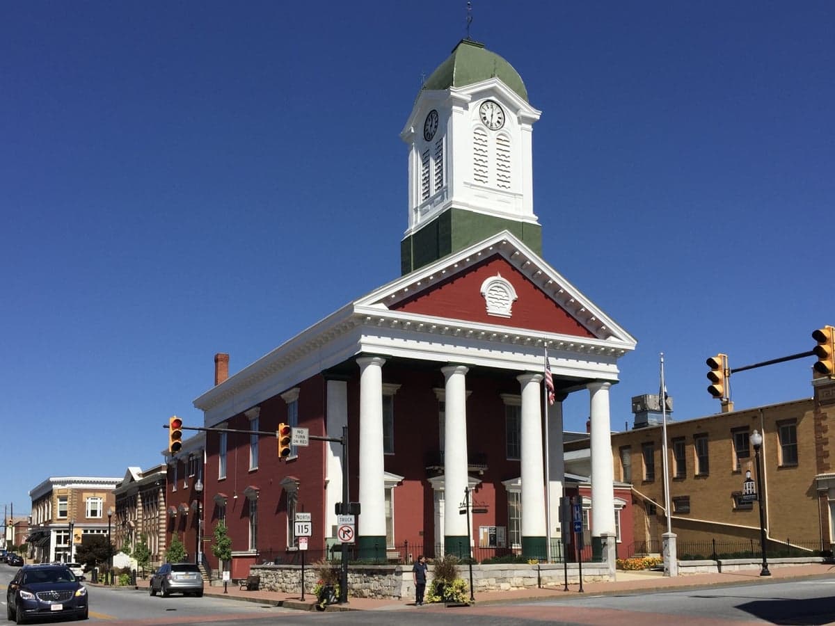

Photo: Wikipedia
Strategic Assessment of Charles Town, WV
Meaningful friction. Expect exposure to either population pressure, blast zones, or natural disaster risk. Consider buying a retreat property.
What does the Strategic Assessment tell us?
Our Strategic Assessment grades tactical survivability of an area. Major population centers, military targets, fallout zones, natural disasters, and border exposure all drive risk — lower exposure means a more defensible position in a crisis.
This is heavily inspired by Joel Skousen's Strategic Relocation book. Highly recommended you checkout the book ($)What does this tell us?
Our Strategic Assessment grades tactical survivability of an area. Major population centers, military targets, fallout zones, natural disasters, and border exposure all drive risk — lower exposure means a more defensible position in a crisis.
This is heavily inspired by Joel Skousen's Strategic Relocation book. Highly recommended you checkout the book ($)Strategic Pillars

Key Distances
Regional Safe Places
Below is our recommended "safe zones" in West Virginia and the surrounding area based on our strategic heuristics. For most people, it's unrealistic to live in a “safe zone” full-time due to work, family or other personal reasons. They tend to be more rural. However, many of these areas are perfect for second homes and retreat properties that double as a vacation home or even a short-term rental.


Important Note: For informational purposes only. This does not mean nothing bad ever happens in the green zones. Please use common sense. This is based on public data and modeled with AI. We tried to take a conservative approach but mistakes happen. We update this regularly as new information becomes available.
Solar Generator Recommendations
Backup power matters more here than in safer locations. We've picked three solar generators across budgets and capacity tiers — start with the budget unit if you only need a few essentials, or step up if you want to run a fridge and HVAC for days at a time.

Jackery Portable Power Station Explorer 300
Budget OptionPower on the Go: Weighing only 11 lbs, it's convenient to set up and store with book-sized foldable solar panels

BLUETTI Portable Power Station AC180
Designed for both indoor and outdoor scenarios, AC180 is highly capable as it has a robost capacity and continuous output power.

EF ECOFLOW DELTA Pro Ultra Power Station
Upgraded PickEcoFlow DELTA Pro Ultra is a whole-home energy system designed to grow with your family. Integrated with the Smart Home Panel 2, it scales to meet your evolving energy needs — keeping your home powered, intelligent, and secure through every stage of life.
We earn a commission, at no additional cost to you.
Strategic Assessment Analysis
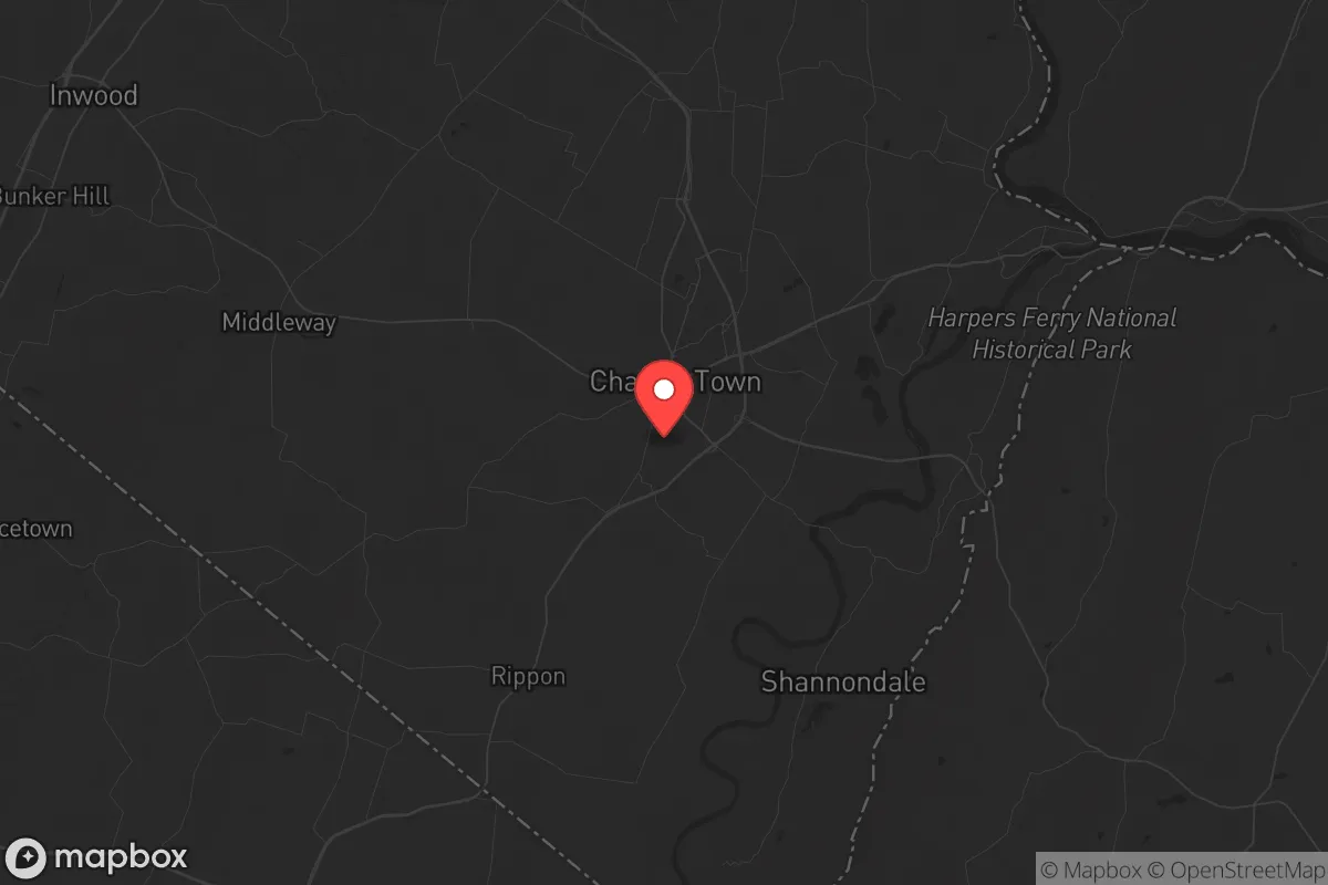
Charles Town, West Virginia, occupies a strategic niche that balances proximity to critical infrastructure with a buffer from the direct blast zones of major metropolitan targets. Its location in the eastern panhandle, roughly 65 miles from Washington, D.C., places it within a day’s drive of the nation’s capital while remaining outside the immediate fallout risk of a nuclear strike on D.C. or Baltimore. The town’s resilience stems from its position in the Shenandoah Valley, a historically defensible corridor with ample water, arable land, and multiple egress routes into the Appalachian spine. For a relocator with a prepper mindset, Charles Town offers a middle ground: close enough to monitor and access urban resources, yet far enough to avoid the worst of a cascading collapse.
Geographic position and natural advantages for long-term survival
Charles Town sits in Jefferson County, a region defined by the confluence of the Shenandoah and Potomac Rivers, providing abundant surface water and groundwater recharge. The surrounding terrain is rolling hills and limestone valleys, offering natural cover and defensible positions without the extreme isolation of deeper Appalachia. The area’s agricultural base is a genuine asset: Jefferson County has over 40,000 acres of farmland, including orchards, grain fields, and livestock operations, meaning local food production is not a theoretical exercise but a current reality. The climate is temperate, with four distinct seasons and an average annual rainfall of 40 inches, supporting rain-fed agriculture and reducing reliance on irrigation. The proximity to the Blue Ridge Mountains to the east and the Allegheny Front to the west creates multiple natural barriers that would slow movement and provide fallback positions if the eastern seaboard becomes compromised. For a relocator, this geography means you can establish a homestead with defensible sightlines, reliable water sources, and the ability to grow a significant portion of your own calories within a few growing seasons.
Risks, exposures, and proximity to fallout-relevant landmarks
The primary risk for Charles Town is its proximity to the Washington-Baltimore corridor, which is a high-priority target set for any strategic adversary. A ground burst on the Pentagon or Capitol would produce fallout that could reach Charles Town within 4-6 hours under prevailing westerly winds, depending on yield and atmospheric conditions. The town itself is not a likely first-strike target—it lacks military bases, major ports, or critical command infrastructure—but it sits within the secondary fallout zone for a strike on D.C. The nearby Jefferson County Airport is a small general aviation field, not a military installation, which reduces its targeting value. However, the area is bisected by Interstate 81, a major north-south logistics corridor that would become a choke point during any evacuation or crisis, potentially turning the town into a bottleneck for refugees fleeing the D.C. metro area. The presence of the Harpers Ferry National Historical Park and the Appalachian Trail corridor means the area is a known route for foot traffic, which could be a security concern during a breakdown of civil order. The risk profile is moderate: you are not in the kill zone, but you are in the zone of secondary effects—fallout, refugee flows, and supply chain disruption—that require serious preparation.
Practical resilience for a relocator: food, water, energy, and defensibility
Water is the strongest suit for Charles Town. The Shenandoah River runs along the county’s eastern edge, and the Potomac forms the northern boundary. Both are perennial, high-volume rivers that can be filtered and treated with portable systems. Groundwater is accessible via wells at depths of 50-150 feet in most of the county, with yields sufficient for a family homestead. The local water table is recharged by the karst limestone geology, which also creates natural springs—many of which are documented and can be developed with minimal infrastructure. Food resilience is above average: the county has a robust farmers’ market network, several CSA operations, and a strong tradition of deer hunting (the county issues over 1,000 deer management permits annually). The growing season runs from April to October, allowing for a diverse garden of vegetables, fruits, and grains. Energy is a mixed picture. The local grid is served by Potomac Edison, which has a history of storm-related outages, but the area has good solar exposure (average 4.5 peak sun hours per day) and ample wood for biomass heating. Natural gas is available in the town limits but not in rural areas, so a prepper should plan for a wood stove and solar array as primary backup. Defensibility is decent but not fortress-grade. The rolling terrain provides good fields of fire from elevated positions, and the many hollows and ridges offer concealment. However, the road network is dense enough that a determined group could approach from multiple directions. The ideal setup is a property on a dead-end road with a well, solar, and a clear view of the approach, preferably with a secondary egress via a forest service road or ATV trail. The local population is a mix of long-term residents, D.C. commuters, and second-home owners; the commuter segment would likely evacuate or become non-functional during a crisis, reducing the density of potential threats.
The overall strategic picture for Charles Town is one of calculated risk. It is not a remote bug-out location in the Idaho wilderness, nor is it a fortified compound in the desert. It is a working agricultural county with a real economy, real water, and real defensible terrain, sitting just outside the blast radius of a major target. The trade-off is that you must be prepared for refugee flows, potential fallout from a D.C. strike, and the general chaos of a region that is both a corridor and a destination. For a relocator who wants to maintain a connection to the Eastern Seaboard’s resources—medical care, specialized equipment, intelligence—while having a viable fallback position, Charles Town is a solid choice. The key is to arrive with a plan: secure a property with a well and a wood stove, establish a garden and a seed bank, and build relationships with the local farming community before the crisis hits. The area’s resilience is not automatic; it requires active preparation. But the raw ingredients—water, soil, terrain, and distance from the bullseye—are all present. If you are looking for a place that is not the first to burn but is not the last to be forgotten, Charles Town warrants a serious look.
* Values derived from national, state, county, city and local statistics and may differ in a specific area. Last updated: 2026-04-23T05:31:28.000Z
Narrative content on this page is AI-generated and may contain mistakes. Verify any details that matter before acting on them.
ReloMaps may earn a commission from affiliate links at no extra cost to you.