Photo: Wikipedia
Strategic Assessment of Frostburg, MD
Meaningful friction. Expect exposure to either population pressure, blast zones, or natural disaster risk. Consider buying a retreat property.
What does the Strategic Assessment tell us?
Our Strategic Assessment grades tactical survivability of an area. Major population centers, military targets, fallout zones, natural disasters, and border exposure all drive risk — lower exposure means a more defensible position in a crisis.
This is heavily inspired by Joel Skousen's Strategic Relocation book. Highly recommended you checkout the book ($)What does this tell us?
Our Strategic Assessment grades tactical survivability of an area. Major population centers, military targets, fallout zones, natural disasters, and border exposure all drive risk — lower exposure means a more defensible position in a crisis.
This is heavily inspired by Joel Skousen's Strategic Relocation book. Highly recommended you checkout the book ($)Strategic Pillars

Key Distances
Regional Safe Places
Below is our recommended "safe zones" in Maryland and the surrounding area based on our strategic heuristics. For most people, it's unrealistic to live in a “safe zone” full-time due to work, family or other personal reasons. They tend to be more rural. However, many of these areas are perfect for second homes and retreat properties that double as a vacation home or even a short-term rental.


Important Note: For informational purposes only. This does not mean nothing bad ever happens in the green zones. Please use common sense. This is based on public data and modeled with AI. We tried to take a conservative approach but mistakes happen. We update this regularly as new information becomes available.
Solar Generator Recommendations
Backup power matters more here than in safer locations. We've picked three solar generators across budgets and capacity tiers — start with the budget unit if you only need a few essentials, or step up if you want to run a fridge and HVAC for days at a time.

Jackery Portable Power Station Explorer 300
Budget OptionPower on the Go: Weighing only 11 lbs, it's convenient to set up and store with book-sized foldable solar panels

BLUETTI Portable Power Station AC180
Designed for both indoor and outdoor scenarios, AC180 is highly capable as it has a robost capacity and continuous output power.

EF ECOFLOW DELTA Pro Ultra Power Station
Upgraded PickEcoFlow DELTA Pro Ultra is a whole-home energy system designed to grow with your family. Integrated with the Smart Home Panel 2, it scales to meet your evolving energy needs — keeping your home powered, intelligent, and secure through every stage of life.
We earn a commission, at no additional cost to you.
Strategic Assessment Analysis
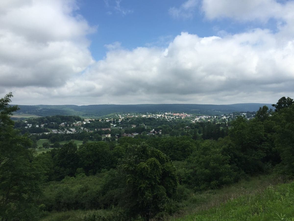
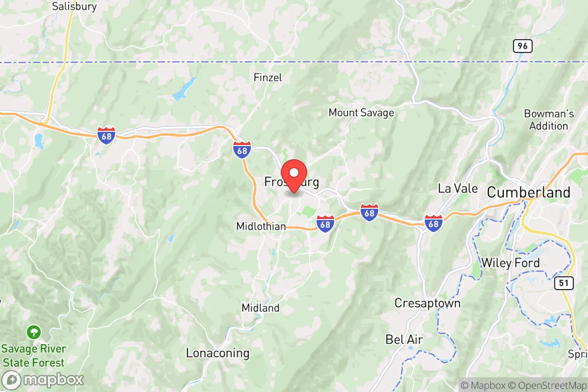
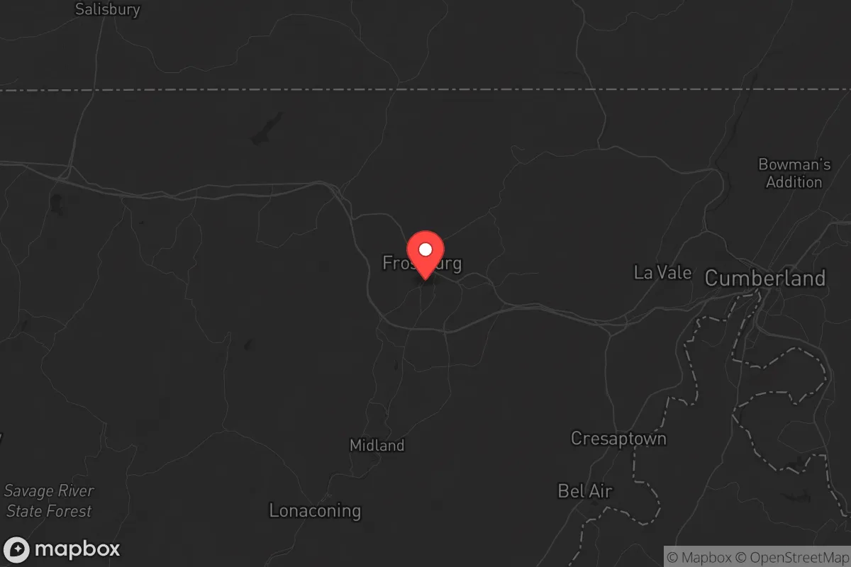
Frostburg, Maryland, sits in a sweet spot for those thinking long-term about resilience: it’s remote enough to avoid the worst of urban collapse, yet connected enough to access resources when things go sideways. Nestled in the Allegheny Mountains of western Maryland, this small town of roughly 8,500 people offers a strategic buffer from the chaos of the I-95 corridor, while still being within a few hours of critical infrastructure. For a conservative-leaning relocator—whether single or raising a family—Frostburg presents a defensible, low-profile base that leverages topography and distance from major population centers as its primary advantages.
Geographic position and natural advantages for long-term security
Frostburg’s location is its strongest card. Perched at about 2,000 feet elevation in the Appalachian Plateau, the town sits on a ridge that provides natural observation points and limits approach routes—a classic defensive terrain feature. The surrounding Savage River State Forest and Green Ridge State Forest offer over 100,000 acres of public land for hunting, foraging, and off-grid movement if needed. The area’s water supply is robust: the nearby Savage River and the Potomac River watershed provide reliable surface water, and the region’s high annual rainfall (around 40 inches) means wells and springs are generally dependable. For a prepper, this means you’re not dependent on a single municipal tap that could be compromised in a crisis. The town’s position also puts it roughly 90 minutes from Pittsburgh and two hours from Washington, D.C.—close enough to monitor events or access supplies, but far enough that a major urban evacuation or riot won’t wash over your doorstep. The Appalachian Trail runs just east of town, offering a potential bug-out corridor or resupply route that avoids major highways.
Risks, exposures, and proximity to fallout-relevant landmarks
No location is perfect, and Frostburg has its share of strategic liabilities. The most obvious is its proximity to the Washington, D.C.-Baltimore metropolitan area, home to over 8 million people and a prime target for civil unrest, terrorist attacks, or a grid-down scenario. In the event of a major event—say, a coordinated attack on federal infrastructure or a pandemic-driven collapse—Frostburg could see a surge of refugees fleeing the I-95 corridor. The town sits along Interstate 68, a major east-west route that connects to I-70 and I-81, meaning it’s a natural funnel for traffic. That’s a double-edged sword: it gives you an escape route, but also makes the town a potential chokepoint. Additionally, the nearby Allegany County contains the Rocky Gap State Park and a federal prison (FCI Cumberland), which could become a security concern during widespread unrest—prison populations don’t disappear when the lights go out. There’s also the small but real risk of industrial accidents from the Marcellus Shale gas fields to the west, though Frostburg itself sits outside the primary drilling zones. No nuclear plants are within 50 miles, which is a plus, but the region’s coal-fired power plants (like the now-closed Warrior Run plant) mean residual environmental contamination in the soil and water is a long-term consideration.
Practical resilience for a relocator: food, water, energy, and defensibility
For someone serious about self-sufficiency, Frostburg offers a workable foundation. The local food system is anchored by small farms and farmers’ markets—the Frostburg Farmers Market runs seasonally, and you can source produce, eggs, and meat from nearby producers like the Mount Savage Farm or the Allegany County Farm Bureau. Growing your own food is viable: the growing season is short (about 150 frost-free days) but the soil in the valleys is decent, and deer, turkey, and small game are abundant in the surrounding forests. Water is the bigger win—most homes in the area have access to well water, and the municipal system draws from the Savage River Reservoir, which is gravity-fed and less vulnerable to power outages. For energy, the region’s wind and solar potential is moderate; you’ll get about 4.5 peak sun hours per day, enough for a modest off-grid setup, and the elevation means consistent wind for small turbines. The town itself is compact and walkable, with a historic downtown that’s defensible in a grid-down scenario—narrow streets and brick buildings offer natural cover. But defensibility cuts both ways: the town’s layout is linear along the I-68 corridor, meaning a single blocked road (like the National Highway or MD-36) could isolate you from the rest of the county. For a family, the local schools (Frostburg Elementary and Mountain Ridge High School) are small and community-oriented, which is a plus for social cohesion during a crisis, but the nearest hospital (UPMC Western Maryland in Cumberland) is 15 minutes away—adequate for routine care, but not a trauma center for mass casualty events.
Overall strategic picture: a low-key base with manageable trade-offs
Frostburg isn’t a fortress, and it won’t shield you from every threat. But for a conservative relocator who wants to stay under the radar while maintaining access to resources, it’s a solid bet. The town’s isolation from the I-95 madness, combined with reliable water, decent farmland, and a community that still values self-reliance (the local gun culture is strong, and the Allegany County Sheriff’s Office is pro-Second Amendment), makes it a viable long-term base. The biggest risk is the refugee funnel from the east—if D.C. or Baltimore implodes, Frostburg will feel the pressure. But with proper planning—stockpiling supplies, establishing a local network, and having a secondary bug-out location deeper into the Alleghenies—you can mitigate that. The cost of living is low (median home price around $150,000), property taxes are reasonable (about 1.1% of assessed value), and the local economy is stable enough to support remote work or a small business. For a single person or a family looking to plant roots in a place that won’t be the first to burn, Frostburg deserves a serious look. Just don’t expect it to be a secret forever—more people are waking up to the value of these mountain towns every year.
* Values derived from national, state, county, city and local statistics and may differ in a specific area. Last updated: 2026-04-22T02:14:30.000Z
Narrative content on this page is AI-generated and may contain mistakes. Verify any details that matter before acting on them.
ReloMaps may earn a commission from affiliate links at no extra cost to you.