Photo: Wikipedia
Strategic Assessment of Laramie, WY
Workable tactical position. Some exposure to population density or targets, but generally defensible in a crisis.
What does the Strategic Assessment tell us?
Our Strategic Assessment grades tactical survivability of an area. Major population centers, military targets, fallout zones, natural disasters, and border exposure all drive risk — lower exposure means a more defensible position in a crisis.
This is heavily inspired by Joel Skousen's Strategic Relocation book. Highly recommended you checkout the book ($)What does this tell us?
Our Strategic Assessment grades tactical survivability of an area. Major population centers, military targets, fallout zones, natural disasters, and border exposure all drive risk — lower exposure means a more defensible position in a crisis.
This is heavily inspired by Joel Skousen's Strategic Relocation book. Highly recommended you checkout the book ($)Strategic Pillars

Key Distances
Regional Safe Places
Below is our recommended "safe zones" in Wyoming and the surrounding area based on our strategic heuristics. For most people, it's unrealistic to live in a “safe zone” full-time due to work, family or other personal reasons. They tend to be more rural. However, many of these areas are perfect for second homes and retreat properties that double as a vacation home or even a short-term rental.
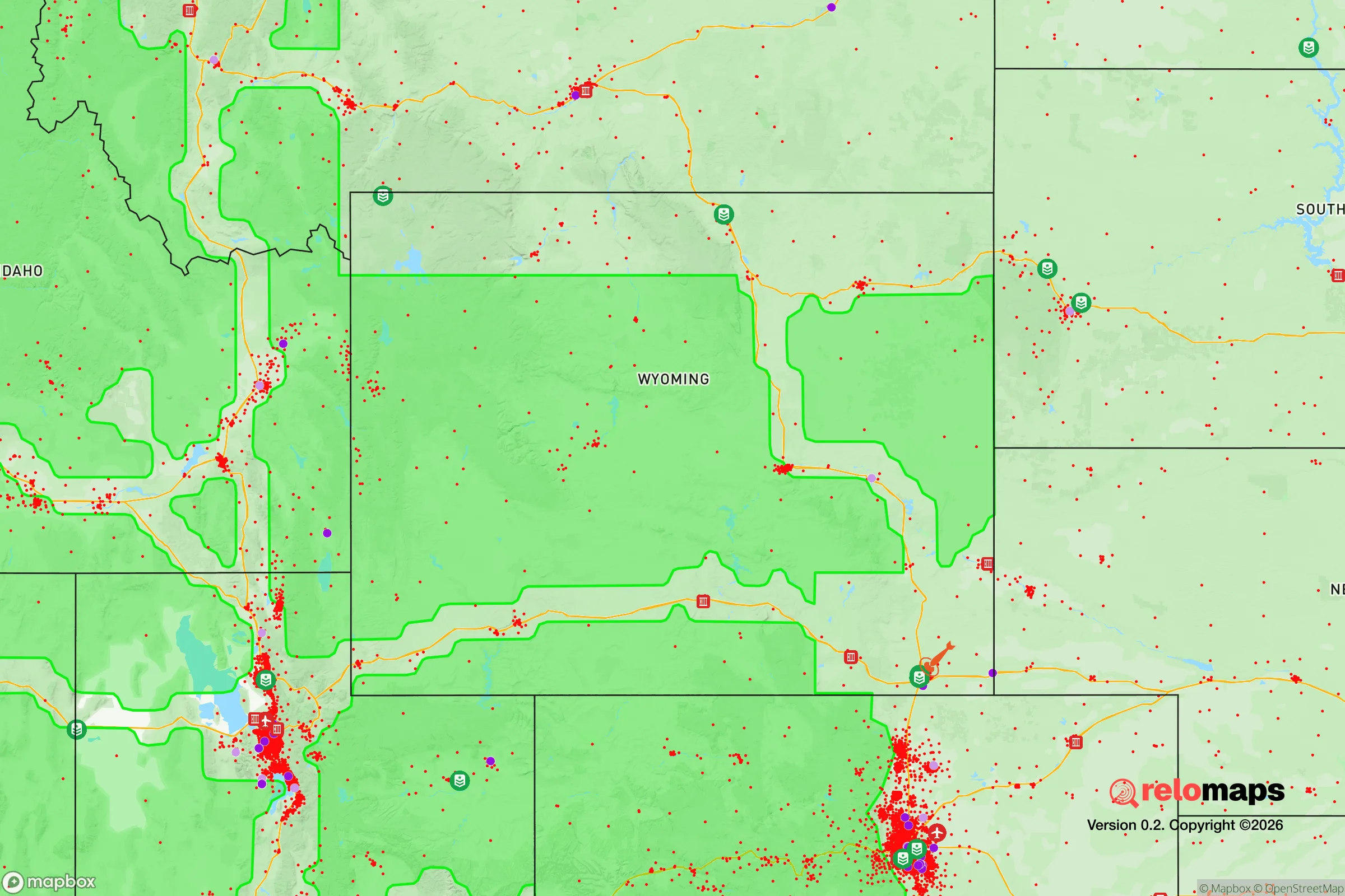
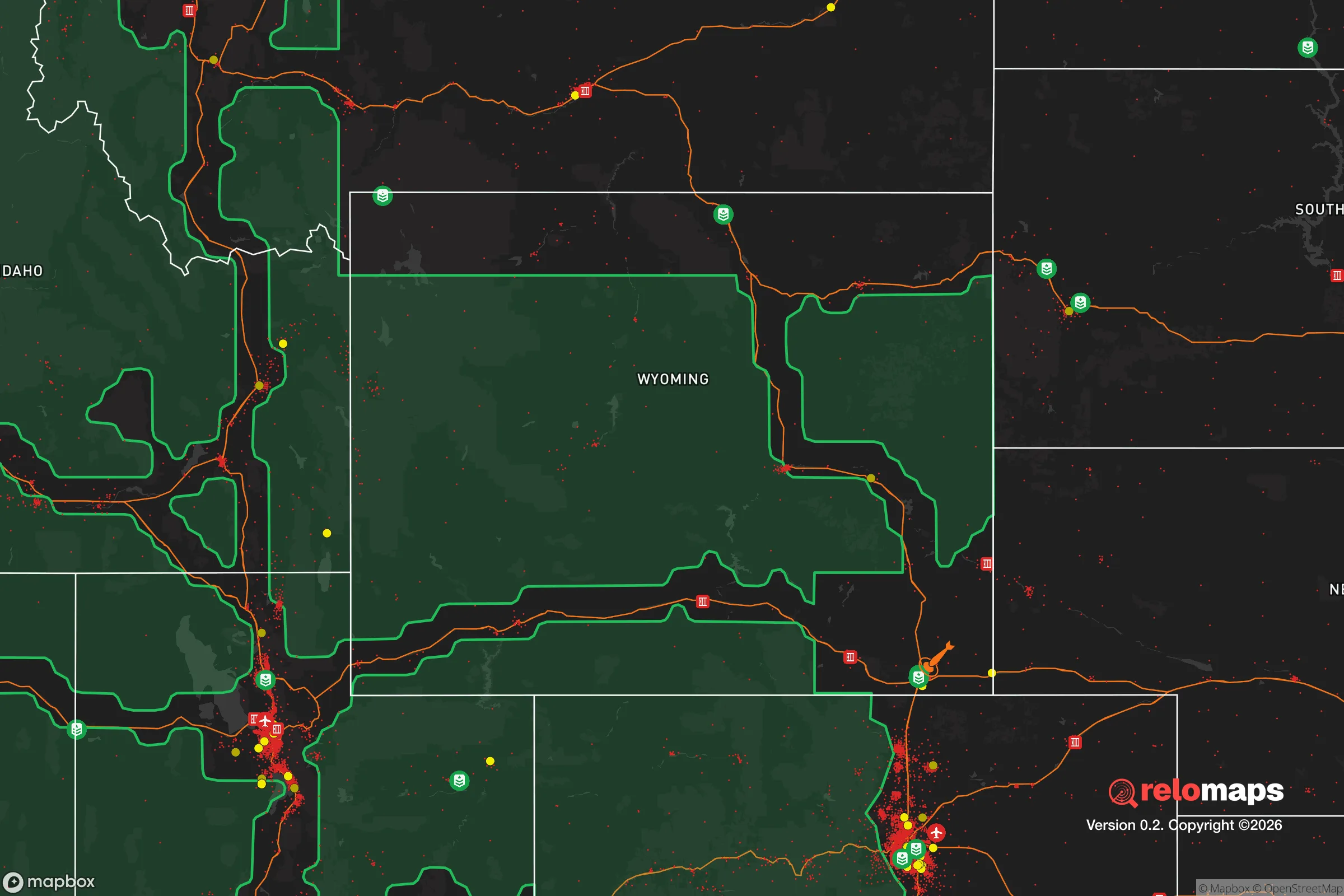
Important Note: For informational purposes only. This does not mean nothing bad ever happens in the green zones. Please use common sense. This is based on public data and modeled with AI. We tried to take a conservative approach but mistakes happen. We update this regularly as new information becomes available.
Solar Generator Recommendations
Backup power matters more here than in safer locations. We've picked three solar generators across budgets and capacity tiers — start with the budget unit if you only need a few essentials, or step up if you want to run a fridge and HVAC for days at a time.

Jackery Portable Power Station Explorer 300
Budget OptionPower on the Go: Weighing only 11 lbs, it's convenient to set up and store with book-sized foldable solar panels

BLUETTI Portable Power Station AC180
Designed for both indoor and outdoor scenarios, AC180 is highly capable as it has a robost capacity and continuous output power.

EF ECOFLOW DELTA Pro Ultra Power Station
Upgraded PickEcoFlow DELTA Pro Ultra is a whole-home energy system designed to grow with your family. Integrated with the Smart Home Panel 2, it scales to meet your evolving energy needs — keeping your home powered, intelligent, and secure through every stage of life.
We earn a commission, at no additional cost to you.
Strategic Assessment Analysis
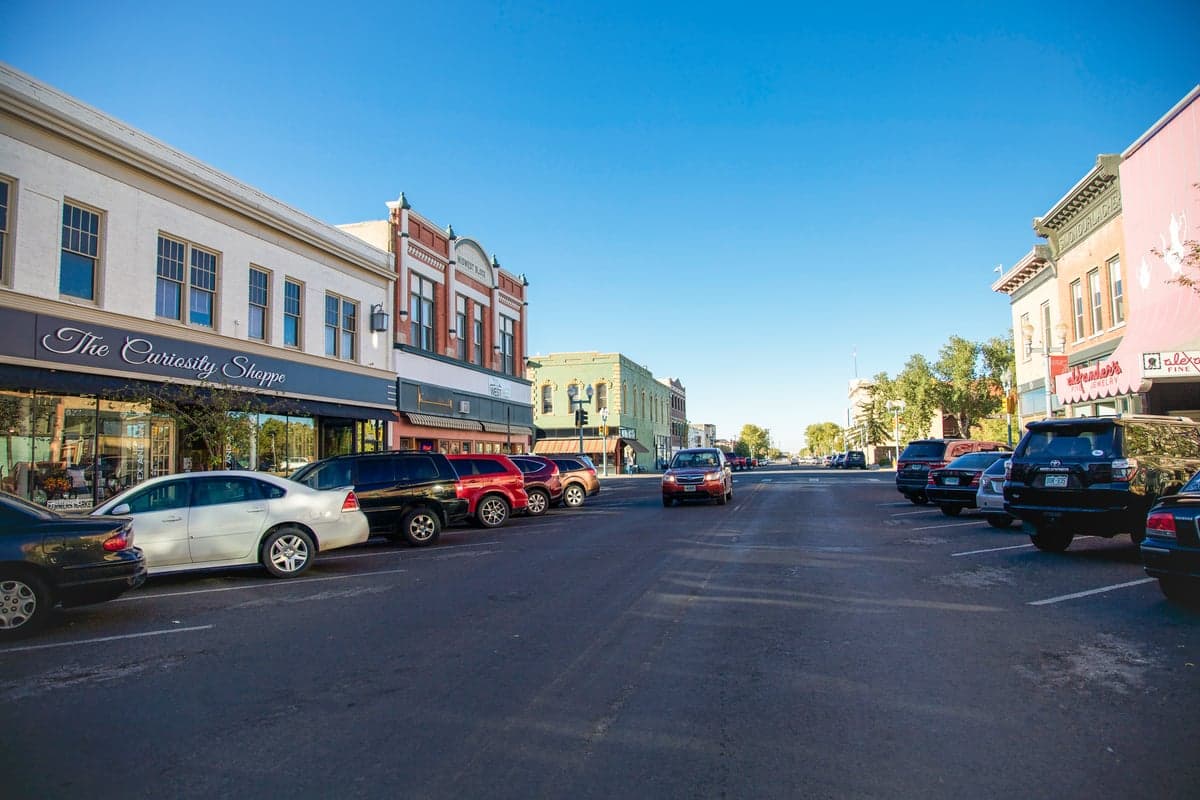
Laramie, Wyoming, sits at a strategic crossroads that makes it a serious contender for anyone thinking long-term about resilience and self-reliance. Perched on the high plains at 7,200 feet, it’s far enough from the chaos of the Front Range to offer genuine buffer, but close enough to access resources when things are stable. The city’s population hovers around 33,000, and the surrounding Albany County is vast and lightly populated—exactly the kind of low-density environment that reduces your exposure to cascading failures in a crisis. The University of Wyoming anchors the local economy, which means a steady influx of educated, often independent-minded people, but the town itself retains a quiet, almost insulated character that’s hard to find in most of the West today.
Geographic position and natural advantages for long-term security
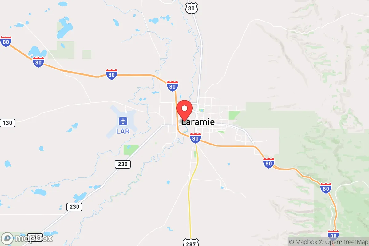
Laramie’s location is its strongest card. It sits in a high, dry basin between the Laramie Range to the east and the Medicine Bow Mountains to the west. That means you’ve got two major mountain ranges within an hour’s drive—excellent for hunting, foraging, and potential retreat options if things go sideways. The area is also a natural funnel for east-west travel via I-80, which is both a blessing and a curse: it gives you access to supply chains in normal times, but it’s a major artery that could become a chokepoint or a target during unrest. The good news is that Laramie itself is off the beaten path compared to Cheyenne or Denver. You’re about 45 minutes from the Colorado border, but the terrain between here and Fort Collins is open, exposed, and easy to monitor. For someone thinking about defensibility, that’s a real advantage—fewer surprise vectors, more time to react.
The natural resources are solid but not abundant. The Laramie River runs through town, and the Medicine Bow National Forest offers timber, game, and water catchments. The area gets about 12 inches of precipitation annually, so water is a primary concern—you’ll need to plan for storage and possibly a well if you’re outside city limits. The growing season is short (about 100 days), but the soil in the basin can support hardy crops like potatoes, root vegetables, and cold-tolerant grains. For a prepper, this is a location that rewards preparation: the raw ingredients are there, but you can’t coast on natural abundance.
Risks, exposures, and proximity to fallout-relevant landmarks
No strategic assessment is honest without naming the threats. Laramie’s biggest exposure is its proximity to F.E. Warren Air Force Base in Cheyenne, about 50 miles north. That base is a major ICBM hub, housing the 90th Missile Wing and a significant nuclear arsenal. In a conflict involving strategic weapons, Cheyenne is a high-priority target. Laramie is far enough away to avoid the immediate blast zone, but fallout patterns depend on wind—and the prevailing winds in this region blow from the west and southwest. That means if a strike hits Cheyenne, Laramie could be downwind depending on the season. You’d need a solid fallout shelter plan, preferably with a basement or underground space, and at least two weeks of sealed supplies.
Another risk is the I-80 corridor itself. In a mass evacuation scenario from Denver or the Front Range, that highway would become a parking lot of desperate people heading west. Laramie sits right on that line. The city could see a surge of refugees, and with limited local resources, that could strain everything from food to medical care. The local police force is small—about 50 officers—and the Albany County Sheriff’s office is similarly lean. Law enforcement capacity is thin for a crisis of scale. On the plus side, the population is largely self-sufficient and rural-minded, which means less reliance on fragile urban systems. But if you’re relocating here, you need to be prepared for the possibility that the town could be overwhelmed in a regional collapse scenario.
Practical resilience for a relocator: food, water, energy, and defensibility
Let’s get practical. Food security in Laramie requires planning. The local grocery stores—Safeway, Walmart, and a few smaller markets—are adequate for normal life, but supply chains are thin. There are no major food distribution centers within 100 miles, so any disruption to I-80 or the rail lines (which run parallel) will hit shelves fast. The solution is to build a local network. The Laramie Farmers Market operates in summer, and there are a handful of small-scale producers in the county, but you’ll want to establish relationships early. Hunting is viable: mule deer, elk, and antelope are common in the surrounding national forests, and Wyoming has a robust public-lands hunting system. Fishing in the Laramie River and nearby lakes is decent, but don’t rely on it as a primary protein source—pressure is moderate.
Water is the bigger challenge. The city’s water comes from the Laramie River and a series of reservoirs, but the system is aging and vulnerable to both drought and contamination. If you’re buying property, prioritize a site with a private well—the aquifer in the basin is generally good, though depth varies. Rainwater collection is legal in Wyoming, but with only 12 inches of annual precipitation, you’d need a large catchment area to make it meaningful. For energy, the area is wind-rich—Laramie is one of the windiest cities in the U.S.—so small-scale wind turbines are a viable option. Solar works too, but winter days are short and snow cover can reduce output. The grid is reasonably stable, but winter storms can knock out power for days. A backup generator with fuel storage is a must, and wood heat is a smart secondary system—firewood is plentiful in the national forest, but you’ll need a permit and a chainsaw.
Defensibility is where Laramie shines compared to most towns its size. The layout is compact, with the university and downtown forming a core, and residential areas spreading out into the plains. The open terrain means you can see threats coming from miles away—no dense urban canyons or blind corners. For a rural property, look for something with a clear line of sight to the east and south, where most traffic would originate. The local gun culture is strong and legal, with Wyoming being a constitutional carry state. That means the average citizen is armed and capable, which is a deterrent in itself. But don’t mistake that for safety: the county has a moderate property crime rate, and in a crisis, isolated homes could be targets. A good fence, a dog, and a community watch network are worth more than any arsenal.
The overall strategic picture for Laramie is one of cautious optimism. It’s not a fortress, and it’s not a self-sufficient paradise. But for someone who wants to be out of the blast radius of major cities while staying within striking distance of resources, it’s a solid bet. The key is to treat it as a base, not a bunker. Build local ties, stockpile smartly, and have a plan for both staying put and bugging out to the mountains if needed. The town’s biggest weakness—its reliance on a single highway and a distant power grid—can be mitigated with preparation. Its biggest strength is the people: independent, practical, and unlikely to panic. In a world where that’s becoming rare, Laramie offers a quiet, defensible corner worth serious consideration.
* Values derived from national, state, county, city and local statistics and may differ in a specific area. Last updated: 2026-04-21T11:27:14.000Z
Narrative content on this page is AI-generated and may contain mistakes. Verify any details that matter before acting on them.
ReloMaps may earn a commission from affiliate links at no extra cost to you.