
Photo: Wikipedia
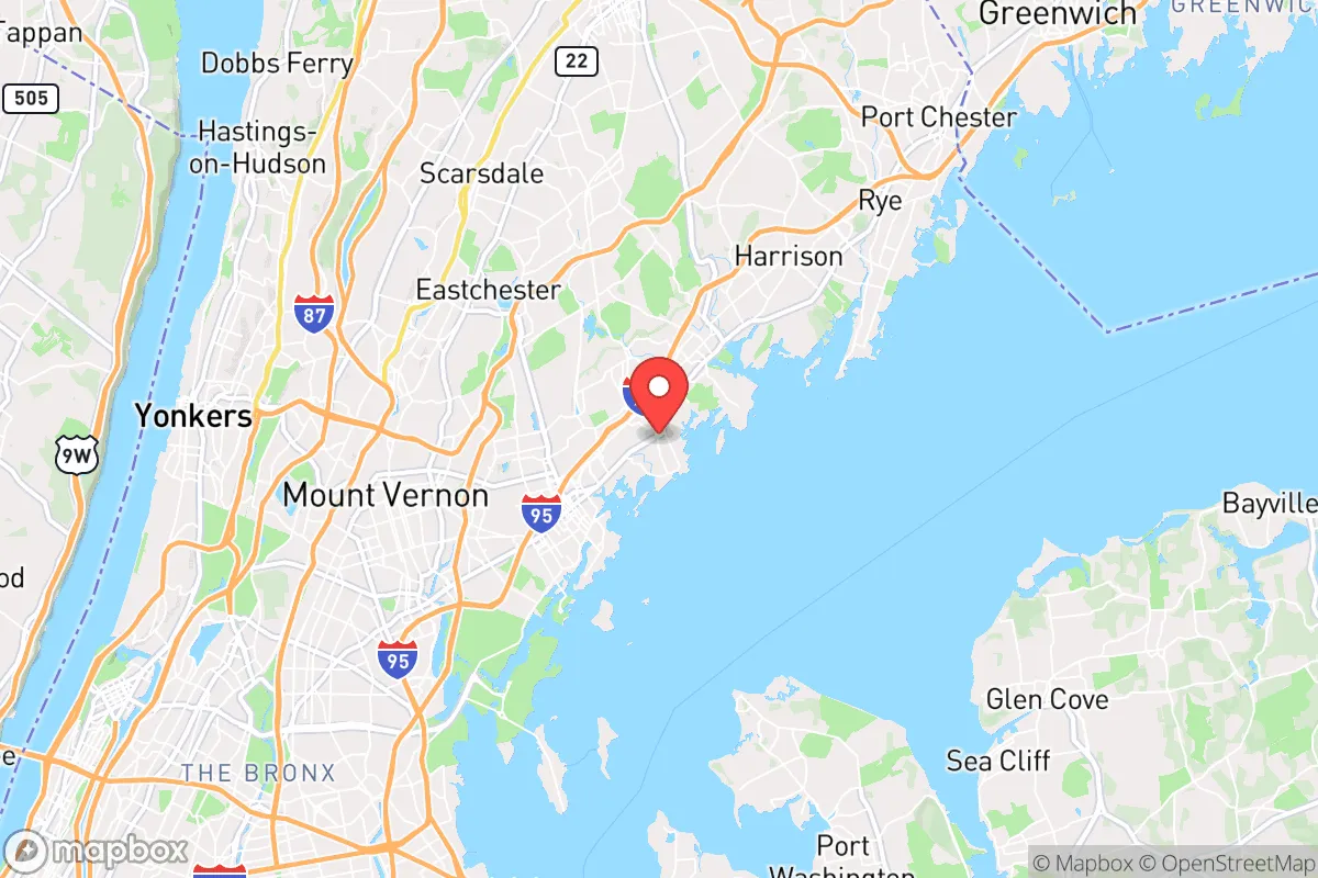
Strategic Assessment of Larchmont, NY
High tactical risk. This location is likely close to major population centers, strategic targets, or sits in a high-disaster corridor. A retreat property and careful exit planning is required.
What does the Strategic Assessment tell us?
Our Strategic Assessment grades tactical survivability of an area. Major population centers, military targets, fallout zones, natural disasters, and border exposure all drive risk — lower exposure means a more defensible position in a crisis.
This is heavily inspired by Joel Skousen's Strategic Relocation book. Highly recommended you checkout the book ($)What does this tell us?
Our Strategic Assessment grades tactical survivability of an area. Major population centers, military targets, fallout zones, natural disasters, and border exposure all drive risk — lower exposure means a more defensible position in a crisis.
This is heavily inspired by Joel Skousen's Strategic Relocation book. Highly recommended you checkout the book ($)Strategic Pillars

Key Distances
Regional Safe Places
Below is our recommended "safe zones" in New York and the surrounding area based on our strategic heuristics. For most people, it's unrealistic to live in a “safe zone” full-time due to work, family or other personal reasons. They tend to be more rural. However, many of these areas are perfect for second homes and retreat properties that double as a vacation home or even a short-term rental.


Important Note: For informational purposes only. This does not mean nothing bad ever happens in the green zones. Please use common sense. This is based on public data and modeled with AI. We tried to take a conservative approach but mistakes happen. We update this regularly as new information becomes available.
Solar Generator Recommendations
Backup power matters more here than in safer locations. We've picked three solar generators across budgets and capacity tiers — start with the budget unit if you only need a few essentials, or step up if you want to run a fridge and HVAC for days at a time.

Jackery Portable Power Station Explorer 300
Budget OptionPower on the Go: Weighing only 11 lbs, it's convenient to set up and store with book-sized foldable solar panels

BLUETTI Portable Power Station AC180
Designed for both indoor and outdoor scenarios, AC180 is highly capable as it has a robost capacity and continuous output power.

EF ECOFLOW DELTA Pro Ultra Power Station
Upgraded PickEcoFlow DELTA Pro Ultra is a whole-home energy system designed to grow with your family. Integrated with the Smart Home Panel 2, it scales to meet your evolving energy needs — keeping your home powered, intelligent, and secure through every stage of life.
We earn a commission, at no additional cost to you.
Strategic Assessment Analysis
Larchmont, New York, offers a deceptive mix of strategic advantages and glaring vulnerabilities for the conservative prepper. Its location in Westchester County, just 18 miles from Manhattan, places it within the blast radius of a major metropolitan target, yet its position on the Long Island Sound provides a natural buffer and a potential maritime escape route. The village’s historic character, with its tree-lined streets and established infrastructure, masks a reality where proximity to New York City’s economic and political instability is the single greatest liability. For a relocator prioritizing resilience, Larchmont is a high-risk, high-reward proposition that demands a clear-eyed assessment of its geographic position, exposure to fallout, and practical survivability.
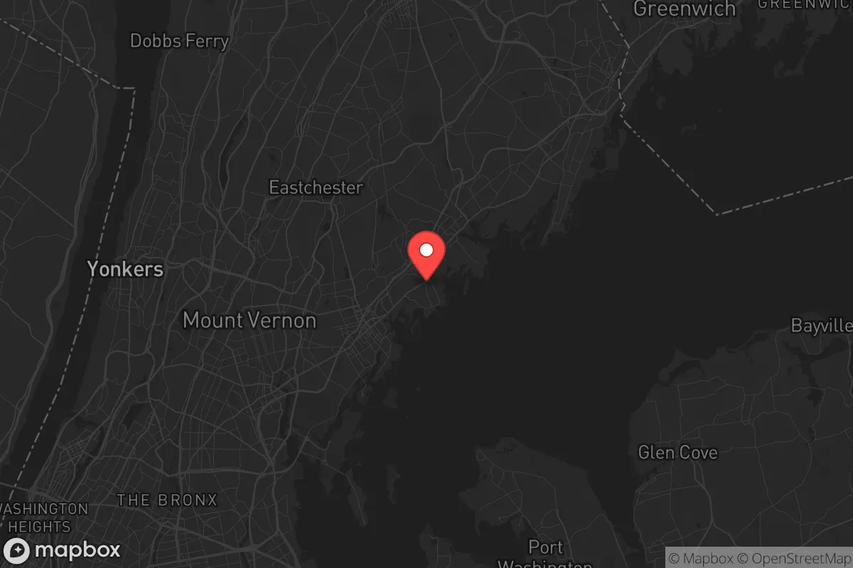
Geographic position and natural advantages for a strategic retreat
Larchmont sits on a peninsula jutting into the Long Island Sound, bordered by the Mamaroneck River to the east and the Hutchinson River to the west. This water-surrounded geography offers a degree of natural defensibility, as approach by land is funneled through a limited number of choke points—primarily the Boston Post Road (US-1) and the Hutchinson River Parkway. The Sound provides a direct water route to the open Atlantic, which could be critical for resupply or evacuation if road networks become compromised. The village’s elevation, ranging from sea level to about 100 feet, means it is not prone to flooding from storm surges, though low-lying areas near the water are vulnerable. The surrounding area is part of the Manhattan Prong of the New England Uplands, with bedrock of Fordham gneiss and Manhattan schist, which offers some natural shielding against radiation but is not a substitute for a dedicated fallout shelter. The proximity to the Sound also means access to a substantial fishery, though contamination from upstream industrial sites or a nuclear event would render that resource unusable for months.
Risks, exposures, and proximity to fallout-relevant landmarks
The primary risk is Larchmont’s location within the New York City metropolitan area, a Tier 1 target for any strategic adversary. The Indian Point Energy Center, a decommissioned nuclear plant 20 miles north in Buchanan, remains a spent fuel storage site with 1,400 tons of radioactive material—a potential dirty bomb target or accident source. The village is also within 30 miles of the New York City ports, the Lincoln Tunnel, and the George Washington Bridge, all high-value infrastructure that would be prioritized in a conflict. A ground burst at the Port of New York and New Jersey would produce fallout that could reach Larchmont within hours, depending on wind patterns. The area’s dense population—over 6,000 people per square mile in Larchmont itself, and 900,000 in Westchester County—means that any evacuation would be chaotic, with the limited road network quickly gridlocked. The village’s reliance on the New York City water supply (via the Catskill/Delaware watershed) is a critical vulnerability; a disruption to the aqueduct system would leave residents dependent on bottled water or local wells, which are shallow and susceptible to contamination. The proximity to the Sound also means that a maritime disaster or attack could cut off the village from its eastern flank, while the Hutchinson River Parkway and I-95 are obvious chokepoints for civil unrest or refugee flows from the city.
Practical resilience for a relocator: food, water, energy, and defensibility
For a relocator with a prepper mindset, Larchmont’s practical resilience is mixed. Water is the most immediate concern: the village’s municipal supply comes from the New York City system, which is vulnerable to both physical attack and cyber disruption. A backup plan would require a private well (rare in the village proper) or rainwater collection, which is feasible given the area’s 50 inches of annual rainfall but requires storage and filtration. Food security is limited; the village has no significant agricultural land, and the nearest farms are in northern Westchester or Putnam County, 20-30 miles away. The Sound offers fish and shellfish, but as noted, contamination risks are high. Stockpiling is essential, but storage space in the typical Larchmont home—often a historic house with limited basement capacity—is a constraint. Energy is a bright spot: Con Edison’s grid is relatively reliable, but a long-term outage would require a generator, and natural gas lines are common in the village. Solar panels are feasible but face shading from mature trees and historic district restrictions. Defensibility is the village’s strongest card: the peninsula layout means that a small group could secure the few road entry points, and the water provides a natural barrier. However, the village’s density means that a determined adversary could overwhelm defenders, and the lack of a unified community defense plan is a weakness. The local police department (Larchmont PD) is professional but small—about 25 officers—and would be overwhelmed in a major event. The village’s proximity to the Sound also offers a potential escape route by boat, but that requires pre-positioned vessels and a destination, such as the less-dense North Fork of Long Island or the Connecticut coast.
The overall strategic picture for Larchmont is one of calculated risk. For a conservative relocator who values proximity to economic opportunity and cultural amenities, the village offers a comfortable lifestyle with a veneer of security. But for someone serious about long-term survival in a worst-case scenario—civil unrest, nuclear exchange, or a cascading infrastructure failure—Larchmont’s location within the New York City orbit is a fundamental liability. The village’s natural advantages (water access, defensible geography) are real but are outweighed by its exposure to a high-value target zone and its dependence on fragile external systems. A prepper would need to invest heavily in self-sufficiency: a deep fallout shelter, a private water source, a substantial food cache, and a reliable boat for evacuation. Without those investments, Larchmont is a comfortable but precarious perch—a place to live well in peacetime, but a place to leave when the lights go out. The strategic recommendation is to treat Larchmont as a secondary location, not a primary retreat, and to have a bug-out plan that moves north or east to less populated, more defensible terrain within the first 24 hours of a crisis.
* Values derived from national, state, county, city and local statistics and may differ in a specific area. Last updated: 2026-04-23T02:53:11.000Z
Narrative content on this page is AI-generated and may contain mistakes. Verify any details that matter before acting on them.
ReloMaps may earn a commission from affiliate links at no extra cost to you.