Photo: Wikipedia
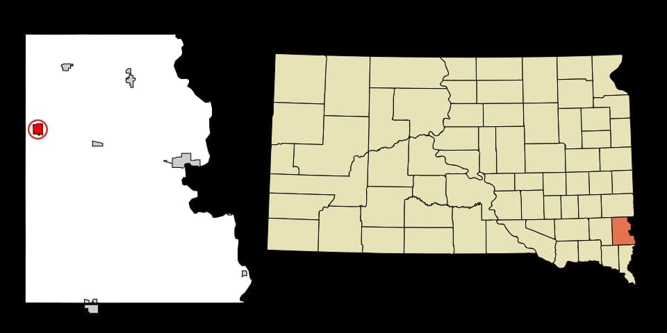
Strategic Assessment of Lennox, SD
Workable tactical position. Some exposure to population density or targets, but generally defensible in a crisis.
What does the Strategic Assessment tell us?
Our Strategic Assessment grades tactical survivability of an area. Major population centers, military targets, fallout zones, natural disasters, and border exposure all drive risk — lower exposure means a more defensible position in a crisis.
This is heavily inspired by Joel Skousen's Strategic Relocation book. Highly recommended you checkout the book ($)What does this tell us?
Our Strategic Assessment grades tactical survivability of an area. Major population centers, military targets, fallout zones, natural disasters, and border exposure all drive risk — lower exposure means a more defensible position in a crisis.
This is heavily inspired by Joel Skousen's Strategic Relocation book. Highly recommended you checkout the book ($)Strategic Pillars

Key Distances
Regional Safe Places
Below is our recommended "safe zones" in South Dakota and the surrounding area based on our strategic heuristics. For most people, it's unrealistic to live in a “safe zone” full-time due to work, family or other personal reasons. They tend to be more rural. However, many of these areas are perfect for second homes and retreat properties that double as a vacation home or even a short-term rental.


Important Note: For informational purposes only. This does not mean nothing bad ever happens in the green zones. Please use common sense. This is based on public data and modeled with AI. We tried to take a conservative approach but mistakes happen. We update this regularly as new information becomes available.
Solar Generator Recommendations
Backup power matters more here than in safer locations. We've picked three solar generators across budgets and capacity tiers — start with the budget unit if you only need a few essentials, or step up if you want to run a fridge and HVAC for days at a time.

Jackery Portable Power Station Explorer 300
Budget OptionPower on the Go: Weighing only 11 lbs, it's convenient to set up and store with book-sized foldable solar panels

BLUETTI Portable Power Station AC180
Designed for both indoor and outdoor scenarios, AC180 is highly capable as it has a robost capacity and continuous output power.

EF ECOFLOW DELTA Pro Ultra Power Station
Upgraded PickEcoFlow DELTA Pro Ultra is a whole-home energy system designed to grow with your family. Integrated with the Smart Home Panel 2, it scales to meet your evolving energy needs — keeping your home powered, intelligent, and secure through every stage of life.
We earn a commission, at no additional cost to you.
Strategic Assessment Analysis
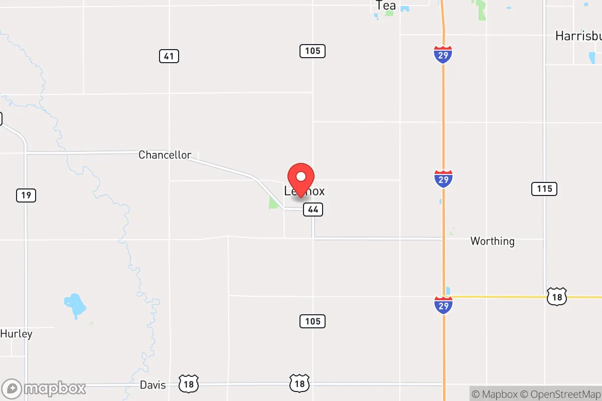
Lennox, South Dakota, sits in a sweet spot that few relocators fully appreciate: close enough to Sioux Falls for supply runs and medical access, yet far enough to avoid the blast radius of a major population center or the chaos of a sudden urban evacuation. With a population hovering around 2,300 and a layout that still feels like small-town America, this Lincoln County community offers a base that is both resilient by design and strategically positioned for those thinking about long-term preparedness. The area’s flat, fertile terrain and low population density create natural buffers against the cascading failures that plague larger metros, while its location along the Big Sioux River provides a reliable water source that many preppers overlook when scouting the Upper Midwest.
Geographic position and natural advantages for long-term stability
Lennox sits roughly 20 miles southwest of Sioux Falls, placing it outside the immediate blast and fallout zones of any plausible high-value target in the region. The city is not near any major military installations, nuclear power plants, or strategic infrastructure that would make it a primary or secondary target in a conflict scenario. The surrounding landscape is predominantly agricultural—corn, soybeans, and cattle operations—which means the area has a built-in food production capacity that most suburban or exurban locations lack. The Big Sioux River runs through the eastern edge of the county, offering a perennial water source that can be tapped with basic filtration or well systems. The local water table is shallow and reliable, and many rural properties already have private wells, a critical advantage if municipal water treatment fails during a prolonged grid-down event. The terrain is flat but not featureless; the lack of dense forest or steep hills means line-of-sight visibility is excellent for security purposes, and the open ground makes it difficult for any hostile group to approach undetected. Winters are harsh, with average January lows around 8°F and occasional blizzards, but that same climate acts as a natural deterrent to transient populations and reduces the viability of year-round nomadic threats. The growing season runs about 150 days, enough for cold-hardy crops like potatoes, carrots, and kale, and the soil is rich loam—some of the best in the state for small-scale farming.
Risks, exposures, and proximity to fallout-relevant landmarks
The primary risk for Lennox is its proximity to Sioux Falls, a city of roughly 200,000 that would become a humanitarian crisis zone in the event of a major economic collapse, civil unrest, or a coordinated attack on the national food supply chain. Sioux Falls is a regional hub for healthcare, banking, and transportation, which makes it a likely target for cyberattacks on the electrical grid or physical disruption of the Interstate 29 corridor. If the power goes down for more than 72 hours, expect a mass exodus from the city, and Lennox sits directly along the path of least resistance for anyone heading southwest toward the Missouri River or the Nebraska Sandhills. The Burlington Northern Santa Fe rail line runs through the area, carrying freight that could include hazardous materials or military logistics, making the tracks a potential secondary target. There are no nuclear plants within 100 miles, but the Minuteman III missile fields of western South Dakota and the Ellsworth Air Force Base near Rapid City are distant enough that fallout from a strike there would not reach Lennox in lethal concentrations—though prevailing westerlies could bring trace contamination in a worst-case scenario. Tornado risk is moderate; Lincoln County averages about six tornadoes per decade, and the flat terrain offers little natural shelter, so a reinforced basement or storm shelter is a non-negotiable for any serious prepper. Flooding along the Big Sioux is a periodic concern, particularly in the spring, but the town itself sits on slightly higher ground than the river bottom, and most residential areas are outside the 100-year floodplain.
Practical resilience for a relocator: food, water, energy, and defensibility
Food security in Lennox is above average for a town its size. The surrounding farmland means direct access to local meat, dairy, and produce, and the town has a small but functional grocery co-op and a weekly farmers' market during the growing season. For those willing to put in the work, a quarter-acre garden can produce enough calories to supplement a family of four for six months, and the local extension office offers soil testing and seed-sharing programs that are still active as of 2026. Water is the stronger card: the Big Sioux River is a reliable surface source, and the glacial aquifer beneath Lincoln County provides clean groundwater at depths of 50 to 150 feet. Drilling a well costs between $5,000 and $10,000, but once it's in, you have a private supply that is independent of municipal treatment plants. Energy resilience is more of a challenge. The local grid is served by Sioux Valley Energy, a cooperative that has been slow to adopt distributed generation, so solar panels with battery storage are a smart investment. Natural gas is available in town, but propane is the standard for rural properties, and bulk delivery can be disrupted during winter storms—keep a minimum of 500 gallons on hand if you're off the main line. Defensibility is decent for a prairie town. The street grid is simple and easy to patrol, and the lack of dense cover means any approach is visible from a quarter mile out. The local law enforcement presence is minimal—Lincoln County has about 15 deputies covering 578 square miles—so a neighborhood watch or mutual-aid group is practical and socially acceptable. The town's population is homogeneous, with strong church and community ties, which reduces the likelihood of internal factionalism during a crisis. Gun culture is normal here; most households own firearms, and the county sheriff's office is supportive of responsible ownership, with no restrictive local ordinances beyond state law.
The overall strategic picture for Lennox is one of calculated trade-offs. You trade the absolute isolation of the Black Hills or the Missouri Breaks for better access to medical care, supply chains, and a larger labor market if you need to work remotely or locally. You trade the security of deep rural seclusion for the risk of being on the edge of a potential urban collapse zone. But for a relocator who wants a place that is livable now, defensible later, and positioned to ride out the next decade of instability without going completely off-grid, Lennox checks the critical boxes: clean water, arable land, low crime, and a community that still knows its neighbors. The key is to arrive before the crisis, build your infrastructure, and integrate into the local network—because in a real emergency, the people who show up after the fact are refugees, not residents. Lennox won't save you from every scenario, but it gives you a fighting chance in the ones that matter most.
* Values derived from national, state, county, city and local statistics and may differ in a specific area. Last updated: 2026-04-30T01:21:48.000Z
Narrative content on this page is AI-generated and may contain mistakes. Verify any details that matter before acting on them.
ReloMaps may earn a commission from affiliate links at no extra cost to you.