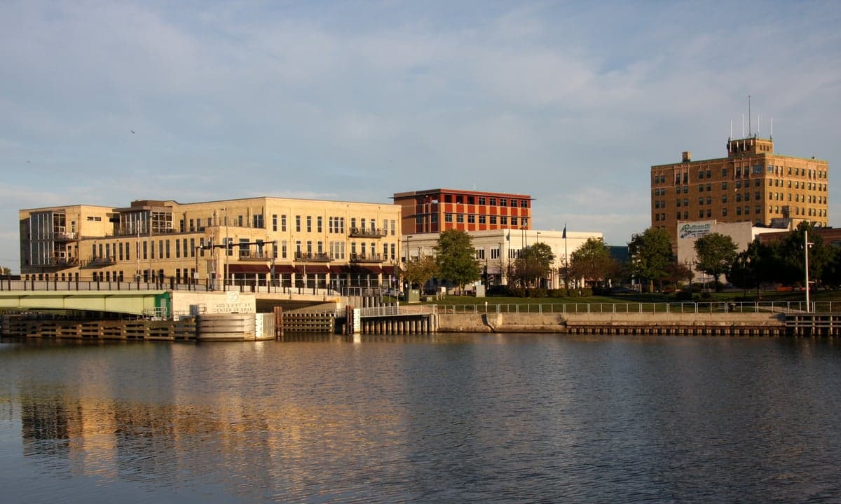
Photo: Wikipedia
Strategic Assessment of Manitowoc, WI
Meaningful friction. Expect exposure to either population pressure, blast zones, or natural disaster risk. Consider buying a retreat property.
What does the Strategic Assessment tell us?
Our Strategic Assessment grades tactical survivability of an area. Major population centers, military targets, fallout zones, natural disasters, and border exposure all drive risk — lower exposure means a more defensible position in a crisis.
This is heavily inspired by Joel Skousen's Strategic Relocation book. Highly recommended you checkout the book ($)What does this tell us?
Our Strategic Assessment grades tactical survivability of an area. Major population centers, military targets, fallout zones, natural disasters, and border exposure all drive risk — lower exposure means a more defensible position in a crisis.
This is heavily inspired by Joel Skousen's Strategic Relocation book. Highly recommended you checkout the book ($)Strategic Pillars

Key Distances
Regional Safe Places
Below is our recommended "safe zones" in Wisconsin and the surrounding area based on our strategic heuristics. For most people, it's unrealistic to live in a “safe zone” full-time due to work, family or other personal reasons. They tend to be more rural. However, many of these areas are perfect for second homes and retreat properties that double as a vacation home or even a short-term rental.
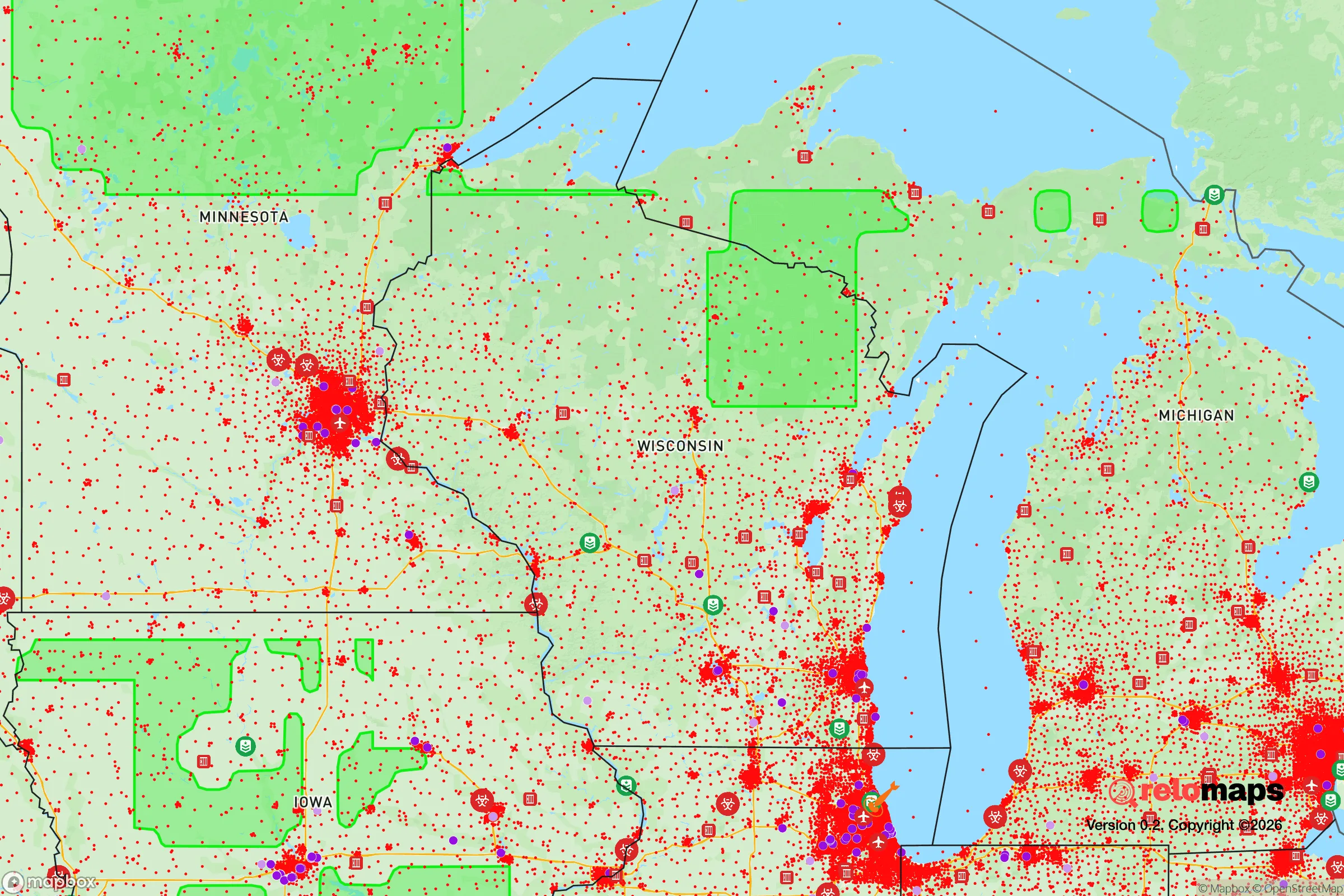
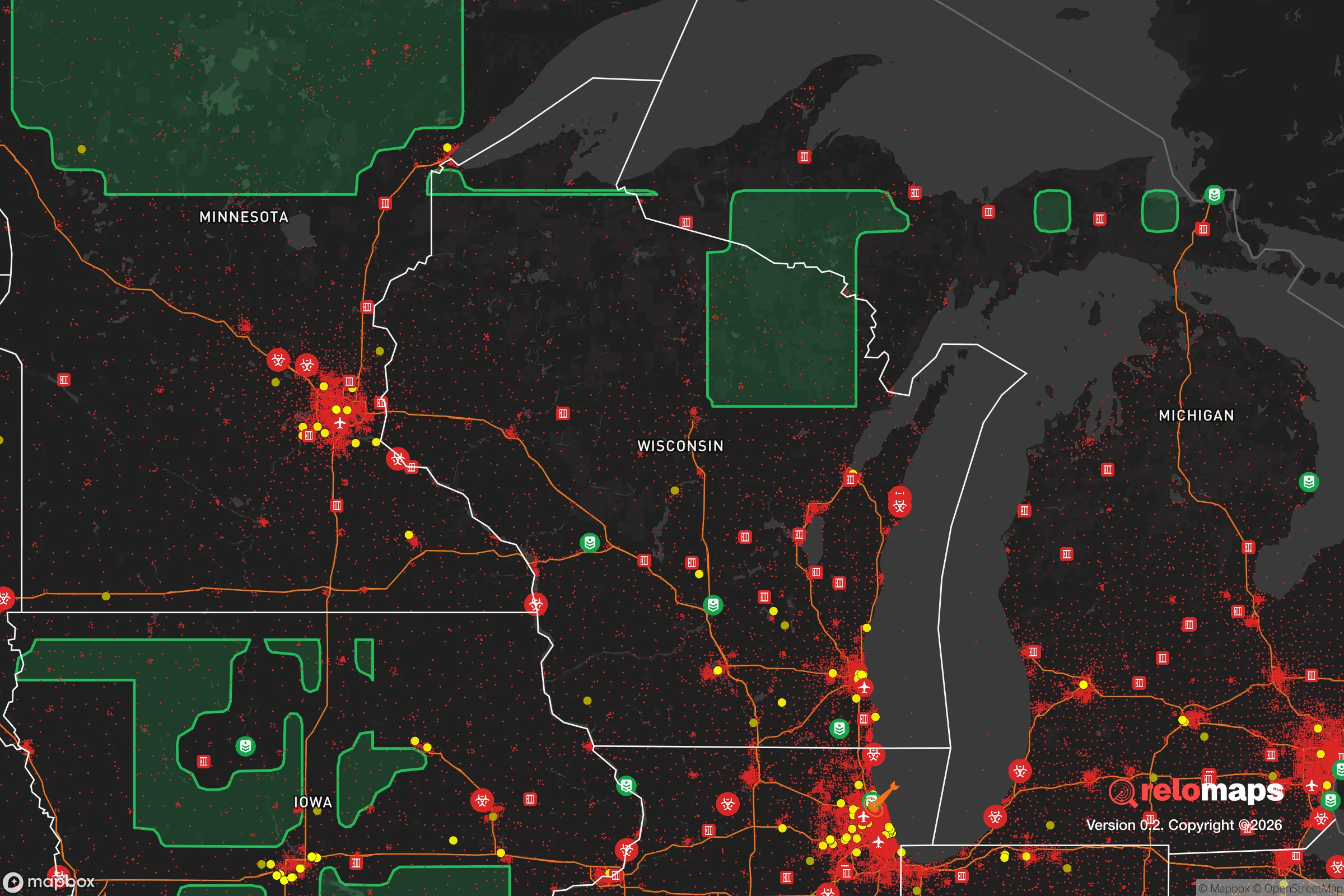
Important Note: For informational purposes only. This does not mean nothing bad ever happens in the green zones. Please use common sense. This is based on public data and modeled with AI. We tried to take a conservative approach but mistakes happen. We update this regularly as new information becomes available.
Solar Generator Recommendations
Backup power matters more here than in safer locations. We've picked three solar generators across budgets and capacity tiers — start with the budget unit if you only need a few essentials, or step up if you want to run a fridge and HVAC for days at a time.

Jackery Portable Power Station Explorer 300
Budget OptionPower on the Go: Weighing only 11 lbs, it's convenient to set up and store with book-sized foldable solar panels

BLUETTI Portable Power Station AC180
Designed for both indoor and outdoor scenarios, AC180 is highly capable as it has a robost capacity and continuous output power.

EF ECOFLOW DELTA Pro Ultra Power Station
Upgraded PickEcoFlow DELTA Pro Ultra is a whole-home energy system designed to grow with your family. Integrated with the Smart Home Panel 2, it scales to meet your evolving energy needs — keeping your home powered, intelligent, and secure through every stage of life.
We earn a commission, at no additional cost to you.
Strategic Assessment Analysis
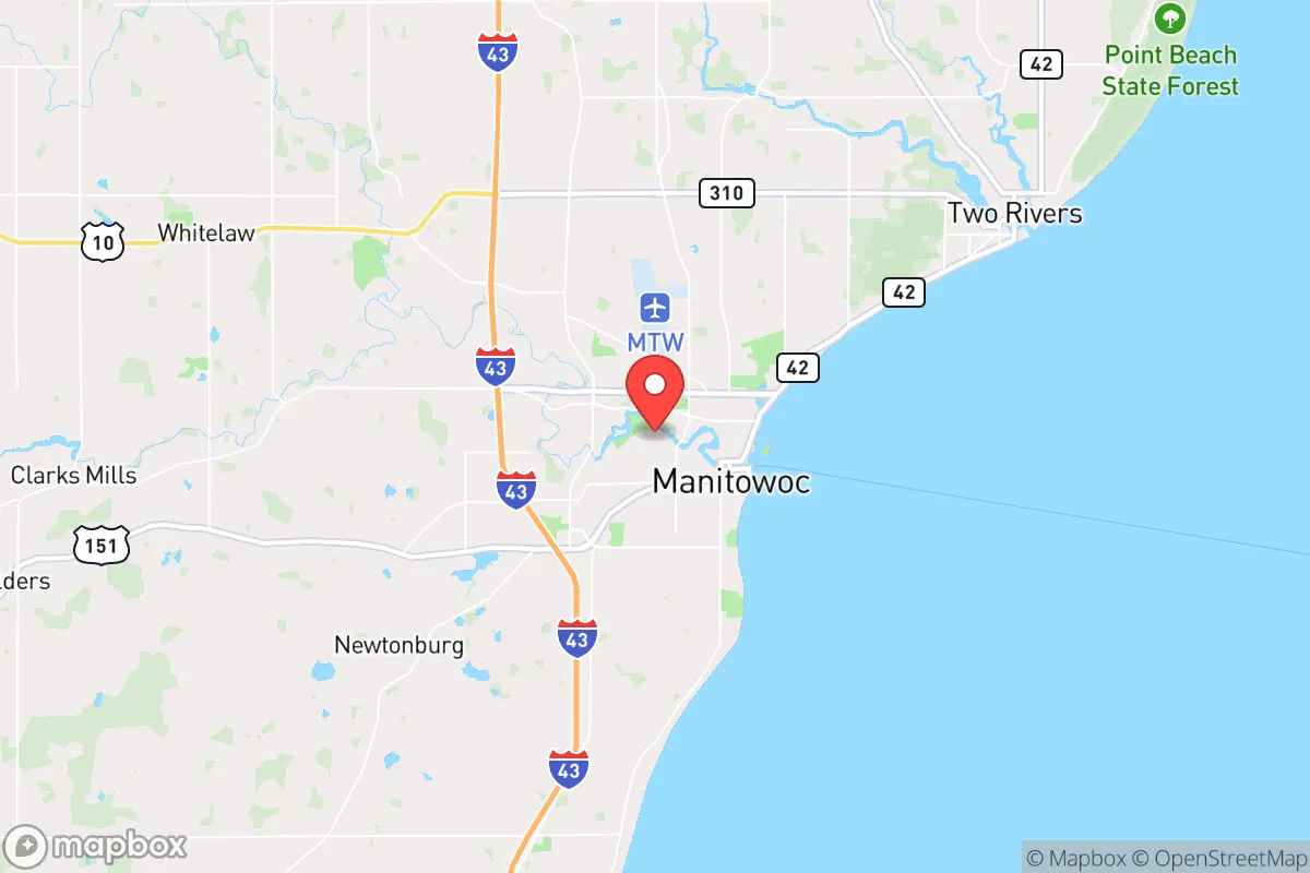
Manitowoc, Wisconsin, sits on the western shore of Lake Michigan, roughly 40 miles southeast of Green Bay and 80 miles north of Milwaukee. For a relocator with a prepper or survivalist mindset, this location offers a distinct blend of advantages and liabilities. The city’s population hovers around 33,000, with a county (Manitowoc County) of about 80,000—small enough to avoid the chaos of a major metro, but large enough to maintain essential infrastructure like a hospital, grocery stores, and a regional airport. Its position on a Great Lake provides a massive freshwater resource, while its agricultural surroundings offer food security. However, being within 100 miles of Milwaukee and Chicago means it is not immune to the fallout of urban collapse, mass casualty events, or civil unrest. This assessment weighs those factors for a conservative-leaning audience prioritizing self-reliance, community stability, and strategic positioning in an uncertain future.
Geographic position and natural advantages for long-term survival
Manitowoc’s primary strategic asset is its location on Lake Michigan, one of the largest freshwater bodies in the world. This provides an essentially limitless supply of potable water, assuming proper filtration or treatment—critical in a grid-down scenario. The city sits at the mouth of the Manitowoc River, which also offers a secondary water source and a natural transportation corridor. The surrounding landscape is predominantly flat, fertile farmland, part of Wisconsin’s Eastern Ridges and Lowlands region. This means local food production is viable, with dairy farms, corn, soybeans, and vegetable operations within a 20-mile radius. The climate is continental, with cold winters (average January low around 14°F) and warm summers (July high near 80°F). Snowfall averages 40-50 inches annually, which can be a challenge for off-grid heating but also provides a natural barrier to movement during winter months—useful for deterring transient populations in a crisis. The area is geologically stable, with no significant earthquake, volcanic, or hurricane risk. Tornadoes are possible but not frequent; the region averages about 10-15 tornadoes per year across the entire state, with most being weak (EF0-EF1). For a relocator, this means you’re not fighting against nature as much as you are preparing for winter resilience and potential supply chain disruptions.
Risks, exposures, and proximity to fallout-relevant landmarks
The most significant risk for Manitowoc is its proximity to major population centers and critical infrastructure that could become targets or sources of chaos. Milwaukee (pop. 577,000) is 80 miles south; Chicago (pop. 2.7 million) is 150 miles south-southwest. In a mass casualty event, civil unrest, or economic collapse, these cities could generate large refugee flows north along I-43, which runs directly through Manitowoc. The city itself has a small port and a rail line, both of which could become chokepoints or vectors for disease, violence, or resource competition. Additionally, Manitowoc is within 100 miles of the Kewaunee Nuclear Power Plant (about 25 miles north), which is currently decommissioned but still contains spent fuel. A catastrophic failure or attack on that facility could render the area uninhabitable for decades. There are also two other nuclear plants within 150 miles: Point Beach (active, 30 miles north) and Byron (Illinois, 120 miles southwest). While the risk of a meltdown is low, it is non-zero and worth factoring into a relocation decision. The area also lies under major flight paths for Chicago’s O’Hare and Milwaukee’s Mitchell airports, meaning air traffic noise is constant, and a plane crash or aerial attack could affect the region. For a prepper, these are not deal-breakers but require evacuation planning and stockpiling of potassium iodide for radiation exposure.
Practical resilience for a relocator: food, water, energy, and defensibility
Manitowoc’s practical resilience is mixed. On the positive side, freshwater access is exceptional. Lake Michigan is a massive, reliable source, and the city’s municipal water system draws from it. In a grid-down scenario, a hand pump or solar-powered pump on a private well (common in rural areas outside city limits) would provide water. The agricultural base means local food is available, but you’ll need to establish relationships with farmers or secure land for your own garden. The growing season is short (about 140 frost-free days), so cold-hardy crops and greenhouse techniques are advisable. For energy, Manitowoc has a coal-fired power plant (the Manitowoc Public Utilities plant) and is connected to the regional grid. In a long-term outage, solar panels with battery storage are viable, though winter cloud cover reduces output. Wood heating is practical given the surrounding forests, but you’ll need a woodlot or reliable supplier. Defensibility is moderate. The city is spread out, with single-family homes on large lots in many neighborhoods, allowing for perimeter security. The rural areas to the west and north offer better concealment and escape routes via county roads and state highways. However, the flat terrain means you cannot rely on natural barriers like mountains or dense forests to slow an advancing threat. The local population is largely conservative, with a strong Lutheran and Catholic heritage, and a culture of self-reliance and neighborly assistance—valuable in a crisis. The Manitowoc County Sheriff’s Office and local police are professional, but in a widespread disaster, they will be overwhelmed. Your best bet is to form a mutual assistance group with like-minded neighbors, stockpile at least 3-6 months of food and medical supplies, and have a bug-out plan for a secondary location further north (e.g., the Upper Peninsula of Michigan, accessible via the Mackinac Bridge, about 200 miles away).
The overall strategic picture for Manitowoc is one of moderate resilience with significant caveats. It is not a hardened survivalist retreat; it is a working-class city with good bones for a post-collapse scenario if you are prepared. The lake provides water, the farmland provides food, and the community is generally stable and conservative. But the proximity to Milwaukee and Chicago, the nuclear plants, and the flat, open terrain mean you cannot afford complacency. For a single individual or a family willing to invest in off-grid infrastructure, build local alliances, and maintain a low profile, Manitowoc offers a viable base of operations. It is not a fortress, but it is a defensible position with essential resources—provided you treat it as a starting point, not a final destination. If the country descends into prolonged unrest or a major disaster, your best move may be to use Manitowoc as a staging ground before relocating further north or west. For now, it is a solid, unglamorous choice for those who value practicality over prestige and preparation over convenience.
* Values derived from national, state, county, city and local statistics and may differ in a specific area. Last updated: 2026-04-21T10:20:37.000Z
Narrative content on this page is AI-generated and may contain mistakes. Verify any details that matter before acting on them.
ReloMaps may earn a commission from affiliate links at no extra cost to you.