Photo: Wikipedia
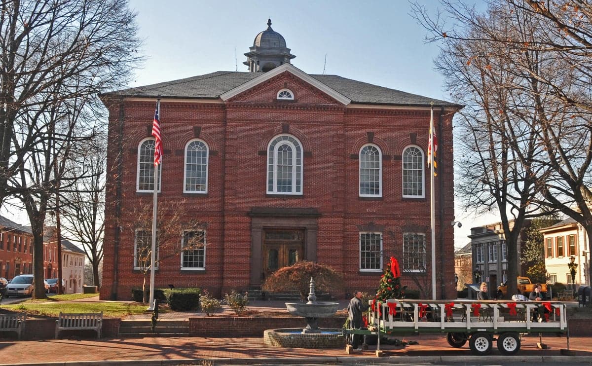
Strategic Assessment of Harford County
Meaningful friction. Expect exposure to either population pressure, blast zones, or natural disaster risk. Consider buying a retreat property.
What does the Strategic Assessment tell us?
Our Strategic Assessment grades tactical survivability of an area. Major population centers, military targets, fallout zones, natural disasters, and border exposure all drive risk — lower exposure means a more defensible position in a crisis.
This is heavily inspired by Joel Skousen's Strategic Relocation book. Highly recommended you checkout the book ($)What does this tell us?
Our Strategic Assessment grades tactical survivability of an area. Major population centers, military targets, fallout zones, natural disasters, and border exposure all drive risk — lower exposure means a more defensible position in a crisis.
This is heavily inspired by Joel Skousen's Strategic Relocation book. Highly recommended you checkout the book ($)Strategic Pillars

Key Distances
Strategic Assessment Analysis
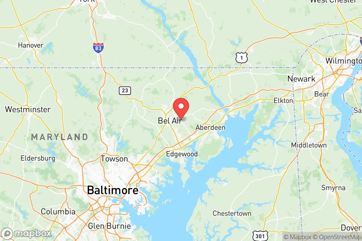
Harford County, Maryland, occupies a strategic middle-ground along the I-95 corridor, offering a rare blend of rural buffer zones and suburban infrastructure that makes it a serious contender for relocation under a prepper or survivalist framework. Sitting roughly halfway between Baltimore and Philadelphia, the county avoids the immediate collapse risks of those major metro areas while still granting access to their logistics networks if needed. The county seat, Bel Air, functions as a practical hub, while towns like Aberdeen and Havre de Grace anchor the eastern edge along the Chesapeake Bay, giving relocators options depending on how far they want to push away from the urban core.
Geographic position and natural advantages for long-term stability
Harford County's geography is its first layer of defense. The Susquehanna River forms the northeastern border, providing a natural barrier and a reliable freshwater source that doesn't depend on municipal treatment plants. The river empties into the Chesapeake Bay at Havre de Grace, which means coastal access for fishing, transport, or alternative travel routes if roads become compromised. Moving inland, the terrain rises into rolling hills and forested patches, particularly around the Broad Creek and Deer Creek watersheds. This topography offers both defensible positions and cover from aerial or long-range observation in a grid-down scenario. The county also contains substantial farmland, especially in the northern and western sections near Jarrettsville and Whiteford, which supports decentralized food production. For a relocator thinking about resource independence, that agricultural base is a concrete asset — not just theoretical potential but actual working soil. Compared to counties farther south along the Bay, Harford has more elevation variability and fewer floodplain vulnerabilities, which reduces risk from both storm surge and groundwater contamination after a disruption.
Risks, exposures, and proximity to fallout-relevant landmarks
The same I-95 corridor that gives Harford County economic access also introduces strategic liabilities. Aberdeen Proving Ground, a major U.S. Army installation focused on weapons testing and chemical/biological defense research, sits directly within the county — a double-edged asset. On one hand, it brings federal infrastructure and military presence that could provide security or logistics support in a crisis. On the other, it is a high-value target for any adversary or for internal civic unrest aimed at federal facilities. The proving ground's ongoing weapons testing operations also mean unexploded ordnance and hazardous materials are present on the installation, which could become a contamination issue if base security degrades. Additionally, Harford County lies within roughly 30 miles of the Peach Bottom Nuclear Power Plant in Pennsylvania and about 40 miles from Calvert Cliffs Nuclear Plant in Maryland. Both are potential fallout-relevant landmarks if an accident or attack occurs. The county's position along the Susquehanna also means it could be downwind of any release from Peach Bottom depending on seasonal weather patterns. For a relocator, this doesn't disqualify the area, but it does mean having a concrete plan for monitoring wind direction and knowing your evacuation route east toward the Delmarva Peninsula if needed. The Perryman peninsula area south of Aberdeen, where heavy industrial facilities and a natural gas terminal are located, is another localized risk zone — worth noting but avoidable by choosing a residence north of Route 40.
Practical resilience for a relocator: food, water, energy, and defensibility
For someone serious about long-term resilience, Harford County offers a mix of suburban convenience and rural capability that is increasingly hard to find along the Northeast corridor. Many properties outside the Bel Air and Aberdeen city limits still sit on well water and septic systems, which means you are not dependent on municipal water treatment or sewer lines — a critical advantage if public infrastructure becomes compromised. The county's groundwater aquifers, fed by the Susquehanna and its tributaries, are generally reliable, but testing for agricultural runoff and military-base-related contaminants is advisable before purchase. For energy independence, the region gets adequate solar exposure, and local zoning in agricultural zones does not prohibit small-scale wind or solar installations. Firewood is plentiful from the county's 30% forest cover, and the Amish and Mennonite communities in the northern part of the county provide pre-existing networks for off-grid skills, tool repair, and livestock trading if you build relationships carefully. Defensibility varies by location: the narrow roads and rolling hills around Jarrettsville and Norrisville create natural chokepoints, making those areas more defensible than the flat, open farmland near the Susquehanna. For a single individual or a family, a property with a southern-facing slope near a spring-fed creek in the northern half of the county — between Bel Air and the Pennsylvania line — represents a strong balance of concealment, water access, and distance from both I-95 and base-adjacent fallout risks.
Overall, Harford County is a strategic compromise for the relocator who wants to stay within the Northeast but avoid the immediate gravitational collapse of Philadelphia, Baltimore, or the D.C. metro area. It is not remote enough for a full isolated retreat, and you must factor in the proximity of Aberdeen Proving Ground and the nuclear plants upwind. But the county's combination of natural water, working farmland, defensible terrain, and existing infrastructure for self-reliant living makes it one of the better options in the Mid-Atlantic for someone who wants to be prepared without going completely off-grid. If your threshold is staying within a few hours of the Eastern Seaboard's logistics hubs while maintaining a credible standalone capability, Harford County earns a serious look — with the caveat that your specific location within the county matters as much as the county itself.
* Values derived from national, state, county, city and local statistics and may differ in a specific area. Last updated: 2026-06-06T04:56:48.000Z
Narrative content on this page is AI-generated and may contain mistakes. Verify any details that matter before acting on them.
ReloMaps may earn a commission from affiliate links at no extra cost to you.