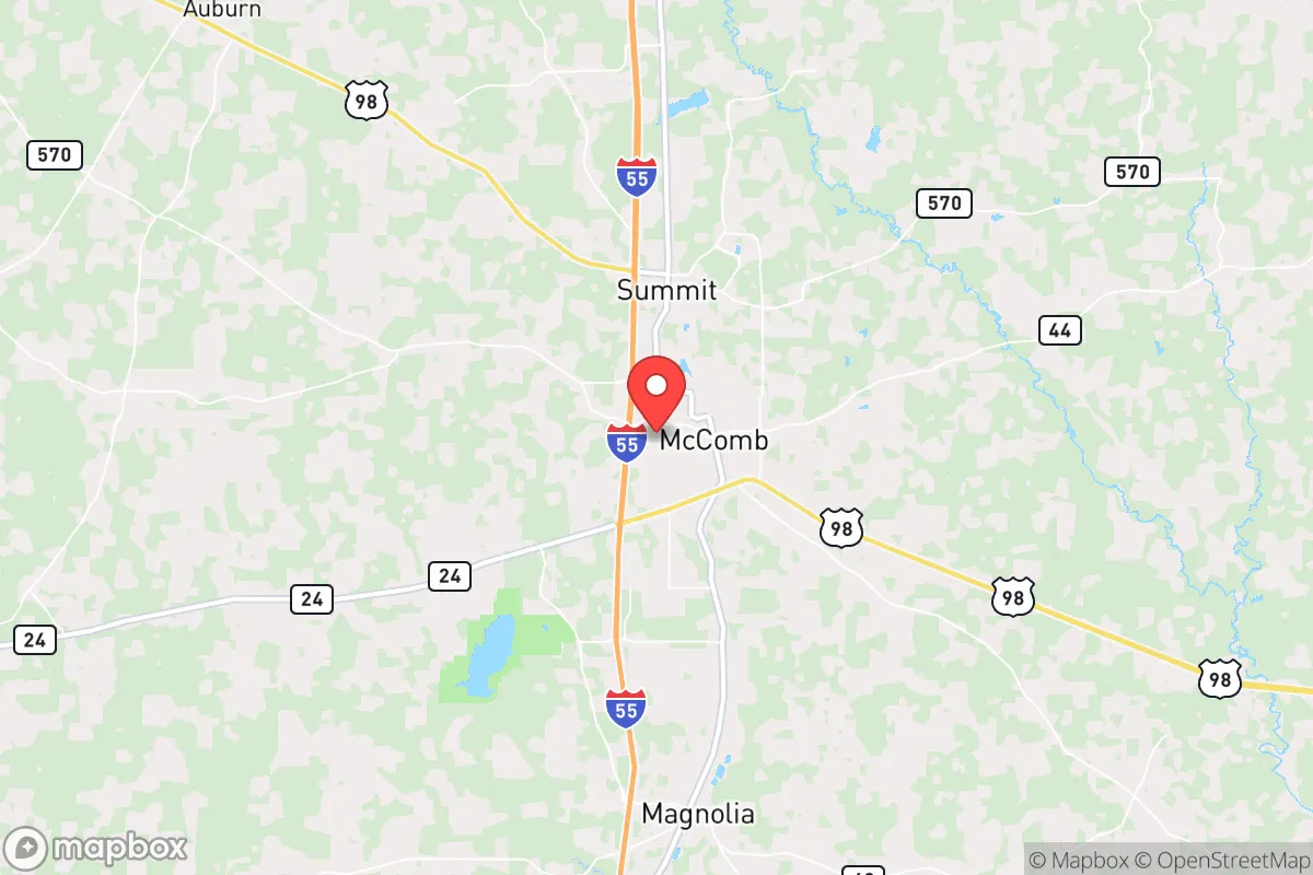
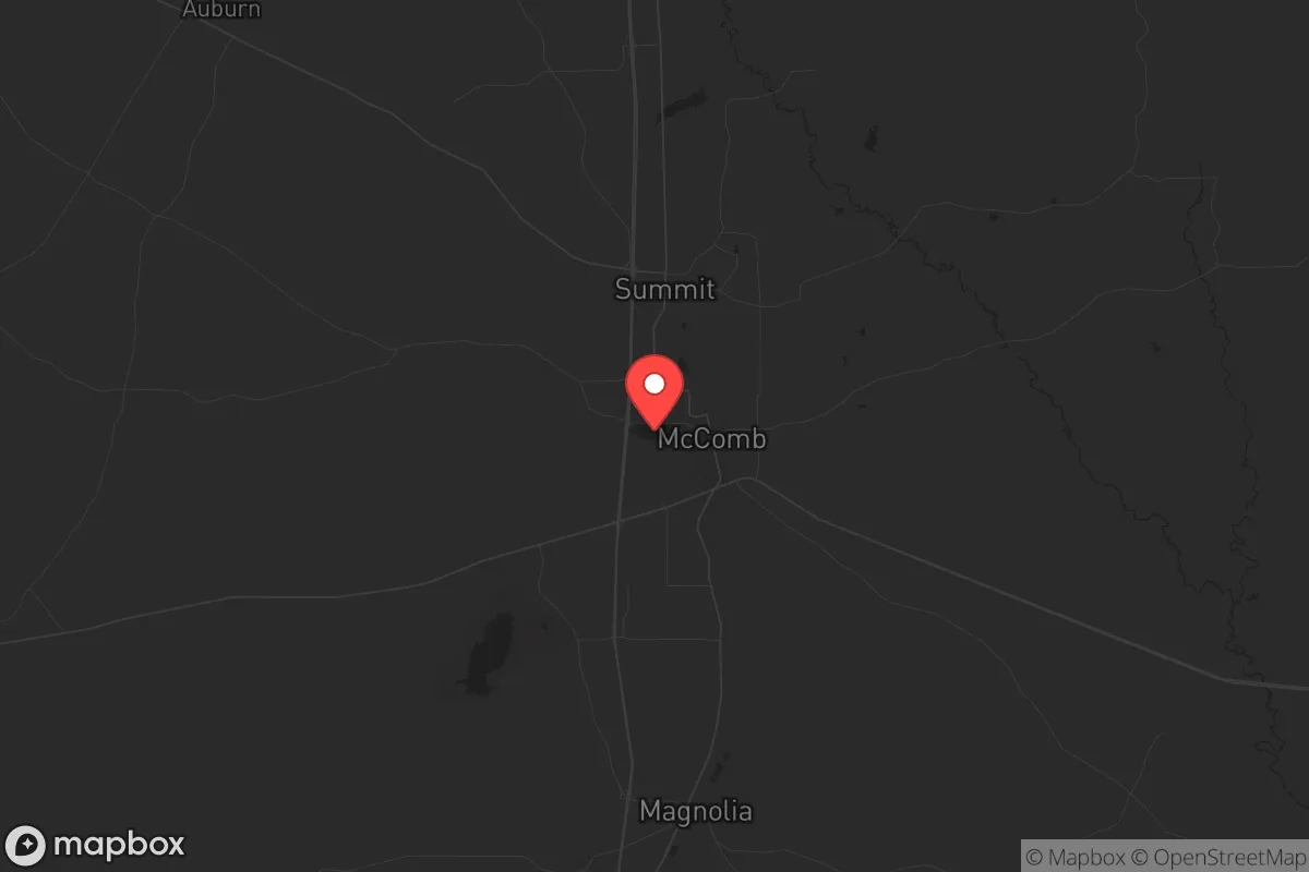
Strategic Assessment of Mccomb, MS
Workable tactical position. Some exposure to population density or targets, but generally defensible in a crisis.
What does the Strategic Assessment tell us?
Our Strategic Assessment grades tactical survivability of an area. Major population centers, military targets, fallout zones, natural disasters, and border exposure all drive risk — lower exposure means a more defensible position in a crisis.
This is heavily inspired by Joel Skousen's Strategic Relocation book. Highly recommended you checkout the book ($)What does this tell us?
Our Strategic Assessment grades tactical survivability of an area. Major population centers, military targets, fallout zones, natural disasters, and border exposure all drive risk — lower exposure means a more defensible position in a crisis.
This is heavily inspired by Joel Skousen's Strategic Relocation book. Highly recommended you checkout the book ($)Strategic Pillars

Key Distances
Regional Safe Places
Below is our recommended "safe zones" in Mississippi and the surrounding area based on our strategic heuristics. For most people, it's unrealistic to live in a “safe zone” full-time due to work, family or other personal reasons. They tend to be more rural. However, many of these areas are perfect for second homes and retreat properties that double as a vacation home or even a short-term rental.
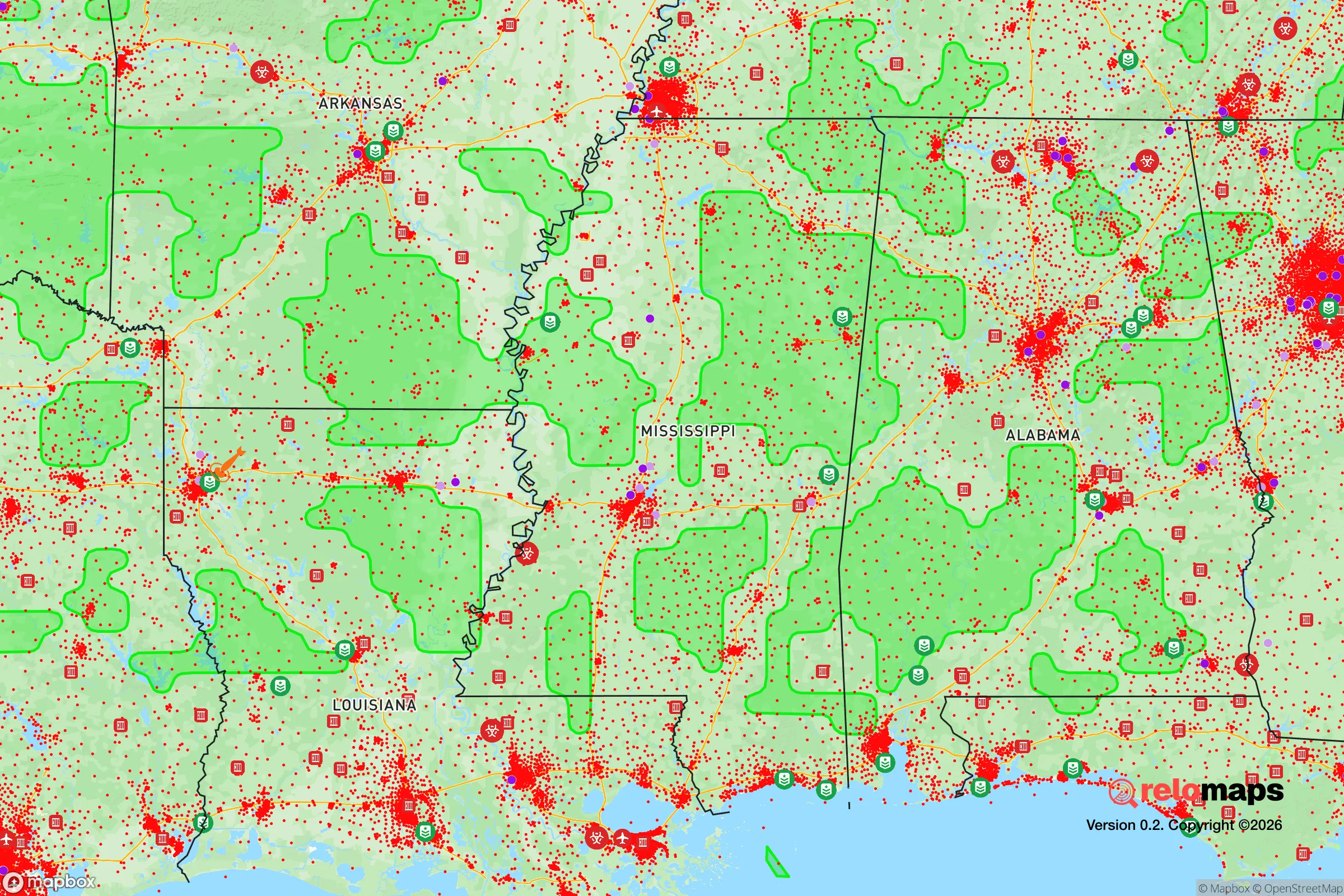
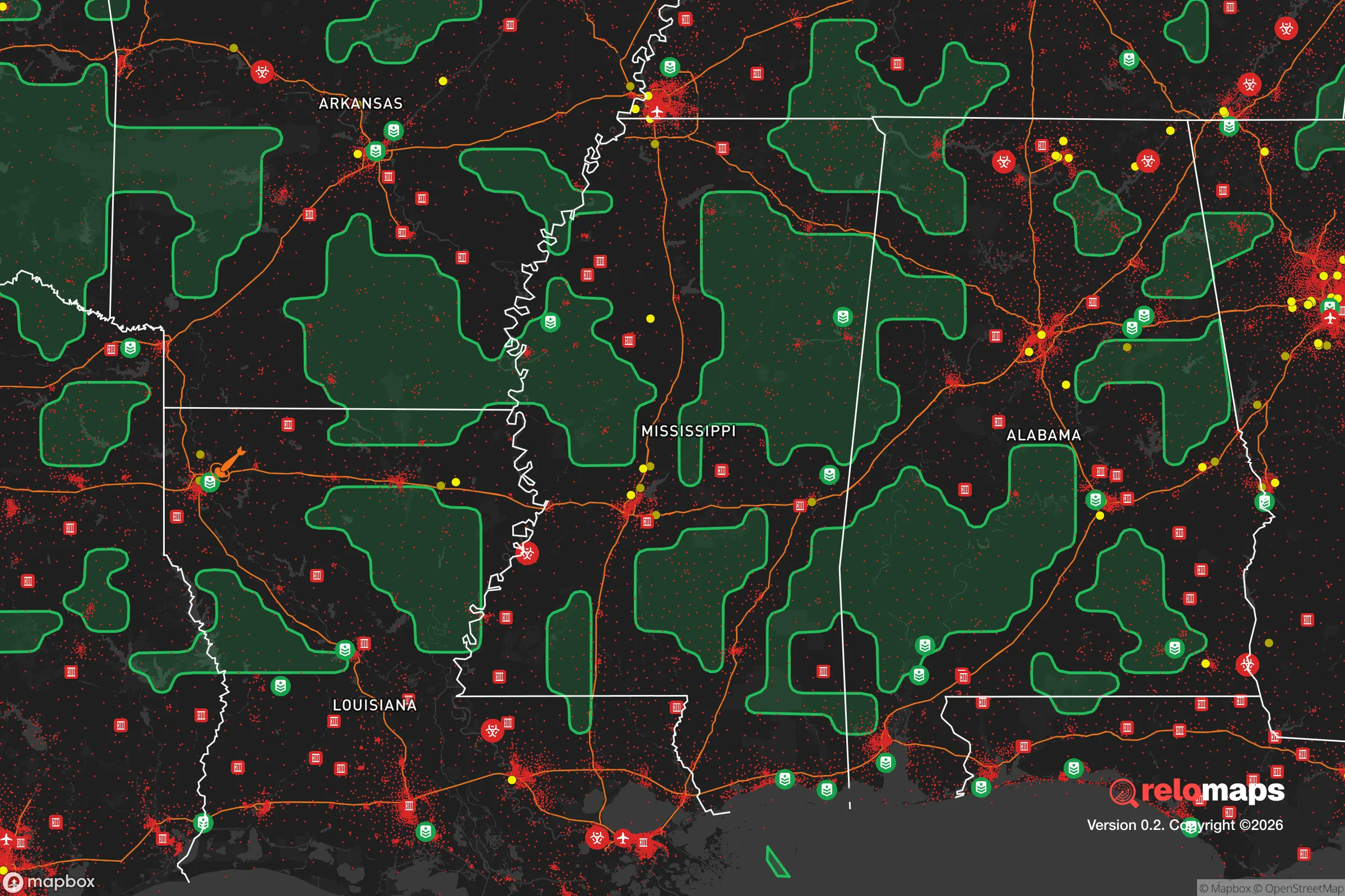
Important Note: For informational purposes only. This does not mean nothing bad ever happens in the green zones. Please use common sense. This is based on public data and modeled with AI. We tried to take a conservative approach but mistakes happen. We update this regularly as new information becomes available.
Solar Generator Recommendations
Backup power matters more here than in safer locations. We've picked three solar generators across budgets and capacity tiers — start with the budget unit if you only need a few essentials, or step up if you want to run a fridge and HVAC for days at a time.

Jackery Portable Power Station Explorer 300
Budget OptionPower on the Go: Weighing only 11 lbs, it's convenient to set up and store with book-sized foldable solar panels

BLUETTI Portable Power Station AC180
Designed for both indoor and outdoor scenarios, AC180 is highly capable as it has a robost capacity and continuous output power.

EF ECOFLOW DELTA Pro Ultra Power Station
Upgraded PickEcoFlow DELTA Pro Ultra is a whole-home energy system designed to grow with your family. Integrated with the Smart Home Panel 2, it scales to meet your evolving energy needs — keeping your home powered, intelligent, and secure through every stage of life.
We earn a commission, at no additional cost to you.
Strategic Assessment Analysis
McComb, Mississippi, offers a strategic paradox for the conservative prepper: it sits in a region of deep natural resilience—ample water, fertile soil, and low population density—yet its proximity to Interstate 55 and the Louisiana border makes it a potential chokepoint during a national crisis. The city’s population hovers around 12,000, with Pike County at roughly 40,000, giving you a small-town buffer without total isolation. Its location 80 miles south of Jackson and 80 miles north of New Orleans places it outside the immediate blast radius of major metro targets, but still close enough that you’d feel the shockwaves of a collapse—both literally and figuratively.
Geographic position and natural advantages for long-term survival
McComb’s real asset is its position in the Piney Woods region of southwest Mississippi, a landscape of rolling hills, dense forests, and abundant surface water. The area receives about 60 inches of rainfall annually, meaning you’re unlikely to face the drought-driven water shortages that plague the West. The Pearl River and the Bogue Chitto River are within a 30-minute drive, providing reliable sources for filtration and irrigation. The soil here is sandy loam, well-draining and workable for gardening, though you’ll need to amend it with organic matter for serious crop yields. The climate is humid subtropical—hot, sticky summers and mild winters—which extends growing seasons to nearly nine months. For a relocator, this means you can produce food year-round with a simple hoop house. The low population density of Pike County (about 55 people per square mile) gives you room to spread out, and land prices remain affordable: you can still find 5- to 10-acre parcels under $3,000 per acre, far cheaper than the Ozarks or Appalachia. The downside? You’re in a region that’s historically poor, with a median household income around $32,000, so local infrastructure is thin. That’s a double-edged sword: less to attract looters, but also fewer resources if you need to barter or rebuild.
Risks, exposures, and proximity to fallout-relevant landmarks
Here’s where the prepper calculus gets tricky. McComb is 80 miles from the Louisiana Chemical Corridor—the stretch of refineries and chemical plants between Baton Rouge and New Orleans. A major industrial accident, terrorist strike, or grid-down event could release toxic plumes that drift north with prevailing winds. The city is also 30 miles from the Mississippi River, a critical national shipping artery that would become a target for disruption during civil unrest. Interstate 55 runs right through town, making McComb a natural funnel for refugees fleeing New Orleans or Jackson. During Hurricane Katrina in 2005, the city saw a surge of evacuees that strained local supplies and services. In a collapse scenario, that highway becomes a liability—expect traffic jams, armed checkpoints, and desperate people moving through. On the plus side, McComb is over 200 miles from any nuclear power plant (the nearest is Waterford 3 in Louisiana), and there are no major military bases within 100 miles that would be primary targets. The biggest natural risk is tornadoes—Pike County sits in Dixie Alley, with a higher frequency of nocturnal, fast-moving storms. Flooding is localized along the creeks and low-lying areas, but most of the town sits on higher ground. You’ll want to build or buy on a ridge, not in a bottom.
Practical resilience for a relocator: food, water, energy, and defensibility
For a serious prepper, McComb offers a workable baseline but requires significant upfront investment. Water is abundant—the Sparta Aquifer lies beneath the region, and private wells are common. Drilling a well runs about $5,000–$8,000 for a 200-foot depth, and yields are typically 10–20 gallons per minute. Surface water from the Bogue Chitto or Tangipahoa River is accessible but requires filtration due to agricultural runoff. Food production is viable: the growing season runs from March to November, and you can raise chickens, goats, and even a few head of cattle on 10 acres. The local soil supports corn, beans, squash, and sweet potatoes—traditional survival crops. Hunting is legal on private land with permission, and the area has healthy populations of white-tailed deer, wild hogs, and turkey. Fishing in the rivers and nearby Lake Tangipahoa is decent for bass and catfish. Energy independence is harder. The local grid is maintained by Entergy Mississippi, which has a mixed reliability record—outages after storms are common, sometimes lasting days. Solar is viable, with about 215 sunny days per year, but you’ll need battery storage to handle the overcast stretches. Propane is widely available for backup generation, and wood heat is practical given the forest cover. Defensibility is moderate. The terrain is not mountainous, so you can’t rely on natural chokepoints. A rural property with a long driveway, cleared sightlines, and a perimeter fence is your best bet. The local law enforcement presence is thin—Pike County has about 40 deputies for the entire county—so in a crisis, you’re largely on your own. The nearest National Guard armory is in McComb itself, which could be a stabilizing force or a target, depending on the scenario.
The overall strategic picture for McComb is one of cautious viability for the conservative prepper. It’s not a fortress—you’re too close to the I-55 corridor and the chemical risks of Louisiana to call it a bug-out paradise. But it offers affordable land, reliable water, and a long growing season that many other regions lack. The local population is predominantly rural, conservative, and church-oriented, which means you’ll find like-minded neighbors if you integrate well. The biggest wildcards are the refugee flow from the Gulf Coast and the potential for industrial fallout from the south. If you can secure a property off the main highways, dig a well, and establish a food system, McComb gives you a fighting chance to ride out a decade of instability. Just don’t expect to do it alone—build a network, stock deep, and keep a low profile. The Piney Woods will shelter you, but only if you respect its limits.
* Values derived from national, state, county, city and local statistics and may differ in a specific area. Last updated: 2026-04-21T17:22:45.000Z
Narrative content on this page is AI-generated and may contain mistakes. Verify any details that matter before acting on them.
ReloMaps may earn a commission from affiliate links at no extra cost to you.