
Photo: Wikipedia
Strategic Assessment of Mustang, OK
Multiple tactical vulnerabilities. Population density, target proximity, or disaster risk are likely compounding. A retreat property and exit planning is required.
What does the Strategic Assessment tell us?
Our Strategic Assessment grades tactical survivability of an area. Major population centers, military targets, fallout zones, natural disasters, and border exposure all drive risk — lower exposure means a more defensible position in a crisis.
This is heavily inspired by Joel Skousen's Strategic Relocation book. Highly recommended you checkout the book ($)What does this tell us?
Our Strategic Assessment grades tactical survivability of an area. Major population centers, military targets, fallout zones, natural disasters, and border exposure all drive risk — lower exposure means a more defensible position in a crisis.
This is heavily inspired by Joel Skousen's Strategic Relocation book. Highly recommended you checkout the book ($)Strategic Pillars

Key Distances
Regional Safe Places
Below is our recommended "safe zones" in Oklahoma and the surrounding area based on our strategic heuristics. For most people, it's unrealistic to live in a “safe zone” full-time due to work, family or other personal reasons. They tend to be more rural. However, many of these areas are perfect for second homes and retreat properties that double as a vacation home or even a short-term rental.
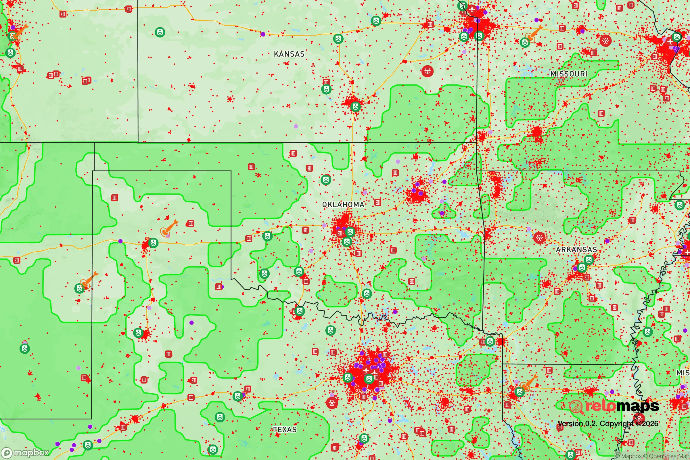
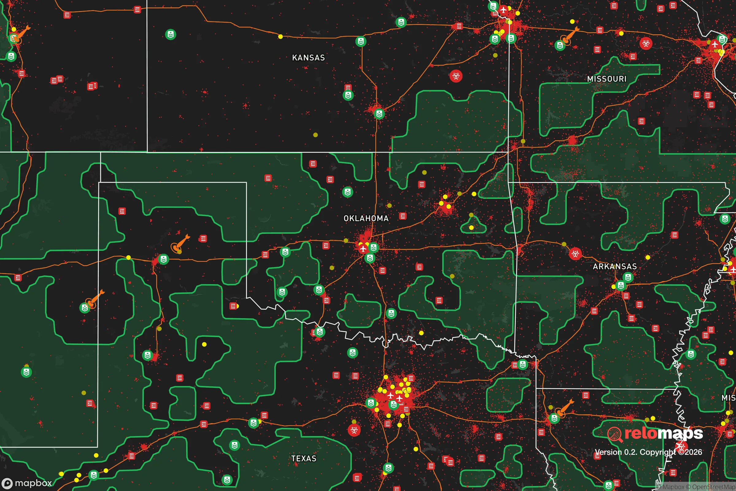
Important Note: For informational purposes only. This does not mean nothing bad ever happens in the green zones. Please use common sense. This is based on public data and modeled with AI. We tried to take a conservative approach but mistakes happen. We update this regularly as new information becomes available.
Solar Generator Recommendations
Backup power matters more here than in safer locations. We've picked three solar generators across budgets and capacity tiers — start with the budget unit if you only need a few essentials, or step up if you want to run a fridge and HVAC for days at a time.

Jackery Portable Power Station Explorer 300
Budget OptionPower on the Go: Weighing only 11 lbs, it's convenient to set up and store with book-sized foldable solar panels

BLUETTI Portable Power Station AC180
Designed for both indoor and outdoor scenarios, AC180 is highly capable as it has a robost capacity and continuous output power.

EF ECOFLOW DELTA Pro Ultra Power Station
Upgraded PickEcoFlow DELTA Pro Ultra is a whole-home energy system designed to grow with your family. Integrated with the Smart Home Panel 2, it scales to meet your evolving energy needs — keeping your home powered, intelligent, and secure through every stage of life.
We earn a commission, at no additional cost to you.
Strategic Assessment Analysis
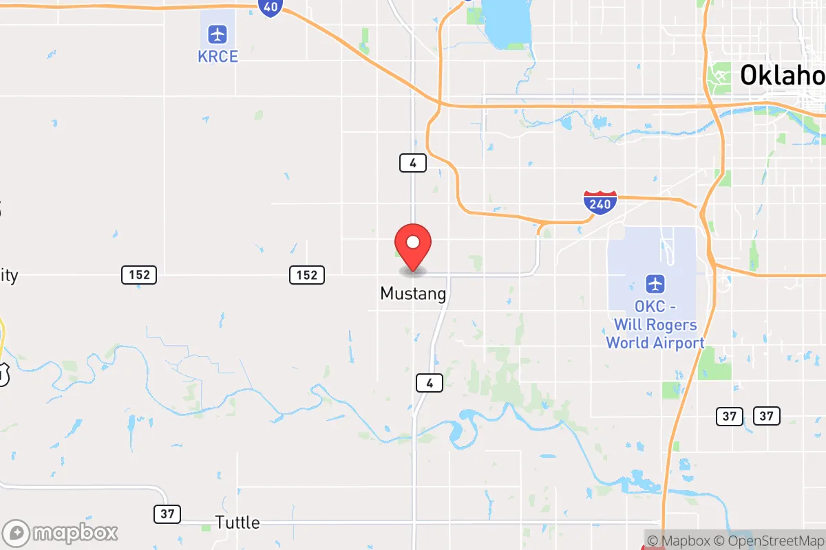
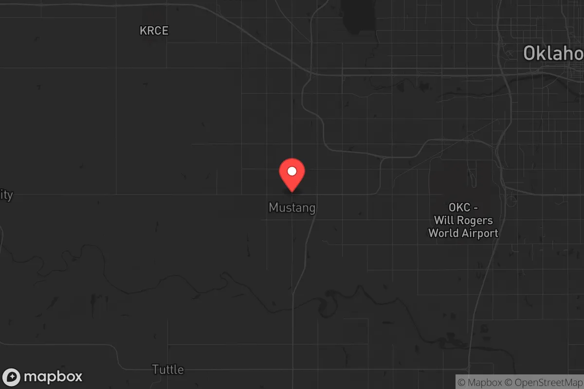
Mustang, Oklahoma, sits in a position that offers a surprisingly strong mix of strategic depth and practical resilience for those looking to get out of the direct blast zone of major population centers while still maintaining access to critical infrastructure. Located roughly 20 miles southwest of Oklahoma City, the town benefits from being far enough from the urban core to avoid the worst of a potential mass casualty event or civil unrest scenario, yet close enough to leverage the region’s agricultural and energy resources. The area’s flat terrain, low population density relative to the metro, and position along the Canadian River corridor give it a defensible, self-sufficient character that appeals to a conservative, prepper-oriented mindset.
Geographic position and natural advantages for long-term survival
Mustang’s location in central Oklahoma places it within a region that is often overlooked in national resilience discussions, but that’s precisely its strength. The town is situated on the edge of the Great Plains, with access to the Canadian River to the north and the Washita River system to the south. This provides a reliable water source for off-grid living, though surface water in the area is often silty and requires filtration. The surrounding landscape is predominantly agricultural—wheat, cattle, and hay operations dominate—meaning food production is a local reality, not a distant concept. The soil is workable, and the growing season runs from April to October, allowing for substantial gardening and small-scale farming. The area’s elevation, around 1,300 feet, offers no significant topographic defense, but the open terrain provides long sightlines and makes it difficult for any large-scale force to approach undetected. The climate is continental, with hot summers and cold winters, but the lack of dense forest cover reduces the risk of wildfire, a common threat in more wooded regions. For a relocator, the key advantage is that Mustang sits in a zone where you can realistically produce your own food and water without being immediately overwhelmed by urban refugees, as the nearest major city, Oklahoma City, is a 25-minute drive away—close enough to monitor but far enough to avoid the initial chaos.
Risks, exposures, and proximity to fallout-relevant landmarks
The primary risk for Mustang is its proximity to Tinker Air Force Base, located about 30 miles to the east-northeast. Tinker is a major strategic asset for the U.S. military, housing the Air Force Sustainment Center and the 552nd Air Control Wing. In a full-scale conflict or a major terrorist event, Tinker would be a high-priority target for a kinetic or cyber attack. The fallout plume from a conventional strike or a dirty bomb at Tinker would likely drift eastward with prevailing winds, but Mustang is close enough that a ground burst could produce localized contamination depending on wind direction. Additionally, the nearby Will Rogers World Airport in Oklahoma City is a secondary target, though less critical. The area is also within the range of the Oklahoma City metropolitan statistical area, which has a population of over 1.4 million. In a civil unrest scenario, that population could surge westward along I-40 and State Highway 152, the main routes into Mustang. The town’s position on the western edge of the metro means it would be a natural chokepoint for refugees fleeing the city, and without a strong local defense network, that could become a security liability. Tornadoes are a recurring natural hazard—Oklahoma averages 50+ tornadoes per year, and Mustang sits in the heart of Tornado Alley. A direct hit from an EF-3 or higher would level most structures, so underground shelter is non-negotiable. The risk of earthquake is low, but the region has seen increased seismic activity from wastewater injection wells, though this is more of a nuisance than a survival threat.
Practical resilience for a relocator: food, water, energy, and defensibility
For someone serious about self-sufficiency, Mustang offers a workable baseline. The water table in central Oklahoma is generally accessible via shallow wells, with depths ranging from 50 to 150 feet in the alluvial plains along the Canadian River. Rainwater catchment is viable, with annual precipitation averaging 35 inches, though it’s unevenly distributed—spring and fall are wet, summer is dry. A 1,000-gallon cistern system paired with a hand pump or solar-powered pump would provide a reliable off-grid water supply. The soil is loamy in the river bottoms but clay-heavy in the uplands, so raised beds or keyline plowing are recommended for gardening. The local agricultural economy means that bulk grains, livestock feed, and seeds are readily available from farm supply stores in nearby Yukon and El Reno. Energy resilience is strong: Oklahoma is a wind energy powerhouse, and the grid is relatively stable, but a prepper should plan for solar panels with battery storage. The region averages 230 sunny days per year, making solar a solid investment. Natural gas is abundant and cheap, and many homes already have gas hookups for heating and cooking, which is a major advantage if the electrical grid goes down. Defensibility is the weak point. Mustang is flat, with no natural barriers like hills or rivers that can be easily fortified. The town’s layout is suburban sprawl, with cul-de-sacs and open fields that offer limited cover. A perimeter defense would require a coordinated neighborhood watch or a private security arrangement. The local law enforcement presence is modest—the Mustang Police Department has about 30 officers for a population of 20,000—so in a prolonged crisis, you’re largely on your own. The good news is that the community is tight-knit and conservative, with a strong sense of mutual aid. Churches and local gun clubs are active, and the culture is generally pro-Second Amendment, which means you won’t face hostility for being armed. The nearest major medical facility is in Oklahoma City, but Mustang has a small clinic and a fire department with basic EMS. For serious trauma care, you’d need to drive 20 minutes, which is a consideration in a mass casualty event.
The overall strategic picture for Mustang is one of cautious optimism for the prepared relocator. It’s not a hardened bunker location like the Ozarks or the Rockies, but it offers a realistic balance of access to resources, distance from primary targets, and a community that shares your values. The biggest threat is the proximity to Oklahoma City and Tinker Air Force Base, but if you’re willing to invest in a well, solar panels, and a tornado shelter, you can build a lifestyle that is largely independent of the grid and the urban system. The area’s agricultural base means you can trade with local farmers for food, and the low cost of living allows you to stockpile supplies without breaking the bank. For a single individual or a family looking to ride out the coming instability, Mustang is a solid B+ choice—not perfect, but far better than staying in a coastal city or a dense suburb. The key is to act now, before the next wave of urban refugees discovers the same thing.
* Values derived from national, state, county, city and local statistics and may differ in a specific area. Last updated: 2026-04-25T13:51:55.000Z
Narrative content on this page is AI-generated and may contain mistakes. Verify any details that matter before acting on them.
ReloMaps may earn a commission from affiliate links at no extra cost to you.