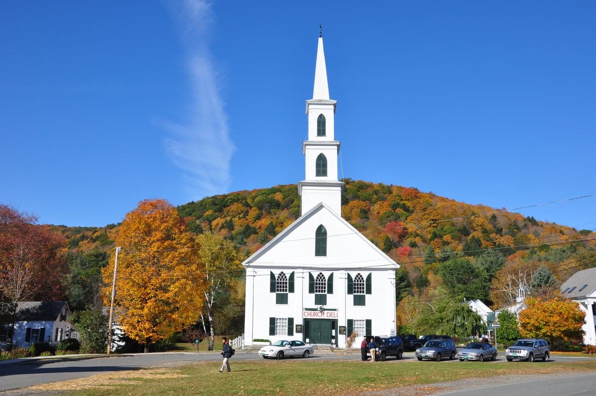
Photo: Wikipedia
Strategic Assessment of Newfane, VT
Meaningful friction. Expect exposure to either population pressure, blast zones, or natural disaster risk. Consider buying a retreat property.
What does the Strategic Assessment tell us?
Our Strategic Assessment grades tactical survivability of an area. Major population centers, military targets, fallout zones, natural disasters, and border exposure all drive risk — lower exposure means a more defensible position in a crisis.
This is heavily inspired by Joel Skousen's Strategic Relocation book. Highly recommended you checkout the book ($)What does this tell us?
Our Strategic Assessment grades tactical survivability of an area. Major population centers, military targets, fallout zones, natural disasters, and border exposure all drive risk — lower exposure means a more defensible position in a crisis.
This is heavily inspired by Joel Skousen's Strategic Relocation book. Highly recommended you checkout the book ($)Strategic Pillars

Key Distances
Regional Safe Places
Below is our recommended "safe zones" in Vermont and the surrounding area based on our strategic heuristics. For most people, it's unrealistic to live in a “safe zone” full-time due to work, family or other personal reasons. They tend to be more rural. However, many of these areas are perfect for second homes and retreat properties that double as a vacation home or even a short-term rental.


Important Note: For informational purposes only. This does not mean nothing bad ever happens in the green zones. Please use common sense. This is based on public data and modeled with AI. We tried to take a conservative approach but mistakes happen. We update this regularly as new information becomes available.
Solar Generator Recommendations
Backup power matters more here than in safer locations. We've picked three solar generators across budgets and capacity tiers — start with the budget unit if you only need a few essentials, or step up if you want to run a fridge and HVAC for days at a time.

Jackery Portable Power Station Explorer 300
Budget OptionPower on the Go: Weighing only 11 lbs, it's convenient to set up and store with book-sized foldable solar panels

BLUETTI Portable Power Station AC180
Designed for both indoor and outdoor scenarios, AC180 is highly capable as it has a robost capacity and continuous output power.

EF ECOFLOW DELTA Pro Ultra Power Station
Upgraded PickEcoFlow DELTA Pro Ultra is a whole-home energy system designed to grow with your family. Integrated with the Smart Home Panel 2, it scales to meet your evolving energy needs — keeping your home powered, intelligent, and secure through every stage of life.
We earn a commission, at no additional cost to you.
Strategic Assessment Analysis
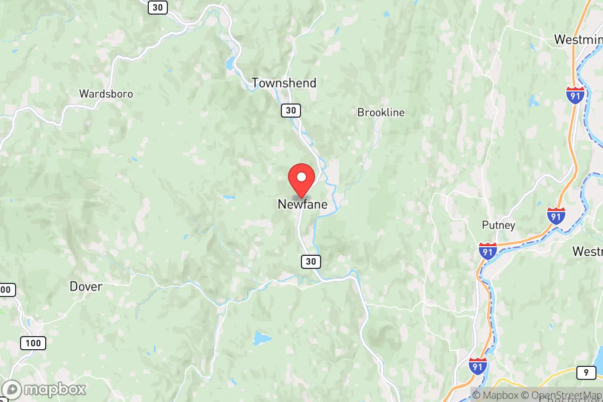
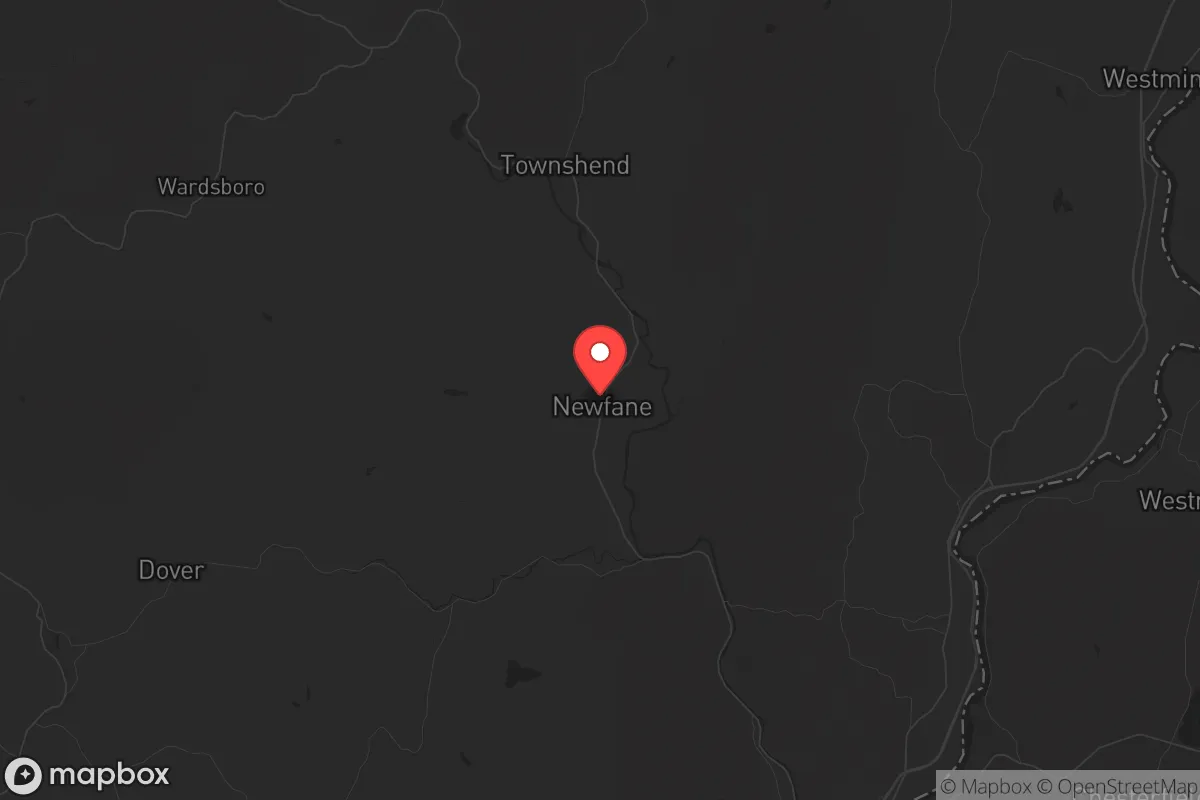
Newfane, Vermont, offers a compelling strategic position for those prioritizing resilience and self-sufficiency, particularly for conservative-leaning individuals and families concerned with long-term stability. Nestled in the southern part of the state, roughly 20 miles from the Massachusetts border, this small town of about 1,700 residents sits in a region that balances relative isolation with practical access to necessary resources. Its location in Windham County, away from major interstate corridors and population centers, provides a natural buffer against the cascading effects of urban unrest, supply chain disruptions, or mass casualty events that could ripple outward from larger cities. The town’s character—rooted in a quiet, rural New England tradition—aligns with a mindset that values preparedness, community self-reliance, and a deliberate distance from the volatility of densely populated areas.
Geographic position and natural advantages for long-term security
Newfane’s geography is its primary strategic asset. The town sits in a valley along the Rock River, surrounded by the Green Mountain National Forest to the west and the rolling hills of southern Vermont. This terrain offers natural defensibility: the area is characterized by winding, narrow roads, dense forest cover, and limited through-traffic, which would complicate any large-scale movement or unrest spilling over from outside. The nearest city of any size is Brattleboro, about 12 miles to the east, which itself is a modest population center of roughly 7,000—not a major target for fallout-related events. Boston is about 100 miles southeast, and New York City is roughly 180 miles southwest, placing Newfane far enough from these high-risk zones to avoid direct blast or fallout exposure from a nuclear incident, yet close enough to monitor broader regional trends. The town’s elevation, ranging from 500 to 1,500 feet, provides good drainage and reduces flood risk compared to low-lying areas. The surrounding forest offers abundant firewood, game, and natural cover, while the Rock River and numerous smaller streams supply a reliable water source for those who can treat or filter it. For a relocator, this means a location that is hard to reach, easy to defend, and rich in natural resources—a combination that is increasingly rare in the Northeast.
Risks, exposures, and proximity to fallout-relevant landmarks
While Newfane’s distance from major cities is a plus, no location is without vulnerabilities. The most significant risk is its proximity to Vermont Yankee, the decommissioned nuclear power plant in Vernon, about 20 miles southeast. Although the plant has been shut down since 2014, spent fuel remains stored on-site in dry casks, which could be a target for sabotage or a source of contamination in a major disaster. A worst-case release would likely affect areas downwind, and prevailing winds in the region are from the west and northwest, meaning Newfane is generally upwind of the plant—but not immune in shifting conditions. Additionally, the town lies within 50 miles of the New Hampshire border, where the Seabrook Station nuclear plant (about 70 miles southeast) also poses a theoretical risk. For a prepper, this means having a radiation detection kit and a plan for sheltering or relocating temporarily is prudent. Beyond nuclear concerns, Newfane’s rural character means limited law enforcement presence—the Windham County Sheriff’s Office covers a large area, and response times in a crisis could be slow. The town’s single main road, Route 30, is a choke point that could become impassable in a mass evacuation scenario. Winter storms are a recurring hazard, with heavy snow and ice occasionally cutting power for days, which tests any off-grid setup. For those concerned with civil unrest, the nearest potential flashpoints are Burlington (about 100 miles north) and the college towns of Northampton and Amherst, Massachusetts (about 50 miles south), but Newfane’s isolation largely insulates it from street-level chaos.
Practical resilience for a relocator: food, water, energy, and defensibility
For a single individual or family looking to establish a resilient homestead, Newfane offers a workable foundation. The growing season is short—roughly 120 days between last and first frost—but the soil in the valley is fertile enough for small-scale vegetable gardens, and the surrounding forest supports foraging for mushrooms, berries, and ramps. Local agriculture is limited; the nearest grocery store is in Brattleboro, about a 20-minute drive, so building a pantry with at least a three-month supply of staples is essential for true self-sufficiency. Water is abundant: the Rock River runs year-round, and most properties have wells. A hand pump or a solar-powered well pump can ensure access when the grid fails. For energy, the area’s tree cover makes wood heat the most practical off-grid option—many homes already have wood stoves, and firewood permits from the national forest are inexpensive. Solar panels are viable but require clearing for southern exposure, which may be limited in heavily wooded lots. Defensibility is strong: the town’s layout, with scattered homes along winding roads and few public gathering spots, means a determined group could secure a perimeter around a property with relative ease. The local population is small and generally self-reliant, with a culture of neighborly assistance that aligns with prepper values—though newcomers should expect a period of proving themselves before being fully accepted. The biggest practical challenge is medical access: the nearest hospital is in Brattleboro (12 miles), and trauma care requires a 45-minute drive to Dartmouth-Hitchcock in Lebanon, New Hampshire. A comprehensive first-aid kit and training in emergency medicine are non-negotiable for anyone serious about long-term resilience here.
Overall, Newfane presents a solid strategic option for those seeking a balance between isolation and accessibility, with natural resources that support a prepared lifestyle. It is not a fortress—no location in the Northeast truly is—but its distance from major targets, defensible terrain, and community of like-minded individuals make it a viable base for weathering the kind of disruptions that concern a conservative prepper. The key trade-offs are the short growing season, the need for robust off-grid systems, and the proximity to a decommissioned nuclear site, which requires monitoring. For a single person or family willing to invest in self-reliance and integrate into a quiet rural community, Newfane offers a realistic foundation for long-term security without the extreme isolation of more remote locations. It is a place where preparation meets practicality, and where the risks are manageable for those who plan ahead.
* Values derived from national, state, county, city and local statistics and may differ in a specific area. Last updated: 2026-05-03T20:38:51.000Z
Narrative content on this page is AI-generated and may contain mistakes. Verify any details that matter before acting on them.
ReloMaps may earn a commission from affiliate links at no extra cost to you.