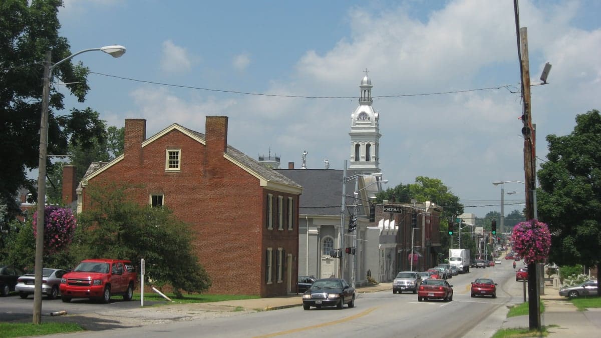
Photo: Wikipedia
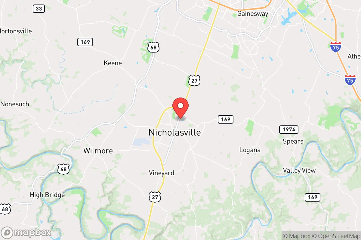
Strategic Assessment of Nicholasville, KY
Meaningful friction. Expect exposure to either population pressure, blast zones, or natural disaster risk. Consider buying a retreat property.
What does the Strategic Assessment tell us?
Our Strategic Assessment grades tactical survivability of an area. Major population centers, military targets, fallout zones, natural disasters, and border exposure all drive risk — lower exposure means a more defensible position in a crisis.
This is heavily inspired by Joel Skousen's Strategic Relocation book. Highly recommended you checkout the book ($)What does this tell us?
Our Strategic Assessment grades tactical survivability of an area. Major population centers, military targets, fallout zones, natural disasters, and border exposure all drive risk — lower exposure means a more defensible position in a crisis.
This is heavily inspired by Joel Skousen's Strategic Relocation book. Highly recommended you checkout the book ($)Strategic Pillars

Key Distances
Regional Safe Places
Below is our recommended "safe zones" in Kentucky and the surrounding area based on our strategic heuristics. For most people, it's unrealistic to live in a “safe zone” full-time due to work, family or other personal reasons. They tend to be more rural. However, many of these areas are perfect for second homes and retreat properties that double as a vacation home or even a short-term rental.


Important Note: For informational purposes only. This does not mean nothing bad ever happens in the green zones. Please use common sense. This is based on public data and modeled with AI. We tried to take a conservative approach but mistakes happen. We update this regularly as new information becomes available.
Solar Generator Recommendations
Backup power matters more here than in safer locations. We've picked three solar generators across budgets and capacity tiers — start with the budget unit if you only need a few essentials, or step up if you want to run a fridge and HVAC for days at a time.

Jackery Portable Power Station Explorer 300
Budget OptionPower on the Go: Weighing only 11 lbs, it's convenient to set up and store with book-sized foldable solar panels

BLUETTI Portable Power Station AC180
Designed for both indoor and outdoor scenarios, AC180 is highly capable as it has a robost capacity and continuous output power.

EF ECOFLOW DELTA Pro Ultra Power Station
Upgraded PickEcoFlow DELTA Pro Ultra is a whole-home energy system designed to grow with your family. Integrated with the Smart Home Panel 2, it scales to meet your evolving energy needs — keeping your home powered, intelligent, and secure through every stage of life.
We earn a commission, at no additional cost to you.
Strategic Assessment Analysis
Nicholasville, Kentucky, offers a compelling strategic position for those prioritizing resilience and self-sufficiency, sitting just far enough from the urban core of Lexington to avoid the worst of its collapse scenarios while remaining close enough to access critical resources. The city’s location in Jessamine County places it within a corridor of relatively stable, low-density development, with a population of roughly 30,000 that provides a buffer against the immediate chaos of a major metropolitan area. For a relocator focused on weathering civic unrest, mass casualty events, or natural disasters, Nicholasville’s blend of rural accessibility and modest infrastructure makes it a viable base of operations, though it is not without its own vulnerabilities.
Geographic position and natural advantages for long-term survival
Nicholasville sits in the heart of the Bluegrass Region, a landscape defined by rolling limestone hills, fertile soil, and abundant groundwater—factors that are critical for sustained food and water security. The area’s karst topography means numerous springs and wells are viable, and the Kentucky River runs roughly 10 miles to the west, providing a reliable surface water source if municipal systems fail. The climate is temperate, with four distinct seasons that support year-round gardening and livestock grazing, and the region is historically less prone to extreme weather events like hurricanes, wildfires, or earthquakes compared to coastal or fault-line zones. The surrounding farmland is among the most productive in the state, with Jessamine County ranking high in tobacco, corn, and hay production, which translates to a local food network that could be leveraged during supply chain disruptions. For a prepper, this means the land itself offers a buffer: you can grow food, harvest rainwater, and rely on natural water sources without being entirely dependent on grid infrastructure. The rolling hills also provide natural defensibility, with numerous hollows and ridgelines that offer concealment and strategic vantage points, though the terrain is not mountainous enough to create significant barriers to movement.
Risks, exposures, and proximity to fallout-relevant landmarks
The primary strategic drawback of Nicholasville is its proximity to Lexington, a city of roughly 320,000 people located just 12 miles to the north. In a scenario involving civil unrest, mass casualty events, or a major disaster, Lexington’s population density and economic dependence on the University of Kentucky and a handful of large employers (like Lexmark and Toyota’s Georgetown plant) could create a cascading failure of services, with refugees and looters likely funneling south along US-27 and KY-169. The Blue Grass Airport and the Lexington VA Medical Center are also within a 20-minute drive, making them potential targets or choke points during a crisis. Additionally, the region is within 150 miles of the Fort Knox military installation and the Paducah Gaseous Diffusion Plant (a former uranium enrichment site), which, while not immediate fallout zones, could become secondary targets in a broader conflict. The Kentucky River’s locks and dams, such as the one at Lock 7 near Camp Nelson, are critical infrastructure that could be sabotaged or overwhelmed, potentially flooding low-lying areas along the river. For a relocator, the key takeaway is that Nicholasville is not a remote bunker—it’s a buffer zone. You’ll need to plan for the influx of urban refugees and the potential for supply chain disruptions tied to Lexington’s collapse, but the distance is enough to give you a 24- to 48-hour head start if you have a solid evacuation or hardening plan.
Practical resilience for a relocator: food, water, energy, and defensibility
On the ground, Nicholasville offers a mix of practical advantages and challenges for a self-sufficient lifestyle. The soil is rich and well-drained, ideal for vegetable gardens, fruit orchards, and small-scale livestock like chickens or goats, and the growing season runs from April to October, allowing for multiple harvests. Water is accessible via private wells (average depth 100-200 feet) and the Kentucky River, but note that the river’s water quality can be impacted by agricultural runoff and upstream industrial activity, so filtration and testing are non-negotiable. Energy resilience is moderate: the area is served by Kentucky Utilities, which relies heavily on coal and natural gas, meaning grid outages during ice storms or heat waves are common (the 2022 ice storm left parts of the county without power for up to a week). Solar is viable, with an average of 196 sunny days per year, but you’ll need battery storage to handle the overcast winter months. Defensibility is a mixed bag: the suburban sprawl around Nicholasville—particularly along US-27 and near the Brannon Crossing shopping center—creates chokepoints and visibility issues, but the rural outskirts offer farmhouses with acreage, tree lines, and gravel roads that are easy to monitor and hard to approach unnoticed. The local law enforcement presence is modest (Jessamine County Sheriff’s Office has about 40 deputies), so in a prolonged crisis, you’ll largely be on your own. The community itself is tight-knit, with a strong church and agricultural network that could be leveraged for mutual aid, but it’s also insular—newcomers should expect a period of proving themselves before being trusted with resources or information.
Overall, Nicholasville represents a solid middle-ground option for the strategic relocator: it’s not a hardened retreat, but it’s far enough from the major fallout zones to give you a fighting chance, and the natural resources are there if you’re willing to put in the work. The biggest threat is the proximity to Lexington, which could turn a bad situation into a desperate one if you’re not prepared for the human wave. But if you secure a property with a well, a garden plot, and a defensible perimeter, and you build relationships with the local farming community, you can create a sustainable base that outlasts the chaos. The Bluegrass isn’t a fortress—it’s a farm. And in a world where the grid is fragile and the cities are tinderboxes, that might be exactly what you need.
* Values derived from national, state, county, city and local statistics and may differ in a specific area. Last updated: 2026-04-21T17:17:31.000Z
Narrative content on this page is AI-generated and may contain mistakes. Verify any details that matter before acting on them.
ReloMaps may earn a commission from affiliate links at no extra cost to you.