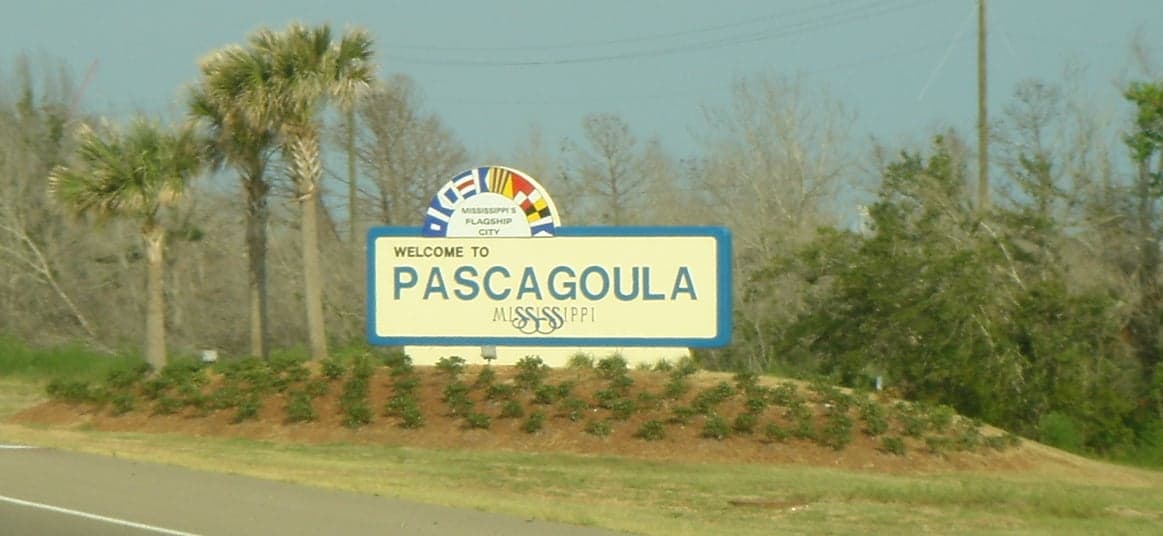
Photo: Wikipedia
Strategic Assessment of Pascagoula, MS
Meaningful friction. Expect exposure to either population pressure, blast zones, or natural disaster risk. Consider buying a retreat property.
What does the Strategic Assessment tell us?
Our Strategic Assessment grades tactical survivability of an area. Major population centers, military targets, fallout zones, natural disasters, and border exposure all drive risk — lower exposure means a more defensible position in a crisis.
This is heavily inspired by Joel Skousen's Strategic Relocation book. Highly recommended you checkout the book ($)What does this tell us?
Our Strategic Assessment grades tactical survivability of an area. Major population centers, military targets, fallout zones, natural disasters, and border exposure all drive risk — lower exposure means a more defensible position in a crisis.
This is heavily inspired by Joel Skousen's Strategic Relocation book. Highly recommended you checkout the book ($)Strategic Pillars

Key Distances
Regional Safe Places
Below is our recommended "safe zones" in Mississippi and the surrounding area based on our strategic heuristics. For most people, it's unrealistic to live in a “safe zone” full-time due to work, family or other personal reasons. They tend to be more rural. However, many of these areas are perfect for second homes and retreat properties that double as a vacation home or even a short-term rental.
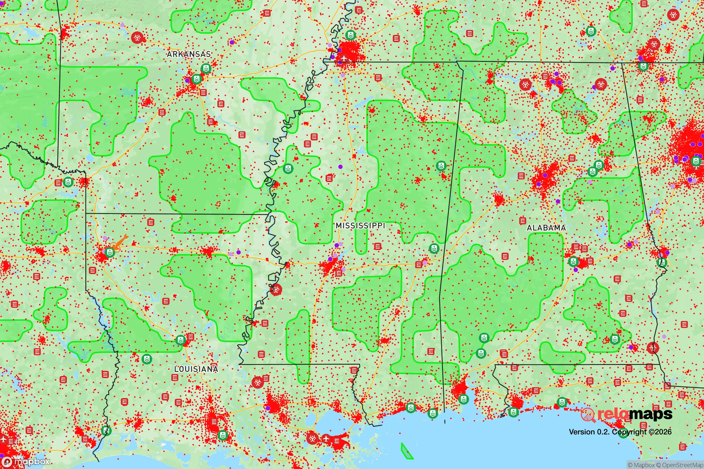
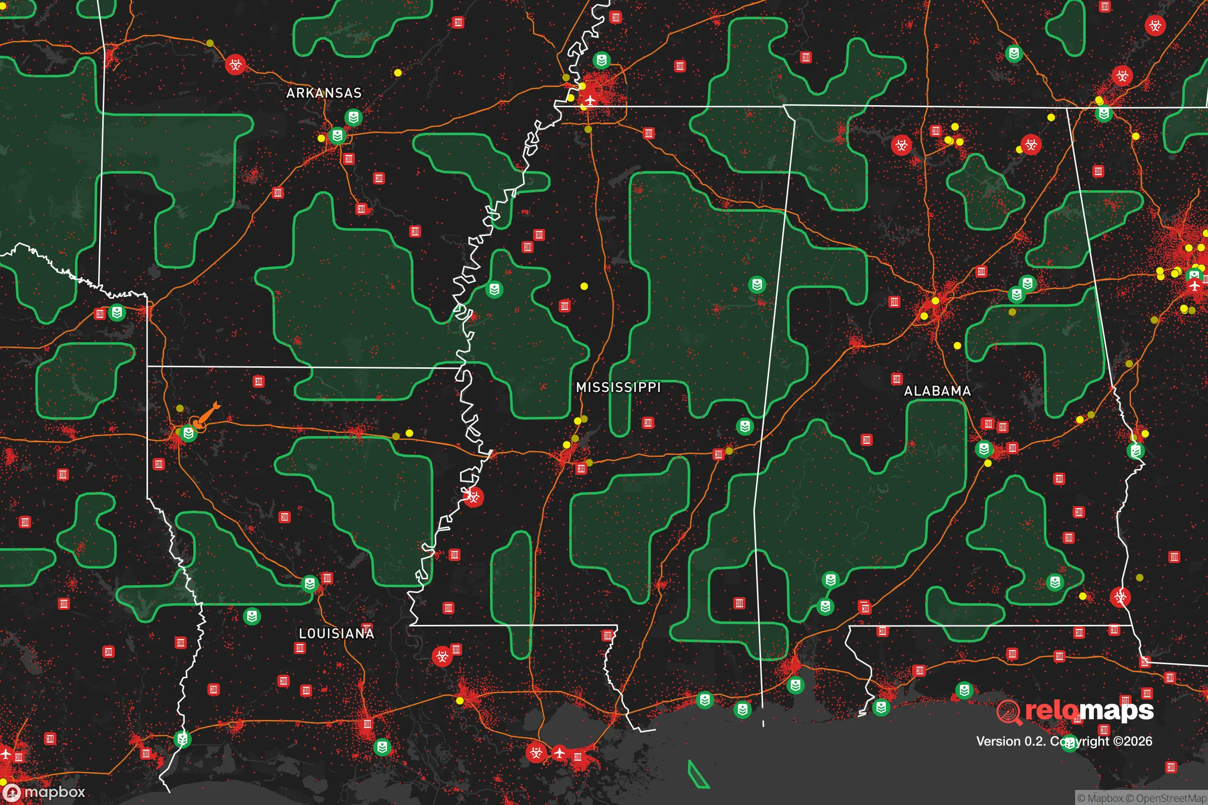
Important Note: For informational purposes only. This does not mean nothing bad ever happens in the green zones. Please use common sense. This is based on public data and modeled with AI. We tried to take a conservative approach but mistakes happen. We update this regularly as new information becomes available.
Solar Generator Recommendations
Backup power matters more here than in safer locations. We've picked three solar generators across budgets and capacity tiers — start with the budget unit if you only need a few essentials, or step up if you want to run a fridge and HVAC for days at a time.

Jackery Portable Power Station Explorer 300
Budget OptionPower on the Go: Weighing only 11 lbs, it's convenient to set up and store with book-sized foldable solar panels

BLUETTI Portable Power Station AC180
Designed for both indoor and outdoor scenarios, AC180 is highly capable as it has a robost capacity and continuous output power.

EF ECOFLOW DELTA Pro Ultra Power Station
Upgraded PickEcoFlow DELTA Pro Ultra is a whole-home energy system designed to grow with your family. Integrated with the Smart Home Panel 2, it scales to meet your evolving energy needs — keeping your home powered, intelligent, and secure through every stage of life.
We earn a commission, at no additional cost to you.
Strategic Assessment Analysis
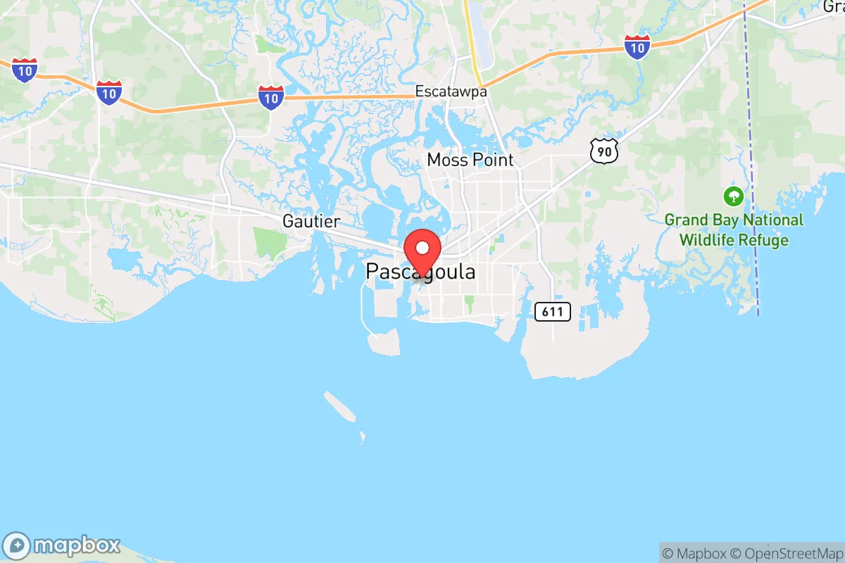
Pascagoula, Mississippi, offers a unique strategic calculus for those prioritizing resilience and self-sufficiency. Its location on the Gulf Coast, with a population around 22,000, provides a buffer from the immediate chaos of major metropolitan centers while still offering access to critical infrastructure. The city’s industrial base—anchored by the massive Ingalls Shipbuilding yard and a Chevron refinery—means it’s not a sleepy backwater but a working town with real economic muscle and a blue-collar, self-reliant culture that aligns well with a preparedness mindset. However, this same industrial density and coastal exposure introduce specific vulnerabilities that any relocator must weigh carefully.
Geographic position and natural advantages for strategic relocation
Pascagoula sits at the mouth of the Pascagoula River, one of the last free-flowing river systems in the lower 48, which is a significant natural asset. This river provides a reliable freshwater source and a potential transportation corridor if roads become compromised. The surrounding Jackson County offers a mix of pine forests, marshlands, and agricultural land, creating multiple layers of natural buffer between the city and the more densely populated corridors of I-10 and US-90. The area’s proximity to the Gulf of Mexico also means access to marine resources—fishing, crabbing, and shrimping—which can supplement food supplies in a prolonged disruption. The Pascagoula River Basin’s 880 square miles of undeveloped watershed offer a natural retreat zone that is difficult to monitor or control from outside, a key consideration for those planning for long-term self-sufficiency. The climate is humid subtropical, with mild winters and a long growing season, which supports year-round gardening and livestock operations if you secure land outside the floodplain.
Risks, exposures, and proximity to fallout-relevant landmarks
The most glaring vulnerability is Pascagoula’s position on the Gulf Coast, which puts it squarely in the path of hurricane storm surges. The city’s elevation averages just 10 feet above sea level, and the entire Jackson County coastline is designated as a high-risk surge zone. Hurricane Katrina (2005) demonstrated this brutally, with storm tides exceeding 20 feet in some areas, destroying thousands of homes and shutting down the shipyard for months. For a prepper, this means any property within a mile of the coast or the river requires a hardened structure or a pre-planned evacuation route inland—ideally to higher ground north of I-10. Beyond weather, the industrial targets are a major concern. The Chevron Pascagoula Refinery, one of the largest on the Gulf Coast, processes 330,000 barrels of crude oil per day. In a scenario of civil unrest or state failure, such a facility becomes a prime target for sabotage or a source of catastrophic environmental release. Similarly, the Ingalls Shipyard, which builds Navy destroyers and amphibious assault ships, is a high-value military asset that could draw hostile attention. Pascagoula is also within 35 miles of the Keesler Air Force Base in Biloxi, a major training and communications hub, and roughly 60 miles from the Stennis Space Center, a NASA rocket testing facility. These are not fallout zones in the nuclear sense, but they are nodes of federal power that could become flashpoints during a collapse. The city’s proximity to Mobile, Alabama (40 miles east) and New Orleans (100 miles west) means that any mass evacuation or unrest in those cities will push refugees and supply chain disruptions directly into Pascagoula via I-10.
Practical resilience for a relocator: food, water, energy, and defensibility
For a single individual or family looking to establish a resilient homestead, Pascagoula offers a mixed bag. The local water supply comes from the Pascagoula River and is treated by the city’s water plant, but a grid-down scenario would require a backup plan. Shallow groundwater is abundant in the region, with typical wells reaching 30-60 feet, making a hand pump or solar-powered well a viable option for off-grid water. The long growing season (roughly 250 frost-free days) allows for three-season vegetable production, and the local soil, while sandy near the coast, improves to loam further inland. Deer, wild hogs, and waterfowl are plentiful in the surrounding national forests (De Soto and Bienville are within an hour’s drive), providing a protein source for those with hunting skills. Energy resilience is a challenge. The Gulf Coast is prone to extended power outages after hurricanes—some areas were without electricity for weeks after Katrina. Solar with battery storage is feasible given the region’s 220+ sunny days per year, but any system must be hardened against 130 mph winds. Natural gas is widely available in the city, but rural properties may rely on propane, which requires storage and resupply. Defensibility is where Pascagoula’s layout becomes important. The city is bisected by the Pascagoula River and numerous bayous, creating natural chokepoints. The major bridges (I-10, US-90, and the rail bridge) are the only crossings for miles, meaning a small group could effectively control access to the eastern half of the city if needed. However, the flat terrain offers little in the way of high ground for observation or defensive positions. Neighborhoods like the historic district near the river are dense and walkable, which is good for community defense but bad for maintaining privacy or a low profile. For a relocator, the sweet spot is likely the northern part of Jackson County, around the town of Moss Point or further inland toward the George County line, where you get more acreage, higher elevation, and fewer industrial neighbors.
The overall strategic picture for Pascagoula is one of calculated trade-offs. It is not a bug-out location for those seeking total isolation—the hurricane risk and industrial targets are real liabilities. But for someone who wants to remain within striking distance of Gulf Coast resources while avoiding the population density and political volatility of cities like New Orleans or Mobile, it offers a viable middle ground. The local economy is stable, the culture is self-reliant, and the natural environment provides the raw materials for a resilient lifestyle. Your biggest preps here need to focus on storm hardening, water purification, and a reliable evacuation route north—preferably to a secondary property in the pine hills of Jones or Perry County. If you can manage those, Pascagoula gives you a working-class anchor point with real strategic depth, as long as you keep one eye on the Gulf and the other on the refinery flares.
* Values derived from national, state, county, city and local statistics and may differ in a specific area. Last updated: 2026-05-01T06:24:27.000Z
Narrative content on this page is AI-generated and may contain mistakes. Verify any details that matter before acting on them.
ReloMaps may earn a commission from affiliate links at no extra cost to you.