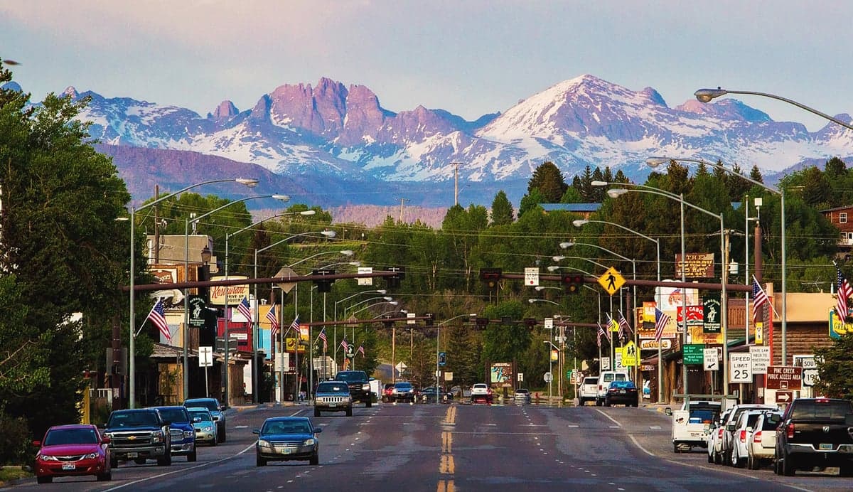
Photo: Wikipedia
Strategic Assessment of Pinedale, WY
Strong survivability profile. Good buffer from population centers, with manageable environmental and tactical risks.
What does the Strategic Assessment tell us?
Our Strategic Assessment grades tactical survivability of an area. Major population centers, military targets, fallout zones, natural disasters, and border exposure all drive risk — lower exposure means a more defensible position in a crisis.
This is heavily inspired by Joel Skousen's Strategic Relocation book. Highly recommended you checkout the book ($)What does this tell us?
Our Strategic Assessment grades tactical survivability of an area. Major population centers, military targets, fallout zones, natural disasters, and border exposure all drive risk — lower exposure means a more defensible position in a crisis.
This is heavily inspired by Joel Skousen's Strategic Relocation book. Highly recommended you checkout the book ($)Strategic Pillars

Key Distances
Regional Safe Places
Below is our recommended "safe zones" in Wyoming and the surrounding area based on our strategic heuristics. For most people, it's unrealistic to live in a “safe zone” full-time due to work, family or other personal reasons. They tend to be more rural. However, many of these areas are perfect for second homes and retreat properties that double as a vacation home or even a short-term rental.
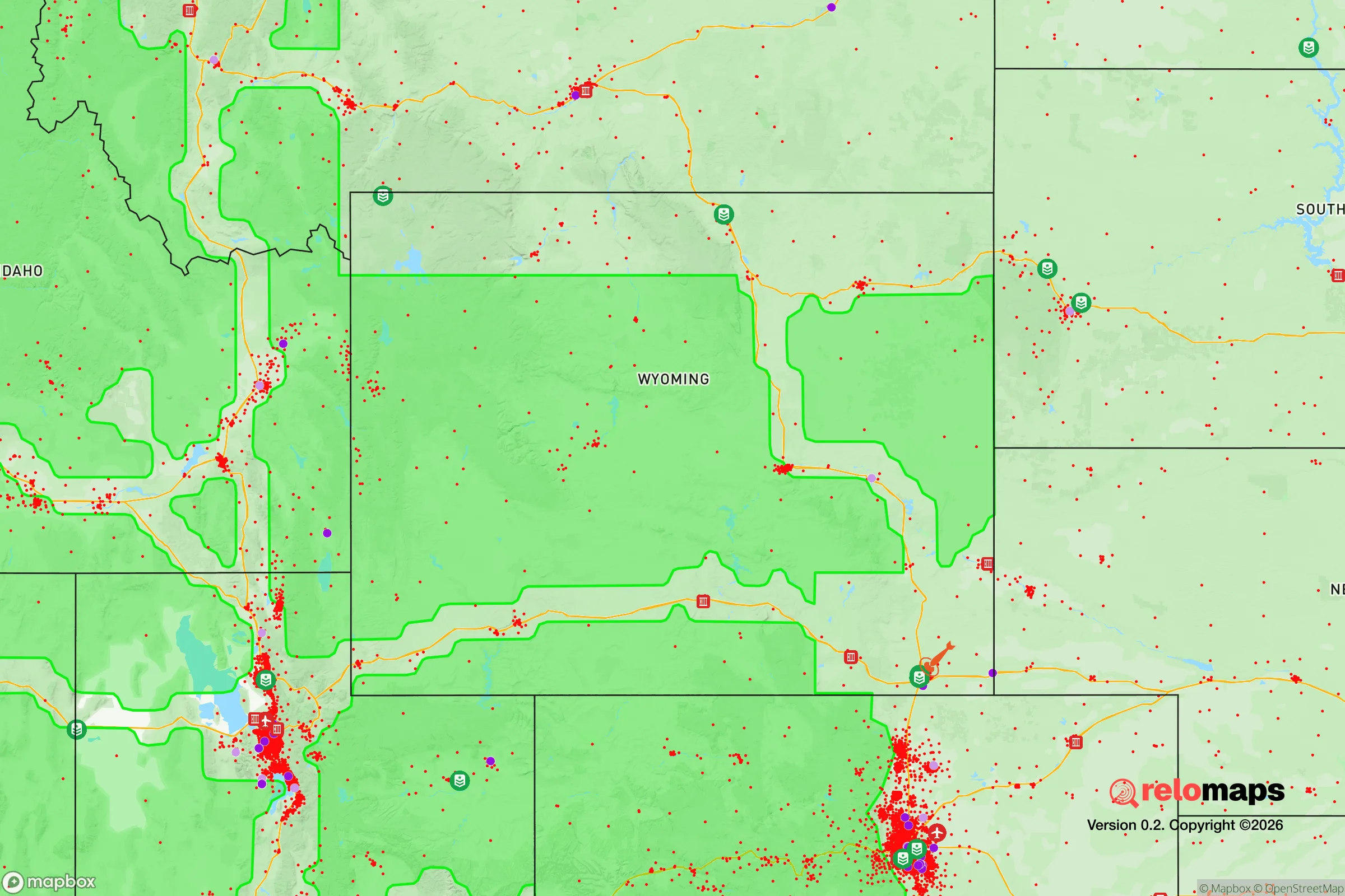
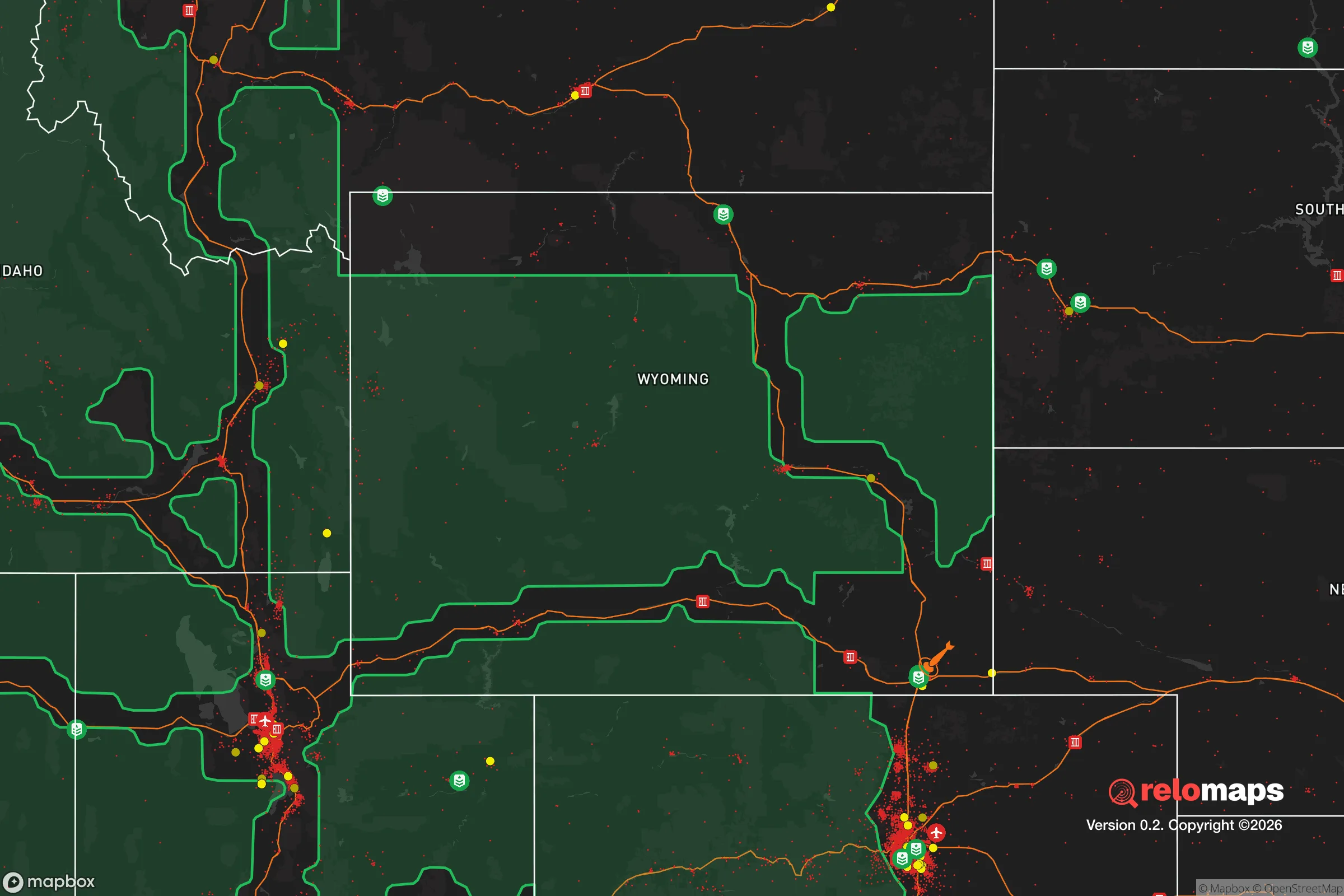
Important Note: For informational purposes only. This does not mean nothing bad ever happens in the green zones. Please use common sense. This is based on public data and modeled with AI. We tried to take a conservative approach but mistakes happen. We update this regularly as new information becomes available.
Solar Generator Recommendations
Backup power matters more here than in safer locations. We've picked three solar generators across budgets and capacity tiers — start with the budget unit if you only need a few essentials, or step up if you want to run a fridge and HVAC for days at a time.

Jackery Portable Power Station Explorer 300
Budget OptionPower on the Go: Weighing only 11 lbs, it's convenient to set up and store with book-sized foldable solar panels

BLUETTI Portable Power Station AC180
Designed for both indoor and outdoor scenarios, AC180 is highly capable as it has a robost capacity and continuous output power.

EF ECOFLOW DELTA Pro Ultra Power Station
Upgraded PickEcoFlow DELTA Pro Ultra is a whole-home energy system designed to grow with your family. Integrated with the Smart Home Panel 2, it scales to meet your evolving energy needs — keeping your home powered, intelligent, and secure through every stage of life.
We earn a commission, at no additional cost to you.
Strategic Assessment Analysis
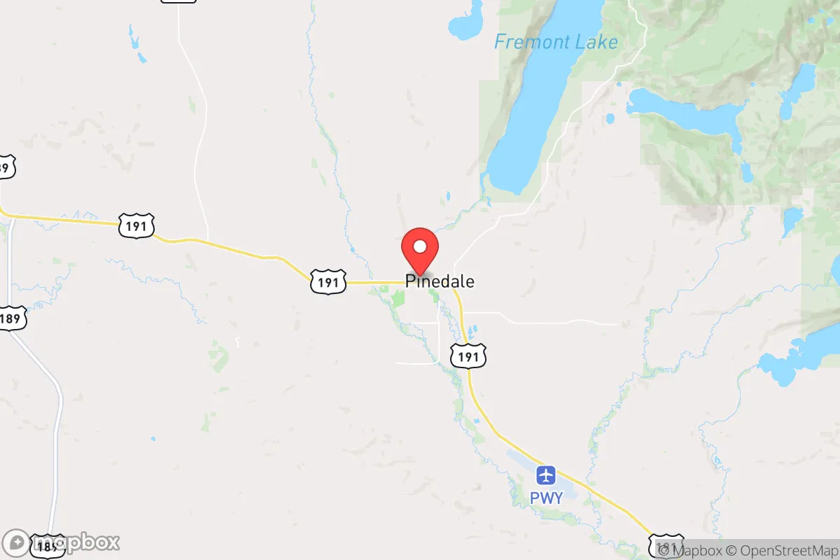
Pinedale, Wyoming, offers a strategic relocation option for those prioritizing resilience, self-sufficiency, and distance from major population centers. Nestled in the Upper Green River Valley at the foot of the Wind River Range, this town of roughly 2,000 people sits over 100 miles from any city of significant size—Jackson is 75 miles northwest, Rock Springs 90 miles south, and Salt Lake City 200 miles southwest. This isolation is a double-edged sword: it provides natural buffer from cascading failures in urban centers, but also demands careful logistical planning for supplies and medical care. For the prepper-minded relocator, Pinedale’s low population density, high elevation (7,175 feet), and proximity to vast public lands make it a compelling base for long-term sustainability, though the harsh winter climate and limited infrastructure require serious preparation.
Geographic position and natural advantages for long-term security
Pinedale sits at the intersection of the Green River and the Wind River Range, giving it access to abundant freshwater—the single most critical resource for any survival scenario. The Green River flows year-round, and the nearby Fremont Lake and Boulder Lake provide additional water reserves. The surrounding Bridger-Teton National Forest and the Wind River Indian Reservation offer hundreds of thousands of acres of remote terrain for hunting, foraging, and retreat. The area’s elevation and latitude mean a short growing season (roughly 60-90 frost-free days), but the fertile valley soil supports hardy crops like potatoes, root vegetables, and cold-tolerant grains if you’re willing to invest in season-extending techniques like hoop houses. The Sublette County seat is also home to the Pinedale Airport (PWY), a general aviation facility that could serve as a lifeline for resupply or evacuation if roads become impassable—a real risk given the area’s heavy snowfall (averaging 50-70 inches annually). For the strategic relocator, the key advantage is defensibility: the town is tucked into a valley with limited road access (primarily US-191 and WY-352), making it easy to monitor and control entry points during unrest.
Risks, exposures, and proximity to fallout-relevant landmarks
The most significant risk for Pinedale is its proximity to the Green River Basin’s natural gas fields—the Pinedale Anticline and Jonah Field are major energy extraction zones. While these provide economic stability (Sublette County has one of the highest per-capita incomes in Wyoming due to energy royalties), they also create a target for sabotage or infrastructure collapse during a national crisis. A coordinated attack on the region’s gas processing plants or pipelines could disrupt local energy supplies and draw unwanted attention. Additionally, the town lies roughly 200 miles from the Idaho National Laboratory (INL), a nuclear research facility that, while not a reactor site, stores radioactive materials and could be a secondary target in a major conflict. The Wind River Range itself is seismically stable, but the area is prone to wildfires in dry summers—the 2022 Muddy Creek Fire burned over 2,000 acres within 20 miles of town. For the prepper, the biggest exposure is the single primary road (US-191) connecting Pinedale to Jackson and Rock Springs; a winter storm or deliberate blockage could isolate the town for days. The nearest Level 1 trauma center is in Jackson (75 miles), and the closest major hospital with full surgical capabilities is in Rock Springs (90 miles)—a serious concern for mass casualty events.
Practical resilience for a relocator: food, water, energy, and defensibility
Water security is Pinedale’s strongest asset. The town’s municipal water comes from deep wells in the Green River aquifer, and many rural properties have private wells with excellent yields (often 10-20 gallons per minute). For off-grid living, the Wind River Range’s snowmelt provides a reliable surface water source, though you’ll need robust filtration due to natural sediment and potential agricultural runoff. Food resilience is moderate: the valley supports cattle ranching and hay production, and local ranchers sell grass-fed beef and bison directly. The Pinedale Farmers Market runs June through September, but year-round food storage is essential—the nearest Costco is in Rock Springs, and supply chains can be disrupted by winter closures. Energy is a mixed bag. Sublette County has abundant natural gas, but residential solar is viable despite the short winter days—average annual sunlight is 220 days, and net metering is available through Lower Valley Energy. For defensibility, the town’s layout works in your favor: the main residential areas are clustered around the historic downtown, with rural properties spread along the valley floor. A well-chosen property with a clear line of sight to the main road and a backup generator (propane or diesel) gives you a strong position. The local sheriff’s office is small (roughly 12 deputies for the entire county), so community self-reliance is the norm—neighbors know each other, and the Sublette County Emergency Management runs active preparedness programs. The biggest practical challenge is winter: temperatures regularly drop to -20°F, and snow removal is a full-time job. You’ll need a four-wheel-drive vehicle, a wood stove or propane furnace, and at least a two-week supply of food and medicine on hand at all times.
Overall, Pinedale presents a strong strategic option for the conservative relocator seeking to escape the vulnerabilities of urban life. Its isolation, water abundance, and low crime rate (Sublette County’s violent crime rate is roughly one-tenth the national average) make it a defensible haven for those willing to accept the trade-offs: harsh winters, limited medical access, and a 200-mile drive to a major airport. The energy industry presence is both a blessing and a curse—it keeps the local economy stable but introduces a potential target. For the prepper who values self-reliance and community cohesion over convenience, Pinedale offers a realistic path to long-term security, provided you arrive with a solid plan for food storage, winter survival, and off-grid energy. It’s not a bug-out location for the unprepared; it’s a permanent lifestyle shift for those serious about resilience in a deteriorating world.
* Values derived from national, state, county, city and local statistics and may differ in a specific area. Last updated: 2026-04-21T11:36:24.000Z
Narrative content on this page is AI-generated and may contain mistakes. Verify any details that matter before acting on them.
ReloMaps may earn a commission from affiliate links at no extra cost to you.