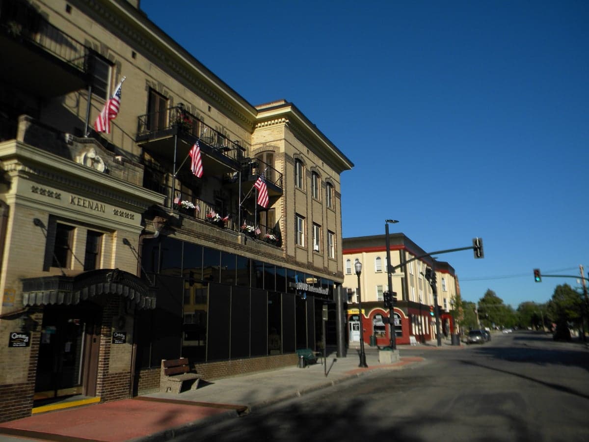
Photo: Wikipedia
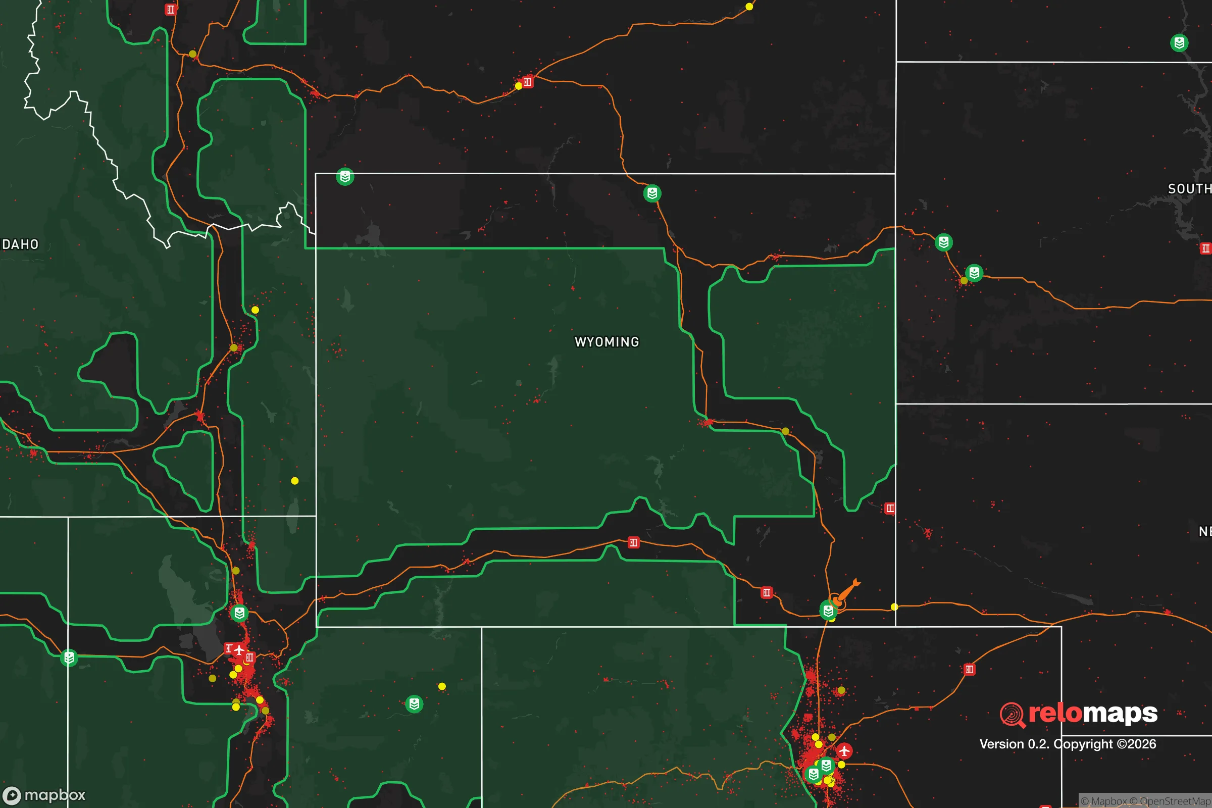
Strategic Assessment of Sheridan, WY
Workable tactical position. Some exposure to population density or targets, but generally defensible in a crisis.
What does the Strategic Assessment tell us?
Our Strategic Assessment grades tactical survivability of an area. Major population centers, military targets, fallout zones, natural disasters, and border exposure all drive risk — lower exposure means a more defensible position in a crisis.
This is heavily inspired by Joel Skousen's Strategic Relocation book. Highly recommended you checkout the book ($)What does this tell us?
Our Strategic Assessment grades tactical survivability of an area. Major population centers, military targets, fallout zones, natural disasters, and border exposure all drive risk — lower exposure means a more defensible position in a crisis.
This is heavily inspired by Joel Skousen's Strategic Relocation book. Highly recommended you checkout the book ($)Strategic Pillars

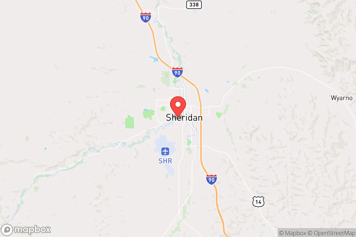
Key Distances
Regional Safe Places
Below is our recommended "safe zones" in Wyoming and the surrounding area based on our strategic heuristics. For most people, it's unrealistic to live in a “safe zone” full-time due to work, family or other personal reasons. They tend to be more rural. However, many of these areas are perfect for second homes and retreat properties that double as a vacation home or even a short-term rental.
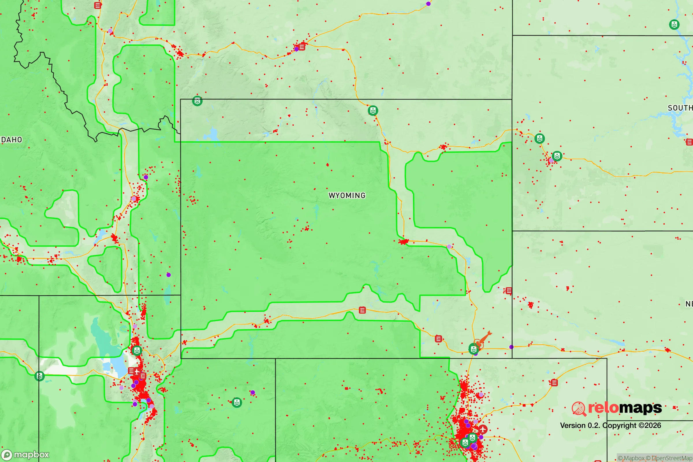
Important Note: For informational purposes only. This does not mean nothing bad ever happens in the green zones. Please use common sense. This is based on public data and modeled with AI. We tried to take a conservative approach but mistakes happen. We update this regularly as new information becomes available.
Solar Generator Recommendations
Backup power matters more here than in safer locations. We've picked three solar generators across budgets and capacity tiers — start with the budget unit if you only need a few essentials, or step up if you want to run a fridge and HVAC for days at a time.

Jackery Portable Power Station Explorer 300
Budget OptionPower on the Go: Weighing only 11 lbs, it's convenient to set up and store with book-sized foldable solar panels

BLUETTI Portable Power Station AC180
Designed for both indoor and outdoor scenarios, AC180 is highly capable as it has a robost capacity and continuous output power.

EF ECOFLOW DELTA Pro Ultra Power Station
Upgraded PickEcoFlow DELTA Pro Ultra is a whole-home energy system designed to grow with your family. Integrated with the Smart Home Panel 2, it scales to meet your evolving energy needs — keeping your home powered, intelligent, and secure through every stage of life.
We earn a commission, at no additional cost to you.
Strategic Assessment Analysis
Sheridan, Wyoming, sits in a geographic sweet spot that makes it one of the more strategically resilient relocation options in the lower 48, offering a rare combination of natural barriers, resource abundance, and distance from the most obvious fallout zones. Tucked against the eastern slope of the Bighorn Mountains, roughly 30 miles south of the Montana line, this town of about 18,000 people benefits from being far enough from major population centers—Denver is 350 miles south, Billings is 130 miles north—to avoid the immediate chaos of a collapse, yet close enough to supply chains and medical infrastructure to function normally in peacetime. For someone thinking seriously about long-term preparedness, Sheridan checks a lot of boxes that most of the Mountain West simply cannot match.
Geographic position and natural advantages for long-term security
The Bighorn Mountains act as a natural western wall, creating a rain shadow that keeps the area relatively dry while also providing a massive, defensible high-ground buffer. To the east, the rolling plains stretch toward the Dakotas, offering open sightlines and limited cover for any large-scale movement. This isn't a choke point like a mountain pass—it's a broad, sparsely populated corridor where a small, organized community could monitor and control access with relative ease. The Tongue River runs through town, fed by mountain snowmelt, providing a reliable surface water source that doesn't depend on fragile aquifers or pumping infrastructure. The surrounding national forest—Bighorn National Forest—covers over 1.1 million acres, giving anyone with backcountry knowledge a massive area for hunting, foraging, and fallback positions. Sheridan sits at 3,700 feet elevation, which means milder winters than the high Rockies but still enough snowpack to guarantee summer water flow—a critical detail for anyone planning to grow food or maintain livestock without municipal water. The area's natural advantages aren't just scenic; they're functional for a low-tech, self-sufficient existence.
Risks, exposures, and proximity to fallout-relevant landmarks
No place is immune to risk, and Sheridan has its share of exposure that a serious relocator needs to weigh. The most obvious concern is the proximity to Warren Air Force Base in Cheyenne, about 200 miles south, which houses ICBM silos and is a primary target in any nuclear exchange. While 200 miles is far enough to avoid blast effects, fallout patterns depend entirely on wind direction—prevailing westerlies could push contamination toward the plains, but a shift could send it north into the Sheridan area. The same logic applies to the Yellowstone Caldera, roughly 300 miles west; a super-eruption would devastate the region regardless, but Sheridan's distance and the Bighorns' shielding offer marginally better odds than towns closer to the park. On the civil unrest front, Sheridan's isolation is a double-edged sword: it's hard for outside threats to reach, but it also means limited law enforcement backup from state or federal resources. The local police force is small, and the county sheriff's office covers a vast area. Interstate 90 runs directly through town, which is a vulnerability—it's a major east-west corridor that could funnel refugees from Billings or the Black Hills in a crisis. A savvy relocator would want to secure a property well off the interstate, preferably up a canyon or on a dead-end road, to avoid being on the path of least resistance.
Practical resilience for a relocator: food, water, energy, and defensibility
Sheridan's practical resilience is where it really stands out for the prepper-minded. The area sits atop the Powder River Basin, one of the most energy-rich regions in North America, with massive coal, natural gas, and uranium deposits. While you may not be mining your own fuel, this means local energy prices are low and infrastructure is robust—natural gas lines, electrical substations, and even a coal-fired power plant in nearby Acme. For off-grid setups, the Bighorns offer excellent micro-hydro potential from the many creeks and streams, and solar works well here despite the winter cloud cover because of the high altitude and clear days. Water is the real ace in the hole: the Tongue River is perennial and clean, and the alluvial aquifer beneath the valley is shallow and easily tapped with a hand pump or well. Agricultural land is still affordable by Western standards, with irrigated hay ground going for $3,000–$5,000 per acre and dryland pasture even cheaper. This means a family could realistically buy 20–40 acres, dig a well, put in a garden and a few head of cattle, and be largely food-independent within a couple of seasons. The growing season is short—about 110 frost-free days—but cold-hardy crops like potatoes, carrots, and kale thrive, and the local extension office is active and helpful. Defensibility is good but not fortress-level: the terrain offers natural chokepoints in the canyons, but the open plains to the east mean you'd need to be proactive about perimeter awareness. Sheridan County has one of the highest rates of private firearm ownership in Wyoming, and the culture is overwhelmingly self-reliant—neighbors will help, but they expect you to pull your own weight. That's a feature, not a bug, for anyone serious about resilience.
The overall strategic picture for Sheridan is one of high potential with manageable trade-offs. It's not a bunker—it's a functioning small city with a hospital, schools, grocery stores, and a regional airport, which means you can live a normal life while maintaining a serious preparedness posture. The downsides—proximity to I-90, some fallout risk from Cheyenne, and a short growing season—are real but not disqualifying, especially compared to alternatives like the Front Range of Colorado or the Wasatch Front in Utah, which are both closer to major targets and more crowded. For a conservative-leaning individual or family looking to get out of the chaos while staying within striking distance of modern amenities, Sheridan offers a rare balance of isolation, resources, and community that's hard to beat in the lower 48. The key is to buy land with water access, get off the main highway, and start building relationships with the locals before you need them. Do that, and you'll be as prepared as anyone can be for whatever comes down the pike.
* Values derived from national, state, county, city and local statistics and may differ in a specific area. Last updated: 2026-04-21T11:22:59.000Z
Narrative content on this page is AI-generated and may contain mistakes. Verify any details that matter before acting on them.
ReloMaps may earn a commission from affiliate links at no extra cost to you.