Photo: Wikipedia
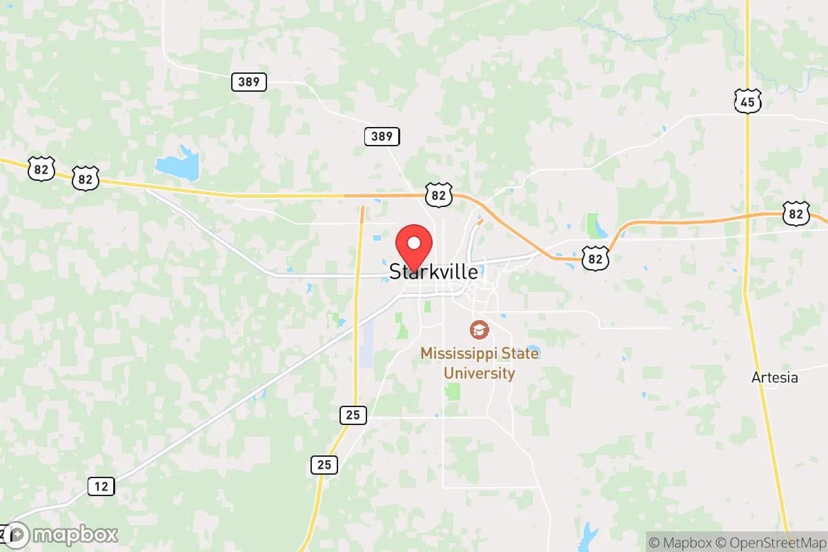
Strategic Assessment of Starkville, MS
Workable tactical position. Some exposure to population density or targets, but generally defensible in a crisis.
What does the Strategic Assessment tell us?
Our Strategic Assessment grades tactical survivability of an area. Major population centers, military targets, fallout zones, natural disasters, and border exposure all drive risk — lower exposure means a more defensible position in a crisis.
This is heavily inspired by Joel Skousen's Strategic Relocation book. Highly recommended you checkout the book ($)What does this tell us?
Our Strategic Assessment grades tactical survivability of an area. Major population centers, military targets, fallout zones, natural disasters, and border exposure all drive risk — lower exposure means a more defensible position in a crisis.
This is heavily inspired by Joel Skousen's Strategic Relocation book. Highly recommended you checkout the book ($)Strategic Pillars

Key Distances
Regional Safe Places
Below is our recommended "safe zones" in Mississippi and the surrounding area based on our strategic heuristics. For most people, it's unrealistic to live in a “safe zone” full-time due to work, family or other personal reasons. They tend to be more rural. However, many of these areas are perfect for second homes and retreat properties that double as a vacation home or even a short-term rental.
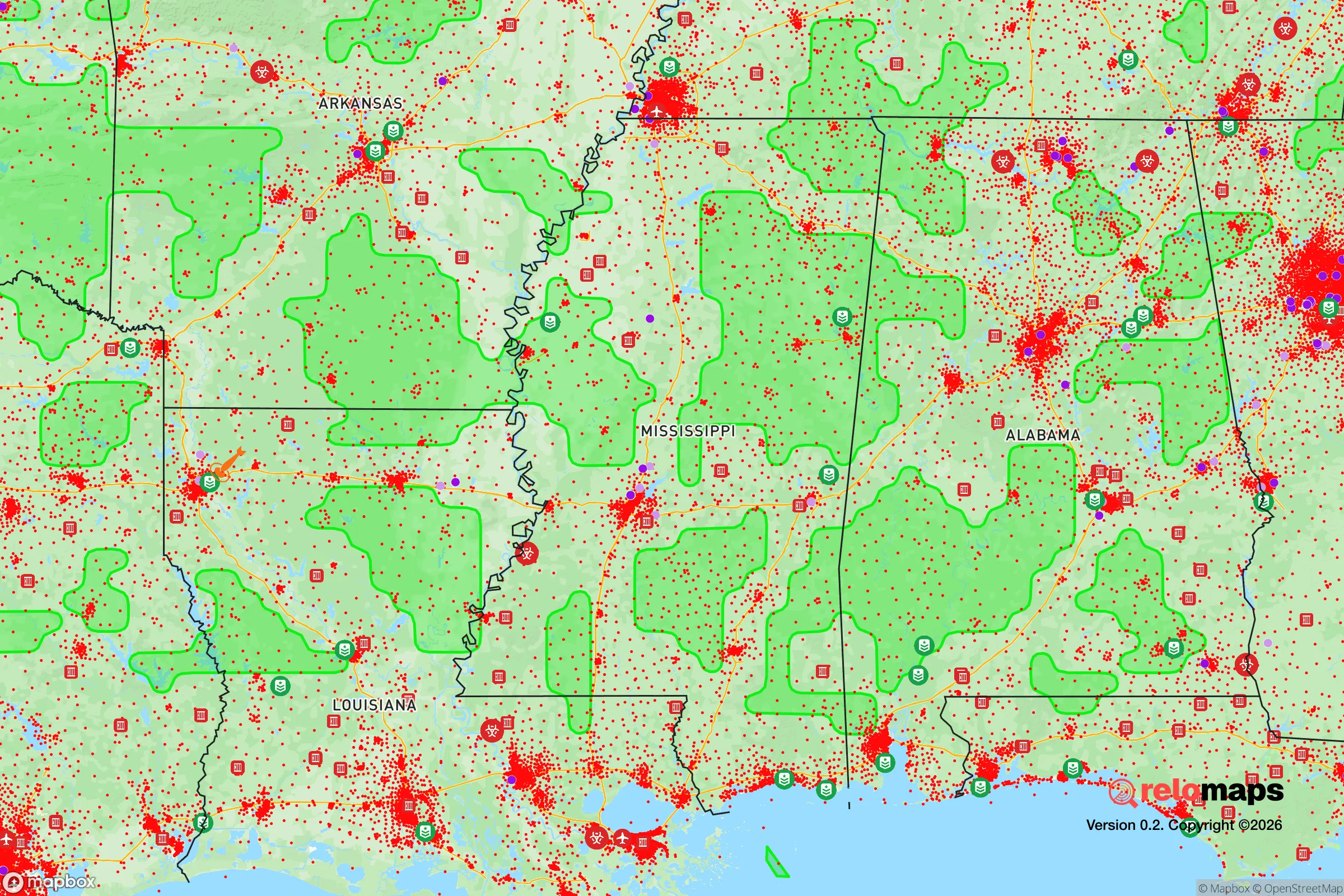
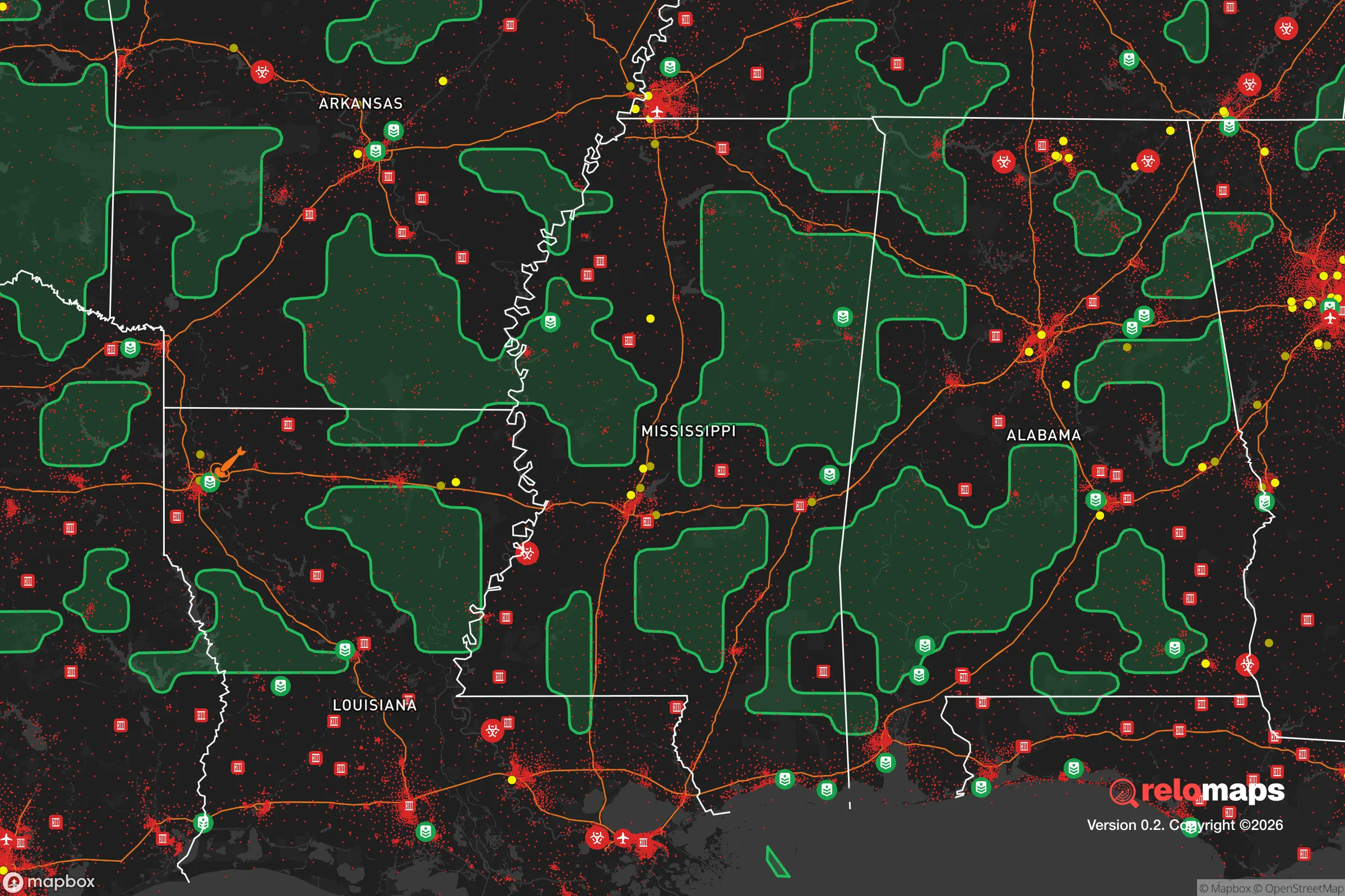
Important Note: For informational purposes only. This does not mean nothing bad ever happens in the green zones. Please use common sense. This is based on public data and modeled with AI. We tried to take a conservative approach but mistakes happen. We update this regularly as new information becomes available.
Solar Generator Recommendations
Backup power matters more here than in safer locations. We've picked three solar generators across budgets and capacity tiers — start with the budget unit if you only need a few essentials, or step up if you want to run a fridge and HVAC for days at a time.

Jackery Portable Power Station Explorer 300
Budget OptionPower on the Go: Weighing only 11 lbs, it's convenient to set up and store with book-sized foldable solar panels

BLUETTI Portable Power Station AC180
Designed for both indoor and outdoor scenarios, AC180 is highly capable as it has a robost capacity and continuous output power.

EF ECOFLOW DELTA Pro Ultra Power Station
Upgraded PickEcoFlow DELTA Pro Ultra is a whole-home energy system designed to grow with your family. Integrated with the Smart Home Panel 2, it scales to meet your evolving energy needs — keeping your home powered, intelligent, and secure through every stage of life.
We earn a commission, at no additional cost to you.
Strategic Assessment Analysis
Starkville, Mississippi, offers a surprisingly resilient strategic position for those prioritizing self-reliance and distance from the most obvious national vulnerabilities. Home to Mississippi State University and roughly 25,000 residents, this town sits in the gently rolling hills of the Golden Triangle region, far enough from the Gulf Coast to avoid the worst hurricane storm surge and far enough from the Mississippi River to sidestep catastrophic flooding. Its location along the I-22 corridor provides a practical evacuation route north toward Memphis or east toward Birmingham, while the surrounding agricultural landscape offers a buffer of open space that most suburban sprawl has lost. For a relocator thinking in terms of decades, not just the next election cycle, Starkville presents a low-profile, high-utility option that doesn't scream "prepper destination" — which is exactly the point.
Geographic position and natural advantages for long-term stability
Starkville sits in Oktibbeha County, roughly 120 miles northeast of Jackson and 90 miles west of Tuscaloosa, Alabama. The terrain is a mix of hardwood forests and pastureland, with the Tombigbee River system to the east and the Noxubee National Wildlife Refuge just south — a 48,000-acre managed forest that provides both a natural buffer and a potential resource for game, timber, and water. The area's elevation averages around 350 feet, which is negligible for mountain survival scenarios but significant in that it sits above the floodplains of the major rivers. The local water table is reliable, with the Gordo and McShan aquifers providing deep groundwater that is less susceptible to surface contamination than shallow wells in flatter delta regions. The climate is humid subtropical, with hot summers and mild winters, meaning a well-insulated home with a wood stove can handle the cold months without grid dependency, and the growing season stretches from March to October — long enough for serious food production. The soil is loamy clay, not the rich alluvial loam of the Delta, but with proper amendment it supports corn, beans, squash, and fruit trees. For a family looking to establish a semi-subsistence lifestyle, the land here is workable without requiring heavy machinery or irrigation infrastructure.
Risks, exposures, and proximity to fallout-relevant landmarks
No location is immune, and Starkville has its own set of strategic liabilities. The most obvious is the presence of Mississippi State University, a land-grant institution with roughly 23,000 students and 4,000 faculty and staff. In a collapse scenario, a university town becomes a double-edged sword: the educated population and medical resources are assets, but the concentration of young adults with no local family ties or survival skills could create a transient, potentially desperate population if the grid goes down and the dorms empty out. The university also operates a nuclear research reactor on campus — the MSU TRIGA reactor, a 1-megawatt training facility. While it's a low-power research reactor and not a commercial power plant, any nuclear facility becomes a psychological and practical liability in a national emergency. The nearest commercial nuclear plant is the Browns Ferry Nuclear Plant in Alabama, about 120 miles east — outside the immediate fallout zone for a worst-case event, but close enough that prevailing westerly winds could carry particulate matter into the region. The Golden Triangle Industrial Park, located in nearby Columbus, hosts major defense contractors like Airbus and Aurora Flight Sciences, which manufacture military drones and aircraft components. This makes the area a potential target for sabotage or protest activity during periods of civil unrest. The proximity to the Tennessee-Tombigbee Waterway, a major barge route for coal and chemicals, also means that a transportation accident or intentional disruption could affect water quality in the region. For the conservative relocator, the calculus is this: Starkville is not a primary target, but it sits within the secondary effects zone of several high-value assets.
Practical resilience for a relocator: food, water, energy, and defensibility
For a family or individual serious about self-sufficiency, Starkville offers a workable baseline. The local food system is anchored by the Starkville Farmers Market, which operates from April through November and connects growers with buyers, but the real value is in the surrounding rural network. Within a 30-minute drive, you can find small-scale cattle operations, poultry farms, and row-crop producers who are often willing to sell direct or barter. The Mississippi State University Extension Service provides free or low-cost resources on soil testing, canning, and livestock management — a practical advantage that most towns of this size lack. Water is the critical resource, and the city's water supply comes from the Starkville Water System, which draws from wells in the Gordo Aquifer. For a prepper, this means a deep well on private property is the gold standard, and the geology here supports it — typical well depths range from 200 to 400 feet, with yields of 10 to 30 gallons per minute. Rainwater catchment is also viable, with annual precipitation averaging 55 inches, spread fairly evenly across the year. Energy resilience is more challenging. The local grid is served by Starkville Electric Department and TVA power, which is reliable but vulnerable to ice storms and hurricane-related outages. Solar is feasible — the region gets about 200 sunny days per year — but the tree canopy in residential areas limits rooftop production. A ground-mounted array on a cleared lot is the better play. Propane is widely available for backup generation, and wood heating is practical given the surrounding forest. Defensibility is moderate. The terrain is not mountainous, so there are no natural chokepoints, but the rural roads are limited in number and easy to monitor. The local law enforcement presence is adequate for normal times — the Starkville Police Department has about 60 sworn officers — but in a prolonged crisis, the county sheriff's office would be the primary authority, and Oktibbeha County has a history of competent, community-oriented law enforcement. The key is to avoid being on a main thoroughfare; properties on dead-end gravel roads or at the end of long driveways offer the best security.
The overall strategic picture for Starkville is one of moderate resilience with specific, manageable vulnerabilities. It is not a remote mountain redoubt, nor is it a fortified compound — but it is a functional, low-visibility town with access to fertile land, deep water, and a regional university that can serve as a knowledge hub rather than a liability. For the conservative relocator who wants to be within a day's drive of major medical centers (Birmingham is two hours, Memphis is three) but far enough from the chaos of interstate corridors and coastal evacuation zones, Starkville hits a practical sweet spot. The biggest risk is complacency — the town feels safe, and it is, for now. But the same factors that make it livable today — the university, the industrial parks, the waterway — could become liabilities in a drawn-out national crisis. The smart move is to buy land with a well and a septic system already in place, establish relationships with local farmers and the county extension office, and treat Starkville as a base of operations rather than a final fortress. It is a place to build from, not a place to hide in.
* Values derived from national, state, county, city and local statistics and may differ in a specific area. Last updated: 2026-05-03T06:45:51.000Z
Narrative content on this page is AI-generated and may contain mistakes. Verify any details that matter before acting on them.
ReloMaps may earn a commission from affiliate links at no extra cost to you.