
Photo: Wikipedia
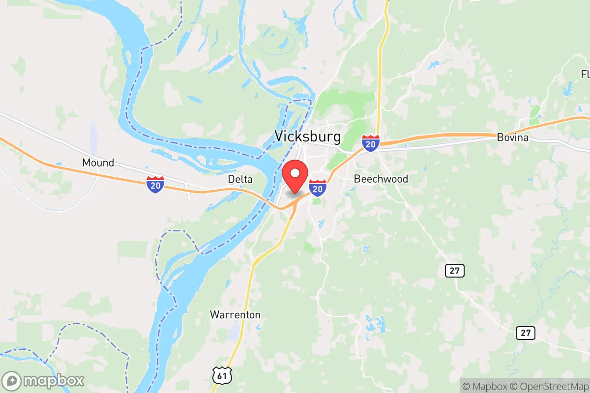
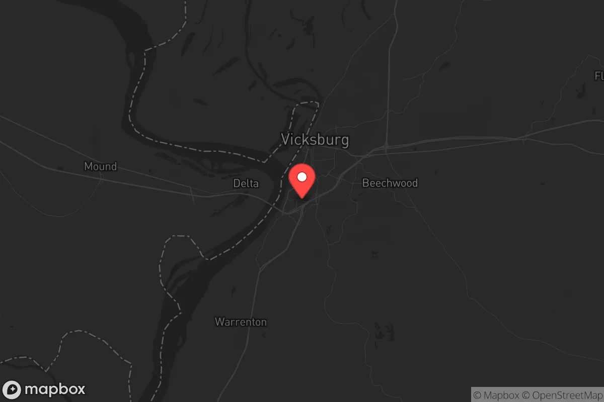
Strategic Assessment of Vicksburg, MS
Workable tactical position. Some exposure to population density or targets, but generally defensible in a crisis.
What does the Strategic Assessment tell us?
Our Strategic Assessment grades tactical survivability of an area. Major population centers, military targets, fallout zones, natural disasters, and border exposure all drive risk — lower exposure means a more defensible position in a crisis.
This is heavily inspired by Joel Skousen's Strategic Relocation book. Highly recommended you checkout the book ($)What does this tell us?
Our Strategic Assessment grades tactical survivability of an area. Major population centers, military targets, fallout zones, natural disasters, and border exposure all drive risk — lower exposure means a more defensible position in a crisis.
This is heavily inspired by Joel Skousen's Strategic Relocation book. Highly recommended you checkout the book ($)Strategic Pillars

Key Distances
Regional Safe Places
Below is our recommended "safe zones" in Mississippi and the surrounding area based on our strategic heuristics. For most people, it's unrealistic to live in a “safe zone” full-time due to work, family or other personal reasons. They tend to be more rural. However, many of these areas are perfect for second homes and retreat properties that double as a vacation home or even a short-term rental.
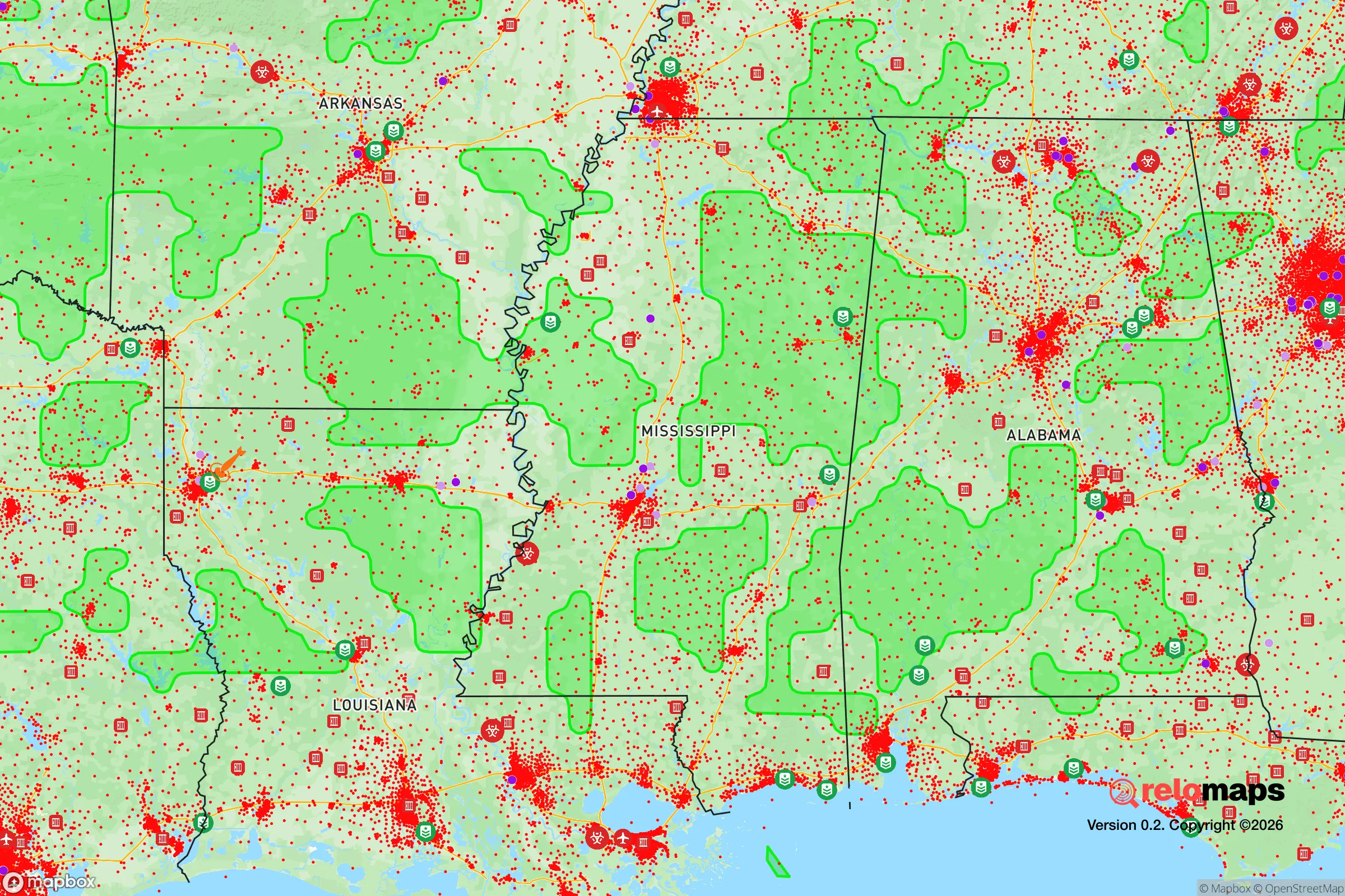
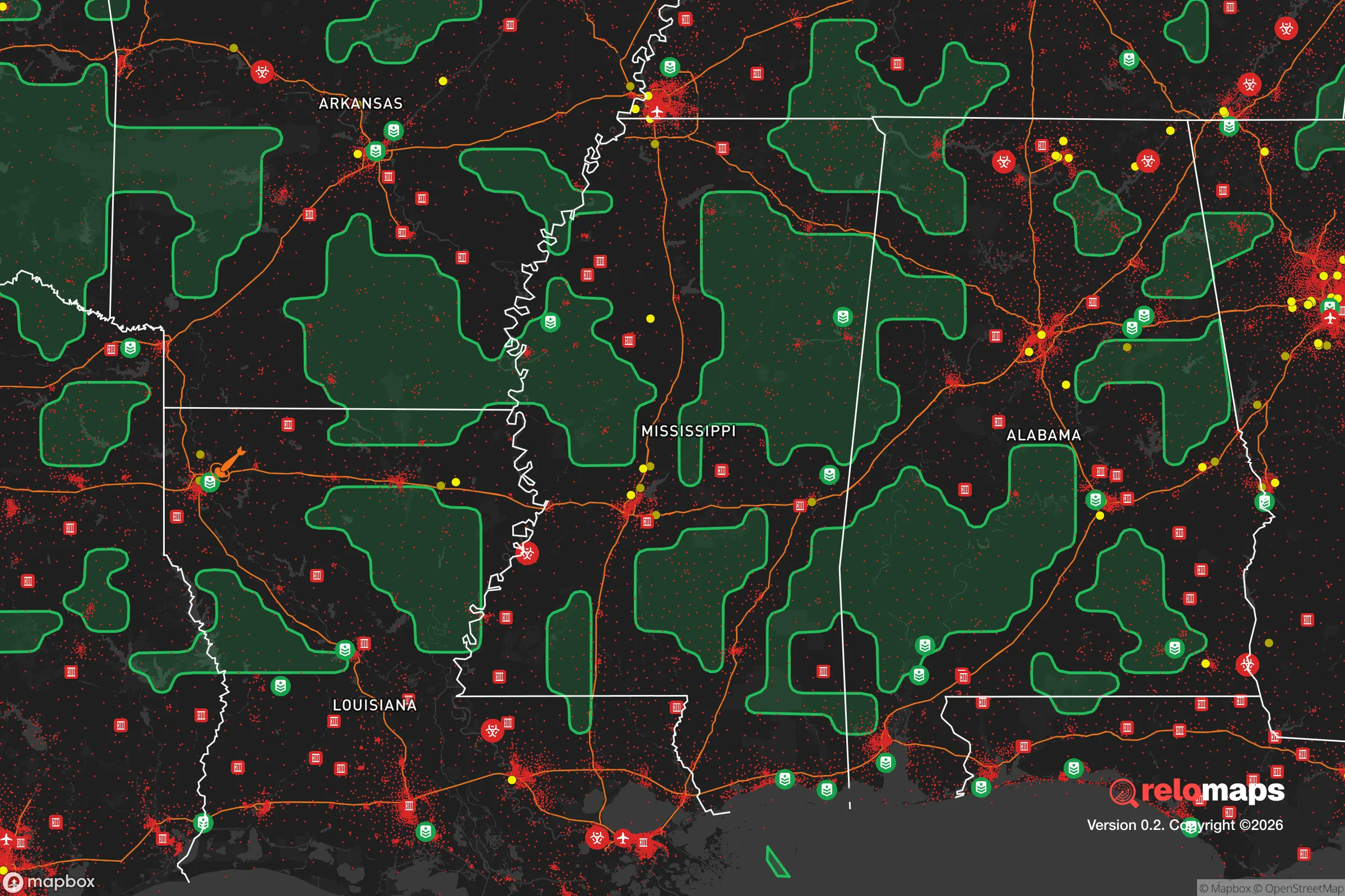
Important Note: For informational purposes only. This does not mean nothing bad ever happens in the green zones. Please use common sense. This is based on public data and modeled with AI. We tried to take a conservative approach but mistakes happen. We update this regularly as new information becomes available.
Solar Generator Recommendations
Backup power matters more here than in safer locations. We've picked three solar generators across budgets and capacity tiers — start with the budget unit if you only need a few essentials, or step up if you want to run a fridge and HVAC for days at a time.

Jackery Portable Power Station Explorer 300
Budget OptionPower on the Go: Weighing only 11 lbs, it's convenient to set up and store with book-sized foldable solar panels

BLUETTI Portable Power Station AC180
Designed for both indoor and outdoor scenarios, AC180 is highly capable as it has a robost capacity and continuous output power.

EF ECOFLOW DELTA Pro Ultra Power Station
Upgraded PickEcoFlow DELTA Pro Ultra is a whole-home energy system designed to grow with your family. Integrated with the Smart Home Panel 2, it scales to meet your evolving energy needs — keeping your home powered, intelligent, and secure through every stage of life.
We earn a commission, at no additional cost to you.
Strategic Assessment Analysis
Vicksburg, Mississippi, sits on a strategic bluff above the Mississippi River, offering a combination of geographic isolation and logistical access that makes it a serious contender for those prioritizing long-term resilience. Its location roughly 45 miles west of Jackson and 240 miles south of Memphis places it outside the immediate blast radius of major population centers while still providing rail, river, and highway connections for supply movement. The city’s history as a Civil War fortress town isn’t just trivia—it’s a testament to the natural defensibility of the terrain, with steep bluffs, river bends, and limited approach routes that could prove valuable in a grid-down or civil unrest scenario.
Geographic position and natural defensive advantages
Vicksburg’s most obvious asset is its position atop the loess bluffs overlooking the Mississippi River. This elevation provides a natural vantage point and makes the city less prone to the flooding that plagues lower-lying Delta communities. The surrounding landscape is a mix of hardwood forests, agricultural fields, and winding bayous, which creates natural chokepoints for anyone approaching from the west or south. The Mississippi River itself acts as a formidable barrier—bridges are limited, and the nearest crossings are the Vicksburg Bridge (I-20) and the Old Highway 80 bridge, both of which could be monitored or controlled if needed. To the east, the terrain rises into the rolling hills of central Mississippi, offering multiple escape routes into less populated areas like the Homochitto National Forest or the Pearl River basin. For a relocator thinking in terms of defensible space, Vicksburg’s layout is a rare find: a city that was literally designed to be held under siege.
Risks, exposures, and proximity to fallout-relevant landmarks
No location is without vulnerabilities, and Vicksburg has a few that demand attention. The most obvious is the presence of the Grand Gulf Nuclear Station, located about 30 miles south of the city near Port Gibson. While this is a single-unit plant with a solid safety record, any nuclear facility within 50 miles introduces a low-probability, high-consequence risk—especially if grid instability or sabotage becomes a concern. Additionally, Vicksburg sits along the New Madrid Seismic Zone fault line, which has produced major earthquakes in the past (1811-1812 series). A significant quake could damage the nuclear plant, disrupt river traffic, and collapse older infrastructure in the city. On the human-caused risk side, Vicksburg is a rail hub for the Kansas City Southern and Canadian National lines, meaning trains carrying hazardous materials (ammonia, chlorine, crude oil) pass through regularly. A derailment or intentional attack on a rail car could force evacuations or contaminate local water sources. The city’s proximity to Jackson (45 miles) also means that unrest or a mass casualty event in the state capital could send refugees or looters down I-20 toward Vicksburg, though the river and bluffs provide a natural buffer.
Practical resilience for a relocator: food, water, energy, and defensibility
For someone serious about self-sufficiency, Vicksburg offers a mix of advantages and gaps. Water access is excellent—the Mississippi River is an almost limitless surface water source, though it requires heavy filtration and treatment due to agricultural runoff and industrial traffic. The city’s municipal water comes from the river, but a well-drilled into the Sparta Aquifer (which underlies much of the region) would provide a more reliable and cleaner backup. Food production potential is strong: the surrounding Warren County has fertile loam soils, a long growing season (zone 8a), and ample rainfall (averaging 55 inches per year). Small-scale farming, orchards, and livestock are viable, and the local farmers’ market and co-ops provide a baseline for barter networks. Energy resilience is a mixed bag—Entergy Mississippi provides grid power, but outages from storms are common (the area gets hit by tornadoes and hurricanes). Solar is feasible, though tree cover on the bluffs can limit panel efficiency; a backup generator with a propane tank is a smarter bet. Defensibility is the standout feature. The city’s layout on a bluff means only a few roads lead into the core, and the surrounding rural areas offer numerous retreat properties with good line-of-sight and natural cover. The Vicksburg National Military Park itself is a network of ridges and ravines that could serve as a fallback position or observation point. For a relocator, the key is to buy land east of the city, away from the river floodplain, and establish a homestead with a well, septic, and solar array before any crisis hits.
The overall strategic picture for a conservative prepper
Vicksburg is not a bug-out location—it’s a stand-your-ground location. Its historical role as a fortress city is not accidental; the geography forces any potential threat to approach through narrow corridors, and the river provides both a water source and a barrier. For a conservative-leaning relocator concerned about federal overreach, civil unrest, or economic collapse, Vicksburg offers a community that is overwhelmingly conservative (Warren County voted +34 points Republican in 2024), with a strong hunting and gun culture, multiple gun shops and ranges, and a local sheriff’s office that has publicly stated it will not enforce federal gun bans. The downsides are real: the nuclear plant to the south, the seismic risk, and the rail traffic. But compared to living within 20 miles of a major city or near a military base (which Vicksburg is not—the nearest is Camp Shelby, 100 miles south), these are manageable risks. The bottom line: if you want a location that combines natural defensibility, water abundance, agricultural potential, and a like-minded community, Vicksburg deserves a serious look. Just drill that well, stockpile water filtration, and keep an eye on the New Madrid fault line.
* Values derived from national, state, county, city and local statistics and may differ in a specific area. Last updated: 2026-04-30T13:12:13.000Z
Narrative content on this page is AI-generated and may contain mistakes. Verify any details that matter before acting on them.
ReloMaps may earn a commission from affiliate links at no extra cost to you.