Photo: Wikipedia
Strategic Assessment of Wyoming, DE
Multiple tactical vulnerabilities. Population density, target proximity, or disaster risk are likely compounding. A retreat property and exit planning is required.
What does the Strategic Assessment tell us?
Our Strategic Assessment grades tactical survivability of an area. Major population centers, military targets, fallout zones, natural disasters, and border exposure all drive risk — lower exposure means a more defensible position in a crisis.
This is heavily inspired by Joel Skousen's Strategic Relocation book. Highly recommended you checkout the book ($)What does this tell us?
Our Strategic Assessment grades tactical survivability of an area. Major population centers, military targets, fallout zones, natural disasters, and border exposure all drive risk — lower exposure means a more defensible position in a crisis.
This is heavily inspired by Joel Skousen's Strategic Relocation book. Highly recommended you checkout the book ($)Strategic Pillars

Key Distances
Regional Safe Places
Below is our recommended "safe zones" in Delaware and the surrounding area based on our strategic heuristics. For most people, it's unrealistic to live in a “safe zone” full-time due to work, family or other personal reasons. They tend to be more rural. However, many of these areas are perfect for second homes and retreat properties that double as a vacation home or even a short-term rental.


Important Note: For informational purposes only. This does not mean nothing bad ever happens in the green zones. Please use common sense. This is based on public data and modeled with AI. We tried to take a conservative approach but mistakes happen. We update this regularly as new information becomes available.
Solar Generator Recommendations
Backup power matters more here than in safer locations. We've picked three solar generators across budgets and capacity tiers — start with the budget unit if you only need a few essentials, or step up if you want to run a fridge and HVAC for days at a time.

Jackery Portable Power Station Explorer 300
Budget OptionPower on the Go: Weighing only 11 lbs, it's convenient to set up and store with book-sized foldable solar panels

BLUETTI Portable Power Station AC180
Designed for both indoor and outdoor scenarios, AC180 is highly capable as it has a robost capacity and continuous output power.

EF ECOFLOW DELTA Pro Ultra Power Station
Upgraded PickEcoFlow DELTA Pro Ultra is a whole-home energy system designed to grow with your family. Integrated with the Smart Home Panel 2, it scales to meet your evolving energy needs — keeping your home powered, intelligent, and secure through every stage of life.
We earn a commission, at no additional cost to you.
Strategic Assessment Analysis
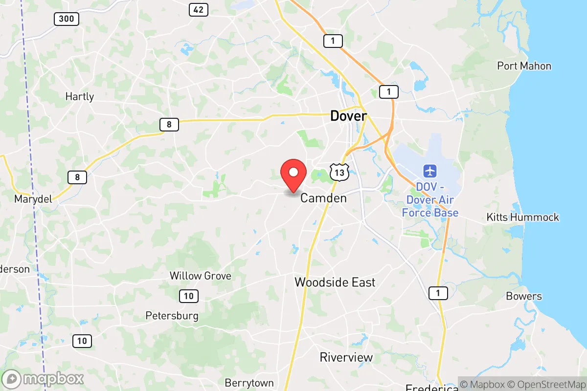
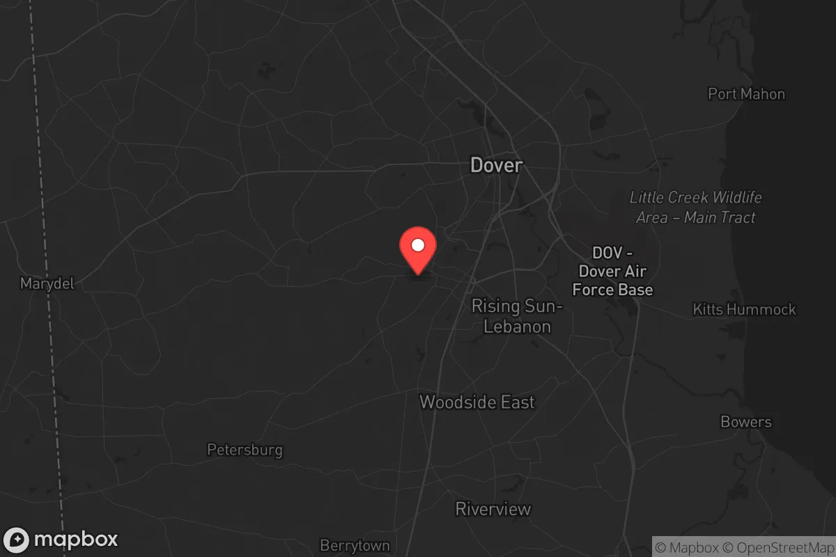
Wyoming, Delaware, offers a surprisingly resilient strategic position for those prioritizing self-sufficiency and distance from major metropolitan vulnerabilities. Located in Kent County, this small town of roughly 1,600 residents sits at a deliberate remove from the dense population centers of Wilmington, Philadelphia, and Baltimore—each within 90 minutes but far enough to avoid the immediate fallout of a major civic disruption. The area’s low population density, agricultural backbone, and access to the Delmarva Peninsula’s natural resources make it a viable base for a prepper or survivalist household seeking a quieter, more defensible posture in an increasingly uncertain national landscape.
Geographic position and natural advantages for long-term security
Wyoming’s location on the Delmarva Peninsula provides a distinct geographic buffer that is hard to overstate. The town is roughly 30 miles from the Chesapeake Bay and 40 miles from the Atlantic Ocean, offering multiple escape routes and resource corridors if inland routes become compromised. The surrounding Kent County is predominantly flat, rural farmland, with a patchwork of woodlots, creeks, and small rivers—ideal for off-grid living, water sourcing, and discreet movement. The area’s agricultural output is substantial: Delaware ranks among the top states for poultry production, and Kent County alone produces millions of bushels of corn and soybeans annually. For a relocator, this means local food supply chains are robust and less dependent on interstate trucking than urban areas. The moderate climate also supports year-round gardening and small-scale livestock, with average frost dates from mid-October to mid-April, giving a solid growing season for staple crops. The lack of major mountain ranges or dense forests means visibility is good, and defensive positions can be established on higher ground near the St. Jones River, which runs through the town. The water table is high, and private wells are common, reducing reliance on municipal systems that could fail during a grid-down scenario.
Risks, exposures, and proximity to fallout-relevant landmarks
No location is without vulnerabilities, and Wyoming’s proximity to several high-value targets requires honest assessment. The town lies about 70 miles from the Salem Nuclear Generating Station in New Jersey, a pressurized water reactor that, in a worst-case event, could produce a fallout plume affecting eastern Delaware depending on wind patterns. Similarly, the Indian Point Energy Center (now decommissioned but still a spent fuel storage site) is roughly 130 miles north, and the Peach Bottom Atomic Power Station in Pennsylvania is about 80 miles northwest. While these distances provide some buffer, a major release could still pose a contamination risk to local water and soil. More immediate concerns include the town’s location along U.S. Route 13, a major north-south corridor that connects to Dover (the state capital, 3 miles south) and the Chesapeake Bay Bridge. In a mass evacuation scenario, this road could become a choke point or a vector for looters and displaced populations. Dover Air Force Base, just 6 miles south, is a strategic military asset that could become a target or a staging ground during civil unrest. The base’s presence also means increased air traffic and potential for collateral damage in a conflict scenario. Flooding is a moderate risk: the St. Jones River has a history of minor flooding during heavy rains, and low-lying areas near the river could become impassable. Hurricanes and nor’easters are the primary natural threats, with the region experiencing storm surge risks from the Delaware Bay, though Wyoming’s inland position reduces direct coastal impact.
Practical resilience for a relocator: food, water, energy, and defensibility
For a relocator focused on practical self-sufficiency, Wyoming offers a workable foundation. Water access is a strong point: the water table is shallow (typically 20-40 feet), and drilling a private well is straightforward and relatively inexpensive compared to rocky or arid regions. Rainwater catchment is also viable, with annual precipitation averaging 45 inches. Food production is the area’s standout advantage. Kent County’s agricultural infrastructure means local farmers’ markets, feed stores, and seed suppliers are plentiful. The town itself has a small grocery store, but serious preppers will want to establish relationships with nearby farms for bulk grains, eggs, and meat. Hunting is permitted in state-managed areas like the nearby Woodland Beach Wildlife Area, providing a protein source for those with the skills. Energy independence is achievable but requires upfront investment. The region has decent solar insolation (about 4.5 peak sun hours per day), and many rural properties already have backup generators. Wood heating is less viable due to the lack of dense forest, but propane is widely available and affordable. Defensibility is moderate: the town’s layout is compact, with a mix of older homes on larger lots and newer subdivisions. A property with a perimeter fence, a well, and a clear line of sight to approach roads is ideal. The local law enforcement presence is limited—Kent County Sheriff’s Office covers the area, but response times in a widespread event could stretch to hours. Community dynamics are a double-edged sword. The population is small and relatively insular, with a strong agricultural and conservative bent. Neighbors are likely to be armed and self-reliant, which can be a deterrent to outsiders but also means a newcomer must earn trust. The local gun culture is robust, with several shooting ranges and gun shops within a 20-minute drive. Medical facilities are limited: the nearest hospital is Bayhealth Kent General in Dover, a 10-minute drive, but in a collapse scenario, this resource would be overwhelmed quickly. Stockpiling medical supplies and establishing a relationship with a local veterinarian (who can provide antibiotics and surgical knowledge) is a practical step.
The overall strategic picture for Wyoming, Delaware, is one of cautious viability for the survivalist-minded relocator. It is not a remote mountain redoubt, but it offers a realistic middle ground: close enough to urban resources to stock up and network, yet far enough to avoid the immediate chaos of a major city collapse. The agricultural base, water availability, and low population density provide a solid foundation for long-term self-sufficiency. The primary drawbacks—proximity to Dover Air Force Base, a nuclear plant within fallout range, and a major evacuation route—are manageable with proper planning and situational awareness. For a conservative individual or family looking to plant roots in a community that values independence and preparedness, Wyoming deserves a serious look. The key is to arrive with skills, supplies, and a low profile, integrating into the local fabric before the storm hits. This is not a place for the unprepared, but for those who are, it offers a fighting chance.
* Values derived from national, state, county, city and local statistics and may differ in a specific area. Last updated: 2026-04-23T03:40:00.000Z
Narrative content on this page is AI-generated and may contain mistakes. Verify any details that matter before acting on them.
ReloMaps may earn a commission from affiliate links at no extra cost to you.