Photo: Wikipedia
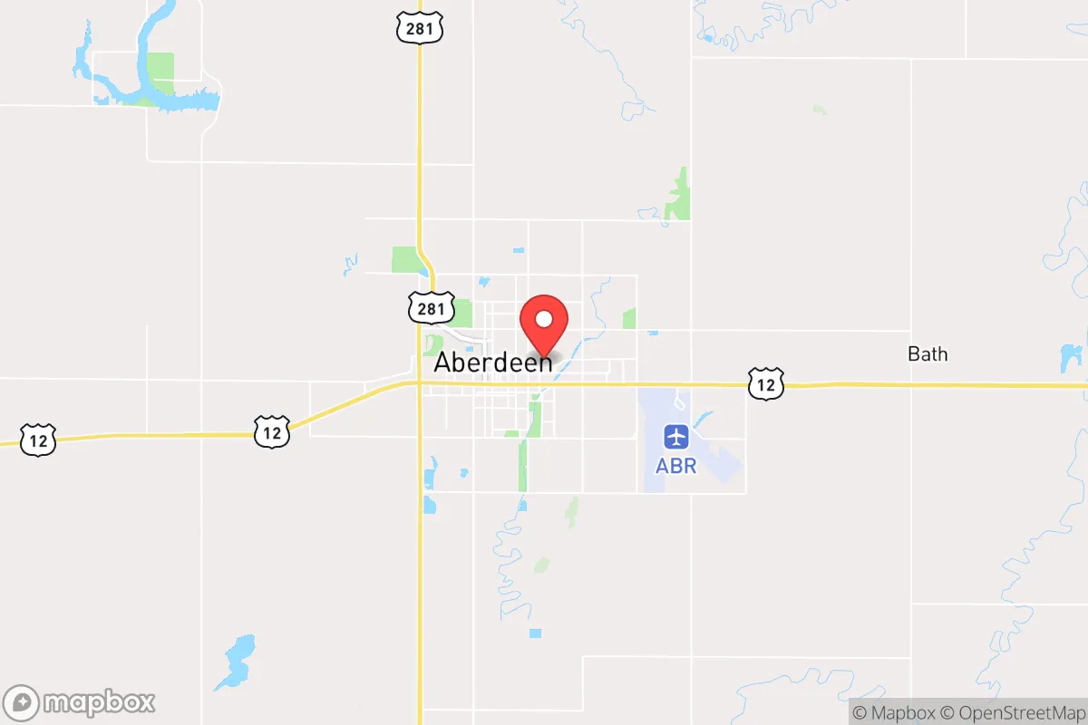
Strategic Assessment of Aberdeen, SD
Workable tactical position. Some exposure to population density or targets, but generally defensible in a crisis.
What does the Strategic Assessment tell us?
Our Strategic Assessment grades tactical survivability of an area. Major population centers, military targets, fallout zones, natural disasters, and border exposure all drive risk — lower exposure means a more defensible position in a crisis.
This is heavily inspired by Joel Skousen's Strategic Relocation book. Highly recommended you checkout the book ($)What does this tell us?
Our Strategic Assessment grades tactical survivability of an area. Major population centers, military targets, fallout zones, natural disasters, and border exposure all drive risk — lower exposure means a more defensible position in a crisis.
This is heavily inspired by Joel Skousen's Strategic Relocation book. Highly recommended you checkout the book ($)Strategic Pillars

Key Distances
Regional Safe Places
Below is our recommended "safe zones" in South Dakota and the surrounding area based on our strategic heuristics. For most people, it's unrealistic to live in a “safe zone” full-time due to work, family or other personal reasons. They tend to be more rural. However, many of these areas are perfect for second homes and retreat properties that double as a vacation home or even a short-term rental.


Important Note: For informational purposes only. This does not mean nothing bad ever happens in the green zones. Please use common sense. This is based on public data and modeled with AI. We tried to take a conservative approach but mistakes happen. We update this regularly as new information becomes available.
Solar Generator Recommendations
Backup power matters more here than in safer locations. We've picked three solar generators across budgets and capacity tiers — start with the budget unit if you only need a few essentials, or step up if you want to run a fridge and HVAC for days at a time.

Jackery Portable Power Station Explorer 300
Budget OptionPower on the Go: Weighing only 11 lbs, it's convenient to set up and store with book-sized foldable solar panels

BLUETTI Portable Power Station AC180
Designed for both indoor and outdoor scenarios, AC180 is highly capable as it has a robost capacity and continuous output power.

EF ECOFLOW DELTA Pro Ultra Power Station
Upgraded PickEcoFlow DELTA Pro Ultra is a whole-home energy system designed to grow with your family. Integrated with the Smart Home Panel 2, it scales to meet your evolving energy needs — keeping your home powered, intelligent, and secure through every stage of life.
We earn a commission, at no additional cost to you.
Strategic Assessment Analysis
Aberdeen, South Dakota, offers a compelling combination of geographic isolation and regional stability that makes it a serious candidate for those prioritizing long-term resilience. Located roughly 120 miles from any major metropolitan area, the city sits in the heart of the Northern Plains, a region historically insulated from the cascading failures that can plague coastal and urban corridors. For a relocator with a prepper or survivalist mindset, Aberdeen’s primary advantage is its low strategic value to adversaries and its distance from likely fallout targets, while still maintaining access to essential infrastructure and a self-sufficient agricultural base.
Geographic position and natural advantages for long-term security
Aberdeen’s location in northeastern South Dakota places it in a sweet spot for those seeking to avoid the chaos of population centers. The city is roughly 200 miles from Minneapolis, 250 miles from Sioux Falls, and over 300 miles from the Denver metro area—distances that provide a meaningful buffer against the immediate effects of civil unrest, supply chain disruptions, or a mass casualty event in those cities. The surrounding landscape is flat, open prairie, which offers excellent visibility and makes it difficult for any large-scale movement to go unnoticed. The James River runs through the city, providing a modest but reliable water source, and the region’s aquifer systems—particularly the Dakota Aquifer—offer deep groundwater reserves that are less vulnerable to surface contamination. Winters are harsh, with average January lows near 0°F, but this climate acts as a natural deterrent to transient populations and reduces the risk of vector-borne diseases. The area’s low population density—Brown County has roughly 38,000 residents, with about 28,000 in Aberdeen itself—means that in a crisis, competition for local resources would be far less intense than in suburban or urban environments.
Risks, exposures, and proximity to fallout-relevant landmarks
The most significant risk for Aberdeen is its proximity to Ellsworth Air Force Base near Rapid City, about 250 miles to the west. Ellsworth is home to the 28th Bomb Wing, operating B-1B Lancers and soon the B-21 Raider, making it a high-priority target in any major conflict. While 250 miles is outside the immediate blast zone for a nuclear strike, fallout patterns depend heavily on wind direction. Prevailing westerlies mean that a strike on Ellsworth could deposit radioactive material across the western half of South Dakota, potentially reaching Aberdeen within 12–24 hours. The city is also about 150 miles from the Grand Forks Air Force Base in North Dakota, another strategic bomber base. On the plus side, Aberdeen is not near any major nuclear power plants—the closest is the Prairie Island plant near Red Wing, Minnesota, over 200 miles away—and it is not a transportation hub for hazardous materials. The city’s rail lines and highways (US-12 and US-281) are secondary routes, meaning they are less likely to be targeted or overwhelmed by refugees fleeing major cities. The primary exposure risk is not from direct attack but from secondary effects: a collapse of the national grid, a pandemic, or a currency crisis would hit Aberdeen hard due to its reliance on external supply chains for many goods, though its agricultural base provides a partial buffer.
Practical resilience for a relocator: food, water, energy, and defensibility
For a relocator looking to establish a sustainable homestead or retreat, Aberdeen’s practical resilience is strong but requires preparation. The surrounding region is some of the most productive farmland in the world, with vast fields of corn, soybeans, and wheat, as well as extensive cattle ranching. This means that in a prolonged crisis, food availability would be better than in most of the country, though you would need to establish direct relationships with local farmers or secure your own growing space. The growing season is short—about 130 frost-free days—but cold-hardy crops like potatoes, carrots, and kale do well, and the soil is rich loam. Water is accessible via shallow wells (typically 50–150 feet deep) in most areas around the city, and the James River provides a surface water option, though it requires filtration due to agricultural runoff. Energy is a mixed bag: the local grid is served by Northwestern Energy and is reasonably reliable, but it is not hardened against EMP or cyberattack. Natural gas is available in town, but rural properties often rely on propane or heating oil. Solar is viable, with about 200 sunny days per year, but winter generation is low, so battery storage and backup generation are essential. Defensibility is moderate: the flat terrain offers few natural chokepoints, but the city’s layout—with a compact downtown and residential areas spreading outward—means that a well-prepared group could secure a perimeter around a rural property. The local law enforcement presence is adequate for normal times, but in a breakdown scenario, the Brown County Sheriff’s Office and Aberdeen Police Department would be stretched thin. The nearest military installation is the South Dakota Army National Guard’s 152nd Combat Sustainment Support Battalion in nearby Watertown, about 90 miles away, which could provide some regional stability but is not a guarantee.
Overall, Aberdeen presents a balanced strategic picture for the conservative-minded relocator who is serious about preparedness. It is not a bunker—it has real vulnerabilities, particularly its distance from major medical centers and its exposure to fallout from distant strategic targets. But it offers a rare combination of agricultural self-sufficiency, low population density, and geographic isolation that makes it a viable base for weathering a range of scenarios, from economic collapse to civil unrest to a pandemic. The key is to arrive with a plan: secure a property with a well and solar capability, build relationships with local farmers and tradespeople, and maintain a stockpile of supplies that accounts for the harsh winters. For those willing to trade the conveniences of urban life for a measure of security and autonomy, Aberdeen is a strong contender in the Northern Plains.
* Values derived from national, state, county, city and local statistics and may differ in a specific area. Last updated: 2026-04-23T09:18:01.000Z
Narrative content on this page is AI-generated and may contain mistakes. Verify any details that matter before acting on them.
ReloMaps may earn a commission from affiliate links at no extra cost to you.