
Photo: Wikipedia
Strategic Assessment of Etowah County
Workable tactical position. Some exposure to population density or targets, but generally defensible in a crisis.
What does the Strategic Assessment tell us?
Our Strategic Assessment grades tactical survivability of an area. Major population centers, military targets, fallout zones, natural disasters, and border exposure all drive risk — lower exposure means a more defensible position in a crisis.
This is heavily inspired by Joel Skousen's Strategic Relocation book. Highly recommended you checkout the book ($)What does this tell us?
Our Strategic Assessment grades tactical survivability of an area. Major population centers, military targets, fallout zones, natural disasters, and border exposure all drive risk — lower exposure means a more defensible position in a crisis.
This is heavily inspired by Joel Skousen's Strategic Relocation book. Highly recommended you checkout the book ($)Strategic Pillars

Key Distances
Strategic Assessment Analysis
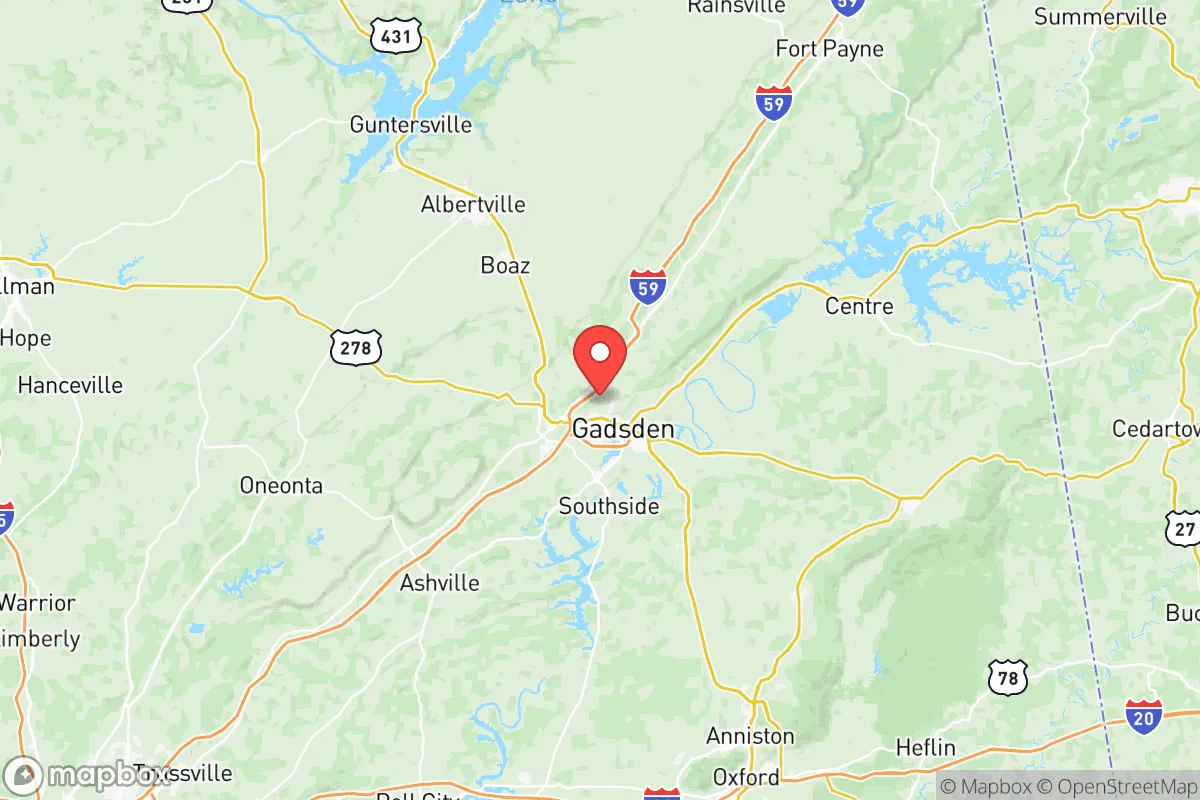
Etowah County, Alabama, offers a strategic balance of industrial resilience and rural buffer, positioning it as a viable relocation target for those prioritizing preparedness in an uncertain national landscape. Anchored by the city of Gadsden, the county sits roughly 60 miles from Birmingham and 90 miles from Atlanta, placing it outside the immediate blast or fallout zones of major metropolitan targets while remaining close enough for supply runs or regional networking. The area’s historical manufacturing base—including steel production and automotive parts—provides a local economic backbone that doesn’t rely solely on federal or coastal markets, a key advantage when supply chains fracture. For a conservative-leaning individual or family assessing long-term stability, Etowah County’s mix of accessible resources, modest population density (about 102,000 residents), and proximity to the Appalachian foothills makes it a defensible, self-sufficient option worth serious consideration.
Geographic position and natural advantages for long-term security
Etowah County sits at the southern edge of the Appalachian foothills, where the Coosa River cuts through the landscape, offering both a natural water source and a geographic barrier that slows movement from the flatter, more exposed regions to the south. The county’s terrain is rolling hills and mixed hardwood forest, which provides natural cover, reduces line-of-sight for potential threats, and supports hunting and foraging if needed. Gadsden, the county seat, is the primary population center, but the surrounding communities—Rainbow City, Southside, Attalla, and Glencoe—offer lower-density living with quick access to the river and state highways. The Coosa River itself is a significant asset: it’s a reliable water source that also supports limited hydroelectric power through the Neely Henry Dam, located just downstream in neighboring Calhoun County. For a relocator, this means you’re not dependent on a single municipal water system; wells are common in rural areas, and the river provides a fallback for irrigation or emergency supply. The county’s position also places it within a day’s drive of the Gulf Coast for evacuation options, but far enough inland to avoid hurricane storm surge or direct naval threats.
Risks, exposures, and proximity to fallout-relevant landmarks
No strategic assessment is honest without acknowledging the liabilities. Etowah County’s primary exposure comes from its industrial infrastructure and transportation corridors. Gadsden is home to a major steel mill (Nucor Steel) and a large automotive parts plant (Honda Manufacturing of Alabama is nearby in Lincoln, about 30 miles south). These facilities are potential targets for sabotage or economic disruption during civil unrest, and their proximity to the Coosa River means any industrial accident could affect water quality downstream. Additionally, Interstate 59 runs through the county, connecting Birmingham to Chattanooga—a major north-south logistics route that could become a chokepoint or target during mass evacuation scenarios. The county is also within 100 miles of the Tennessee Valley Authority’s Browns Ferry Nuclear Plant in Limestone County, AL, and the Sequoyah Nuclear Plant near Chattanooga, TN. While Etowah County is outside the primary fallout zones for a catastrophic event at either plant, prevailing winds from the west and southwest could carry particulate matter into the area depending on the season. For a prepper, this means having a robust air filtration system and a plan for sheltering in place for 72 hours is non-negotiable. On the positive side, there are no major military bases, refineries, or ports within the county itself, which reduces the likelihood of direct kinetic targeting.
Practical resilience for a relocator: food, water, energy, and defensibility
For a family or individual looking to establish a self-sufficient homestead, Etowah County offers a workable baseline. The growing season runs roughly April through October, with fertile river-bottom soils in the Coosa Valley supporting gardens and small-scale farming. Local farmers’ markets in Gadsden and Rainbow City provide fresh produce during normal times, but the real value is in the number of small farms and rural properties that allow for private food production. Water access is strong: the Coosa River is supplemented by numerous creeks and springs in the northern part of the county, and well drilling is common and affordable (typical depths of 100-300 feet). For energy, the county is served by the Tennessee Valley Authority (TVA), which provides relatively stable grid power, but solar potential is moderate—about 4.5 peak sun hours per day—making battery-backed solar arrays a viable supplement. Defensibility is where Etowah County shines: the hilly terrain and winding roads create natural chokepoints, and the county’s low population density means you can secure a property with good sightlines and limited neighbor proximity. The Lookout Mountain range runs along the county’s eastern edge, offering high-ground retreat options and caves for storage or shelter. For those willing to invest in a rural property outside the Gadsden city limits, the combination of water, defensible terrain, and local manufacturing (which can be repurposed for repairs or fabrication) makes this one of the more practical options in the Southeast.
The overall strategic picture for Etowah County is one of cautious optimism for the prepared relocator. It’s not a remote bunker location—you’re still within striking distance of regional population centers and industrial targets—but it offers a realistic middle ground between isolation and access. The county’s conservative political leanings (Etowah County voted +40 points for Trump in 2020) align with a culture of self-reliance, gun ownership, and community networks that are invaluable during crises. The local economy is anchored by manufacturing and healthcare, not tourism or government contracts, which provides a buffer against federal shutdowns or coastal disruptions. For a single individual or a family with children, the trade-offs are clear: you gain a defensible, resource-rich environment with good water and terrain, but you must account for the industrial risks in Gadsden and the proximity to interstate corridors that could become evacuation routes or target zones. If you secure a property north of the Coosa River, away from the I-59 corridor, and invest in well water, solar backup, and a solid pantry, Etowah County can serve as a long-term base for weathering the storms ahead—both literal and societal.
* Values derived from national, state, county, city and local statistics and may differ in a specific area. Last updated: 2026-05-09T19:29:35.000Z
Narrative content on this page is AI-generated and may contain mistakes. Verify any details that matter before acting on them.
ReloMaps may earn a commission from affiliate links at no extra cost to you.