Photo: Wikipedia
Strategic Assessment of Marshall County
Workable tactical position. Some exposure to population density or targets, but generally defensible in a crisis.
What does the Strategic Assessment tell us?
Our Strategic Assessment grades tactical survivability of an area. Major population centers, military targets, fallout zones, natural disasters, and border exposure all drive risk — lower exposure means a more defensible position in a crisis.
This is heavily inspired by Joel Skousen's Strategic Relocation book. Highly recommended you checkout the book ($)What does this tell us?
Our Strategic Assessment grades tactical survivability of an area. Major population centers, military targets, fallout zones, natural disasters, and border exposure all drive risk — lower exposure means a more defensible position in a crisis.
This is heavily inspired by Joel Skousen's Strategic Relocation book. Highly recommended you checkout the book ($)Strategic Pillars

Key Distances
Strategic Assessment Analysis
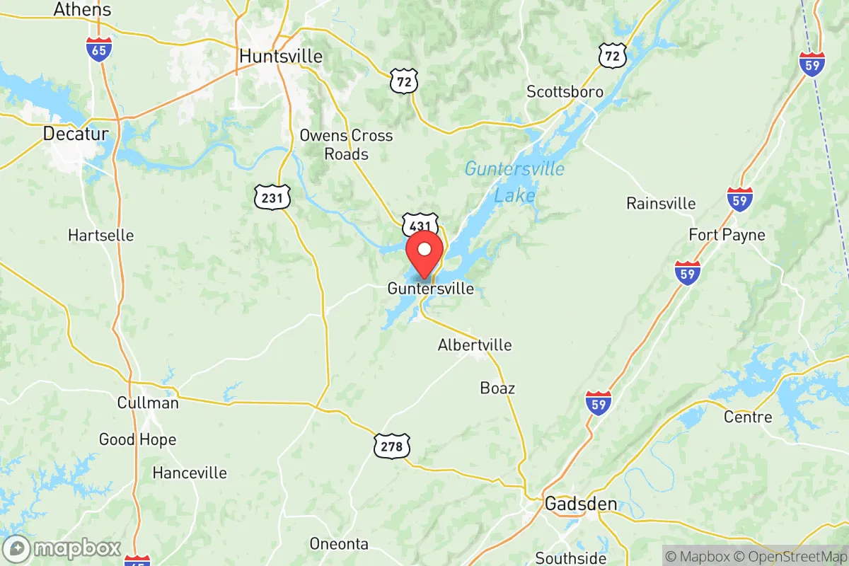
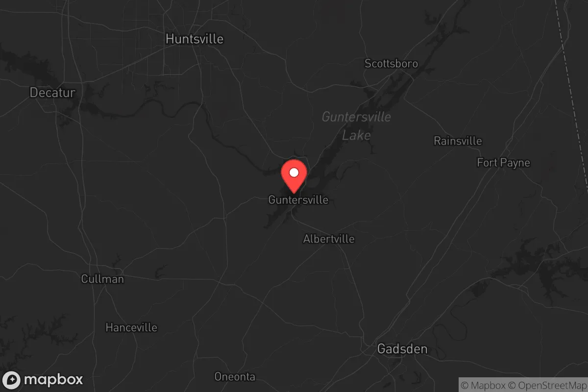
Marshall County, Alabama, offers a strategic blend of geographic isolation and practical self-sufficiency that appeals to those prioritizing resilience over convenience. Located in the northeastern part of the state, the county sits roughly 50 miles from the major population centers of Huntsville and Birmingham, placing it outside the immediate blast and fallout zones of those cities while still providing access to their resources if needed. The county's rolling hills, abundant water sources, and lower population density—around 97,000 residents spread across 567 square miles—create a defensible position that's hard to replicate in more urbanized areas. For a relocator with a conservative, preparedness-minded outlook, Marshall County represents a calculated bet on stability in an increasingly uncertain national landscape.
Geographic position and natural advantages for long-term security
Marshall County's location is its primary strategic asset. It sits in the Tennessee Valley region, bordered by the Tennessee River to the north and the Appalachian foothills to the south. The county seat, Guntersville, lies directly on the Tennessee River, providing access to a major navigable waterway that can serve as both a transportation corridor and a water source in a crisis. The Guntersville Dam and Guntersville Lake, a 69,000-acre reservoir created by the Tennessee Valley Authority (TVA), offer a reliable freshwater supply and hydroelectric power generation—critical for long-term sustainability. The dam itself is a hardened infrastructure asset, though it also represents a potential target; its destruction would flood downstream areas but leave Marshall County's higher ground largely intact. The county's terrain is a mix of forested ridges, farmland, and river valleys, providing natural cover and defensible positions. The Sand Mountain plateau runs through the eastern part of the county, offering elevated ground with limited access points—ideal for a retreat or a community stronghold. The area's moderate climate, with mild winters and warm summers, supports year-round agriculture, reducing reliance on external food supply chains.
Risks, exposures, and proximity to fallout-relevant landmarks
No location is without risk, and Marshall County has its share of vulnerabilities. The most significant concern is the proximity to Redstone Arsenal, a U.S. Army base in Huntsville about 40 miles to the northwest. Redstone is a major center for missile defense, space research, and chemical weapons storage—specifically, the Redstone Chemical Agent Disposal Facility handles aging chemical munitions. In a worst-case scenario involving a major accident or attack, Marshall County could be downwind of a chemical release or fallout plume, depending on weather patterns. The county is also within 100 miles of the Browns Ferry Nuclear Plant in Limestone County, Alabama, which has three reactors. A meltdown or sabotage event there could contaminate the Tennessee River watershed, directly affecting Guntersville Lake and the county's water supply. Additionally, Interstate 65 runs along the county's western edge, a major north-south evacuation route that could become a chokepoint or target during civil unrest. The county's own industrial base includes a few small manufacturing plants and a 3M plant in Guntersville that produces abrasives and adhesives—not a high-consequence target, but worth noting for potential chemical spills. The risk of tornadoes is real, with the county averaging 10-15 tornado warnings per year, but the terrain limits the damage footprint compared to flatter regions.
Practical resilience for a relocator: food, water, energy, and defensibility
For a single individual or family looking to build a self-sufficient life, Marshall County offers strong fundamentals. Water is abundant: Guntersville Lake provides a massive reservoir, and numerous smaller creeks and springs dot the county. The TVA manages the lake levels, but a private well on higher ground is a more resilient option—drilling costs in the area average $15-$25 per foot, with most wells hitting good water at 100-200 feet. Food production is viable, with the county's agricultural base including cattle, poultry, and row crops like corn and soybeans. The Albertville area, in particular, has a strong farming community and a weekly farmers' market that could be leveraged for seed stock and local knowledge. The county's soil is generally fertile in the river valleys, though the Sand Mountain plateau has thinner, rockier soil that requires more effort for gardening. Energy is a mixed bag: the TVA grid is reliable, but a grid-down scenario would require backup. Solar potential is decent, with about 200 sunny days per year, but the region's humidity and cloud cover reduce efficiency compared to the Southwest. Wood heating is practical, given the county's 60% forest cover, and many homes already have fireplaces or wood stoves. Defensibility is where Marshall County shines. The terrain—hills, ridges, and river bends—creates natural chokepoints. The county's road network is sparse enough that a few well-placed barriers could control access to most rural areas. The local law enforcement presence is modest, with the Marshall County Sheriff's Office covering the unincorporated areas, but the community is tight-knit and generally armed—Alabama has some of the most permissive gun laws in the country, with no permit required for open or concealed carry. The Guntersville Police Department and Albertville Police Department are professional but understaffed, meaning self-reliance is the norm in rural parts.
The overall strategic picture for Marshall County is one of calculated trade-offs. It's not a perfect fortress—the proximity to Redstone Arsenal and the Browns Ferry nuclear plant introduces real, if low-probability, risks. But for a relocator who values water security, defensible terrain, and a community that leans conservative and self-reliant, it's a strong candidate. The county's location puts it outside the immediate fallout zones of Huntsville and Birmingham, while still allowing access to their hospitals and supply chains in normal times. The TVA infrastructure is a double-edged sword—it provides power and water but also represents a centralized vulnerability. The key is to pick a specific location within the county: the higher ground of the Sand Mountain plateau offers better defensibility and lower flood risk, while the lakefront areas near Guntersville offer better water access but higher population density. For a family or individual serious about long-term preparedness, Marshall County deserves a hard look—just make sure you have a plan for the day the wind blows from the north.
* Values derived from national, state, county, city and local statistics and may differ in a specific area. Last updated: 2026-06-06T08:30:42.000Z
Narrative content on this page is AI-generated and may contain mistakes. Verify any details that matter before acting on them.
ReloMaps may earn a commission from affiliate links at no extra cost to you.