Photo: Wikipedia
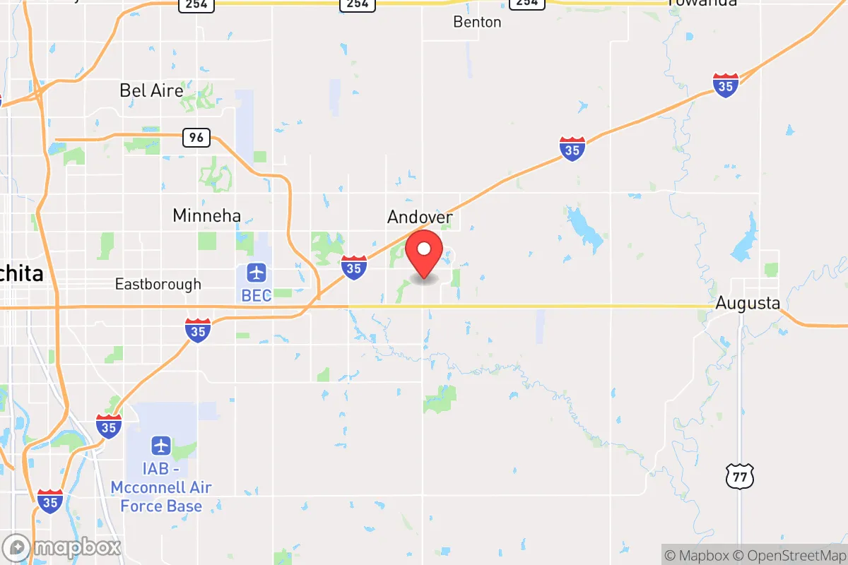
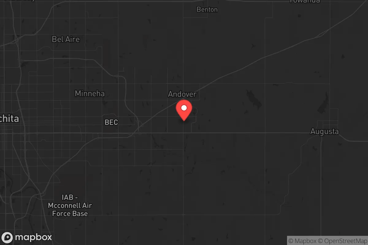
Strategic Assessment of Andover, KS
Meaningful friction. Expect exposure to either population pressure, blast zones, or natural disaster risk. Consider buying a retreat property.
What does the Strategic Assessment tell us?
Our Strategic Assessment grades tactical survivability of an area. Major population centers, military targets, fallout zones, natural disasters, and border exposure all drive risk — lower exposure means a more defensible position in a crisis.
This is heavily inspired by Joel Skousen's Strategic Relocation book. Highly recommended you checkout the book ($)What does this tell us?
Our Strategic Assessment grades tactical survivability of an area. Major population centers, military targets, fallout zones, natural disasters, and border exposure all drive risk — lower exposure means a more defensible position in a crisis.
This is heavily inspired by Joel Skousen's Strategic Relocation book. Highly recommended you checkout the book ($)Strategic Pillars

Key Distances
Regional Safe Places
Below is our recommended "safe zones" in Kansas and the surrounding area based on our strategic heuristics. For most people, it's unrealistic to live in a “safe zone” full-time due to work, family or other personal reasons. They tend to be more rural. However, many of these areas are perfect for second homes and retreat properties that double as a vacation home or even a short-term rental.
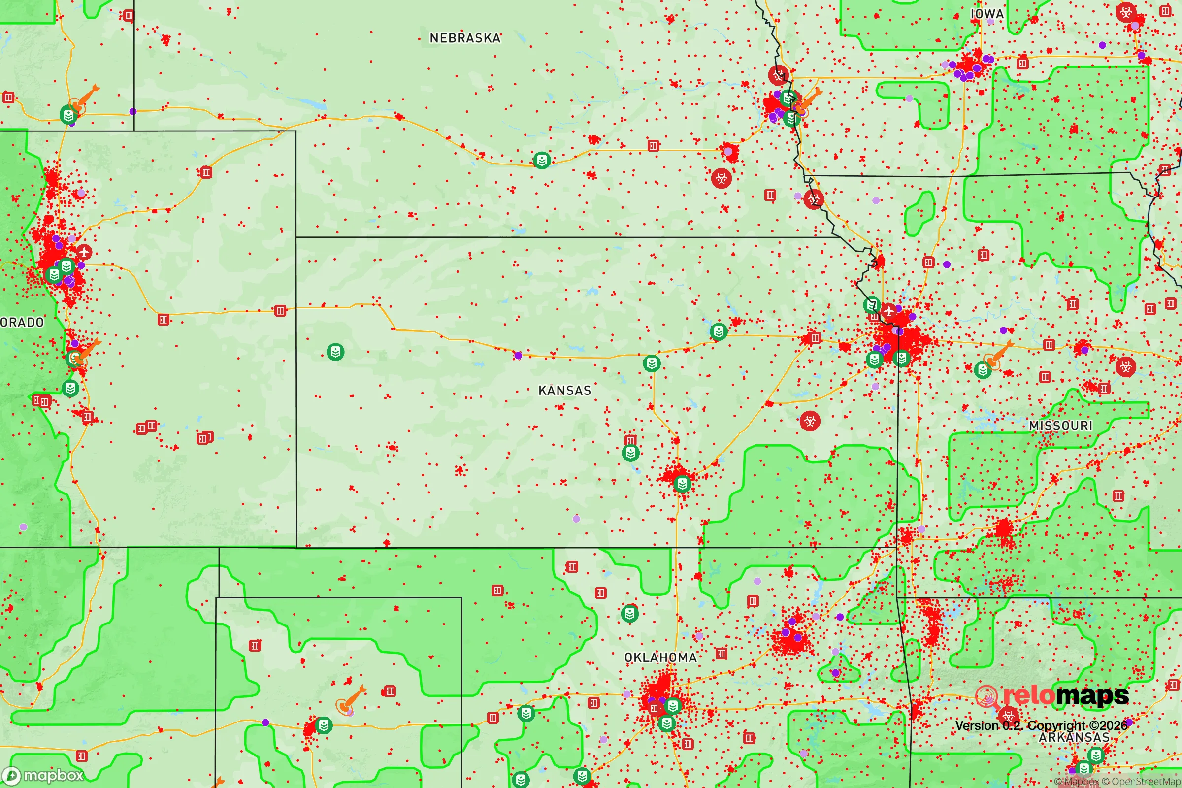
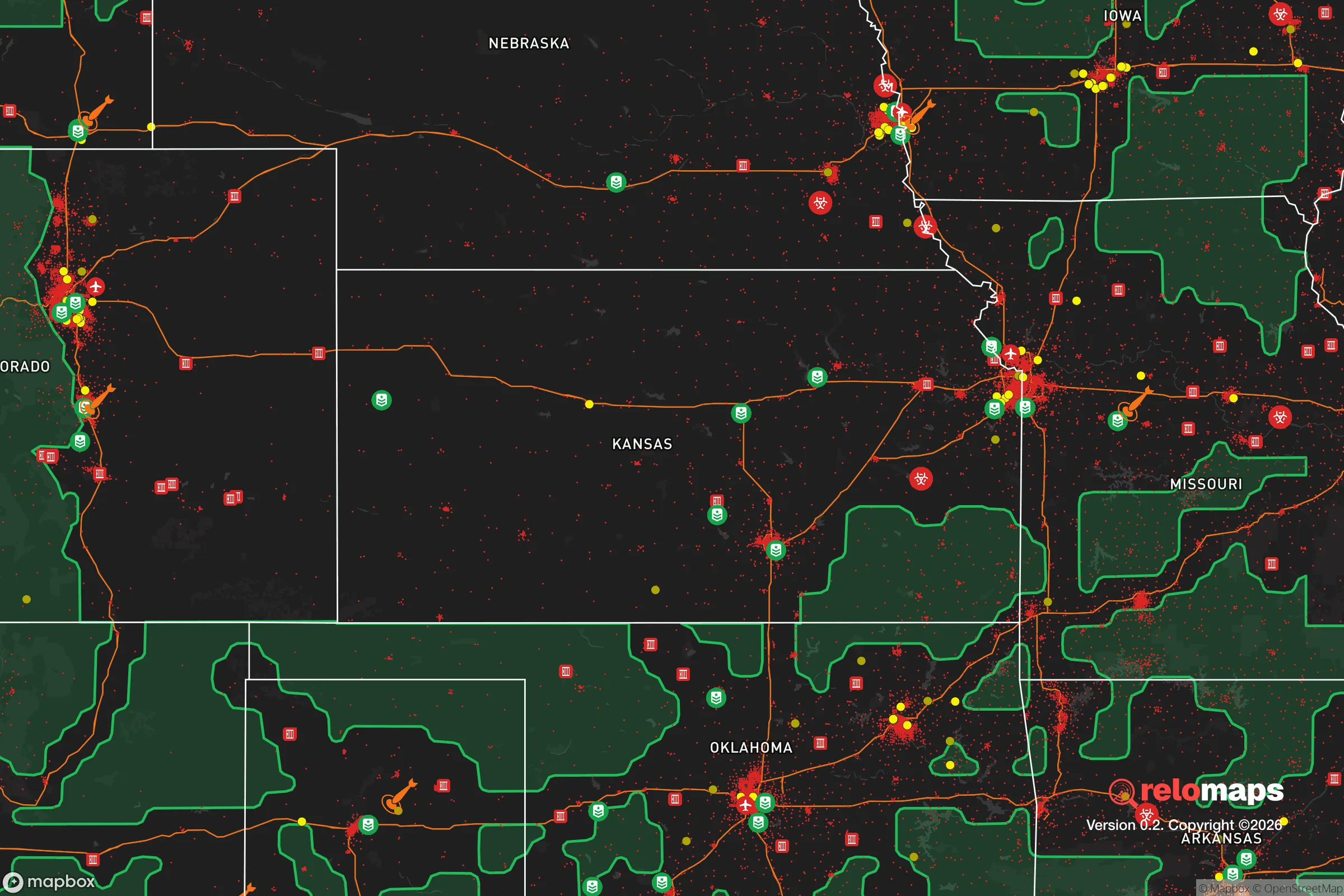
Important Note: For informational purposes only. This does not mean nothing bad ever happens in the green zones. Please use common sense. This is based on public data and modeled with AI. We tried to take a conservative approach but mistakes happen. We update this regularly as new information becomes available.
Solar Generator Recommendations
Backup power matters more here than in safer locations. We've picked three solar generators across budgets and capacity tiers — start with the budget unit if you only need a few essentials, or step up if you want to run a fridge and HVAC for days at a time.

Jackery Portable Power Station Explorer 300
Budget OptionPower on the Go: Weighing only 11 lbs, it's convenient to set up and store with book-sized foldable solar panels

BLUETTI Portable Power Station AC180
Designed for both indoor and outdoor scenarios, AC180 is highly capable as it has a robost capacity and continuous output power.

EF ECOFLOW DELTA Pro Ultra Power Station
Upgraded PickEcoFlow DELTA Pro Ultra is a whole-home energy system designed to grow with your family. Integrated with the Smart Home Panel 2, it scales to meet your evolving energy needs — keeping your home powered, intelligent, and secure through every stage of life.
We earn a commission, at no additional cost to you.
Strategic Assessment Analysis
Andover, Kansas, sits in a deceptive pocket of stability that deserves a hard look from anyone serious about strategic relocation. Tucked into the southeastern edge of Sedgwick County, this town of roughly 15,000 offers a blend of suburban convenience and genuine rural buffer that most preppers overlook. Its resilience comes not from flashy infrastructure but from a quiet geographic position that keeps it close enough to Wichita for supply runs yet far enough to avoid the worst of urban collapse scenarios. For a conservative-leaning individual or family weighing long-term security against daily practicality, Andover presents a compelling—if imperfect—option worth analyzing in detail.
Geographic position and natural advantages for long-term security
Andover’s location at the intersection of US-54 and K-15 gives it solid road access without being a major transit choke point. The town sits roughly 15 miles east of Wichita’s urban core, placing it outside the immediate blast radius of any hypothetical Wichita-centric event while still within a reasonable drive for resupply or medical care. The surrounding terrain is flat to gently rolling Kansas prairie, which offers excellent long-range visibility—a tactical advantage for anyone concerned with perimeter awareness. The Arkansas River flows about 10 miles west, and the Walnut River runs closer, roughly 5 miles east near El Dorado. Both provide potential water sources, though neither is directly in Andover’s city limits. The area’s natural drainage is decent, with few flood-prone zones compared to eastern Kansas. Soil quality supports small-scale agriculture, and the growing season runs roughly April through October, which is workable for a serious gardening operation. The lack of dense forest or mountain cover means less concealment but also fewer places for threats to approach unseen. For a prepper mindset, this is a trade-off that favors surveillance over stealth.
Risks, exposures, and proximity to fallout-relevant landmarks
The most significant risk factor for Andover is its proximity to McConnell Air Force Base, located about 12 miles west-southwest. McConnell houses the 931st Air Refueling Wing and the 184th Intelligence Wing, making it a legitimate Tier-1 target in any major conflict scenario. A ground burst or airburst over McConnell would produce fallout that, depending on wind patterns, could easily reach Andover within hours. Prevailing winds in south-central Kansas run west to east roughly 60% of the time, meaning Andover sits in a moderate-risk downwind zone. This is not a dealbreaker—many prepper-friendly towns in the Plains face similar exposure—but it demands serious fallout shelter planning. Beyond military targets, the nearby Koch Industries headquarters in Wichita and the sprawling refineries and chemical plants along the Kansas Turnpike corridor add industrial hazard risks. A major accident or sabotage at these facilities could release toxic plumes that drift eastward. On the plus side, Andover is far from any nuclear power plant (the nearest is Wolf Creek, 120 miles east) and sits outside the 50-mile emergency planning zones for any reactor. Tornado risk is real—Andover was hit by an EF-3 tornado in April 2022 that caused significant damage—but the town’s building codes have improved, and modern storm shelters are increasingly common in new construction. For a relocator, the tornado threat is manageable with a below-ground shelter; the fallout risk requires more deliberate planning.
Practical resilience for a relocator: food, water, energy, and defensibility
Andover’s practical resilience hinges on its suburban-rural hybrid character. The town has its own municipal water system drawing from the Equus Beds aquifer, a substantial groundwater source that also supplies Wichita. In a grid-down scenario, residents on well water (common in the outskirts) would fare better than those dependent on municipal pumps without backup power. The local power grid is served by Evergy, which has a mixed reliability record—outages during storms are common, but the area is not prone to the rolling blackouts seen in California or Texas. Solar potential is good: Andover averages about 230 sunny days per year, and a modest rooftop array with battery storage could cover a family’s basic needs through most disruptions. Natural gas is widely available, and propane tanks are common in rural parcels. For food security, the surrounding agricultural land is dominated by wheat, corn, and soybeans, but local farmers’ markets and small-scale producers are present. The town has a handful of grocery stores, including a Dillons and a Walmart Neighborhood Market, but supply chain disruptions would hit these hard. A serious prepper would want at least six months of stored food and the ability to garden or barter. Defensibility is moderate: Andover is a typical suburban layout with cul-de-sacs and grid streets, not a natural fortress. However, the town’s low population density and lack of major industrial targets within its limits mean that civil unrest would likely be less severe than in Wichita proper. The local police department is small but professional, and the Butler County Sheriff’s Office provides backup. For a family, the school system (Andover USD 385) is well-regarded and would serve as a community anchor during prolonged disruptions. The biggest practical gap is medical infrastructure: the nearest hospital with a trauma center is Wesley Medical Center in Wichita, 20 minutes away. In a mass casualty event, that facility would be overwhelmed, and Andover has no standalone emergency room. A relocator should plan for advanced first aid capability and telemedicine options.
The overall strategic picture for Andover is one of cautious optimism for the prepared relocator. It offers a rare combination of proximity to urban resources and genuine separation from the worst-case urban failure modes. The McConnell Air Force Base fallout risk is the single greatest vulnerability, but it is a known, quantifiable threat that can be mitigated with a properly designed shelter and a wind-monitoring plan. The tornado hazard is real but survivable with modern construction and a storm shelter. The town’s water supply, agricultural surroundings, and solar potential provide a solid foundation for long-term self-sufficiency. For a conservative-leaning individual or family who wants to stay connected to the broader economy while maintaining a credible backup plan for societal disruption, Andover deserves a spot on the short list. It is not a remote mountain redoubt, and it never will be. But for those who understand that resilience is about layers—not absolutes—Andover provides a workable middle ground that balances risk, access, and everyday livability. The key is to arrive with eyes open, a shelter plan in hand, and a willingness to invest in the infrastructure that turns a good location into a secure one.
* Values derived from national, state, county, city and local statistics and may differ in a specific area. Last updated: 2026-05-01T04:18:31.000Z
Narrative content on this page is AI-generated and may contain mistakes. Verify any details that matter before acting on them.
ReloMaps may earn a commission from affiliate links at no extra cost to you.