Photo: Wikipedia
Strategic Assessment of Anthony, NM
Multiple tactical vulnerabilities. Population density, target proximity, or disaster risk are likely compounding. A retreat property and exit planning is required.
What does the Strategic Assessment tell us?
Our Strategic Assessment grades tactical survivability of an area. Major population centers, military targets, fallout zones, natural disasters, and border exposure all drive risk — lower exposure means a more defensible position in a crisis.
This is heavily inspired by Joel Skousen's Strategic Relocation book. Highly recommended you checkout the book ($)What does this tell us?
Our Strategic Assessment grades tactical survivability of an area. Major population centers, military targets, fallout zones, natural disasters, and border exposure all drive risk — lower exposure means a more defensible position in a crisis.
This is heavily inspired by Joel Skousen's Strategic Relocation book. Highly recommended you checkout the book ($)Strategic Pillars

Key Distances
Regional Safe Places
Below is our recommended "safe zones" in New Mexico and the surrounding area based on our strategic heuristics. For most people, it's unrealistic to live in a “safe zone” full-time due to work, family or other personal reasons. They tend to be more rural. However, many of these areas are perfect for second homes and retreat properties that double as a vacation home or even a short-term rental.

Important Note: For informational purposes only. This does not mean nothing bad ever happens in the green zones. Please use common sense. This is based on public data and modeled with AI. We tried to take a conservative approach but mistakes happen. We update this regularly as new information becomes available.
Solar Generator Recommendations
Backup power matters more here than in safer locations. We've picked three solar generators across budgets and capacity tiers — start with the budget unit if you only need a few essentials, or step up if you want to run a fridge and HVAC for days at a time.

Jackery Portable Power Station Explorer 300
Budget OptionPower on the Go: Weighing only 11 lbs, it's convenient to set up and store with book-sized foldable solar panels

BLUETTI Portable Power Station AC180
Designed for both indoor and outdoor scenarios, AC180 is highly capable as it has a robost capacity and continuous output power.

EF ECOFLOW DELTA Pro Ultra Power Station
Upgraded PickEcoFlow DELTA Pro Ultra is a whole-home energy system designed to grow with your family. Integrated with the Smart Home Panel 2, it scales to meet your evolving energy needs — keeping your home powered, intelligent, and secure through every stage of life.
We earn a commission, at no additional cost to you.
Strategic Assessment Analysis
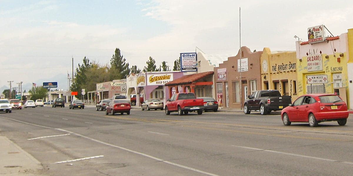
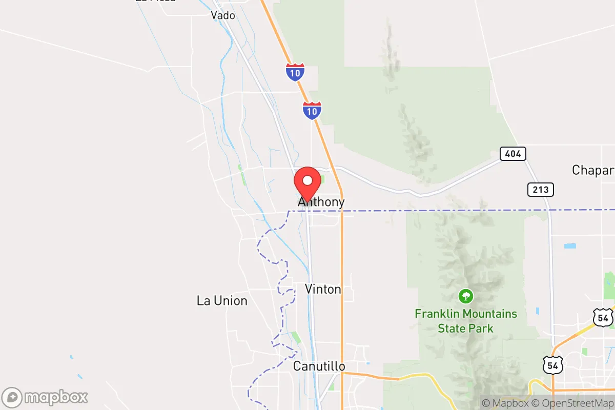
Anthony, New Mexico, sits in a unique strategic pocket that offers a mix of genuine resilience and serious exposure. Located at the southern tip of Doña Ana County, straddling the Texas state line, this unincorporated community of roughly 9,000 people benefits from being far enough from major urban centers to avoid the worst of a collapse scenario, yet close enough to critical infrastructure to matter. Its position along the Rio Grande Valley provides a reliable water source, and the surrounding desert offers natural isolation. For a relocator thinking about long-term stability, Anthony presents a calculated trade-off: you get a defensible, low-profile location with agricultural potential, but you also inherit proximity to the U.S.-Mexico border, a major interstate, and a regional population center in El Paso that could become a liability during widespread unrest.
Geographic position and natural advantages for long-term stability
Anthony’s geography is its strongest card. The community sits at the intersection of I-10 and the Rio Grande, giving it direct access to a perennial water source—a non-negotiable asset in any preparedness plan. The Rio Grande here is not a trickle; it supports irrigated farmland that produces pecans, cotton, and alfalfa, meaning local food production is already established. The surrounding terrain is mostly flat desert with scattered mesas, offering good visibility and limited approach routes for anyone trying to move through the area undetected. The climate is arid, with low humidity and over 300 days of sunshine per year, which simplifies solar energy generation and reduces the risk of mold or rot in stored supplies. Elevation sits around 3,800 feet, so summer heat is manageable, and winter lows rarely drop below freezing for long. For a prepper, this means year-round growing potential with minimal infrastructure—hoophouses and drip irrigation can keep a family in vegetables without heavy reliance on external supply chains.
Risks, exposures, and proximity to fallout-relevant landmarks
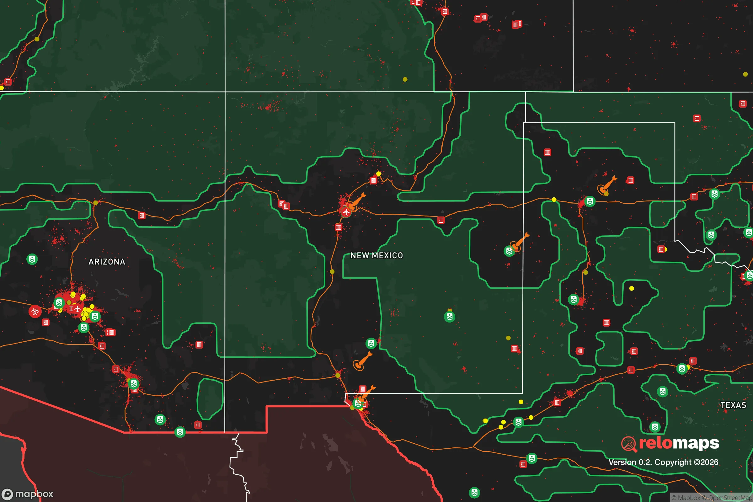
No strategic assessment is honest without flagging the downsides. Anthony’s biggest vulnerability is its location less than 30 miles from the U.S.-Mexico border and roughly 40 miles from downtown El Paso. In a scenario involving mass migration, cartel violence spilling north, or a breakdown of border security, this area becomes a funnel. I-10 is a major east-west corridor that connects El Paso to Las Cruces and points beyond; during a crisis, it could become a choke point for both refugees and looters. The nearby Santa Teresa port of entry and the Union Pacific rail line add to the traffic risk. Additionally, White Sands Missile Range is about 50 miles north, and while it’s not a nuclear power plant, it does handle missile testing and could be a target in a broader conflict. Fort Bliss, a major Army post, is just east of El Paso—meaning military assets and potential retaliation zones are uncomfortably close. For a relocator prioritizing low-profile survivability, being within a day’s drive of a city of 700,000 and an active military installation is a liability, not an asset.
Practical resilience for a relocator: food, water, energy, and defensibility
For someone serious about self-sufficiency, Anthony offers several concrete advantages. Water is the foundation: the local aquifer is part of the Mesilla Basin, and many properties have access to well water or irrigation rights. Surface water from the Rio Grande is allocated through the Elephant Butte Irrigation District, so a relocator should verify water rights before buying land, but the potential is there. The growing season runs from March to November, and the soil, while sandy, is workable with amendments. For energy, solar is a no-brainer—the area averages 5.5 to 6 peak sun hours per day, and net metering is available through El Paso Electric. Battery storage is recommended given the grid’s vulnerability to summer storms and border-related disruptions. Defensibility is decent but not fortress-level: the flat terrain means you can see threats coming from a distance, but it also means you have limited natural cover. A property with a walled compound, a well, and a solar array would be hard to approach without warning. The local population is sparse, with most residents living on small farms or in mobile homes, so you won’t be surrounded by dense neighborhoods. However, law enforcement presence is minimal—the Doña Ana County Sheriff’s Office covers a huge area, and response times in a crisis could be measured in hours, not minutes. That means you need to be your own first responder, with medical training, ammunition, and a communication plan that doesn’t rely on cell towers.
The broader strategic picture for Anthony is one of cautious viability. It is not a bug-out location for someone looking to disappear into the mountains—there are no mountains here, and the border proximity is a constant variable. But for a relocator who wants to stay in the Southwest, maintain access to a major highway for trade or evacuation, and build a semi-self-sufficient homestead, it checks important boxes. The key is to treat Anthony as a base of operations, not a final redoubt. Stockpile supplies for at least six months, invest in water storage and filtration, and establish relationships with local farmers and ranchers before any crisis hits. The community itself is small and rural, with a mix of Hispanic and Anglo families, many of whom are already accustomed to hard work and limited services. That cultural resilience matters more than any piece of gear. If you can accept the border risk and the flat terrain, Anthony offers a realistic, low-cost entry point into a prepared lifestyle—just don’t expect to be invisible. The I-10 corridor ensures you’ll have company, and in a bad scenario, that company might not be friendly.
* Values derived from national, state, county, city and local statistics and may differ in a specific area. Last updated: 2026-04-19T02:56:29.000Z
Narrative content on this page is AI-generated and may contain mistakes. Verify any details that matter before acting on them.
ReloMaps may earn a commission from affiliate links at no extra cost to you.