
Photo: Wikipedia
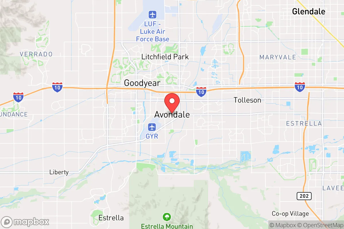
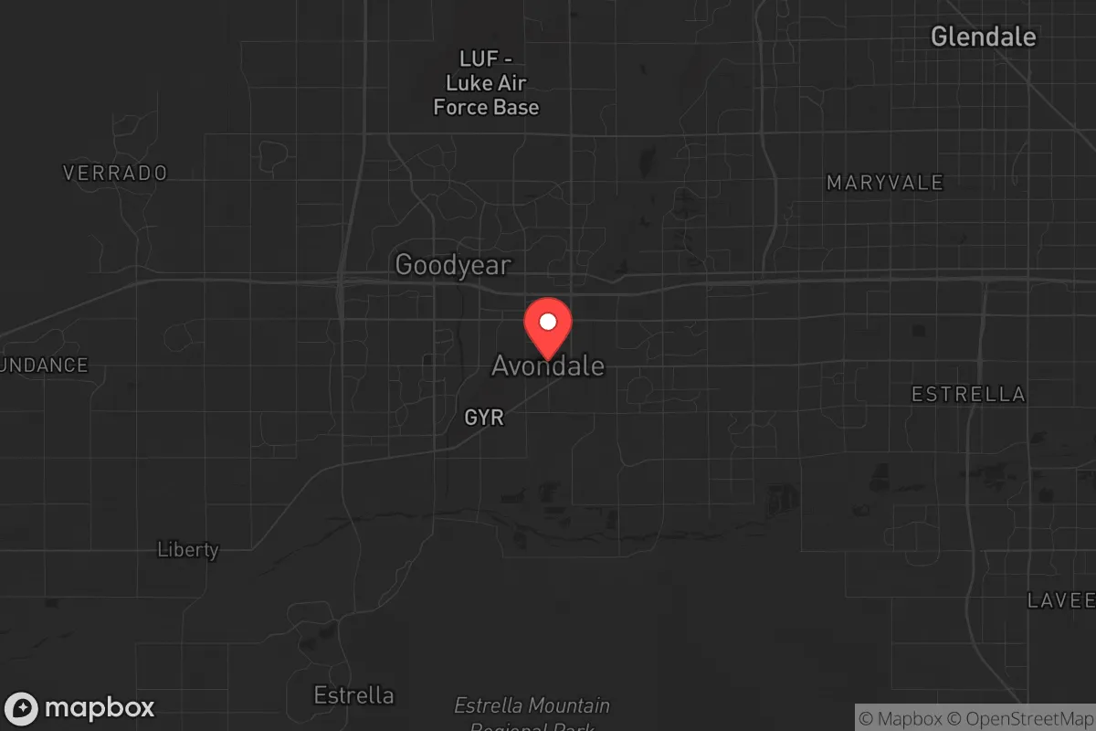
Strategic Assessment of Avondale, AZ
Multiple tactical vulnerabilities. Population density, target proximity, or disaster risk are likely compounding. A retreat property and exit planning is required.
What does the Strategic Assessment tell us?
Our Strategic Assessment grades tactical survivability of an area. Major population centers, military targets, fallout zones, natural disasters, and border exposure all drive risk — lower exposure means a more defensible position in a crisis.
This is heavily inspired by Joel Skousen's Strategic Relocation book. Highly recommended you checkout the book ($)What does this tell us?
Our Strategic Assessment grades tactical survivability of an area. Major population centers, military targets, fallout zones, natural disasters, and border exposure all drive risk — lower exposure means a more defensible position in a crisis.
This is heavily inspired by Joel Skousen's Strategic Relocation book. Highly recommended you checkout the book ($)Strategic Pillars

Key Distances
Regional Safe Places
Below is our recommended "safe zones" in Arizona and the surrounding area based on our strategic heuristics. For most people, it's unrealistic to live in a “safe zone” full-time due to work, family or other personal reasons. They tend to be more rural. However, many of these areas are perfect for second homes and retreat properties that double as a vacation home or even a short-term rental.
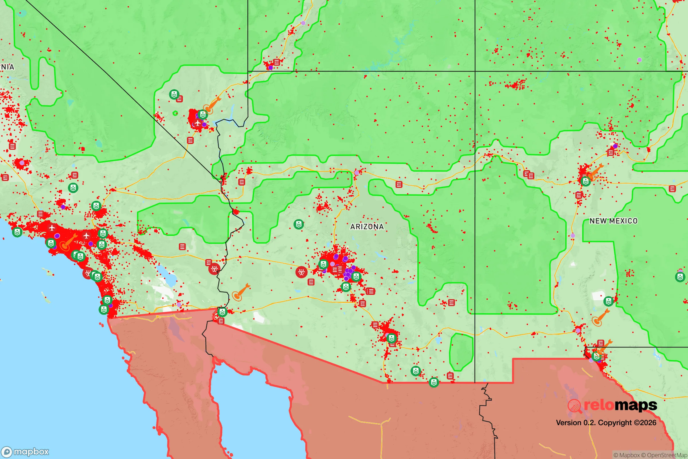
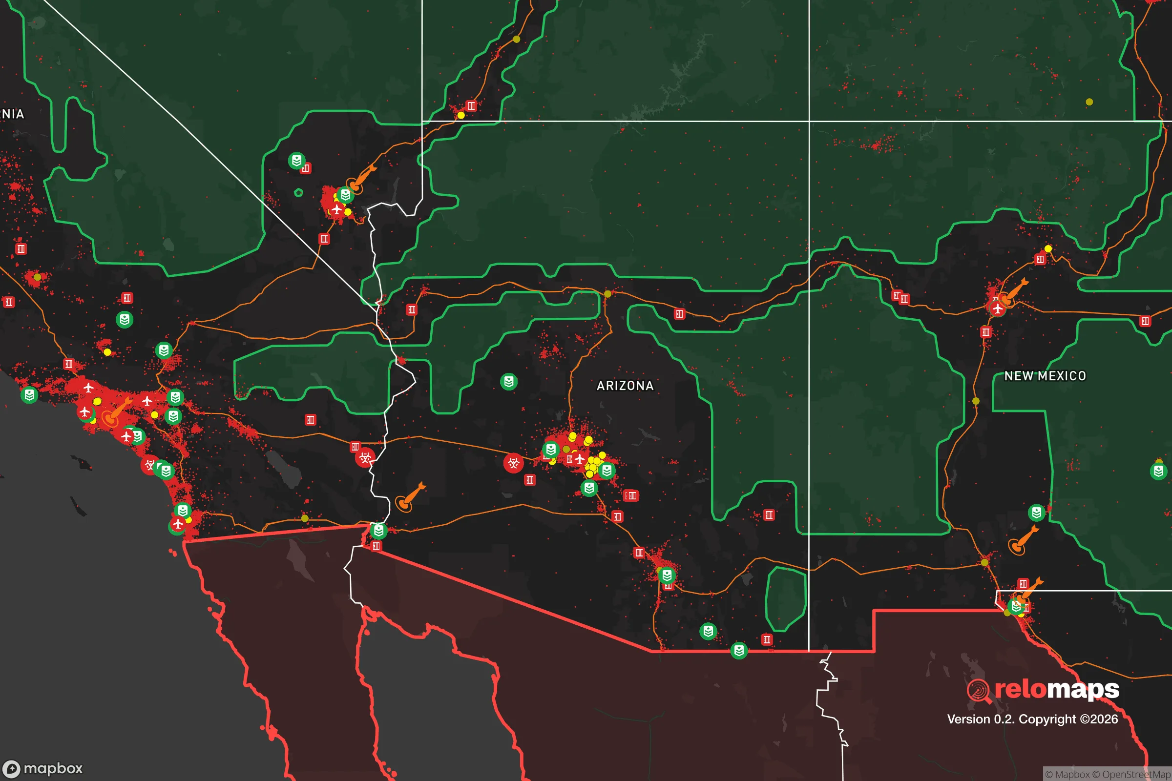
Important Note: For informational purposes only. This does not mean nothing bad ever happens in the green zones. Please use common sense. This is based on public data and modeled with AI. We tried to take a conservative approach but mistakes happen. We update this regularly as new information becomes available.
Solar Generator Recommendations
Backup power matters more here than in safer locations. We've picked three solar generators across budgets and capacity tiers — start with the budget unit if you only need a few essentials, or step up if you want to run a fridge and HVAC for days at a time.

Jackery Portable Power Station Explorer 300
Budget OptionPower on the Go: Weighing only 11 lbs, it's convenient to set up and store with book-sized foldable solar panels

BLUETTI Portable Power Station AC180
Designed for both indoor and outdoor scenarios, AC180 is highly capable as it has a robost capacity and continuous output power.

EF ECOFLOW DELTA Pro Ultra Power Station
Upgraded PickEcoFlow DELTA Pro Ultra is a whole-home energy system designed to grow with your family. Integrated with the Smart Home Panel 2, it scales to meet your evolving energy needs — keeping your home powered, intelligent, and secure through every stage of life.
We earn a commission, at no additional cost to you.
Strategic Assessment Analysis
Avondale, Arizona, sits in a precarious strategic position that demands a hard-eyed assessment for anyone serious about long-term preparedness. Its location within the sprawling Phoenix metropolitan area offers immediate access to resources and infrastructure, but that very proximity to a major urban center introduces significant vulnerabilities in a crisis scenario. For the conservative prepper weighing relocation, Avondale presents a mixed picture: it is close enough to benefit from the region’s economic and logistical strengths, yet dangerously near the potential fallout zones and population-density risks that make a true retreat difficult to defend.
Geographic position and natural advantages for long-term survival
Avondale’s geographic reality is defined by its place in the Sonoran Desert, roughly 15 miles west of downtown Phoenix. The area’s natural advantages are limited but real. The desert climate means low humidity and minimal risk of flooding or hurricane-force winds, though flash floods during monsoon season are a genuine hazard in low-lying washes. The region sits on a stable geological plate, so earthquakes are not a concern. Water is the critical issue: the Central Arizona Project canal runs through the area, delivering Colorado River water, but this is a single-point-of-failure system vulnerable to disruption from civil unrest, infrastructure sabotage, or prolonged drought. The Salt River and Gila River basins provide some groundwater, but aquifer levels have been dropping for decades. For a relocator, the natural advantage here is the dry air and wide-open spaces to the west and south, which offer escape routes into less populated areas like the Barry M. Goldwater Range or the desert beyond Gila Bend. However, those routes are also exposed and offer little cover.
Risks, exposures, and proximity to fallout-relevant landmarks
The most glaring risk for Avondale is its position within the Phoenix metroplex. In a mass casualty event—whether from a biological outbreak, coordinated terrorist attack, or nuclear detonation at a nearby target—Avondale would be caught in the chaos. Luke Air Force Base is just 10 miles to the northwest, a high-value military target that would be a primary strike location in any conflict involving strategic bombing. A ground burst there would send fallout across Avondale within hours, depending on wind direction. Additionally, the Palo Verde Nuclear Generating Station, the largest nuclear power plant in the United States, lies about 35 miles west. While not a likely target for a direct attack, a catastrophic failure or sabotage at that facility would place Avondale in a dangerous downwind zone. The city is also crisscrossed by major interstate highways (I-10 and the Loop 101) and rail lines that serve as logistical arteries for the region—but in a crisis, those same routes become chokepoints for fleeing populations and potential ambush corridors. The concentration of population in Avondale itself (over 90,000 residents) means that any localized disaster could quickly escalate into a resource-scarcity nightmare, with food and water supplies running out within days.
Practical resilience for a relocator: food, water, energy, and defensibility
For the individual or family looking to hunker down, Avondale’s practical resilience is weak without significant advance preparation. Water storage is non-negotiable: the municipal supply depends on electricity to pump from the CAP canal and groundwater wells. A grid-down scenario means taps go dry within hours. Rainwater harvesting is possible but yields are low—the area averages only about 7 inches of rain per year. Food resilience is equally challenging. The soil is alkaline and sandy, requiring heavy amendment to grow vegetables, and the summer heat (often exceeding 110°F) makes gardening a battle. Local grocery stores rely on just-in-time delivery; shelves would empty in 48 hours during a panic. Energy-wise, solar is a strong option—Avondale averages over 300 sunny days per year—but panels require battery storage and maintenance. Natural gas lines are widespread but vulnerable to rupture. Defensibility is the hardest factor. Avondale is a suburban grid of tract homes with fenced yards and cul-de-sacs, which can be secured with effort, but the surrounding area is flat and open. There is no natural high ground or defensible terrain. Neighbors are close, and in a breakdown of civil order, the noise and light from nearby homes would make stealth impossible. The best defensive strategy is to have a pre-planned bug-out route west toward the desert or south toward the borderlands, but that requires a vehicle, fuel, and cached supplies.
The overall strategic picture for Avondale is one of calculated risk. It is not a true retreat location—it is a suburban outpost with serious exposure to the vulnerabilities of a major metro area. For the conservative prepper who must remain near Phoenix for work or family obligations, Avondale offers a reasonable compromise if you invest heavily in self-sufficiency: deep water storage, solar power, a well-stocked pantry, and a solid security plan. But for anyone with the freedom to choose a more remote location, the risks here likely outweigh the benefits. The proximity to Luke Air Force Base and the Palo Verde plant, combined with the flat, exposed terrain and dependence on fragile infrastructure, make Avondale a location that demands constant vigilance and a robust contingency plan. It is a place to survive, not to thrive, in a prolonged crisis.
* Values derived from national, state, county, city and local statistics and may differ in a specific area. Last updated: 2026-04-19T19:47:23.000Z
Narrative content on this page is AI-generated and may contain mistakes. Verify any details that matter before acting on them.
ReloMaps may earn a commission from affiliate links at no extra cost to you.