 Popular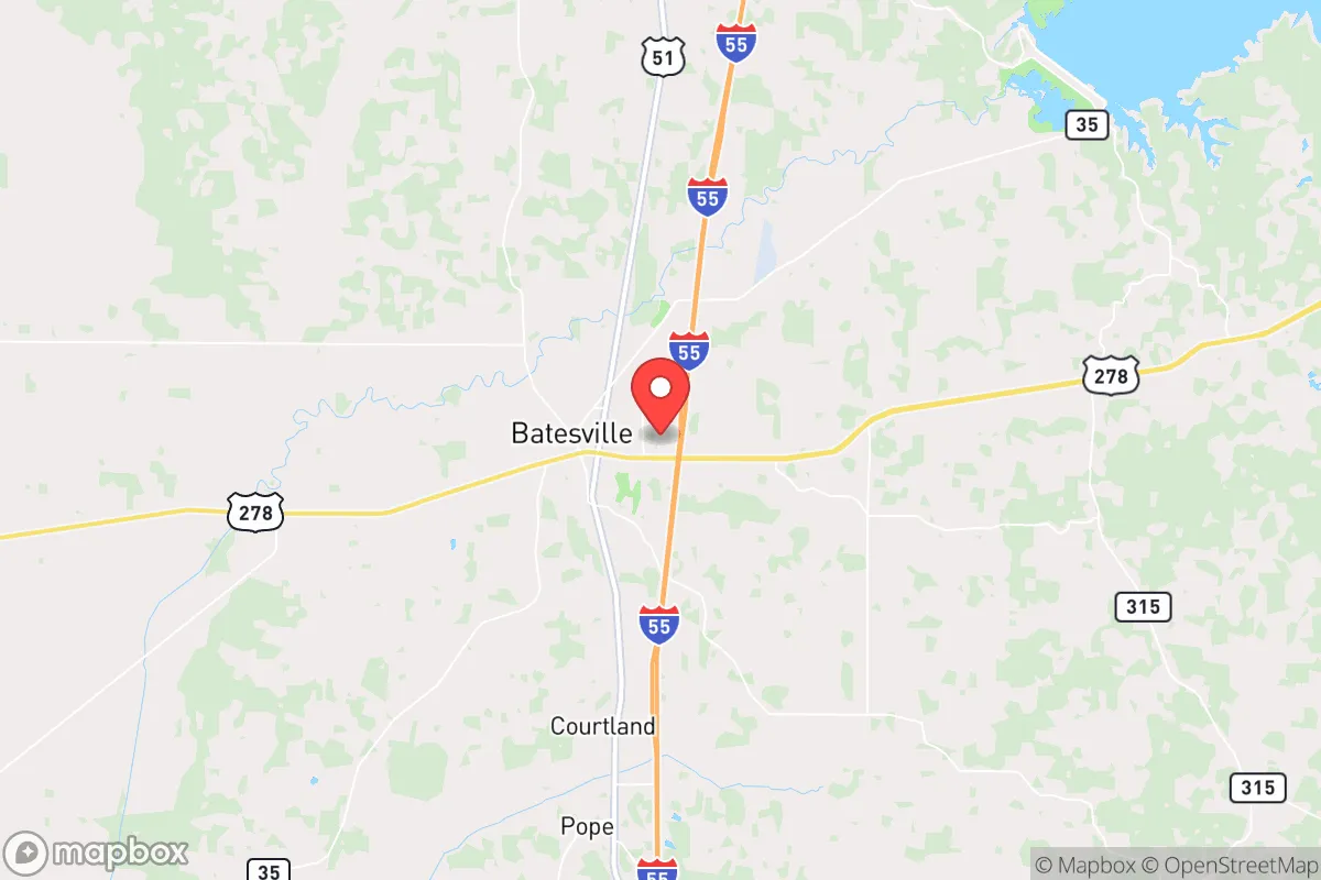
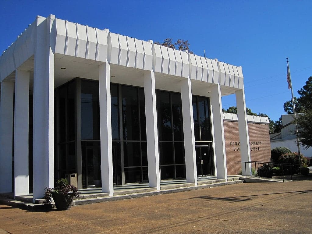
Photo: Wikipedia
Strategic Assessment of Batesville, MS
Workable tactical position. Some exposure to population density or targets, but generally defensible in a crisis.
What does the Strategic Assessment tell us?
Our Strategic Assessment grades tactical survivability of an area. Major population centers, military targets, fallout zones, natural disasters, and border exposure all drive risk — lower exposure means a more defensible position in a crisis.
This is heavily inspired by Joel Skousen's Strategic Relocation book. Highly recommended you checkout the book ($)What does this tell us?
Our Strategic Assessment grades tactical survivability of an area. Major population centers, military targets, fallout zones, natural disasters, and border exposure all drive risk — lower exposure means a more defensible position in a crisis.
This is heavily inspired by Joel Skousen's Strategic Relocation book. Highly recommended you checkout the book ($)Strategic Pillars

Key Distances
Regional Safe Places
Below is our recommended "safe zones" in Mississippi and the surrounding area based on our strategic heuristics. For most people, it's unrealistic to live in a “safe zone” full-time due to work, family or other personal reasons. They tend to be more rural. However, many of these areas are perfect for second homes and retreat properties that double as a vacation home or even a short-term rental.
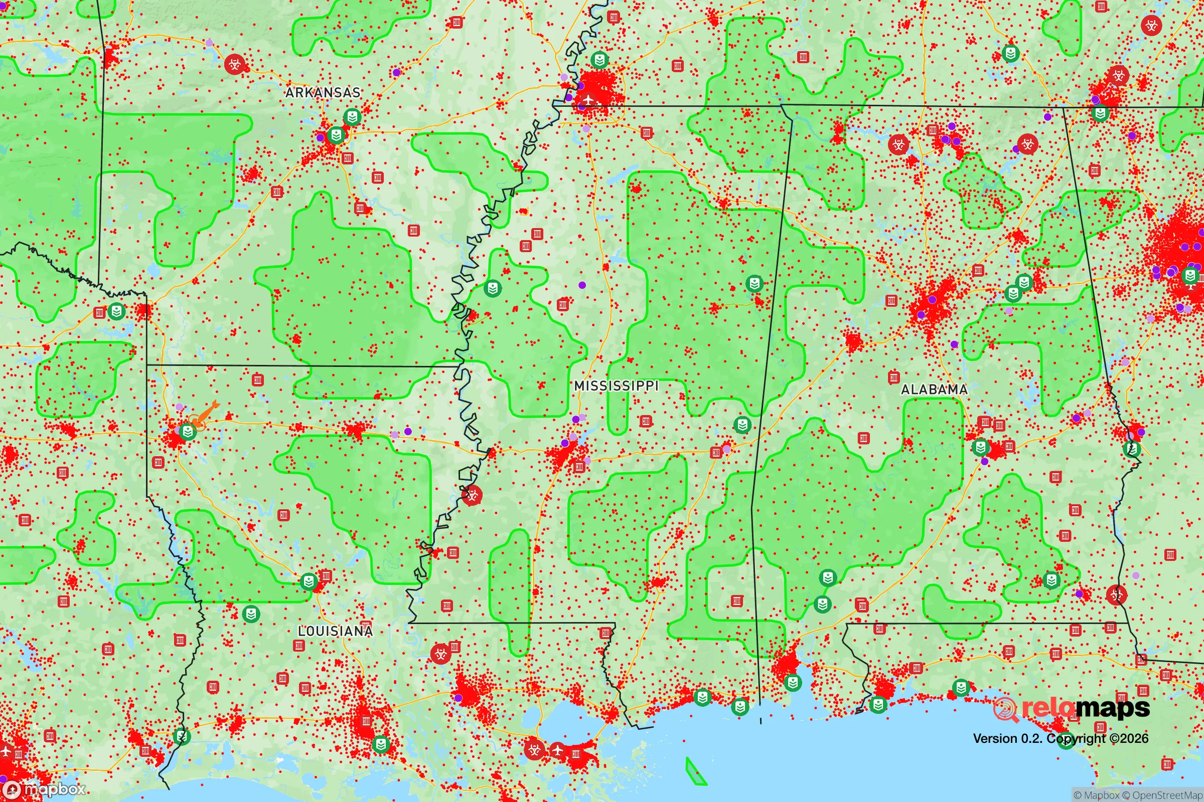
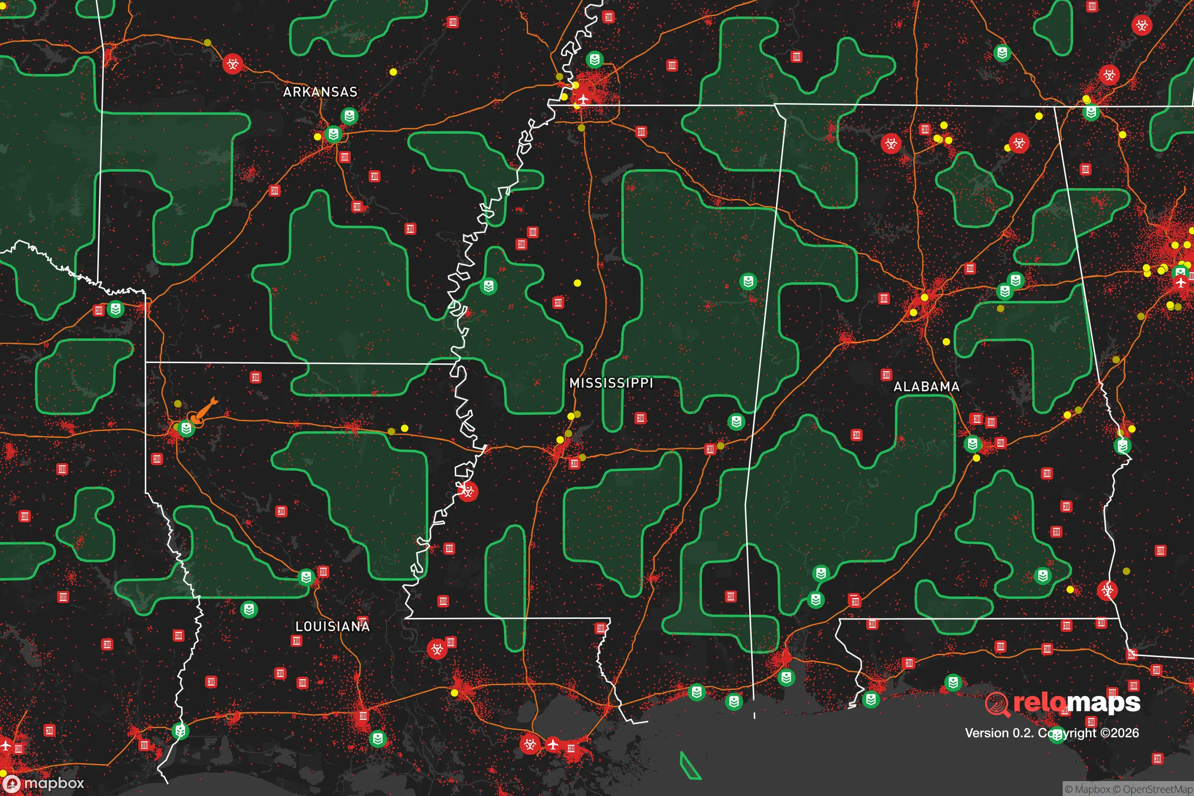


Important Note: For informational purposes only. This does not mean nothing bad ever happens in the green zones. Please use common sense. This is based on public data and modeled with AI. We tried to take a conservative approach but mistakes happen. We update this regularly as new information becomes available.
Solar Generator Recommendations
Backup power matters more here than in safer locations. We've picked three solar generators across budgets and capacity tiers — start with the budget unit if you only need a few essentials, or step up if you want to run a fridge and HVAC for days at a time.

Jackery Portable Power Station Explorer 300
Budget OptionPower on the Go: Weighing only 11 lbs, it's convenient to set up and store with book-sized foldable solar panels

BLUETTI Portable Power Station AC180
Designed for both indoor and outdoor scenarios, AC180 is highly capable as it has a robost capacity and continuous output power.

EF ECOFLOW DELTA Pro Ultra Power Station
Upgraded PickEcoFlow DELTA Pro Ultra is a whole-home energy system designed to grow with your family. Integrated with the Smart Home Panel 2, it scales to meet your evolving energy needs — keeping your home powered, intelligent, and secure through every stage of life.
We earn a commission, at no additional cost to you.
Strategic Assessment Analysis
Batesville, Mississippi, offers a compelling mix of geographic isolation and practical access that makes it a serious contender for a relocator prioritizing resilience and self-sufficiency. Situated in Panola County, roughly 50 miles south of Memphis and 90 miles north of Jackson, the town sits at a strategic crossroads—close enough to major supply chains and medical hubs, yet far enough from the immediate blast zones and urban chaos that would follow a major disruption. The area’s foundation is agricultural and industrial, anchored by a major Toyota assembly plant and a deep-rooted farming economy, giving it a built-in capacity for local food production and a workforce accustomed to hands-on problem-solving. For someone thinking in terms of decades rather than headlines, Batesville represents a balanced bet: not a fortress, but a place where the fundamentals of survival—land, water, and community—are still within reach.
Geographic position and natural advantages for long-term stability
Batesville’s location in the North Mississippi hill country provides a natural buffer against many of the risks that plague coastal or densely populated regions. The area sits on the Loess Bluffs, a band of fertile, wind-deposited soil that rises above the Mississippi Delta floodplain. This means the town itself is largely above the 100-year floodplain, a critical advantage when considering the increasing frequency of extreme weather events. The surrounding landscape is a mix of hardwood forests, rolling pastures, and small creeks feeding into the Tallahatchie River, which provides a reliable surface water source. The climate is humid subtropical, with hot summers and mild winters—no deep freezes that would cripple solar infrastructure, and no hurricane storm surge. The region’s annual rainfall averages around 55 inches, more than enough to support rain catchment and off-grid gardening without the drought risks seen in the West. For a relocator, the key takeaway is that Batesville sits on defensible, productive land with a forgiving climate, far from the seismic and hurricane zones that threaten other parts of the South.
Risks, exposures, and proximity to fallout-relevant landmarks
No location is risk-free, and Batesville has its own set of exposures that a serious prepper must weigh. The most obvious is its proximity to Memphis, a major metropolitan area and transportation hub that includes a FedEx SuperHub, a major medical center (St. Jude), and a significant rail and river port. In a national emergency—whether economic collapse, pandemic, or geopolitical conflict—Memphis would become a chokepoint for refugees and supply chain disruptions. Interstate 55 runs directly through Batesville, making it a natural evacuation corridor from Memphis, which could bring both opportunity and danger. On the man-made risk side, the area is within roughly 100 miles of the Tennessee Valley Authority’s nuclear facilities, including the Browns Ferry Nuclear Plant in Alabama and the Sequoyah plant near Chattanooga. While not in the immediate fallout zone of a worst-case scenario, a major incident could still affect air and water quality. More locally, the Toyota plant and associated industrial parks are potential targets for sabotage or economic disruption, though they are not high-value military targets. The overall risk profile is moderate: no direct nuclear or chemical weapons targets, but a clear vulnerability to cascading failures from a Memphis collapse.
Practical resilience for a relocator: food, water, energy, and defensibility
For someone serious about self-sufficiency, Batesville’s practical assets are where it shines. The agricultural base is real: Panola County is a top producer of soybeans, corn, and cotton, and there is a strong tradition of small-scale livestock farming. Local farmers’ markets and co-ops operate year-round, and the soil is fertile enough for serious home gardening without heavy amendment. Water access is excellent—the Tallahatchie River and numerous creeks provide surface water, and the Mississippi River Valley Alluvial Aquifer lies beneath the region, meaning private wells are viable and generally produce good-quality water at moderate depths (100-300 feet). Energy resilience is more mixed: the local grid is served by Entergy Mississippi, which has a mixed reliability record during storms, but the area’s low tree density and flat terrain make solar panel installation straightforward. Off-grid solar is practical here, with enough sun even in winter to maintain basic loads. Defensibility is a double-edged sword. The open farmland and I-55 corridor make the area hard to completely seal off, but the surrounding hill country offers numerous small valleys and dead-end roads where a determined group could establish a secure homestead. The local culture is gun-friendly and self-reliant, with a strong hunting tradition—meaning neighbors are likely to be armed and capable, which can be either a stabilizing or a complicating factor depending on the situation. The biggest practical gap is medical infrastructure: the local hospital, Panola Medical Center, is a small critical-access facility, and serious trauma care requires a 50-mile drive to Memphis. For a relocator, the prescription is clear: stockpile medical supplies, establish a well and solar backup, and build relationships with local farmers before a crisis hits.
The overall strategic picture for Batesville is that of a solid, middle-ground relocation choice for the resilience-minded. It lacks the extreme isolation of the Mountain West or the deep bunker culture of the Ozarks, but it offers something arguably more valuable: a functioning, productive community with a real economy and a climate that supports year-round self-sufficiency. The risks are manageable with planning—the Memphis proximity is the biggest variable, but it also provides access to specialized goods and services that a truly remote location would lack. For a family or individual willing to invest in a well, solar panels, and a good garden, Batesville provides a foundation that is both practical and affordable, with land prices well below the national median. It is not a bug-out location for the paranoid; it is a live-your-life location for the prepared. In a world of increasing uncertainty, that balance is worth a serious look.

* Values derived from national, state, county, city and local statistics and may differ in a specific area. Last updated: 2026-08-16T13:19:05.000Z
Narrative content on this page is AI-generated and may contain mistakes. Verify any details that matter before acting on them.
ReloMaps may earn a commission from affiliate links at no extra cost to you.

