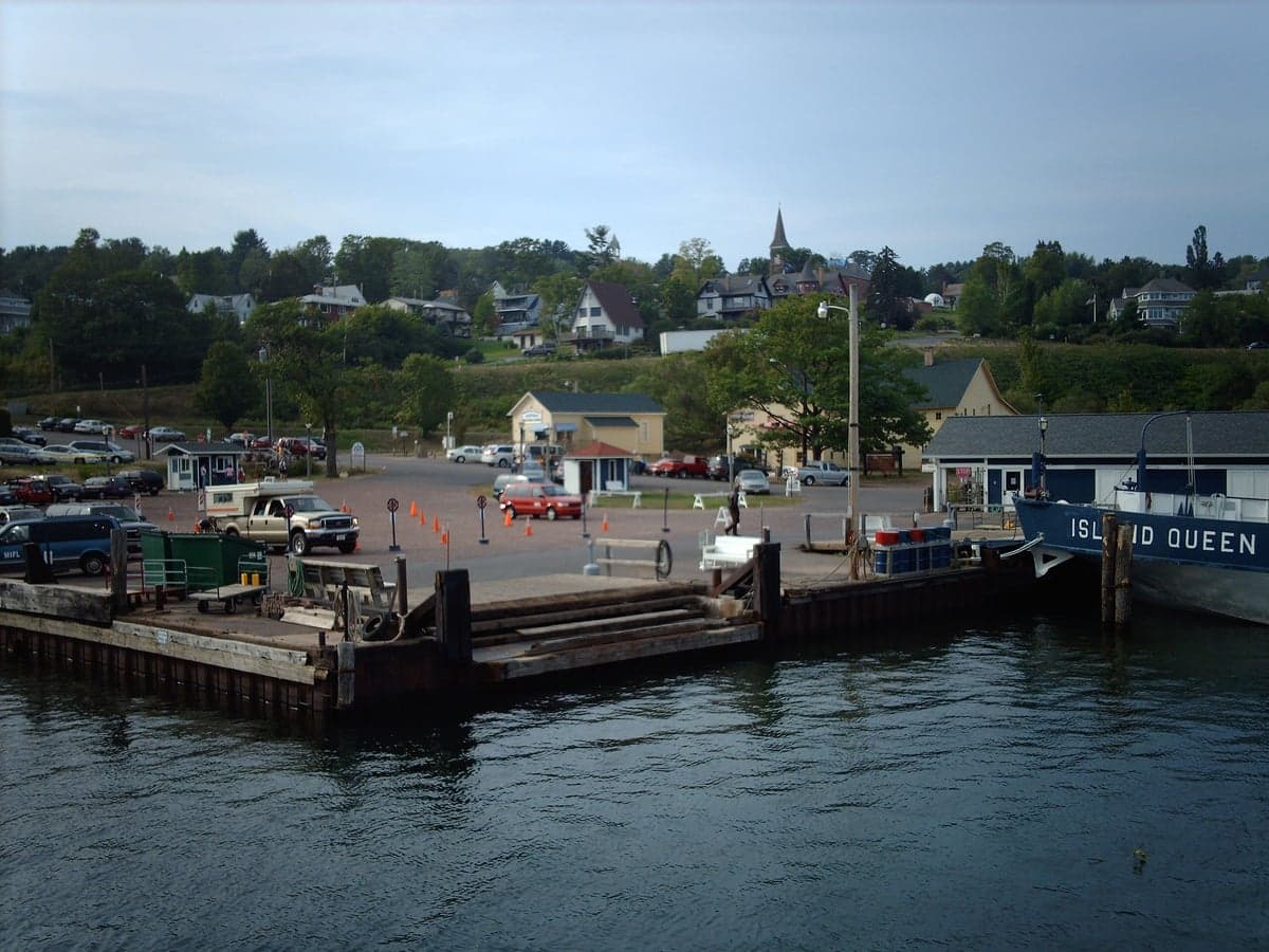
Photo: Wikipedia
Strategic Assessment of Bayfield, WI
Workable tactical position. Some exposure to population density or targets, but generally defensible in a crisis.
What does the Strategic Assessment tell us?
Our Strategic Assessment grades tactical survivability of an area. Major population centers, military targets, fallout zones, natural disasters, and border exposure all drive risk — lower exposure means a more defensible position in a crisis.
This is heavily inspired by Joel Skousen's Strategic Relocation book. Highly recommended you checkout the book ($)What does this tell us?
Our Strategic Assessment grades tactical survivability of an area. Major population centers, military targets, fallout zones, natural disasters, and border exposure all drive risk — lower exposure means a more defensible position in a crisis.
This is heavily inspired by Joel Skousen's Strategic Relocation book. Highly recommended you checkout the book ($)Strategic Pillars

Key Distances
Regional Safe Places
Below is our recommended "safe zones" in Wisconsin and the surrounding area based on our strategic heuristics. For most people, it's unrealistic to live in a “safe zone” full-time due to work, family or other personal reasons. They tend to be more rural. However, many of these areas are perfect for second homes and retreat properties that double as a vacation home or even a short-term rental.
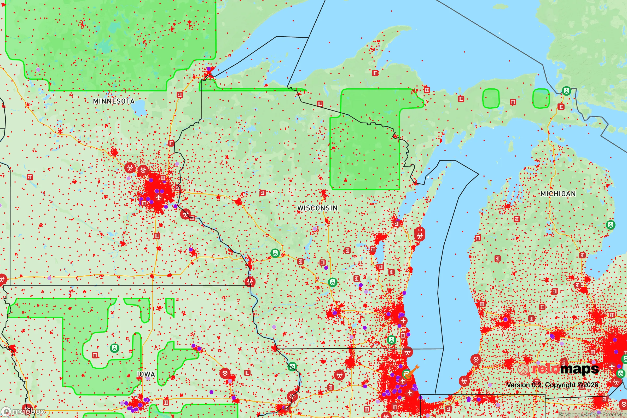
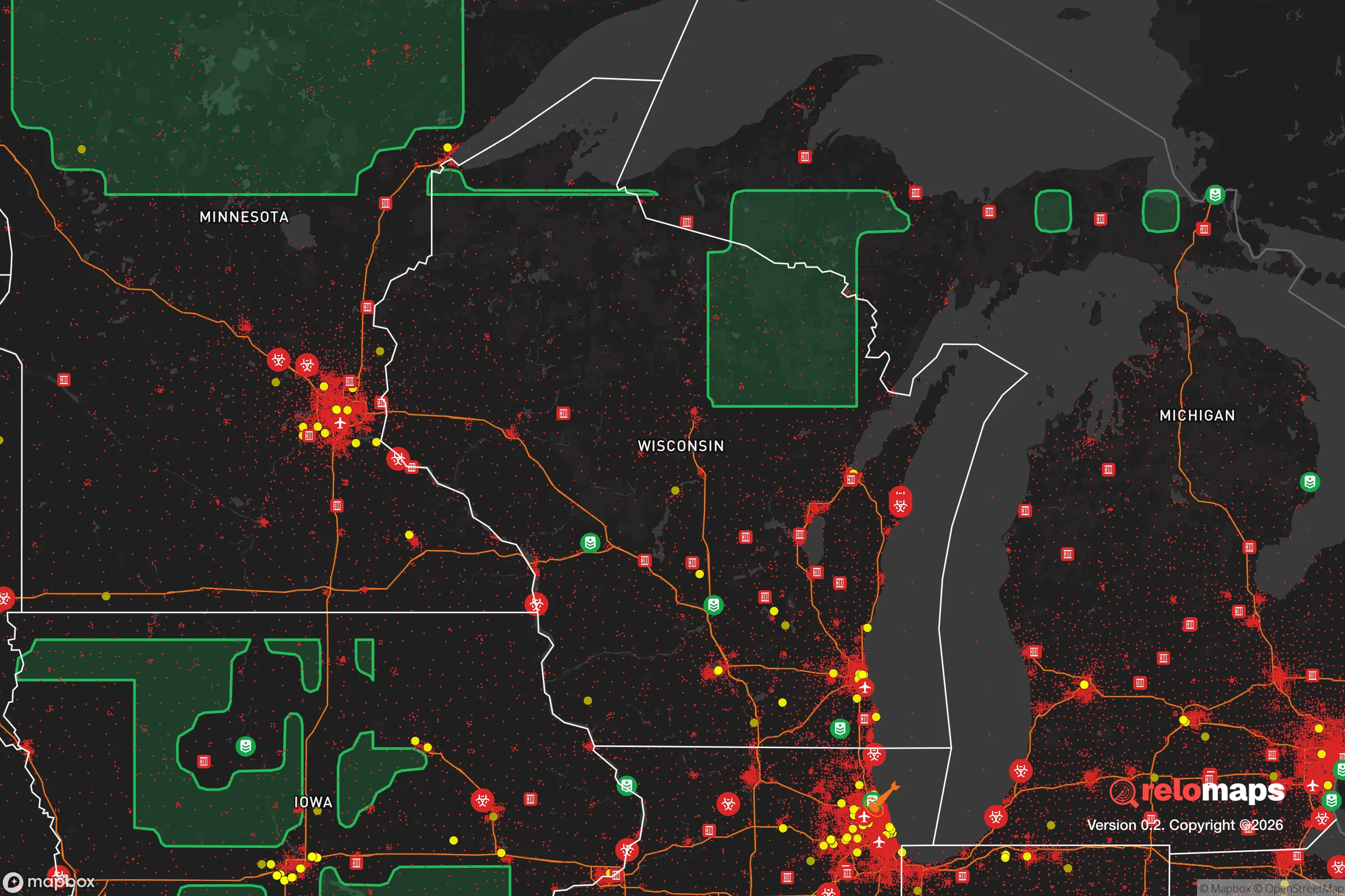


Important Note: For informational purposes only. This does not mean nothing bad ever happens in the green zones. Please use common sense. This is based on public data and modeled with AI. We tried to take a conservative approach but mistakes happen. We update this regularly as new information becomes available.
Solar Generator Recommendations
Backup power matters more here than in safer locations. We've picked three solar generators across budgets and capacity tiers — start with the budget unit if you only need a few essentials, or step up if you want to run a fridge and HVAC for days at a time.

Jackery Portable Power Station Explorer 300
Budget OptionPower on the Go: Weighing only 11 lbs, it's convenient to set up and store with book-sized foldable solar panels

BLUETTI Portable Power Station AC180
Designed for both indoor and outdoor scenarios, AC180 is highly capable as it has a robost capacity and continuous output power.

EF ECOFLOW DELTA Pro Ultra Power Station
Upgraded PickEcoFlow DELTA Pro Ultra is a whole-home energy system designed to grow with your family. Integrated with the Smart Home Panel 2, it scales to meet your evolving energy needs — keeping your home powered, intelligent, and secure through every stage of life.
We earn a commission, at no additional cost to you.
Strategic Assessment Analysis
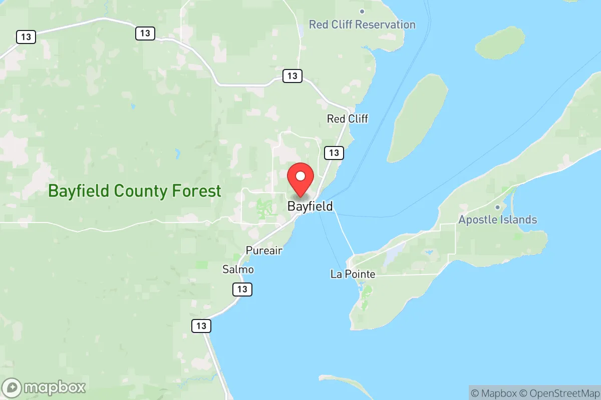
Bayfield, Wisconsin, occupies a distinctive strategic position on the southern shore of Lake Superior, offering a blend of natural isolation and practical access that makes it a serious contender for relocation-minded individuals prioritizing resilience and self-sufficiency. Its location on the Apostle Islands archipelago, roughly 90 miles east of Duluth, Minnesota, and 20 miles west of the Red Cliff Indian Reservation, places it far from major metropolitan centers while still within a manageable distance of regional infrastructure. The area’s low population density—around 500 year-round residents in the town proper, with Bayfield County at roughly 15,000—combined with its lake-moderated climate and abundant freshwater resources, creates a foundation for long-term stability that few inland communities can match.
Geographic position and natural advantages for long-term stability
Bayfield’s primary resilience asset is its location on Lake Superior, the largest freshwater lake by surface area in the world. This provides an essentially inexhaustible supply of potable water, a critical advantage in any prolonged disruption scenario. The lake also moderates temperatures, keeping summers cooler and winters slightly milder than inland Wisconsin, which reduces heating demands and extends growing seasons for cold-hardy crops. The surrounding Bayfield Peninsula is characterized by rolling hills, mixed hardwood-conifer forests, and clay-loam soils that, while not prime agricultural land, support orchards, berries, and root vegetables—evidenced by the region’s established apple and berry farms. The Apostle Islands National Lakeshore, a federally protected area covering 21 islands and 12 miles of mainland shoreline, acts as a natural buffer against development pressure and preserves wildlife corridors. The area’s distance from major population centers—Duluth is the nearest city of any size at 90 miles, and Minneapolis-St. Paul is roughly 230 miles southwest—means that in a crisis, Bayfield is unlikely to be a primary destination for urban evacuees, reducing competition for local resources. The Chequamegon-Nicolet National Forest, which abuts the peninsula to the south, provides additional timber, game, and foraging opportunities, though access is regulated.
Risks, exposures, and proximity to fallout-relevant landmarks
Bayfield’s relative isolation is a double-edged sword. The area is exposed to several natural and man-made risks that a relocator must weigh carefully. Lake Superior’s notorious lake-effect snow can dump 100–150 inches annually, creating significant transportation challenges; Highway 13, the primary arterial, is frequently closed during winter storms, and power outages from ice-laden trees are common. The region sits in a low-seismicity zone, so earthquakes are not a concern, but the area is prone to occasional derechos and straight-line wind events that can fell trees and damage structures. Wildfire risk is low due to the moist climate, though drought years (e.g., 2021) have elevated it temporarily. Flooding is limited to low-lying shoreline areas and creek drainages; most residential lots are on elevated terrain. From a man-made risk perspective, Bayfield’s distance from strategic targets is a net positive. The nearest nuclear power plant is the Monticello plant near Minneapolis, roughly 200 miles southwest, well outside the primary fallout zone for a plausible accident or attack. The Duluth-Superior port and the Twin Cities metro area are the nearest plausible targets for a conventional or nuclear strike, but prevailing westerly winds would carry fallout eastward, away from Bayfield. The area’s proximity to the Red Cliff Band of Lake Superior Chippewa reservation introduces no unique risks, though jurisdictional complexity could arise in a crisis. The primary man-made risk is a prolonged power outage from grid failure, given that the local distribution lines are rural and vulnerable to ice and wind damage.
Practical resilience for a relocator: food, water, energy, and defensibility
For a relocator serious about self-sufficiency, Bayfield offers a mixed but generally favorable picture. Water is the area’s strongest suit: Lake Superior provides an unlimited, high-quality source, though shoreline access is limited by private property and the Apostle Islands National Lakeshore. A well is the most reliable option for inland properties, with typical depths of 100–300 feet in the sandstone aquifer; water quality is generally good but may require filtration for iron and hardness. Rainwater collection is viable, with annual precipitation averaging 30 inches, but winter freezing limits above-ground systems. Food production is feasible but requires effort. The growing season is short—roughly 100–120 frost-free days—but cool-season crops like potatoes, kale, carrots, and apples thrive. Soil is acidic and rocky in many areas, requiring raised beds or heavy amendment. Lake Superior provides a reliable protein source: lake trout, whitefish, and salmon are abundant, and fishing is regulated but accessible to residents. Deer hunting is popular, with Bayfield County offering a moderate deer population; small game and waterfowl are also available. Foraging for wild berries, mushrooms, and maple syrup is common but requires knowledge of public land boundaries. Energy resilience is a challenge. The local grid is served by Dairyland Power Cooperative, which relies on coal, natural gas, and purchased hydroelectricity; outages are frequent in winter. Solar is viable but limited by heavy snow cover from November through March; a south-facing array with a steep tilt and ground-mount design can mitigate this. Wood heat is the most practical backup—the area is heavily forested, and a permit for firewood collection on national forest land costs $20 per cord. Propane is widely available for cooking and backup heating. Defensibility is moderate: the peninsula’s geography—bounded by Lake Superior to the north and east, with limited road access via Highway 13—creates natural chokepoints. However, the terrain is not easily fortified, and the small population means that a determined group could be isolated. The local law enforcement presence is minimal (Bayfield County Sheriff’s Office has roughly 20 deputies for the entire county), so community self-reliance is essential.
The overall strategic picture for Bayfield is one of a high-resilience, low-profile location that rewards preparation but punishes complacency. Its greatest strengths—unlimited freshwater, low population density, distance from major targets, and abundant natural resources—are balanced by real challenges: a harsh winter climate, limited growing season, vulnerable grid infrastructure, and modest defensibility. For a relocator willing to invest in wood heat, a well, cold-hardy food production, and a robust emergency supply chain, Bayfield offers a sustainable long-term base. It is not a bug-out location for a weekend; it is a place to build a life that is already partially decoupled from fragile urban systems. The key trade-off is between isolation and access: you are far from the chaos of cities, but also far from the hospitals, supply chains, and labor markets that make modern life convenient. For those who value self-sufficiency over convenience, Bayfield represents a solid, defensible choice in the upper Midwest’s resilience landscape.

* Values derived from national, state, county, city and local statistics and may differ in a specific area. Last updated: 2026-10-20T08:04:13.000Z
Narrative content on this page is AI-generated and may contain mistakes. Verify any details that matter before acting on them.
ReloMaps may earn a commission from affiliate links at no extra cost to you.

