Photo: Wikipedia
Strategic Assessment of Bethel Park, PA
Multiple tactical vulnerabilities. Population density, target proximity, or disaster risk are likely compounding. A retreat property and exit planning is required.
What does the Strategic Assessment tell us?
Our Strategic Assessment grades tactical survivability of an area. Major population centers, military targets, fallout zones, natural disasters, and border exposure all drive risk — lower exposure means a more defensible position in a crisis.
This is heavily inspired by Joel Skousen's Strategic Relocation book. Highly recommended you checkout the book ($)What does this tell us?
Our Strategic Assessment grades tactical survivability of an area. Major population centers, military targets, fallout zones, natural disasters, and border exposure all drive risk — lower exposure means a more defensible position in a crisis.
This is heavily inspired by Joel Skousen's Strategic Relocation book. Highly recommended you checkout the book ($)Strategic Pillars

Key Distances
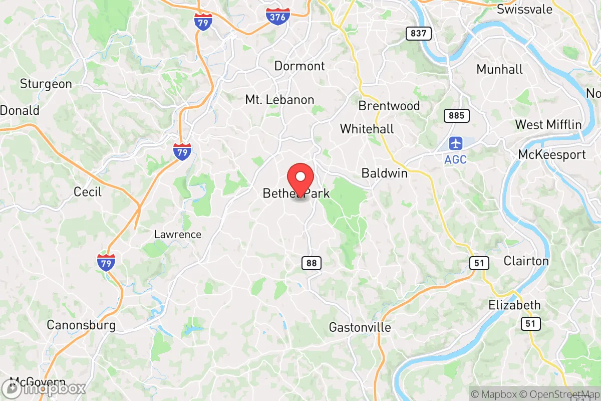
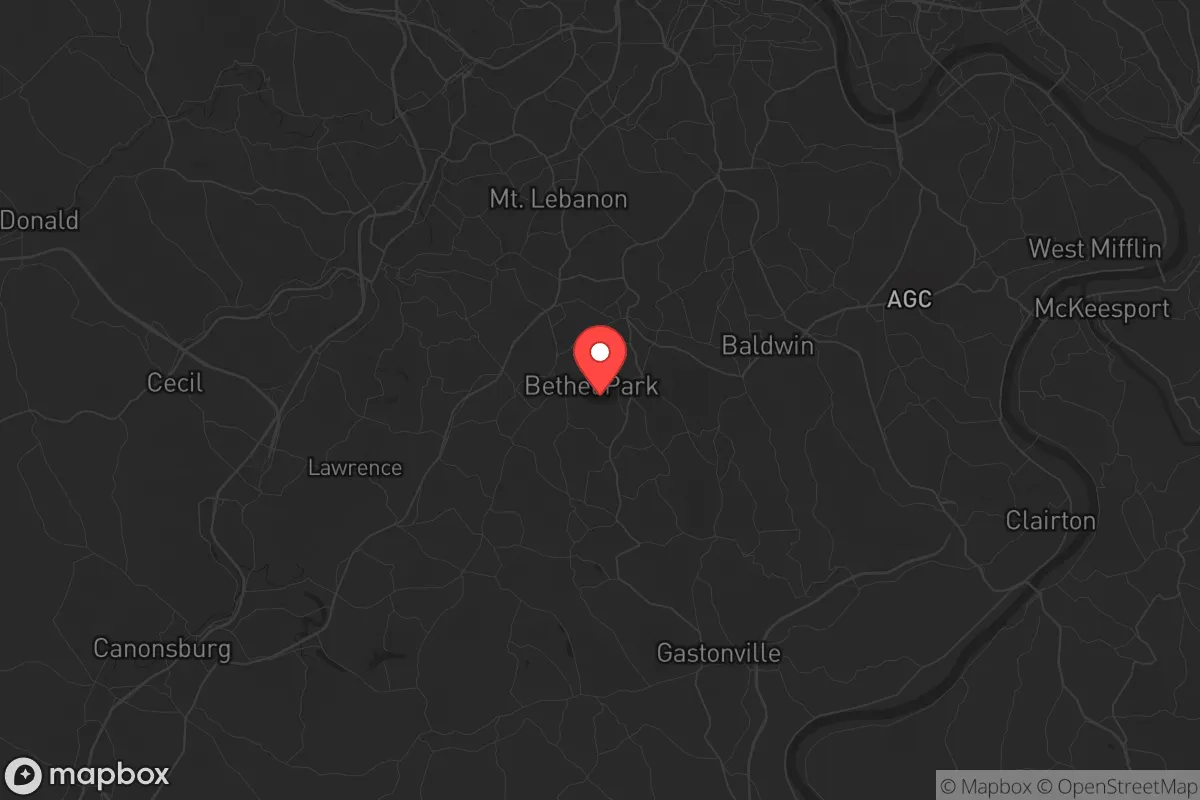
Regional Safe Places
Below is our recommended "safe zones" in Pennsylvania and the surrounding area based on our strategic heuristics. For most people, it's unrealistic to live in a “safe zone” full-time due to work, family or other personal reasons. They tend to be more rural. However, many of these areas are perfect for second homes and retreat properties that double as a vacation home or even a short-term rental.


Important Note: For informational purposes only. This does not mean nothing bad ever happens in the green zones. Please use common sense. This is based on public data and modeled with AI. We tried to take a conservative approach but mistakes happen. We update this regularly as new information becomes available.
Solar Generator Recommendations
Backup power matters more here than in safer locations. We've picked three solar generators across budgets and capacity tiers — start with the budget unit if you only need a few essentials, or step up if you want to run a fridge and HVAC for days at a time.

Jackery Portable Power Station Explorer 300
Budget OptionPower on the Go: Weighing only 11 lbs, it's convenient to set up and store with book-sized foldable solar panels

BLUETTI Portable Power Station AC180
Designed for both indoor and outdoor scenarios, AC180 is highly capable as it has a robost capacity and continuous output power.

EF ECOFLOW DELTA Pro Ultra Power Station
Upgraded PickEcoFlow DELTA Pro Ultra is a whole-home energy system designed to grow with your family. Integrated with the Smart Home Panel 2, it scales to meet your evolving energy needs — keeping your home powered, intelligent, and secure through every stage of life.
We earn a commission, at no additional cost to you.
Strategic Assessment Analysis
Bethel Park, Pennsylvania, offers a surprisingly resilient position for those prioritizing strategic relocation, balancing proximity to critical infrastructure with a degree of natural separation from the most acute risks of major urban centers. Located about 10 miles south of downtown Pittsburgh, this suburban community of roughly 33,000 sits atop the Allegheny Plateau, providing a natural elevation advantage over the river valleys below. For the prepper or survivalist, this means a location that is close enough to access resources and employment but far enough to avoid the immediate blast zones, civil unrest epicenters, and fallout corridors that would plague the city core during a major event.
Geographic position and natural defensive advantages
Bethel Park’s position on the plateau is its first and most significant strategic asset. The community sits at an elevation of roughly 1,200 feet, which places it above the fog, flood zones, and industrial pollution that plague the lower-lying areas of the Pittsburgh metro. This elevation also provides a natural defensive buffer: any ground-based threat approaching from the city would have to navigate the steep hills and narrow roads of the South Hills region, creating natural chokepoints. The area is heavily wooded with mature deciduous forest, offering ample cover and concealment for those who know how to use it. The local topography includes numerous small creeks and ravines, which can serve as water sources and natural barriers. For a relocator, this means the land itself works in your favor—it’s not flat, open farmland that leaves you exposed, but rather a series of ridges and hollows that can be defended or used for retreat.
Risks, exposures, and proximity to fallout-relevant landmarks
The primary risk for Bethel Park is its proximity to Pittsburgh and the associated critical infrastructure that would be a target in a major conflict or terrorist event. The city is home to major industrial facilities, including U.S. Steel’s Edgar Thomson Plant in Braddock, the Pittsburgh International Airport (a potential military logistics hub), and the region’s extensive natural gas and pipeline network. A nuclear detonation or conventional strike on downtown Pittsburgh would place Bethel Park within the moderate fallout zone, depending on wind direction. The community is also within 20 miles of the Beaver Valley Nuclear Power Station (Shippingport), a potential target for sabotage or accident. Additionally, the area’s reliance on the Parkway West and I-79 corridors for evacuation means that any major event would quickly gridlock these routes. For the prepper, the key takeaway is that Bethel Park is not a remote bunker location—it’s a suburban buffer zone. You are close enough to be affected by urban collapse but far enough to have a fighting chance if you have a plan and supplies.
Practical resilience for a relocator: food, water, energy, and defensibility
For a relocator looking to establish a sustainable household, Bethel Park offers a mixed but workable picture. Water is the most critical concern: the community draws from the Pittsburgh Water and Sewer Authority, which relies on the Allegheny River and a treatment plant vulnerable to contamination or disruption. However, the area’s numerous small streams and creeks (like Piney Fork and Streets Run) provide backup sources if properly filtered. The region’s average annual rainfall of 38 inches means rainwater collection is viable. Food resilience is moderate—there are several community gardens and farmers’ markets, but the area is not agricultural. The closest farmland is in Washington County to the south, about 20 minutes away. For energy, the grid is reliable but aging; natural gas is abundant in the region, and many homes already have gas lines for heating and cooking. Solar is feasible but limited by tree cover and winter cloud cover. Defensibility is where Bethel Park shines: the winding, hilly streets and dense tree cover make it difficult for large groups to move through quickly. Many homes are set back from the road, and the community’s layout—with numerous dead-end streets and cul-de-sacs—creates natural security perimeters. For a single individual or family, a well-chosen property with a basement, a backup water source, and a defensible perimeter can serve as a solid base of operations.
Overall, Bethel Park represents a calculated compromise for the strategic relocator. It is not a remote survivalist retreat, nor is it a high-risk urban core. It offers a defensible terrain, moderate resource availability, and a community that, while suburban, retains a degree of self-reliance and neighborly awareness. The biggest vulnerability is its proximity to Pittsburgh and the associated infrastructure that would draw attention in a crisis. For those willing to invest in water storage, alternative energy, and a solid evacuation plan for the first 72 hours of a major event, Bethel Park provides a viable long-term position. The key is to treat it as a base, not a fortress—a place to ride out the initial shock and then adapt to whatever comes next.
* Values derived from national, state, county, city and local statistics and may differ in a specific area. Last updated: 2026-05-01T16:27:44.000Z
Narrative content on this page is AI-generated and may contain mistakes. Verify any details that matter before acting on them.
ReloMaps may earn a commission from affiliate links at no extra cost to you.