
Photo: Wikipedia
Strategic Assessment of Blair, NE
Meaningful friction. Expect exposure to either population pressure, blast zones, or natural disaster risk. Consider buying a retreat property.
What does the Strategic Assessment tell us?
Our Strategic Assessment grades tactical survivability of an area. Major population centers, military targets, fallout zones, natural disasters, and border exposure all drive risk — lower exposure means a more defensible position in a crisis.
This is heavily inspired by Joel Skousen's Strategic Relocation book. Highly recommended you checkout the book ($)What does this tell us?
Our Strategic Assessment grades tactical survivability of an area. Major population centers, military targets, fallout zones, natural disasters, and border exposure all drive risk — lower exposure means a more defensible position in a crisis.
This is heavily inspired by Joel Skousen's Strategic Relocation book. Highly recommended you checkout the book ($)Strategic Pillars

Key Distances
Regional Safe Places
Below is our recommended "safe zones" in Nebraska and the surrounding area based on our strategic heuristics. For most people, it's unrealistic to live in a “safe zone” full-time due to work, family or other personal reasons. They tend to be more rural. However, many of these areas are perfect for second homes and retreat properties that double as a vacation home or even a short-term rental.
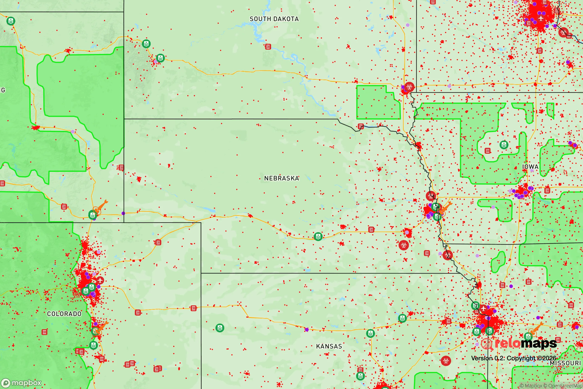
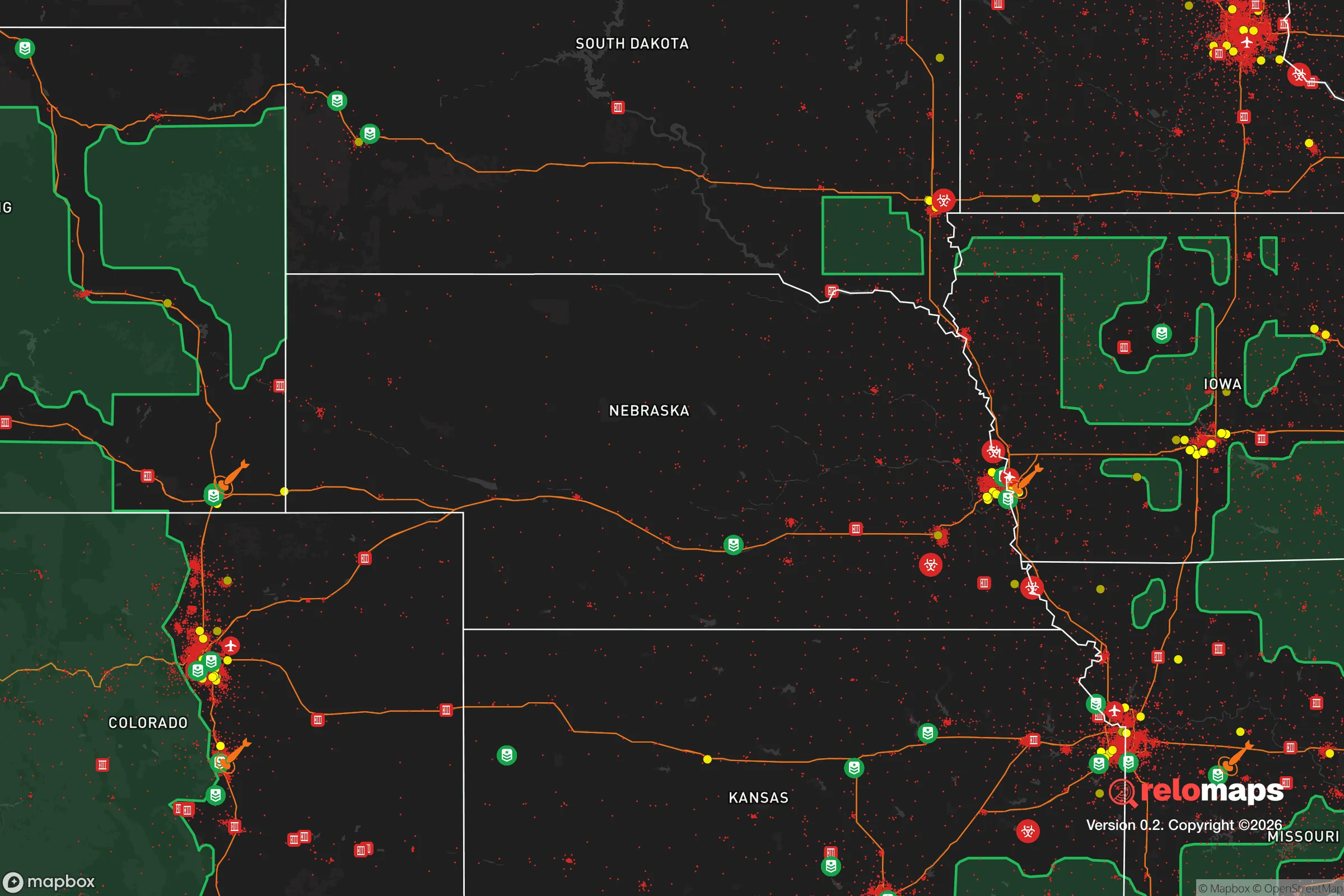
Important Note: For informational purposes only. This does not mean nothing bad ever happens in the green zones. Please use common sense. This is based on public data and modeled with AI. We tried to take a conservative approach but mistakes happen. We update this regularly as new information becomes available.
Solar Generator Recommendations
Backup power matters more here than in safer locations. We've picked three solar generators across budgets and capacity tiers — start with the budget unit if you only need a few essentials, or step up if you want to run a fridge and HVAC for days at a time.

Jackery Portable Power Station Explorer 300
Budget OptionPower on the Go: Weighing only 11 lbs, it's convenient to set up and store with book-sized foldable solar panels

BLUETTI Portable Power Station AC180
Designed for both indoor and outdoor scenarios, AC180 is highly capable as it has a robost capacity and continuous output power.

EF ECOFLOW DELTA Pro Ultra Power Station
Upgraded PickEcoFlow DELTA Pro Ultra is a whole-home energy system designed to grow with your family. Integrated with the Smart Home Panel 2, it scales to meet your evolving energy needs — keeping your home powered, intelligent, and secure through every stage of life.
We earn a commission, at no additional cost to you.
Strategic Assessment Analysis
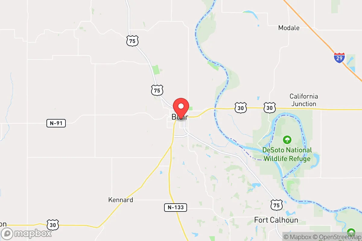
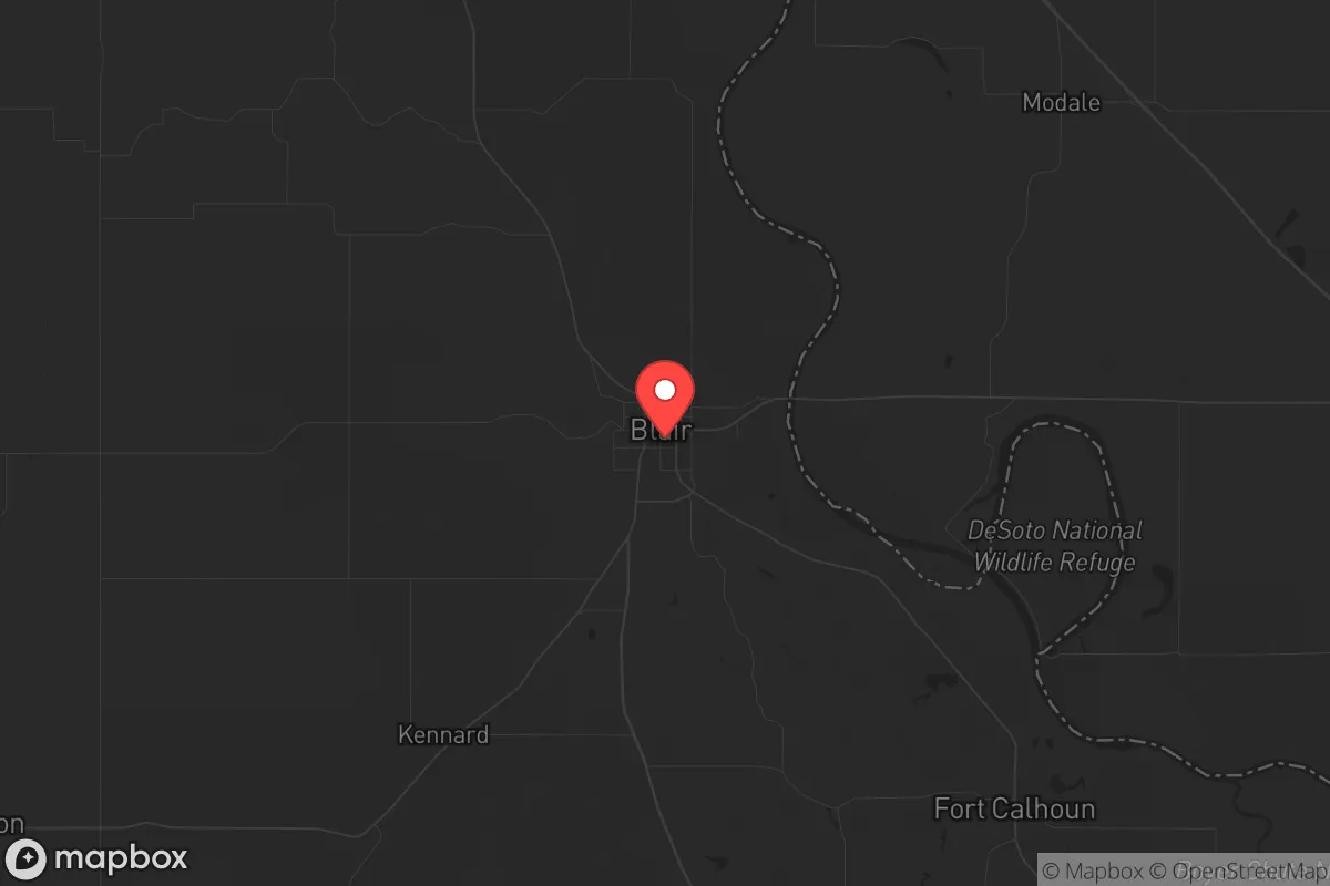
Blair, Nebraska, sits in a strategic sweet spot that few relocators fully appreciate: close enough to Omaha’s job market and medical infrastructure to be practical, yet far enough to avoid the worst of urban collapse scenarios. The town’s position along the Missouri River bluffs provides natural elevation advantages, and its small population of roughly 8,000 means you won’t be competing with thousands of others for the same resources when things go sideways. For a conservative-minded prepper or survivalist, Blair offers a rare combination of accessibility and buffer—provided you understand where the real risks lie.
Geographic position and natural advantages for long-term security
Blair’s location in eastern Nebraska, roughly 25 miles north of Omaha, places it outside the immediate blast radius of any major metropolitan target while still allowing a 30-minute drive to Omaha’s hospitals, supply chains, and airports when times are stable. The town sits on high ground above the Missouri River floodplain, which gives it a natural defensive advantage over low-lying communities like Council Bluffs or Plattsmouth. The surrounding Washington County is predominantly agricultural—corn, soybeans, and cattle operations dominate the landscape—meaning local food production is not a theoretical backup but an ongoing reality. The Loess Hills just across the river in Iowa provide additional terrain that could serve as a fallback position if you need to move east. Blair’s water supply comes from groundwater wells rather than a single vulnerable surface intake, which reduces the risk of contamination or sabotage compared to cities that rely on river water. The area also benefits from relatively low population density: Washington County has about 21,000 residents spread over 420 square miles, giving you room to breathe and a lower chance of encountering desperate crowds during a crisis.
Risks, exposures, and proximity to fallout-relevant landmarks
The biggest strategic liability for Blair is its proximity to Offutt Air Force Base, located just 20 miles south in Bellevue. Offutt is home to U.S. Strategic Command (STRATCOM) and the 55th Wing—a high-value target in any major conflict. A nuclear strike on Offutt would produce fallout that could reach Blair depending on wind direction, though the prevailing westerlies would carry most debris east into Iowa. Still, you’re close enough that a ground burst could cause significant contamination within the first 24 hours. The Omaha metro area itself, with its mutual funds, insurance headquarters, and rail hub, is a secondary concern for civil unrest or supply chain disruptions. Blair’s position along U.S. Highway 30 and near the intersection of Interstates 29 and 680 means it’s a natural chokepoint for traffic fleeing Omaha—expect gridlock and potential roadblocks if an evacuation order comes. The Missouri River, while a resource, also acts as a barrier: only a few bridges cross it in this region, and those bridges could become bottlenecks or targets. Tornado risk is real here—Washington County sits in Tornado Alley’s eastern fringe—so your property needs a storm shelter or reinforced basement. Flooding along the Missouri is a periodic threat, though Blair’s elevation keeps most of the town dry; low-lying areas near the river are the exception.
Practical resilience for a relocator: food, water, energy, and defensibility
For a prepper moving to Blair, the practical resilience picture is mixed but workable. Food security is strong: you’re surrounded by farms, and the town has a small but functional grocery co-op plus a Walmart Supercenter for bulk buying. The local farmers’ market operates seasonally, and direct relationships with nearby cattle and poultry producers are easy to establish if you make the effort. Water security is decent—your own well is possible on larger lots outside city limits, and the municipal supply is groundwater-based with backup generators at the pump stations. Energy reliability is a weak point: Blair’s grid is tied to the Omaha Public Power District, which means a regional blackout will take you down too. Solar panels with battery storage are a wise investment here, as the area gets about 200 sunny days per year—enough for a modest off-grid setup. Natural gas is available in town, but rural properties rely on propane, so plan accordingly. Defensibility depends on your specific property. In-town lots are small and close to neighbors, which is fine for community watch but bad for operational security. The real value is in the rural outskirts—five to ten acres with tree lines, a long driveway, and a clear field of fire. Washington County has no zoning restrictions on firearms or ammunition storage, and Nebraska is a constitutional carry state, so you can keep your defensive tools ready without legal hassle. The local sheriff’s office is responsive but small—about 15 deputies for the whole county—so don’t expect rapid response in a widespread emergency. Medical facilities are limited: there’s a small critical-access hospital in Blair (Memorial Community Hospital) that can handle basic emergencies and stabilization, but anything serious means a 30-minute ambulance ride to Omaha. Stock your own trauma kit and plan for telemedicine if the grid holds.
The overall strategic picture for Blair is one of calculated trade-offs. You get proximity to urban resources without being inside the blast zone, agricultural abundance, and a community that still votes conservative and values self-reliance. But you also inherit the risks of being downwind from a primary nuclear target, dependent on a fragile regional grid, and positioned along evacuation routes that will clog fast. For a single individual or family willing to invest in off-grid power, a well, and a rural property with defensible terrain, Blair offers a solid base camp. It’s not a remote mountain redoubt—you won’t disappear here—but it’s a place where you can build a life that’s prepared for the worst while still functioning in the present. The key is to treat Blair as a launch point, not a final destination: know your fallback routes east into the Loess Hills, keep your supplies rotated, and maintain a low profile. In a world where the cities are the targets and the countryside is the refuge, Blair sits right on the edge of both—and that edge is exactly where you want to be.
* Values derived from national, state, county, city and local statistics and may differ in a specific area. Last updated: 2026-04-19T10:41:32.000Z
Narrative content on this page is AI-generated and may contain mistakes. Verify any details that matter before acting on them.
ReloMaps may earn a commission from affiliate links at no extra cost to you.