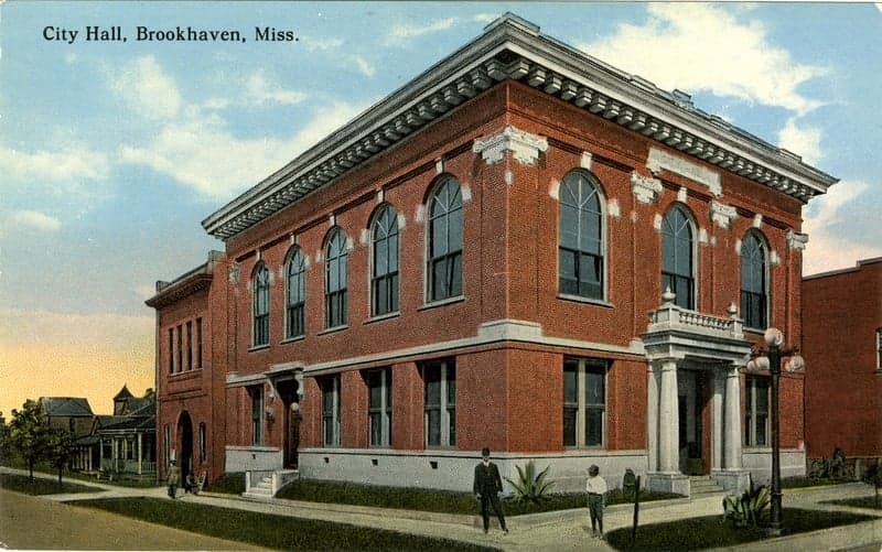
Photo: Wikipedia
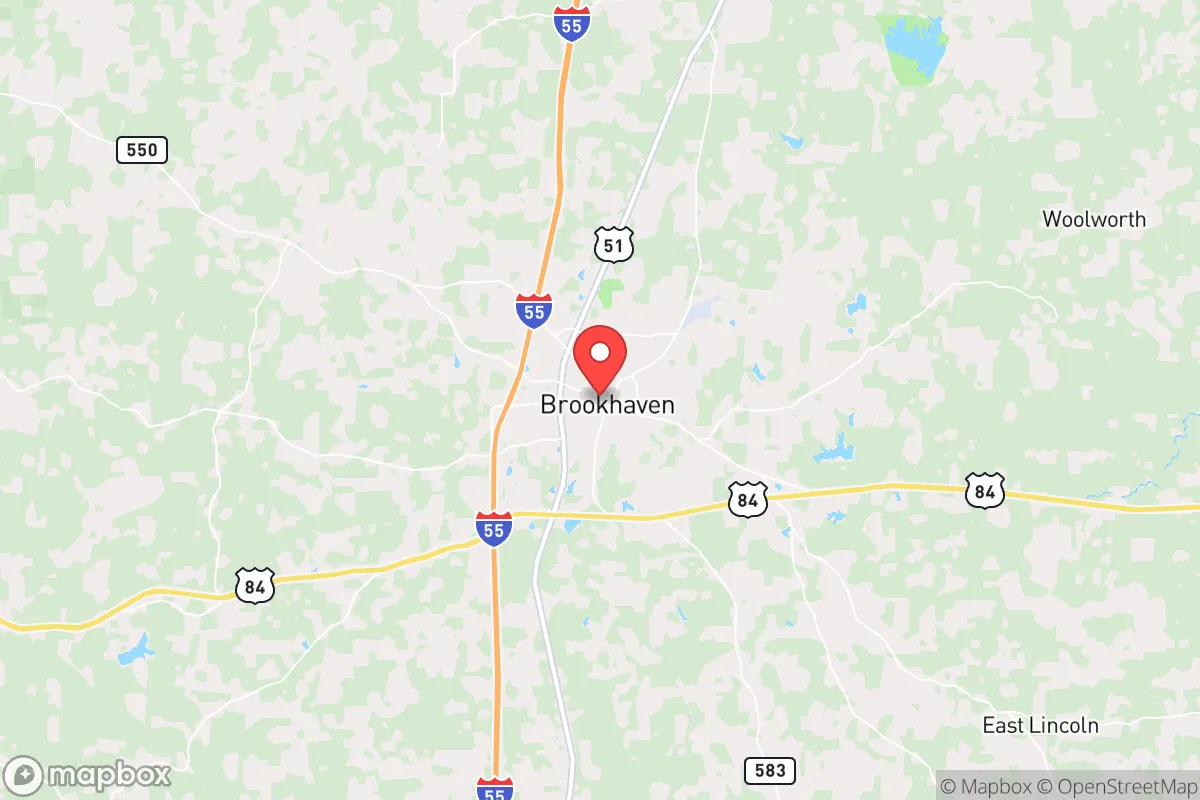
Strategic Assessment of Brookhaven, MS
Workable tactical position. Some exposure to population density or targets, but generally defensible in a crisis.
What does the Strategic Assessment tell us?
Our Strategic Assessment grades tactical survivability of an area. Major population centers, military targets, fallout zones, natural disasters, and border exposure all drive risk — lower exposure means a more defensible position in a crisis.
This is heavily inspired by Joel Skousen's Strategic Relocation book. Highly recommended you checkout the book ($)What does this tell us?
Our Strategic Assessment grades tactical survivability of an area. Major population centers, military targets, fallout zones, natural disasters, and border exposure all drive risk — lower exposure means a more defensible position in a crisis.
This is heavily inspired by Joel Skousen's Strategic Relocation book. Highly recommended you checkout the book ($)Strategic Pillars

Key Distances
Regional Safe Places
Below is our recommended "safe zones" in Mississippi and the surrounding area based on our strategic heuristics. For most people, it's unrealistic to live in a “safe zone” full-time due to work, family or other personal reasons. They tend to be more rural. However, many of these areas are perfect for second homes and retreat properties that double as a vacation home or even a short-term rental.
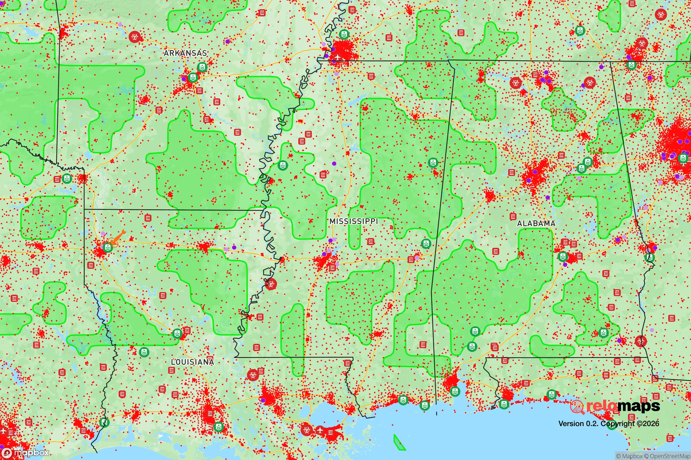
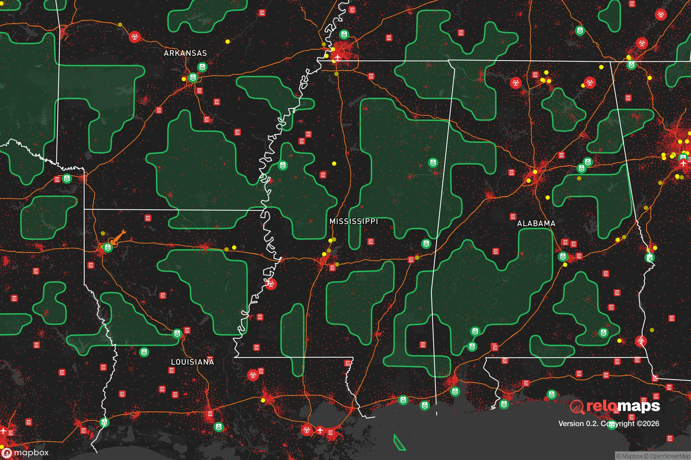
Important Note: For informational purposes only. This does not mean nothing bad ever happens in the green zones. Please use common sense. This is based on public data and modeled with AI. We tried to take a conservative approach but mistakes happen. We update this regularly as new information becomes available.
Solar Generator Recommendations
Backup power matters more here than in safer locations. We've picked three solar generators across budgets and capacity tiers — start with the budget unit if you only need a few essentials, or step up if you want to run a fridge and HVAC for days at a time.

Jackery Portable Power Station Explorer 300
Budget OptionPower on the Go: Weighing only 11 lbs, it's convenient to set up and store with book-sized foldable solar panels

BLUETTI Portable Power Station AC180
Designed for both indoor and outdoor scenarios, AC180 is highly capable as it has a robost capacity and continuous output power.

EF ECOFLOW DELTA Pro Ultra Power Station
Upgraded PickEcoFlow DELTA Pro Ultra is a whole-home energy system designed to grow with your family. Integrated with the Smart Home Panel 2, it scales to meet your evolving energy needs — keeping your home powered, intelligent, and secure through every stage of life.
We earn a commission, at no additional cost to you.
Strategic Assessment Analysis
Brookhaven, Mississippi, sits in a sweet spot that few relocation guides talk about: close enough to supply chains and medical hubs to matter, but far enough from the obvious targets to offer genuine breathing room. For someone thinking in terms of decades, not just next year, this Lincoln County seat presents a resilience profile that rewards a careful look. The town’s location along I-55, roughly halfway between Jackson and New Orleans, gives it a logistical advantage without the density that makes those cities vulnerable to cascading failures. The surrounding landscape—rolling piney woods, working farms, and the Homochitto National Forest to the south—provides a natural buffer that urban evacuees simply don’t have.
Geographic position and natural advantages for long-term stability
Brookhaven’s geography is its strongest card. The town sits on the divide between the Mississippi River basin and the Gulf Coastal Plain, meaning it’s less prone to the flooding that plagues communities closer to the big rivers. The underlying geology is mostly clay and sand over a deep aquifer—the Cockfield Formation—which provides reliable groundwater at depths of 200 to 400 feet. For a relocator thinking about water security, that’s a concrete advantage: private wells are feasible, and the local water table is less susceptible to drought than surface reservoirs. The terrain itself is gently rolling, with enough elevation change to offer defensible positions on rural acreage without the extreme slopes that complicate access. The Homochitto National Forest, about 15 miles south, adds a 190,000-acre resource for foraging, timber, and emergency retreat, though it’s managed by the USFS and subject to federal access rules. The climate is humid subtropical, with hot summers and mild winters—growing season runs from March to November, which supports year-round gardening for anyone serious about food independence. The area’s position also places it outside the direct path of most Gulf hurricanes; the storm surge stops well south, and the worst winds typically weaken before reaching Lincoln County. That’s not a guarantee, but it’s a meaningful risk reduction compared to coastal Mississippi.
Risks, exposures, and proximity to fallout-relevant landmarks
No location is immune, and Brookhaven has specific vulnerabilities that a strategic relocator must weigh. The most obvious is its proximity to I-55, a major north-south evacuation corridor. In a mass-casualty event or civil unrest scenario, that highway could become a chokepoint or a vector for displaced populations. Jackson, 55 miles north, is the state capital and a regional medical hub with the University of Mississippi Medical Center—a likely target for any coordinated disruption. New Orleans, 130 miles south, is a port city with critical infrastructure that could draw secondary effects. The Louisiana Chemical Corridor, stretching from Baton Rouge to New Orleans, is roughly 100 miles southwest; a major industrial accident or sabotage event there could send a toxic plume across the region, depending on wind patterns. Brookhaven itself has no nuclear power plants within 50 miles—the nearest is Grand Gulf in Port Gibson, about 60 miles northwest—but the spent fuel storage there is a long-term concern. The town’s own industrial base is modest: a few manufacturing plants, a poultry processing facility, and a regional hospital. None are high-value targets, but the hospital (King’s Daughters Medical Center) is a Level III trauma center, meaning it can stabilize but not handle major trauma—a limitation in a mass-casualty event. The local police force is small, and the Lincoln County Sheriff’s Office covers a large rural area; response times in an emergency could stretch. For a prepper, the key takeaway is that Brookhaven is not a primary target, but it sits within the fallout zone of regional infrastructure that is.
Practical resilience for a relocator: food, water, energy, and defensibility
For someone serious about self-sufficiency, Brookhaven offers a workable baseline. The local soil is acidic but fertile with amendment; the Mississippi State University Extension Service in Lincoln County provides soil testing and crop advice tailored to the region. Deer, turkey, and small game are abundant in the national forest and on private timberland—hunting licenses are inexpensive for residents, and the season structure allows year-round harvest with proper permits. The local agricultural economy is built around soybeans, corn, and poultry, which means bulk feed and seed are available within a 20-mile radius. Water access is the standout: the Cockfield aquifer is shallow enough for hand-pumped wells in most of the county, and the average well depth is 300 feet. Solar insolation is good—about 4.5 peak sun hours per day—so a modest off-grid solar array can cover basic loads for a family. The local utility, Entergy Mississippi, has a mixed reliability record; outages during thunderstorms are common, but the grid is not under the strain seen in coastal or northern states. Defensibility is situational: the town itself is laid out on a grid with limited choke points, but rural properties along the county roads offer natural standoff. The Homochitto National Forest provides a potential bug-out location, but it’s patrolled by law enforcement and subject to fire restrictions. For a relocator, the practical play is to buy acreage outside the city limits—10 to 20 acres with a well and septic—and treat the town as a resupply point, not a primary residence. The local gun culture is strong, with several gun shops and a shooting range in the county; Mississippi is a constitutional carry state, and the legal environment is favorable for self-defense. The biggest gap is medical: the nearest Level I trauma center is in Jackson, and the local hospital has limited surgical capacity. A prepper should plan for a serious medical kit and telemedicine capability.
The overall strategic picture for Brookhaven is one of moderate resilience with clear trade-offs. It’s not a hardened bunker location, and it’s not remote enough to ignore the risks of regional instability. But for a relocator who wants a balance of access and buffer—who wants to be able to drive to a Home Depot or a grocery store without being trapped in a city during a crisis—it’s a rational choice. The land is affordable, the water is reliable, and the community is small enough that a prepared individual can build local relationships before things go sideways. The conservative lean of the area is reflected in its politics—Lincoln County voted +38 R in 2024—and in the everyday culture of self-reliance. If the country holds together, Brookhaven is a quiet place to live. If it doesn’t, it’s a place where a prepared person has a fighting chance. That’s more than most locations can offer.
* Values derived from national, state, county, city and local statistics and may differ in a specific area. Last updated: 2026-04-21T21:44:24.000Z
Narrative content on this page is AI-generated and may contain mistakes. Verify any details that matter before acting on them.
ReloMaps may earn a commission from affiliate links at no extra cost to you.