
Photo: Wikipedia
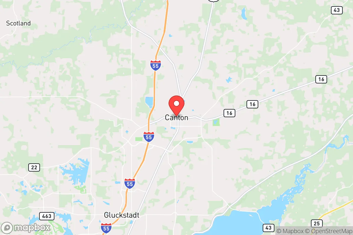
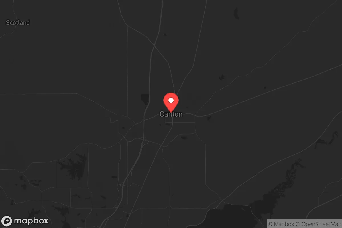
Strategic Assessment of Canton, MS
Workable tactical position. Some exposure to population density or targets, but generally defensible in a crisis.
What does the Strategic Assessment tell us?
Our Strategic Assessment grades tactical survivability of an area. Major population centers, military targets, fallout zones, natural disasters, and border exposure all drive risk — lower exposure means a more defensible position in a crisis.
This is heavily inspired by Joel Skousen's Strategic Relocation book. Highly recommended you checkout the book ($)What does this tell us?
Our Strategic Assessment grades tactical survivability of an area. Major population centers, military targets, fallout zones, natural disasters, and border exposure all drive risk — lower exposure means a more defensible position in a crisis.
This is heavily inspired by Joel Skousen's Strategic Relocation book. Highly recommended you checkout the book ($)Strategic Pillars

Key Distances
Regional Safe Places
Below is our recommended "safe zones" in Mississippi and the surrounding area based on our strategic heuristics. For most people, it's unrealistic to live in a “safe zone” full-time due to work, family or other personal reasons. They tend to be more rural. However, many of these areas are perfect for second homes and retreat properties that double as a vacation home or even a short-term rental.
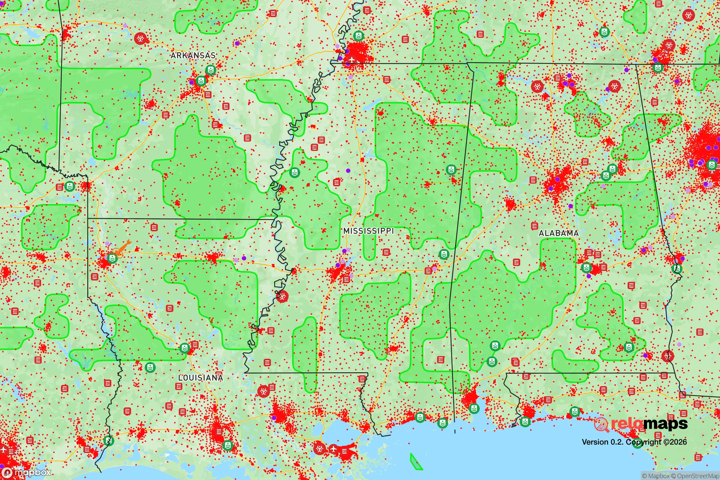
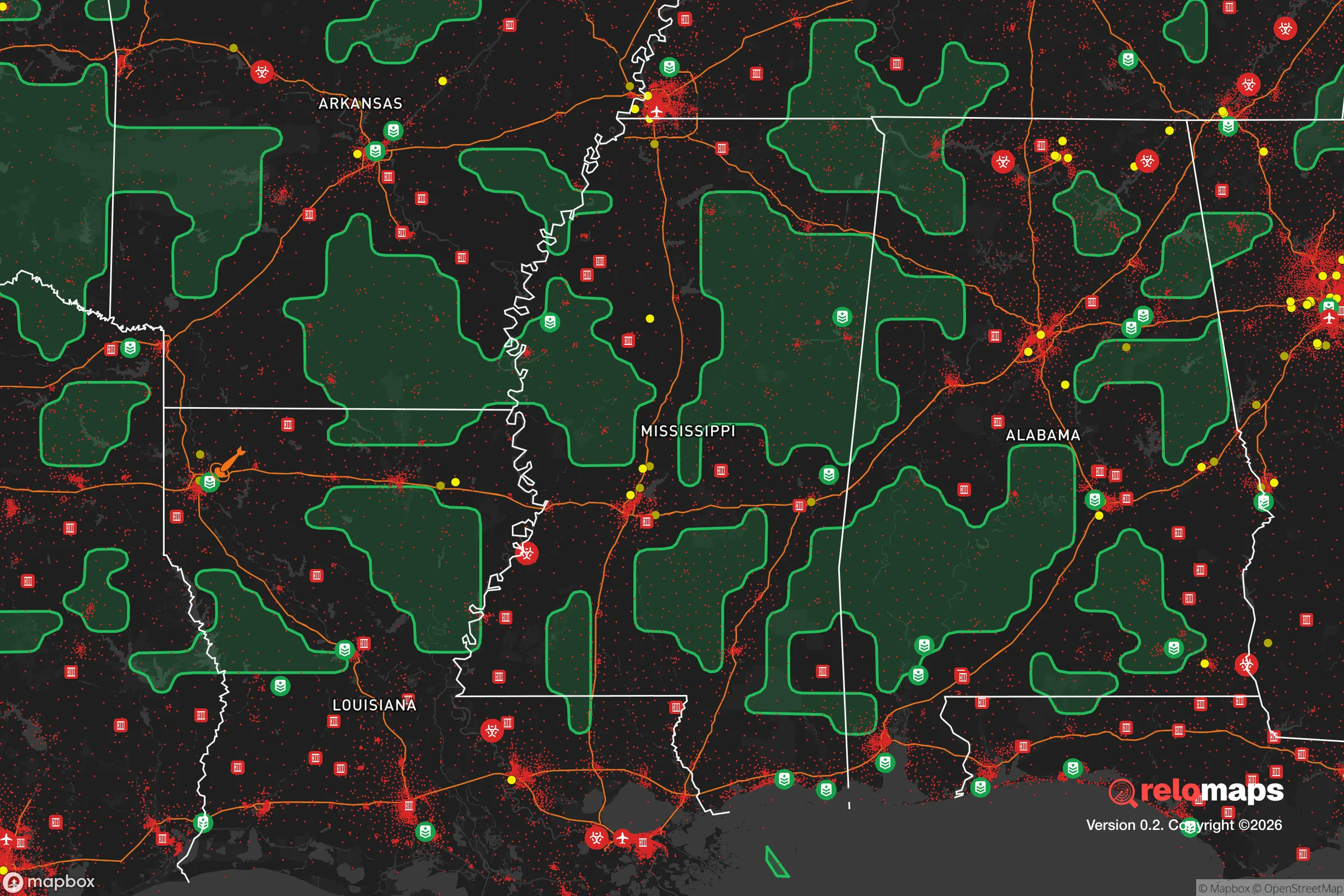
Important Note: For informational purposes only. This does not mean nothing bad ever happens in the green zones. Please use common sense. This is based on public data and modeled with AI. We tried to take a conservative approach but mistakes happen. We update this regularly as new information becomes available.
Solar Generator Recommendations
Backup power matters more here than in safer locations. We've picked three solar generators across budgets and capacity tiers — start with the budget unit if you only need a few essentials, or step up if you want to run a fridge and HVAC for days at a time.

Jackery Portable Power Station Explorer 300
Budget OptionPower on the Go: Weighing only 11 lbs, it's convenient to set up and store with book-sized foldable solar panels

BLUETTI Portable Power Station AC180
Designed for both indoor and outdoor scenarios, AC180 is highly capable as it has a robost capacity and continuous output power.

EF ECOFLOW DELTA Pro Ultra Power Station
Upgraded PickEcoFlow DELTA Pro Ultra is a whole-home energy system designed to grow with your family. Integrated with the Smart Home Panel 2, it scales to meet your evolving energy needs — keeping your home powered, intelligent, and secure through every stage of life.
We earn a commission, at no additional cost to you.
Strategic Assessment Analysis
Canton, Mississippi, sits in a position that demands a hard, clear-eyed look from anyone serious about long-term strategic relocation. Located roughly 15 miles north of Jackson along Interstate 55, this seat of Madison County offers a mix of genuine geographic advantages and proximity-based risks that a prepper or survivalist cannot afford to gloss over. The area’s resilience hinges on its ability to buffer against the worst of urban collapse while still providing access to critical infrastructure—but only if you understand exactly where the fault lines lie.
Geographic position and natural advantages for long-term survival
Canton’s location in central Mississippi places it within the broader Gulf Coastal Plain, a region characterized by rolling hills, abundant hardwood forests, and a dense network of rivers and creeks. The Pearl River flows just east of town, and the Big Black River runs to the west, providing natural water sources that are less likely to be immediately contaminated by industrial runoff compared to urban waterways. The terrain offers decent defensibility—not mountainous, but with enough elevation changes and tree cover to make movement off-road difficult for anyone without local knowledge. The climate is humid subtropical, meaning a growing season of roughly 220 days, which is a concrete advantage for anyone planning to establish food security through gardening or small-scale farming. The soil in Madison County is primarily loam and sandy loam, well-drained and suitable for row crops, though you’ll want to test for lead and other contaminants if you’re buying land near old rail lines or highways. Canton itself is far enough from the Gulf Coast (about 150 miles) to avoid the worst of hurricane storm surge, though inland flooding from slow-moving systems remains a real risk—Hurricane Katrina’s remnants dropped over 10 inches of rain on the area in 2005. The town’s elevation averages around 230 feet, which puts most of the developed area above the 100-year floodplain, but low-lying pockets near the Pearl River are vulnerable. For a relocator, the key takeaway is that Canton offers a solid baseline of natural resources—water, timber, arable land—but you’ll need to secure a property with good drainage and a reliable well, because municipal water systems are a single-point-of-failure risk in any extended grid-down scenario.
Risks, exposures, and proximity to fallout-relevant landmarks
The single biggest strategic liability for Canton is its proximity to Jackson, the state capital and largest city in Mississippi, with a metropolitan population of roughly 590,000. In a mass casualty event, civil unrest scenario, or major disaster, Jackson’s population would likely attempt to flee north along I-55, and Canton sits directly in that funnel. The interstate runs right through the eastern edge of town, and the parallel U.S. 51 offers a secondary evacuation route that could become a chokepoint. Canton’s own population is around 12,000, but the surrounding Madison County has grown rapidly—over 100,000 residents as of 2024—meaning the area is already denser than it appears on a map. There are no nuclear power plants within a 100-mile radius (the closest is Grand Gulf in Port Gibson, about 80 miles southwest), but the presence of the Mississippi River to the west and the industrial corridor along I-55 means chemical spills or rail accidents involving hazardous materials are a non-zero risk. The Nissan Canton Vehicle Assembly Plant, a major employer, is a potential target for civil unrest or sabotage, given its role in automotive supply chains. On the plus side, Canton is far from any major military installations or strategic bombing targets—the nearest Air Force base is Columbus AFB, about 150 miles east. The area’s lack of high-value infrastructure (no major ports, no refineries, no nuclear sites) actually works in its favor for a survivalist: it’s not a priority target for any adversary. But the Jackson proximity means you must plan for a sudden influx of refugees, and that means having a defensible property with multiple egress routes, preferably on a dead-end road or a rural tract with limited access points.
Practical resilience for a relocator: food, water, energy, and defensibility
For someone serious about self-sufficiency, Canton’s practical resilience is a mixed bag that requires active mitigation. Water is the most critical factor: the Pearl River is a reliable surface source, but it’s also a vector for contamination from upstream agricultural runoff and potential sewage overflows during floods. A deep well (150-300 feet) tapping into the Wilcox aquifer is the gold standard here, and many rural properties in Madison County already have them. You’ll want to budget for a hand pump or solar-powered pump as a backup to electric submersible pumps. Food production is viable: the growing season runs from late March to early November, and you can get two crops of cool-weather vegetables (broccoli, lettuce, carrots) with proper timing. Local soil tests from the Mississippi State University Extension Service show that adding organic matter is usually necessary, but the base fertility is adequate. For protein, the area supports small livestock—chickens, goats, rabbits—and deer hunting is legal with a license. The Mississippi Department of Wildlife, Fisheries, and Parks manages public hunting lands within 30 minutes of Canton, including the 12,000-acre Pearl River Wildlife Management Area. Energy resilience is a weak point: the local grid is served by Entergy Mississippi, which has a mixed reliability record, especially during summer thunderstorms and winter ice storms. Solar is viable—the area averages about 215 sunny days per year—but you’ll need battery storage because net metering policies are not particularly favorable for off-grid setups. A backup generator running on propane or diesel is a near-necessity, and you should store at least 50 gallons of fuel in a secure, ventilated shed. Defensibility is where Canton’s rural character helps: many properties are set back from main roads, with tree lines and natural barriers. But the town itself has a higher crime rate than the national average—property crime is the main issue, with theft and burglary being common—so you cannot assume rural isolation equals safety. A layered security approach (motion lights, cameras, reinforced doors, a safe room) is recommended, and you should get to know your neighbors because rural Mississippi still operates on a mutual-aid basis in emergencies.
The overall strategic picture for Canton, Mississippi, is one of cautious viability for a survivalist or prepper. It offers genuine natural advantages—water, arable land, a long growing season, and a low probability of being a direct target in a national crisis. But those advantages are offset by the hard reality of being a potential overflow zone for Jackson’s population in any collapse scenario, and by the area’s own property crime issues. If you secure a well-watered, defensible property on a dead-end road, stockpile supplies for at least 90 days, and build relationships with like-minded locals, Canton can work as a base for long-term resilience. But it is not a bug-out location—it’s a place you commit to, with all the work that entails. For a conservative-leaning relocator who values community, self-reliance, and a slower pace, it’s worth a serious look, but only if you go in with eyes wide open about the risks.
* Values derived from national, state, county, city and local statistics and may differ in a specific area. Last updated: 2026-04-19T14:33:11.000Z
Narrative content on this page is AI-generated and may contain mistakes. Verify any details that matter before acting on them.
ReloMaps may earn a commission from affiliate links at no extra cost to you.