Photo: Wikipedia
Strategic Assessment of Chamberlain, SD
Strong survivability profile. Good buffer from population centers, with manageable environmental and tactical risks.
What does the Strategic Assessment tell us?
Our Strategic Assessment grades tactical survivability of an area. Major population centers, military targets, fallout zones, natural disasters, and border exposure all drive risk — lower exposure means a more defensible position in a crisis.
This is heavily inspired by Joel Skousen's Strategic Relocation book. Highly recommended you checkout the book ($)What does this tell us?
Our Strategic Assessment grades tactical survivability of an area. Major population centers, military targets, fallout zones, natural disasters, and border exposure all drive risk — lower exposure means a more defensible position in a crisis.
This is heavily inspired by Joel Skousen's Strategic Relocation book. Highly recommended you checkout the book ($)Strategic Pillars

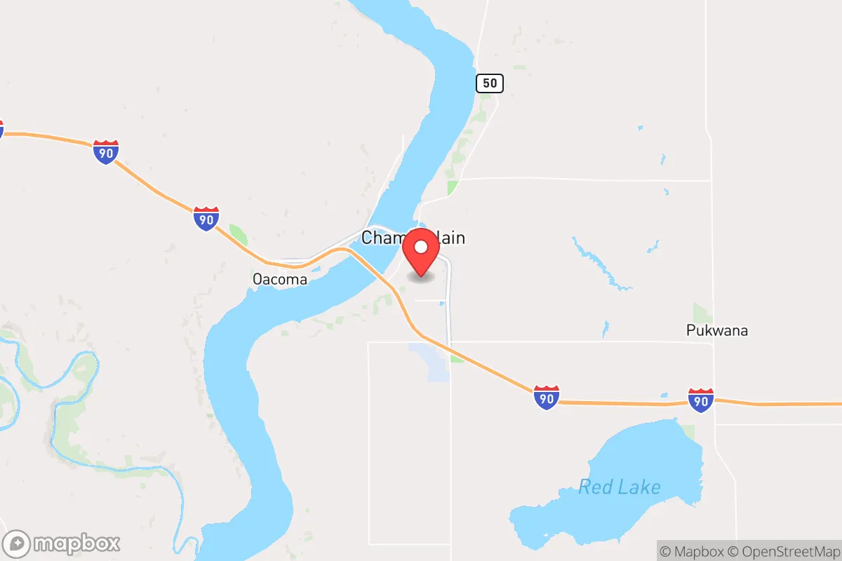
Key Distances
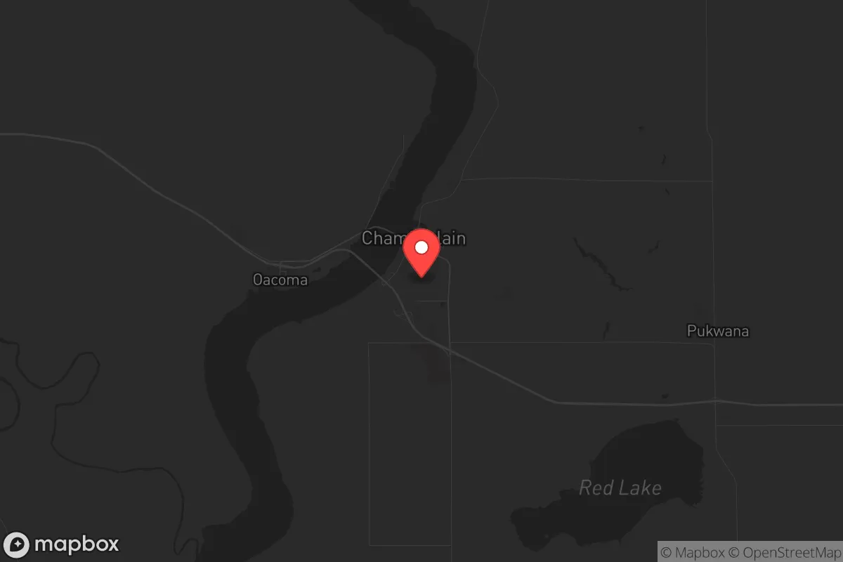
Regional Safe Places
Below is our recommended "safe zones" in South Dakota and the surrounding area based on our strategic heuristics. For most people, it's unrealistic to live in a “safe zone” full-time due to work, family or other personal reasons. They tend to be more rural. However, many of these areas are perfect for second homes and retreat properties that double as a vacation home or even a short-term rental.


Important Note: For informational purposes only. This does not mean nothing bad ever happens in the green zones. Please use common sense. This is based on public data and modeled with AI. We tried to take a conservative approach but mistakes happen. We update this regularly as new information becomes available.
Solar Generator Recommendations
Backup power matters more here than in safer locations. We've picked three solar generators across budgets and capacity tiers — start with the budget unit if you only need a few essentials, or step up if you want to run a fridge and HVAC for days at a time.

Jackery Portable Power Station Explorer 300
Budget OptionPower on the Go: Weighing only 11 lbs, it's convenient to set up and store with book-sized foldable solar panels

BLUETTI Portable Power Station AC180
Designed for both indoor and outdoor scenarios, AC180 is highly capable as it has a robost capacity and continuous output power.

EF ECOFLOW DELTA Pro Ultra Power Station
Upgraded PickEcoFlow DELTA Pro Ultra is a whole-home energy system designed to grow with your family. Integrated with the Smart Home Panel 2, it scales to meet your evolving energy needs — keeping your home powered, intelligent, and secure through every stage of life.
We earn a commission, at no additional cost to you.
Strategic Assessment Analysis
Chamberlain, South Dakota, offers a compelling mix of geographic isolation and strategic access that makes it a serious candidate for those prioritizing long-term resilience and self-sufficiency. Situated on the Missouri River and straddling Interstate 90, this town of roughly 2,500 people sits at a critical chokepoint between the eastern and western halves of the state, far enough from major population centers to avoid the immediate fallout of urban collapse but close enough to supply routes and regional resources. For a relocator with a prepper mindset, Chamberlain’s low population density, agricultural backbone, and river-based infrastructure create a foundation that is both defensible and sustainable in the face of civic unrest or large-scale disruptions.
Geographic position and natural advantages for long-term survival
Chamberlain’s location is its primary strategic asset. The town sits at the intersection of Interstate 90 and the Missouri River, giving it a dual advantage: a major east-west highway for potential resupply or movement, and a massive freshwater artery that is less vulnerable to contamination than smaller streams. The surrounding landscape is a mix of rolling prairie and river breaks, offering natural cover and defensible terrain. The Missouri River itself provides a reliable water source, fish, and irrigation potential, which is critical for any long-term food strategy. The nearest major city, Sioux Falls, is about 160 miles east, and Rapid City is roughly 200 miles west—both far enough that a collapse in those urban centers would not immediately spill over into Chamberlain. The town’s small population means fewer people to compete with for resources, and the surrounding Brule and Lyman counties have a combined population density of under 10 people per square mile, giving ample room for retreat or expansion if needed.
Risks, exposures, and proximity to fallout-relevant landmarks
No location is without vulnerabilities, and Chamberlain has a few that a strategic relocator must weigh. The most obvious is its position along Interstate 90, which in a crisis could become a corridor for refugees fleeing the coasts or larger cities. While the highway is an asset for movement, it is also a liability if mass migration events occur. The town itself is not near any major military installations, nuclear power plants, or known fallout targets—the closest significant infrastructure is the Oahe Dam upstream near Pierre, which is a potential target but far enough away (about 90 miles) to avoid direct blast effects. However, the Missouri River corridor could see secondary effects from dam failures or upstream contamination. Chamberlain is also in Tornado Alley, with a moderate risk of severe weather, though this is manageable with proper shelter. The bigger risk is economic isolation: the town’s economy relies heavily on tourism (the Dignity statue and Lewis and Clark sites) and agriculture, both of which are vulnerable to supply chain disruptions and federal policy shifts. For a prepper, the lack of a major hospital or advanced medical facilities within 60 miles is a real concern—the nearest trauma center is in Sioux Falls.
Practical resilience for a relocator: food, water, energy, and defensibility
For someone serious about self-sufficiency, Chamberlain checks several critical boxes. Water is abundant from the Missouri River, but access requires either a riverfront property or a well—municipal water could be compromised in a grid-down scenario. The surrounding farmland is some of the most productive in the state, with corn, soybeans, and wheat as staples, and local ranchers raise cattle and bison. A relocator with land could easily establish a garden and small livestock operation. Energy infrastructure is mixed: the area is served by the Western Area Power Administration grid, which is relatively stable, but rural areas are prone to outages during storms. Solar and wind potential is excellent—South Dakota ranks among the top states for wind energy—so off-grid setups are viable. Defensibility is strong due to the low population density and the natural chokepoints created by the river and highway. The town itself is compact, with a single main street and limited entry points, making it easier to monitor and control access in a crisis. The local Chamberlain Police Department and Brule County Sheriff’s Office are small but professional, and the community has a strong hunting and firearms culture, which means many residents are already armed and trained. For a relocator, integrating into this culture is essential—outsiders who keep to themselves will be viewed with suspicion.
Overall strategic picture for a conservative-minded relocator
Chamberlain is not a bug-out location for the faint of heart. It is a working-class, agricultural community where self-reliance is a necessity, not a lifestyle choice. The town’s strengths—abundant water, low population density, defensible terrain, and a culture of preparedness—outweigh its risks, provided you are willing to put in the work. The biggest challenge is economic: jobs are limited to healthcare, education, agriculture, and tourism, so a relocator needs either remote income, savings, or a trade that fits the local economy. The political climate is reliably conservative, with Brule County voting +40 points Republican in 2024, which aligns with the values of most prepper-minded individuals. For a single person or family looking to ride out the coming instability, Chamberlain offers a realistic balance of isolation and access, natural resources, and a community that will not panic when the lights go out. It is not a fortress, but it is a solid base of operations for those who understand that survival is about preparation, not luck.
* Values derived from national, state, county, city and local statistics and may differ in a specific area. Last updated: 2026-05-02T05:34:28.000Z
Narrative content on this page is AI-generated and may contain mistakes. Verify any details that matter before acting on them.
ReloMaps may earn a commission from affiliate links at no extra cost to you.