
Photo: Wikipedia
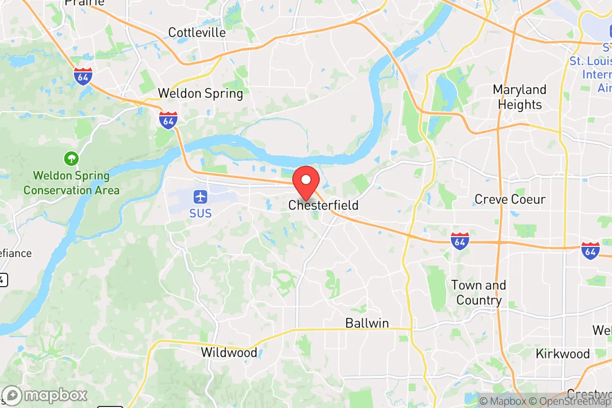
Strategic Assessment of Chesterfield, MO
Meaningful friction. Expect exposure to either population pressure, blast zones, or natural disaster risk. Consider buying a retreat property.
What does the Strategic Assessment tell us?
Our Strategic Assessment grades tactical survivability of an area. Major population centers, military targets, fallout zones, natural disasters, and border exposure all drive risk — lower exposure means a more defensible position in a crisis.
This is heavily inspired by Joel Skousen's Strategic Relocation book. Highly recommended you checkout the book ($)What does this tell us?
Our Strategic Assessment grades tactical survivability of an area. Major population centers, military targets, fallout zones, natural disasters, and border exposure all drive risk — lower exposure means a more defensible position in a crisis.
This is heavily inspired by Joel Skousen's Strategic Relocation book. Highly recommended you checkout the book ($)Strategic Pillars

Key Distances
Regional Safe Places
Below is our recommended "safe zones" in Missouri and the surrounding area based on our strategic heuristics. For most people, it's unrealistic to live in a “safe zone” full-time due to work, family or other personal reasons. They tend to be more rural. However, many of these areas are perfect for second homes and retreat properties that double as a vacation home or even a short-term rental.


Important Note: For informational purposes only. This does not mean nothing bad ever happens in the green zones. Please use common sense. This is based on public data and modeled with AI. We tried to take a conservative approach but mistakes happen. We update this regularly as new information becomes available.
Solar Generator Recommendations
Backup power matters more here than in safer locations. We've picked three solar generators across budgets and capacity tiers — start with the budget unit if you only need a few essentials, or step up if you want to run a fridge and HVAC for days at a time.

Jackery Portable Power Station Explorer 300
Budget OptionPower on the Go: Weighing only 11 lbs, it's convenient to set up and store with book-sized foldable solar panels

BLUETTI Portable Power Station AC180
Designed for both indoor and outdoor scenarios, AC180 is highly capable as it has a robost capacity and continuous output power.

EF ECOFLOW DELTA Pro Ultra Power Station
Upgraded PickEcoFlow DELTA Pro Ultra is a whole-home energy system designed to grow with your family. Integrated with the Smart Home Panel 2, it scales to meet your evolving energy needs — keeping your home powered, intelligent, and secure through every stage of life.
We earn a commission, at no additional cost to you.
Strategic Assessment Analysis
Chesterfield, Missouri, occupies a strategic niche that balances proximity to St. Louis with a surprising degree of natural insulation, making it a location worth serious consideration for those prioritizing resilience and long-term preparedness. While no place within 30 miles of a major metropolitan area is truly safe from the cascading effects of civic unrest or a mass casualty event, Chesterfield’s position along the Missouri River bluffs and its status as a regional economic hub offer distinct advantages for a relocator with a conservative, survivalist mindset. The city’s infrastructure, zoning, and demographic profile suggest a community that could weather localized disruptions better than most inner-ring suburbs, provided one understands its specific vulnerabilities and plans accordingly.
Geographic position and natural advantages for long-term security
Chesterfield sits on the northern bank of the Missouri River, roughly 25 miles west of downtown St. Louis, in a corridor that historically served as a natural buffer between the city and the rural expanses of St. Charles and Warren counties. The area’s defining feature is the Missouri River bluffs—steep, wooded hills that rise 200 to 300 feet above the floodplain. These bluffs provide natural elevation and defensible terrain, especially in neighborhoods like Chesterfield Valley (which sits on the floodplain) versus the higher ground of Wildwood or the western parts of Chesterfield proper. For a prepper, this elevation means reduced risk from riverine flooding and a tactical advantage in terms of line-of-sight and retreat options. The surrounding landscape includes the 1,500-acre Babler State Park and the expansive Rockwoods Reservation, offering immediate access to woodlands, water sources, and game. This is not a flat, exposed prairie; it’s a rolling, forested environment that could sustain a small group for weeks if supply chains falter. The area’s karst topography—limestone bedrock with caves and springs—also provides potential for water catchment and hidden storage, though it requires careful well placement to avoid contamination.
Risks, exposures, and proximity to fallout-relevant landmarks
The most significant risk for Chesterfield is its proximity to St. Louis—a city that, in a worst-case scenario, could become a focal point for civil unrest, infrastructure collapse, or a mass casualty event. St. Louis has a history of social friction, and its location near the confluence of the Missouri and Mississippi rivers makes it a potential target for both natural disasters (e.g., a major earthquake along the New Madrid fault) and man-made disruptions. Chesterfield is roughly 15 miles from Lambert–St. Louis International Airport, a potential evacuation or military staging point, and about 20 miles from the St. Louis downtown core, which houses federal buildings, hospitals, and the Scottrade Center—all potential flashpoints. More concerning for the survivalist: Chesterfield lies within 50 miles of the Callaway Nuclear Plant (Fulton, MO) and the now-decommissioned but still waste-storing West Lake Landfill (Bridgeton, MO), which has a history of radioactive material concerns. A catastrophic event at either site could render the area uninhabitable for months or years, depending on wind patterns. The Missouri River itself is a double-edged sword: it provides water and transport, but it also channels floodwaters and could be used as a vector for contaminated runoff. Flooding in Chesterfield Valley (the commercial district) is a recurring issue—the 1993 and 2019 floods submerged parts of the valley under 10+ feet of water, demonstrating that even modern levees have limits. For a relocator, the key takeaway is that Chesterfield is not a remote bunker; it’s a suburban node with clear exposure to regional threats. The defensibility comes from its terrain and community cohesion, not from isolation.
Practical resilience for a relocator: food, water, energy, and defensibility
Chesterfield’s practical resilience hinges on its infrastructure and the mindset of its population. The city has a well-maintained water system drawing from the Missouri River, but a prolonged power outage would cripple pumping stations. Private wells are common in the western, more rural parts of the county (St. Louis County’s unincorporated areas), but within Chesterfield city limits, most homes rely on municipal supply. A prepper should prioritize a property with a well and a backup generator, or at minimum a rainwater catchment system—the area averages 42 inches of rainfall annually, so water is not scarce if you can capture it. Food security is moderate: Chesterfield has several large grocery chains (Schnucks, Dierbergs) and a thriving farmers’ market (Chesterfield Farmers Market, May–October), but these are vulnerable to supply chain disruptions. The surrounding farmland in St. Charles and Warren counties is a major asset—within a 30-minute drive, you can find livestock, grain, and produce operations that could be bartered with or sourced directly. Energy resilience is a weak point. The grid is served by Ameren Missouri, which has faced criticism for outage response times during storms. Solar adoption is growing but not yet widespread; a relocator should plan for off-grid capability, especially given the area’s occasional ice storms and derecho events. Defensibility is where Chesterfield shines relative to other St. Louis suburbs. The bluffs create natural chokepoints—roads like Highway 40/61 and Clarkson Road are the primary arteries, and they could be monitored or blocked with relative ease. The community is predominantly single-family homes on 0.25- to 1-acre lots, offering space for gardens, livestock, and perimeter security. The local police department is well-funded and responsive, but in a prolonged crisis, law enforcement would likely be stretched thin. The demographic profile—largely white, middle-to-upper-class, with a strong veteran presence—suggests a population that would organize quickly into neighborhood watch or mutual aid groups. That’s a double-edged sword: it means less chaos than in denser areas, but also a potential for exclusion if you’re not seen as part of the community.
The overall strategic picture for Chesterfield is one of calculated risk. It’s not a remote redoubt—you can’t disappear into the woods here—but it offers a rare combination of natural defenses, resource access, and community stability that many preppers overlook in favor of more isolated locations. The proximity to St. Louis is a liability, but it’s also an asset: in a crisis, the city’s hospitals, warehouses, and transportation hubs could be leveraged if you have the skills and connections to navigate the chaos. For a conservative relocator who values self-reliance and wants to be within striking distance of urban resources without being swallowed by them, Chesterfield is a viable option—provided you secure your own water, energy, and a defensible property on the bluffs. The real test will come not from a single event, but from the slow erosion of societal trust and infrastructure. Chesterfield’s residents, by and large, still believe in the system. That faith may be misplaced, but it also means they’ll be the last to panic—and in a collapse, that kind of steady-headed neighbor is worth more than any bunker.
* Values derived from national, state, county, city and local statistics and may differ in a specific area. Last updated: 2026-05-01T09:14:20.000Z
Narrative content on this page is AI-generated and may contain mistakes. Verify any details that matter before acting on them.
ReloMaps may earn a commission from affiliate links at no extra cost to you.