
Photo: Wikipedia
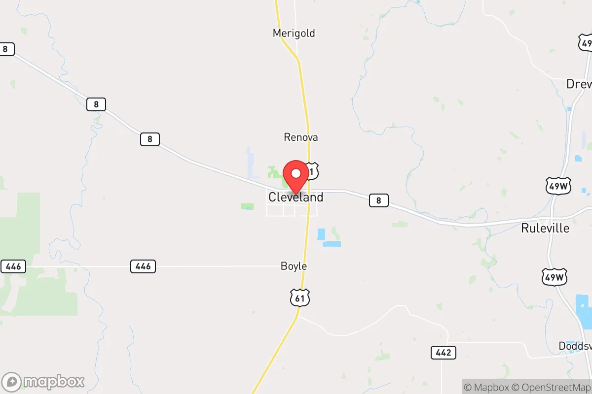
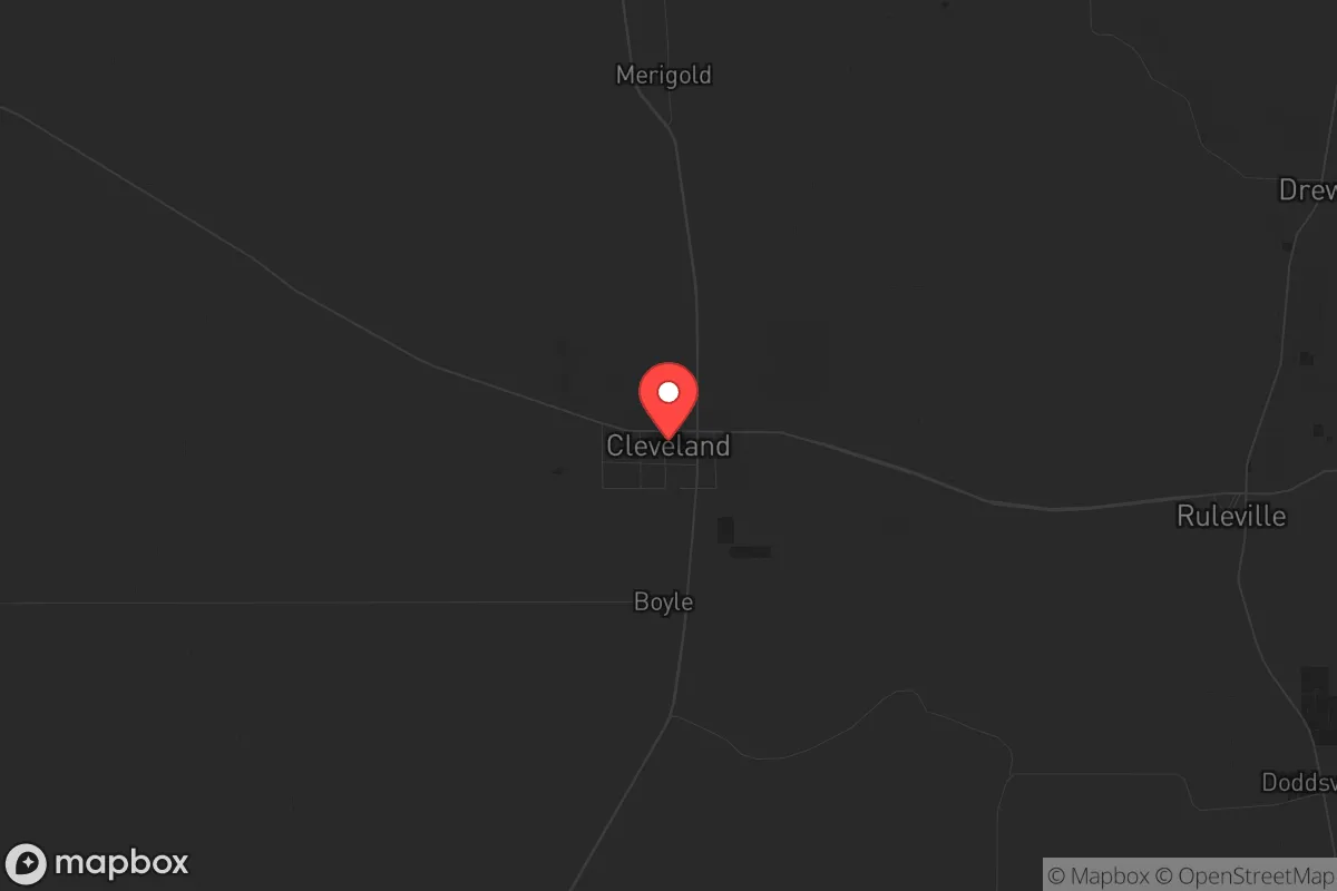
Strategic Assessment of Cleveland, MS
Workable tactical position. Some exposure to population density or targets, but generally defensible in a crisis.
What does the Strategic Assessment tell us?
Our Strategic Assessment grades tactical survivability of an area. Major population centers, military targets, fallout zones, natural disasters, and border exposure all drive risk — lower exposure means a more defensible position in a crisis.
This is heavily inspired by Joel Skousen's Strategic Relocation book. Highly recommended you checkout the book ($)What does this tell us?
Our Strategic Assessment grades tactical survivability of an area. Major population centers, military targets, fallout zones, natural disasters, and border exposure all drive risk — lower exposure means a more defensible position in a crisis.
This is heavily inspired by Joel Skousen's Strategic Relocation book. Highly recommended you checkout the book ($)Strategic Pillars

Key Distances
Regional Safe Places
Below is our recommended "safe zones" in Mississippi and the surrounding area based on our strategic heuristics. For most people, it's unrealistic to live in a “safe zone” full-time due to work, family or other personal reasons. They tend to be more rural. However, many of these areas are perfect for second homes and retreat properties that double as a vacation home or even a short-term rental.
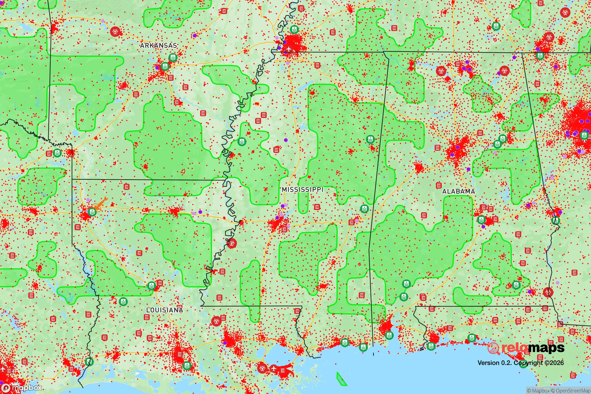
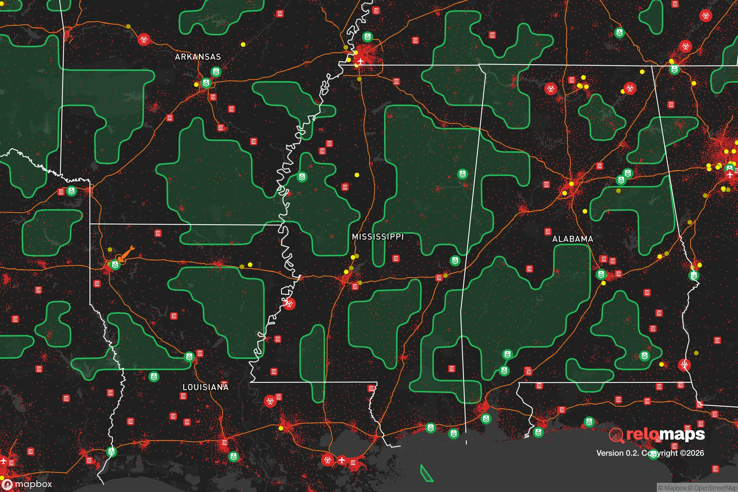
Important Note: For informational purposes only. This does not mean nothing bad ever happens in the green zones. Please use common sense. This is based on public data and modeled with AI. We tried to take a conservative approach but mistakes happen. We update this regularly as new information becomes available.
Solar Generator Recommendations
Backup power matters more here than in safer locations. We've picked three solar generators across budgets and capacity tiers — start with the budget unit if you only need a few essentials, or step up if you want to run a fridge and HVAC for days at a time.

Jackery Portable Power Station Explorer 300
Budget OptionPower on the Go: Weighing only 11 lbs, it's convenient to set up and store with book-sized foldable solar panels

BLUETTI Portable Power Station AC180
Designed for both indoor and outdoor scenarios, AC180 is highly capable as it has a robost capacity and continuous output power.

EF ECOFLOW DELTA Pro Ultra Power Station
Upgraded PickEcoFlow DELTA Pro Ultra is a whole-home energy system designed to grow with your family. Integrated with the Smart Home Panel 2, it scales to meet your evolving energy needs — keeping your home powered, intelligent, and secure through every stage of life.
We earn a commission, at no additional cost to you.
Strategic Assessment Analysis
Cleveland, Mississippi, presents a mixed bag for the strategic relocator. Its primary advantage is a deep, almost forgotten resilience rooted in the Mississippi Delta’s agricultural backbone, but its location within a flat, flood-prone region and proximity to major transportation corridors introduces significant vulnerabilities. For a conservative prepper, this town offers a potential fallback position—not a fortress—where self-sufficiency is possible if you can navigate the area’s inherent risks and limited infrastructure.
Geographic position and natural advantages for long-term survival
Cleveland sits in Bolivar County, roughly 100 miles south of Memphis and 120 miles north of Jackson, placing it in a relative void between major population centers. This isolation is a double-edged sword: it’s far enough from the immediate blast radius of a Memphis or Jackson event, but close enough that fallout or refugee flows could reach you within hours. The area’s defining feature is the Mississippi River, about 20 miles west, and the vast alluvial plain of the Delta. This flat, fertile land is a genuine asset for food production—the soil is among the richest in the world, and you could realistically grow corn, soybeans, rice, and vegetables on a small plot. The Yazoo-Mississippi Delta also has a high water table, meaning shallow wells are feasible, and the numerous bayous and oxbow lakes provide surface water for irrigation or emergency use. However, the flat terrain offers zero natural defensibility; there are no hills, forests, or ridges to use as cover or observation points. The area’s primary natural advantage is its agricultural capacity, not its tactical geography.
Risks, exposures, and proximity to fallout-relevant landmarks
The most glaring risk is the area’s vulnerability to flooding. The Delta is essentially a bowl, and the Mississippi River levee system, while maintained, is a single point of failure. A catastrophic levee breach during a flood event could inundate Cleveland under several feet of water, making evacuation the only option. For a prepper, this means any retreat must be on high ground or include a boat and a plan to move east toward the loess bluffs. Beyond natural disasters, Cleveland’s location near Interstate 55 and U.S. Highway 61—both major north-south evacuation routes—means it would be a funnel for refugees fleeing a Memphis or New Orleans disaster. The town itself is small (population ~12,000), but it’s a regional hub for healthcare and retail, which could attract looting or resource competition during a collapse. There are no nuclear power plants within 50 miles, but the proximity to Memphis (a major transportation and industrial hub) means any terrorist or military strike on that city could send fallout clouds southeast, potentially over Cleveland. The nearest military installation is the 186th Air Refueling Wing in Meridian, over 150 miles east, so direct military targeting is unlikely. The bigger concern is the area’s reliance on the Mississippi River for barge traffic—a disruption to that supply chain would cripple fuel and grain shipments, hitting the local economy hard.
Practical resilience for a relocator: food, water, energy, and defensibility
For a relocator willing to work the land, Cleveland offers genuine self-sufficiency potential. The growing season is long (March to October), and you can produce a surplus of calories on a few acres. Local farmers’ markets and co-ops exist, but you’d likely need to build relationships with nearby landowners to secure access to equipment or seed stock. Water is abundant but requires treatment; the Delta’s groundwater is high in iron and sediment, so a good filtration system (like a Berkey or a sand filter) is essential. Municipal water comes from the Mississippi River via the Cleveland Waterworks, which is vulnerable to contamination from upstream industrial spills or flooding. A private well with a hand pump is a smart investment. Energy-wise, the grid is served by Entergy Mississippi, which is prone to outages during storms. Solar panels are viable—the area gets about 5.5 peak sun hours per day—but you’ll need battery storage or a generator backup. Natural gas is available in town, but rural properties may rely on propane. Defensibility is the weak link. The flat, open terrain means any retreat is visible from miles away. You’d need to rely on a tight-knit community or a fortified homestead with clear sightlines, motion sensors, and a plan for perimeter security. The local culture is generally conservative and self-reliant, but the area also has a history of poverty and crime—Bolivar County’s violent crime rate is above the national average, so a prepper must be prepared for both external threats and local desperation. Building a network of trusted neighbors is not optional; it’s survival.
The overall strategic picture for Cleveland is one of calculated trade-offs. It is not a bug-out location for a fast escape—the flat terrain and flood risk make it a poor choice for a quick retreat. But for a long-term, agrarian-minded relocator who wants to be out of the immediate shadow of major cities, it offers a rare combination of cheap land, fertile soil, and abundant water. The key is to buy property on the highest ground you can find (look for areas near the loess bluffs east of town, like around Boyle or Merigold), invest in flood mitigation, and establish a community of like-minded individuals before a crisis hits. The Delta’s isolation works both ways: it keeps you away from the chaos of urban collapse, but it also means help is far away if things go wrong. For a conservative prepper who values independence over convenience, Cleveland is a viable option—but only if you go in with eyes wide open about the risks and a plan to mitigate them.
* Values derived from national, state, county, city and local statistics and may differ in a specific area. Last updated: 2026-05-04T02:58:14.000Z
Narrative content on this page is AI-generated and may contain mistakes. Verify any details that matter before acting on them.
ReloMaps may earn a commission from affiliate links at no extra cost to you.