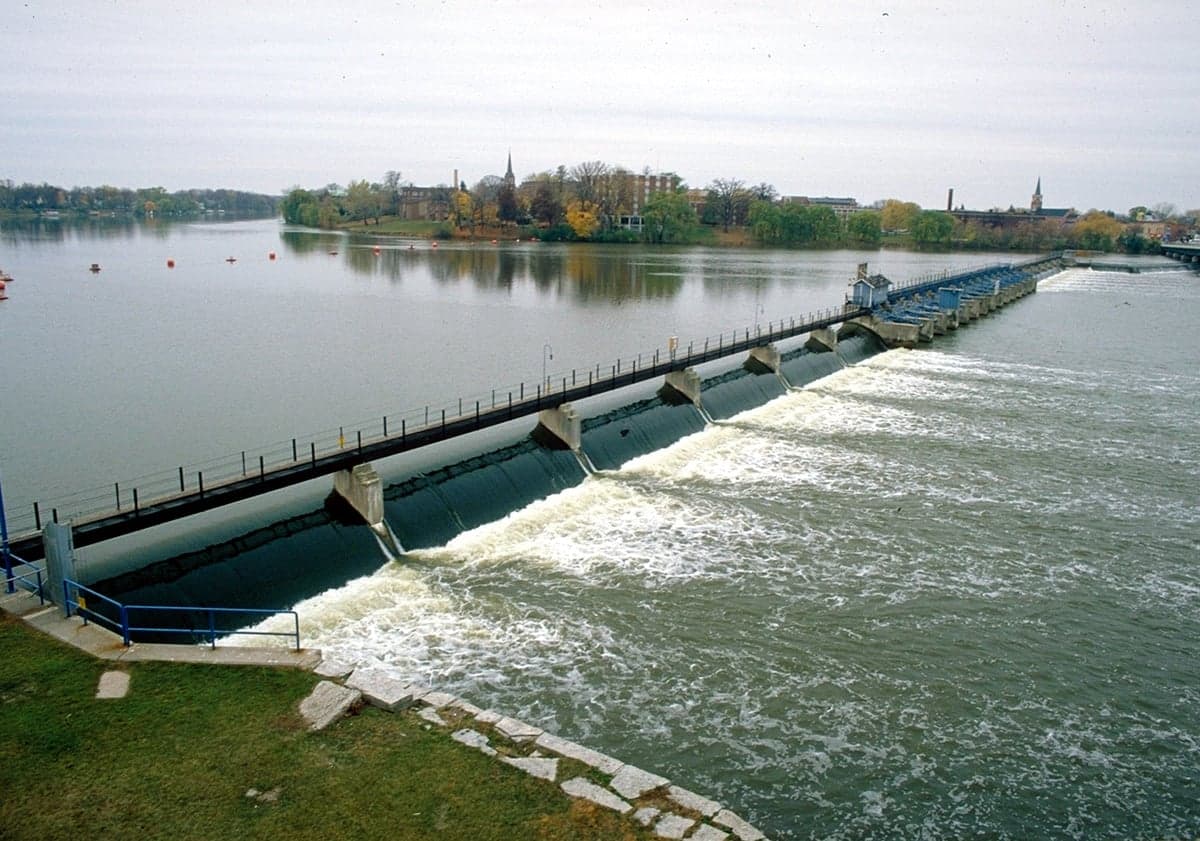
Photo: Wikipedia
Strategic Assessment of De Pere, WI
Meaningful friction. Expect exposure to either population pressure, blast zones, or natural disaster risk. Consider buying a retreat property.
What does the Strategic Assessment tell us?
Our Strategic Assessment grades tactical survivability of an area. Major population centers, military targets, fallout zones, natural disasters, and border exposure all drive risk — lower exposure means a more defensible position in a crisis.
This is heavily inspired by Joel Skousen's Strategic Relocation book. Highly recommended you checkout the book ($)What does this tell us?
Our Strategic Assessment grades tactical survivability of an area. Major population centers, military targets, fallout zones, natural disasters, and border exposure all drive risk — lower exposure means a more defensible position in a crisis.
This is heavily inspired by Joel Skousen's Strategic Relocation book. Highly recommended you checkout the book ($)Strategic Pillars

Key Distances
Regional Safe Places
Below is our recommended "safe zones" in Wisconsin and the surrounding area based on our strategic heuristics. For most people, it's unrealistic to live in a “safe zone” full-time due to work, family or other personal reasons. They tend to be more rural. However, many of these areas are perfect for second homes and retreat properties that double as a vacation home or even a short-term rental.
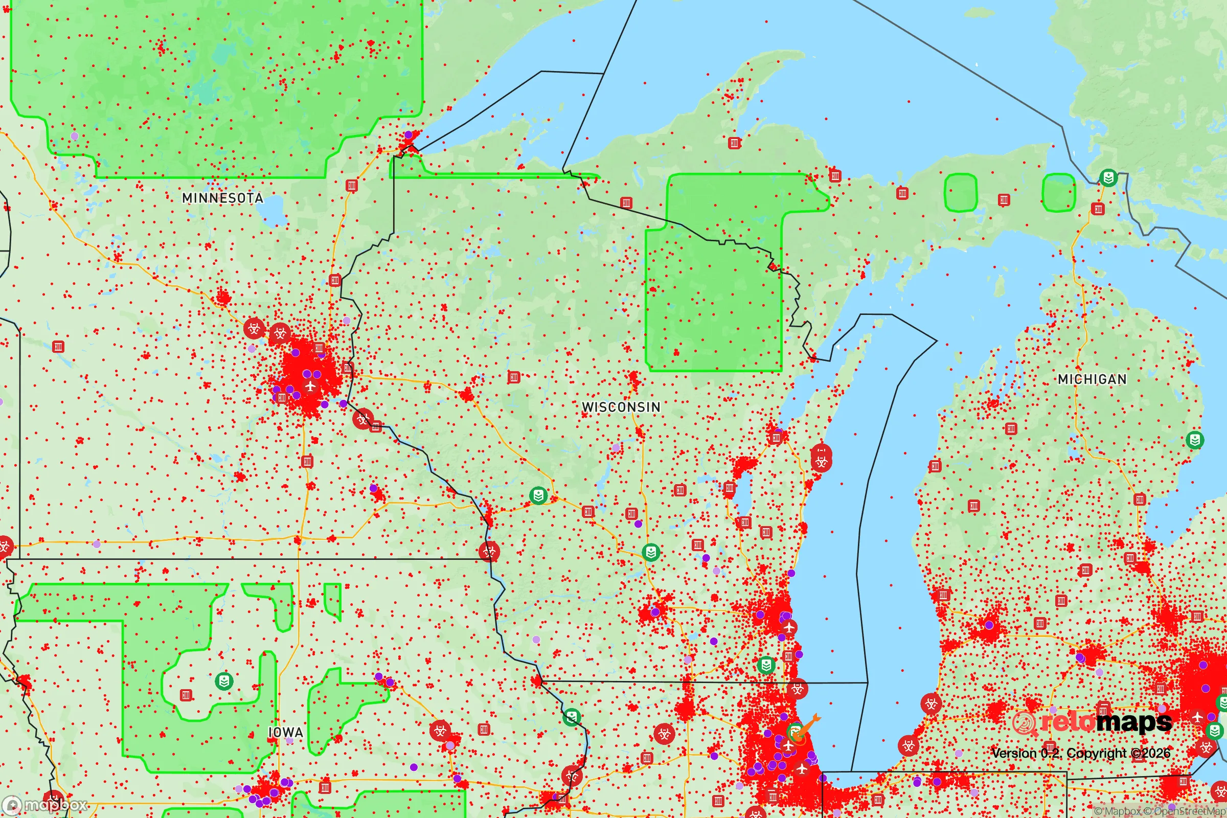
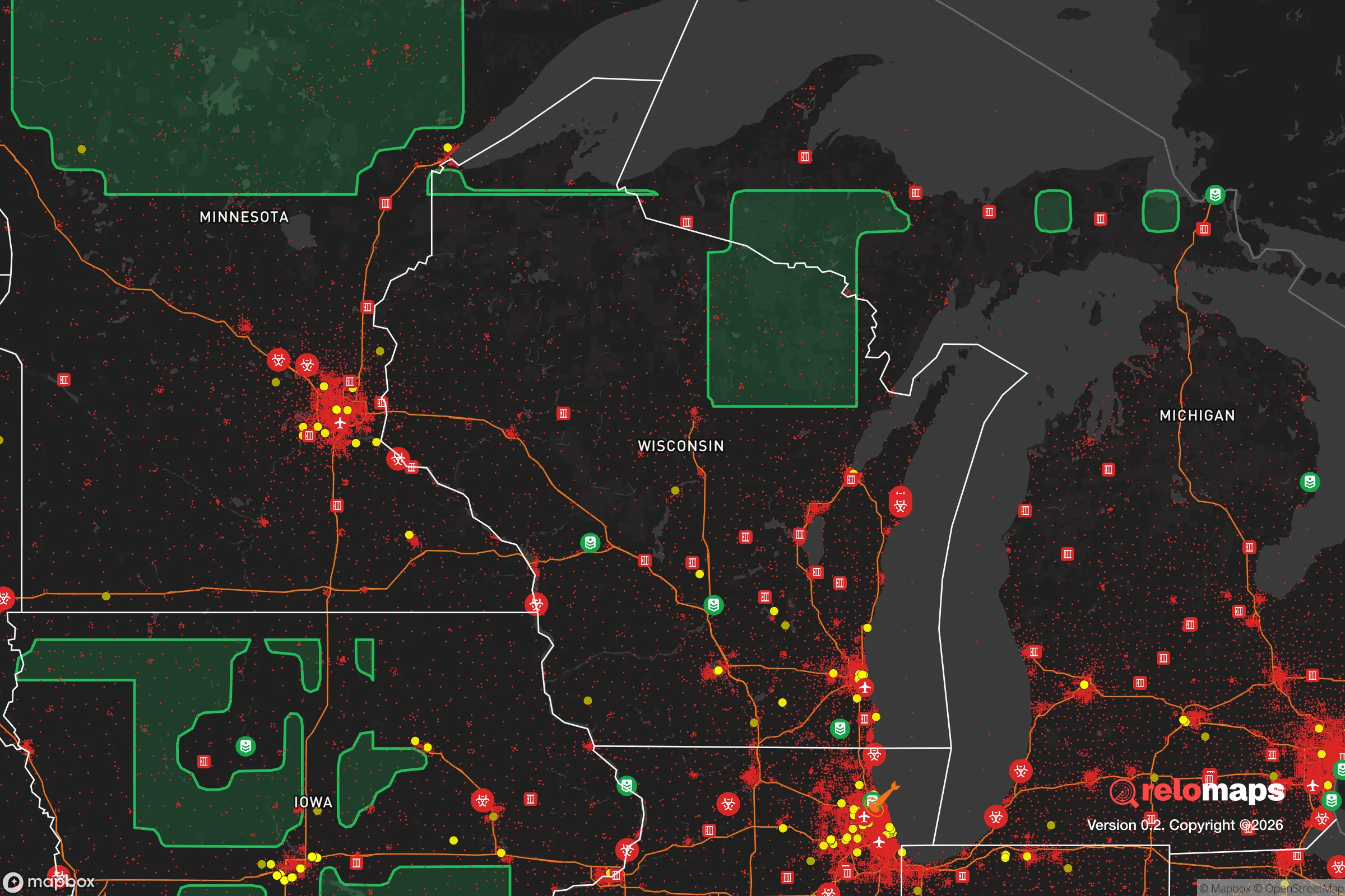
Important Note: For informational purposes only. This does not mean nothing bad ever happens in the green zones. Please use common sense. This is based on public data and modeled with AI. We tried to take a conservative approach but mistakes happen. We update this regularly as new information becomes available.
Solar Generator Recommendations
Backup power matters more here than in safer locations. We've picked three solar generators across budgets and capacity tiers — start with the budget unit if you only need a few essentials, or step up if you want to run a fridge and HVAC for days at a time.

Jackery Portable Power Station Explorer 300
Budget OptionPower on the Go: Weighing only 11 lbs, it's convenient to set up and store with book-sized foldable solar panels

BLUETTI Portable Power Station AC180
Designed for both indoor and outdoor scenarios, AC180 is highly capable as it has a robost capacity and continuous output power.

EF ECOFLOW DELTA Pro Ultra Power Station
Upgraded PickEcoFlow DELTA Pro Ultra is a whole-home energy system designed to grow with your family. Integrated with the Smart Home Panel 2, it scales to meet your evolving energy needs — keeping your home powered, intelligent, and secure through every stage of life.
We earn a commission, at no additional cost to you.
Strategic Assessment Analysis
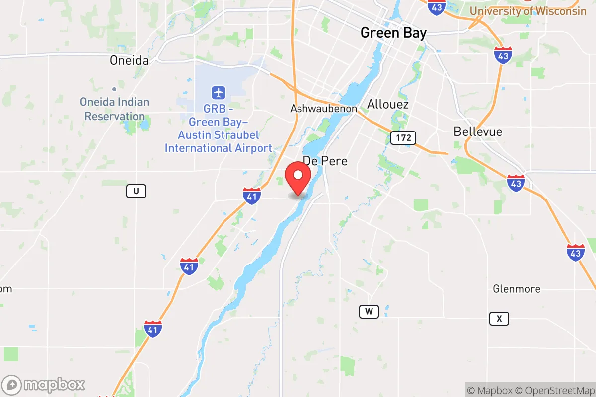
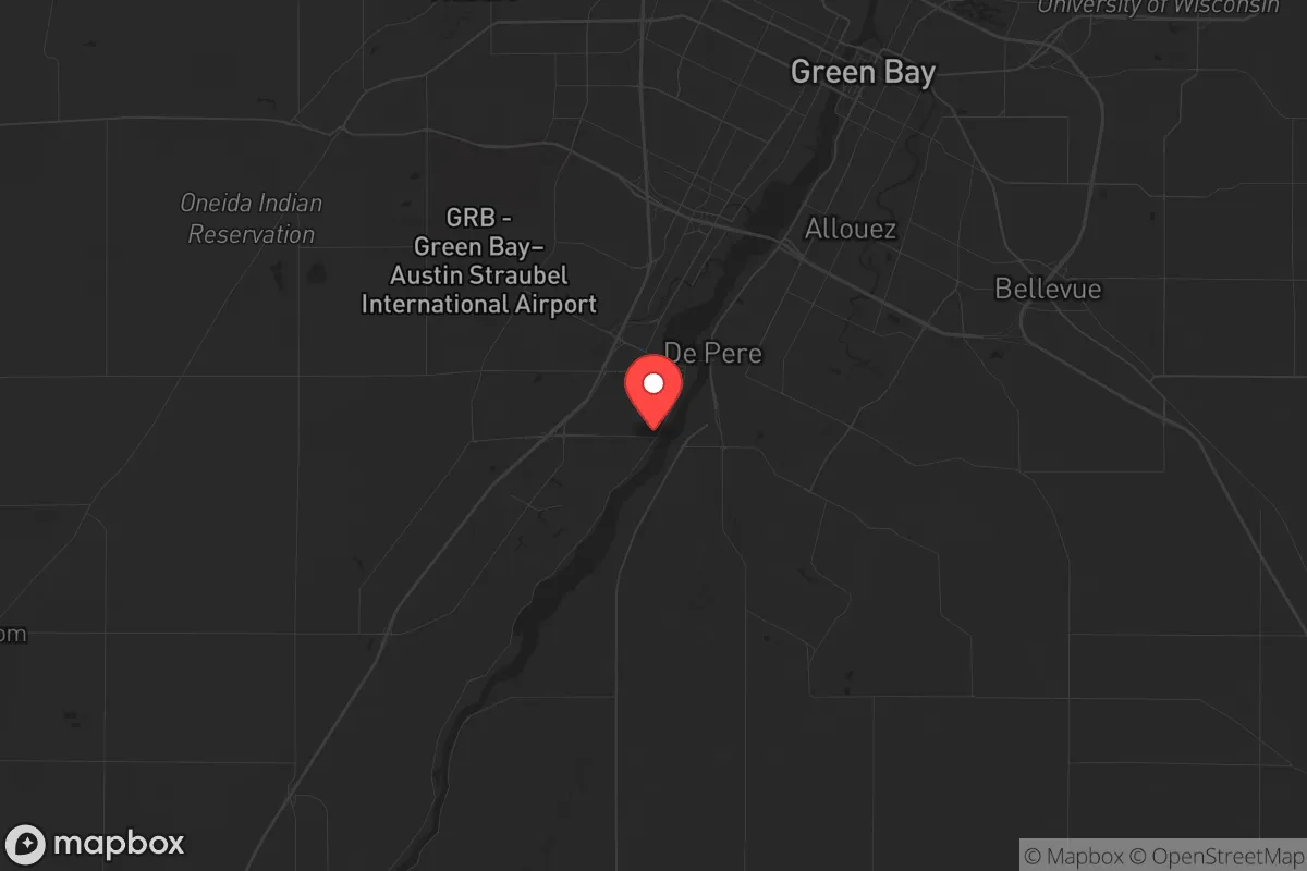
De Pere, Wisconsin, offers a surprisingly resilient strategic position for those prioritizing preparedness and stability, combining a small-city footprint with proximity to the logistical backbone of the Upper Midwest. Nestled along the Fox River just south of Green Bay, this community of roughly 25,000 benefits from a location that is close enough to regional resources yet far enough from the most acute risks of major metropolitan collapse. For a relocator with a conservative, survivalist mindset, De Pere presents a defensible base with access to fresh water, agricultural land, and a relatively insulated social fabric—though it is not without its own exposure to fallout-relevant landmarks and potential chokepoints.
Geographic position and natural advantages for long-term stability
De Pere’s geographic anchor is the Fox River, a major tributary of Green Bay and Lake Michigan, providing a reliable freshwater source that is critical for any long-term resilience plan. The city sits at the southern edge of Brown County, roughly 100 miles north of Milwaukee and 200 miles northwest of Chicago—far enough to avoid the immediate blast radius or civil unrest of those urban centers, but close enough to monitor their signals. The surrounding landscape is predominantly flat, fertile farmland, which means local food production potential is high, and the region’s cold winters naturally slow the spread of disease and limit outdoor activity during crisis periods. The area’s position along the Fox River Valley also places it on a historical transportation corridor, which is a double-edged sword: it offers access to supply routes but also makes it a potential target for movement during a breakdown. For a prepper, the key advantage is that De Pere is not a primary economic or military target—no major defense installations, no nuclear power plants within 30 miles, and no major refineries. The nearest significant fallout risk is the Kewaunee Nuclear Power Plant, about 30 miles east on Lake Michigan, but prevailing winds generally carry any plume away from De Pere, and the plant has been decommissioned since 2013, reducing the immediate danger.
Risks, exposures, and proximity to fallout-relevant landmarks
While De Pere avoids the worst of urban vulnerability, it is not a fortress. The most pressing risk is its proximity to Green Bay (population ~107,000), which sits just 6 miles north. In a scenario of civil unrest or mass casualty events, Green Bay’s population could surge south along Highway 41, creating a refugee flow that would overwhelm De Pere’s small police force and limited infrastructure. The city itself has no major hospitals—the nearest Level II trauma center is at Bellin Hospital in Green Bay—meaning medical self-sufficiency is a must for any serious prepper. Additionally, the Fox River is a navigable waterway that could become a chokepoint if bridges are compromised; there are only a handful of crossings within the city limits, and a single failure could isolate neighborhoods. From a fallout perspective, the nearest active nuclear facility is the Point Beach Nuclear Plant, about 40 miles north-northeast in Two Rivers, which is within the 50-mile emergency planning zone. While a meltdown is statistically unlikely, the prevailing winds from the northeast could carry a plume directly over De Pere in a worst-case scenario. The city also sits within 150 miles of the Chicago metropolitan area, a prime target for any large-scale attack or economic collapse, and the resulting secondary effects—supply chain disruption, refugee movement, and resource scarcity—would hit De Pere within days, not weeks.
Practical resilience for a relocator: food, water, energy, and defensibility
For a relocator focused on practical self-sufficiency, De Pere offers a mixed but workable profile. Water is the strongest asset: the Fox River provides an abundant surface water source, and the underlying aquifer is deep and generally clean, though testing for agricultural runoff is advisable. Most homes in the area are on municipal water, but a well-equipped prepper should plan for a backup filtration system or a private well if purchasing rural land outside city limits. Food security is moderate: Brown County is one of Wisconsin’s top agricultural producers, with dairy, corn, and soybeans dominating the landscape. Local farmers’ markets operate seasonally, and the growing season runs from May to October, allowing for gardening. However, the region’s heavy reliance on industrial agriculture means that a collapse in fuel or fertilizer supply would hit local food production hard. Stockpiling heirloom seeds and learning cold-weather preservation techniques (canning, root cellaring) is essential. Energy is a vulnerability: De Pere’s grid is tied to the regional Wisconsin Public Service network, which relies on a mix of natural gas, coal, and nuclear from Point Beach. A grid-down scenario would leave most homes without power for weeks, given the area’s harsh winters. Solar panels with battery storage are a wise investment, but the region’s cloudy winters reduce output significantly; a backup generator with a 500-gallon propane tank is more reliable. Defensibility is situational: The city’s layout is a mix of older neighborhoods with narrow streets and newer subdivisions with cul-de-sacs, which can be secured with relative ease if neighbors cooperate. The rural areas south and west of De Pere offer better defensibility—sparse population, long sightlines, and multiple escape routes via county roads. The biggest defensive weakness is the lack of natural barriers; the flat terrain offers no high ground, and the river is a potential infiltration route. A group of like-minded families could secure a rural compound within 15 minutes of De Pere, but solo preppers should look for properties with tree lines and limited road access.
The overall strategic picture for De Pere is one of calculated trade-offs. It is not a remote bunker—it is a small city with real exposure to regional instability and a moderate fallout risk from nearby nuclear infrastructure. But for a conservative relocator who values community cohesion, access to fresh water, and a buffer from the worst of urban chaos, De Pere offers a viable base of operations. The key is to treat it as a staging point rather than a final redoubt: build relationships with local farmers, secure a property with a well and off-grid energy, and maintain a vehicle capable of navigating winter roads. The city’s greatest strength is its ordinariness—it is unlikely to be a target, and its residents are generally self-reliant and skeptical of federal overreach. If the goal is to ride out a crisis in a place where you can still buy groceries and talk to your neighbors without suspicion, De Pere earns a solid, if cautious, recommendation.
* Values derived from national, state, county, city and local statistics and may differ in a specific area. Last updated: 2026-04-21T10:18:26.000Z
Narrative content on this page is AI-generated and may contain mistakes. Verify any details that matter before acting on them.
ReloMaps may earn a commission from affiliate links at no extra cost to you.