Photo: Wikipedia
Strategic Assessment of Devils Lake, ND
Workable tactical position. Some exposure to population density or targets, but generally defensible in a crisis.
What does the Strategic Assessment tell us?
Our Strategic Assessment grades tactical survivability of an area. Major population centers, military targets, fallout zones, natural disasters, and border exposure all drive risk — lower exposure means a more defensible position in a crisis.
This is heavily inspired by Joel Skousen's Strategic Relocation book. Highly recommended you checkout the book ($)What does this tell us?
Our Strategic Assessment grades tactical survivability of an area. Major population centers, military targets, fallout zones, natural disasters, and border exposure all drive risk — lower exposure means a more defensible position in a crisis.
This is heavily inspired by Joel Skousen's Strategic Relocation book. Highly recommended you checkout the book ($)Strategic Pillars

Key Distances
Regional Safe Places
Below is our recommended "safe zones" in North Dakota and the surrounding area based on our strategic heuristics. For most people, it's unrealistic to live in a “safe zone” full-time due to work, family or other personal reasons. They tend to be more rural. However, many of these areas are perfect for second homes and retreat properties that double as a vacation home or even a short-term rental.
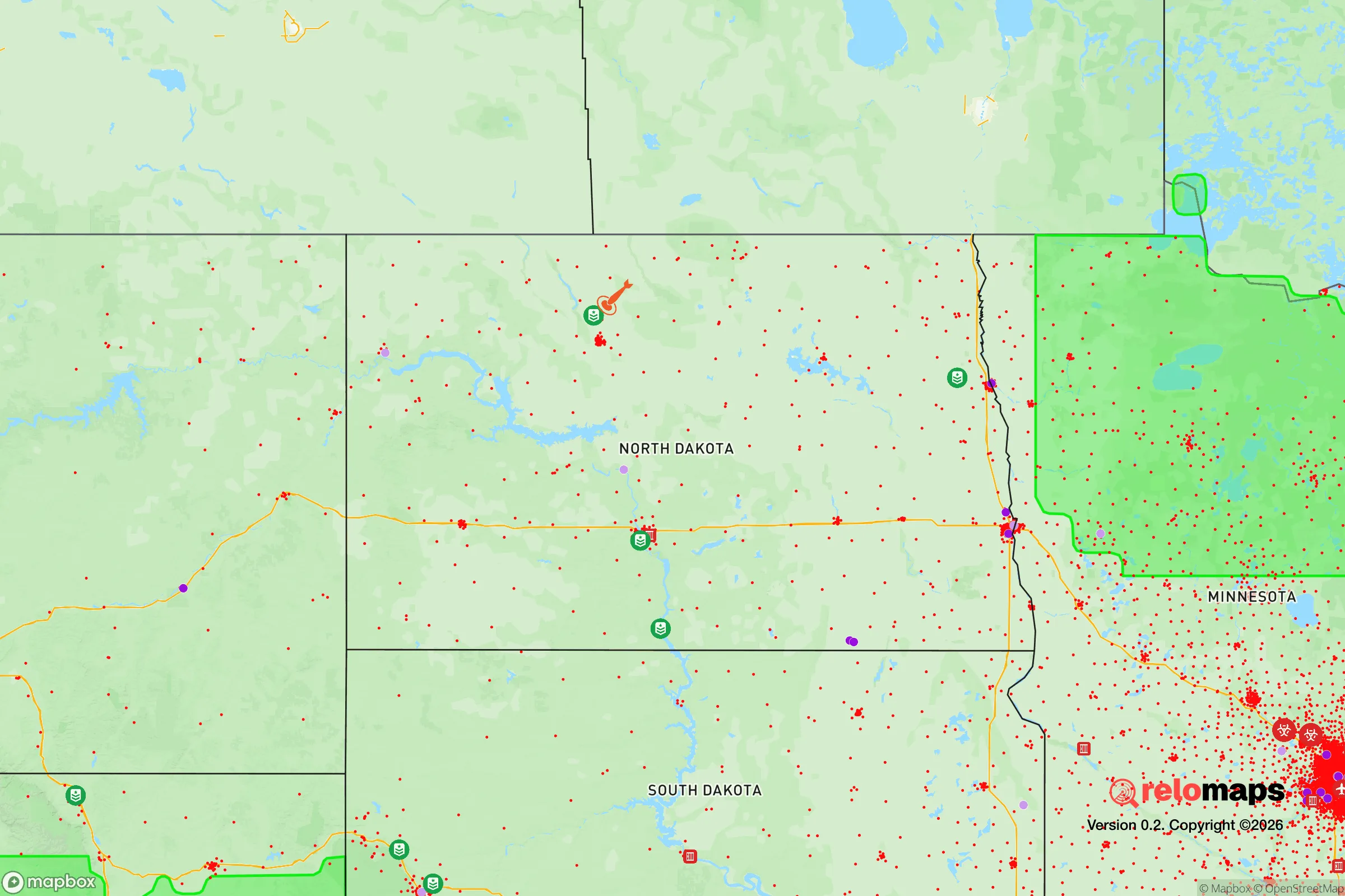
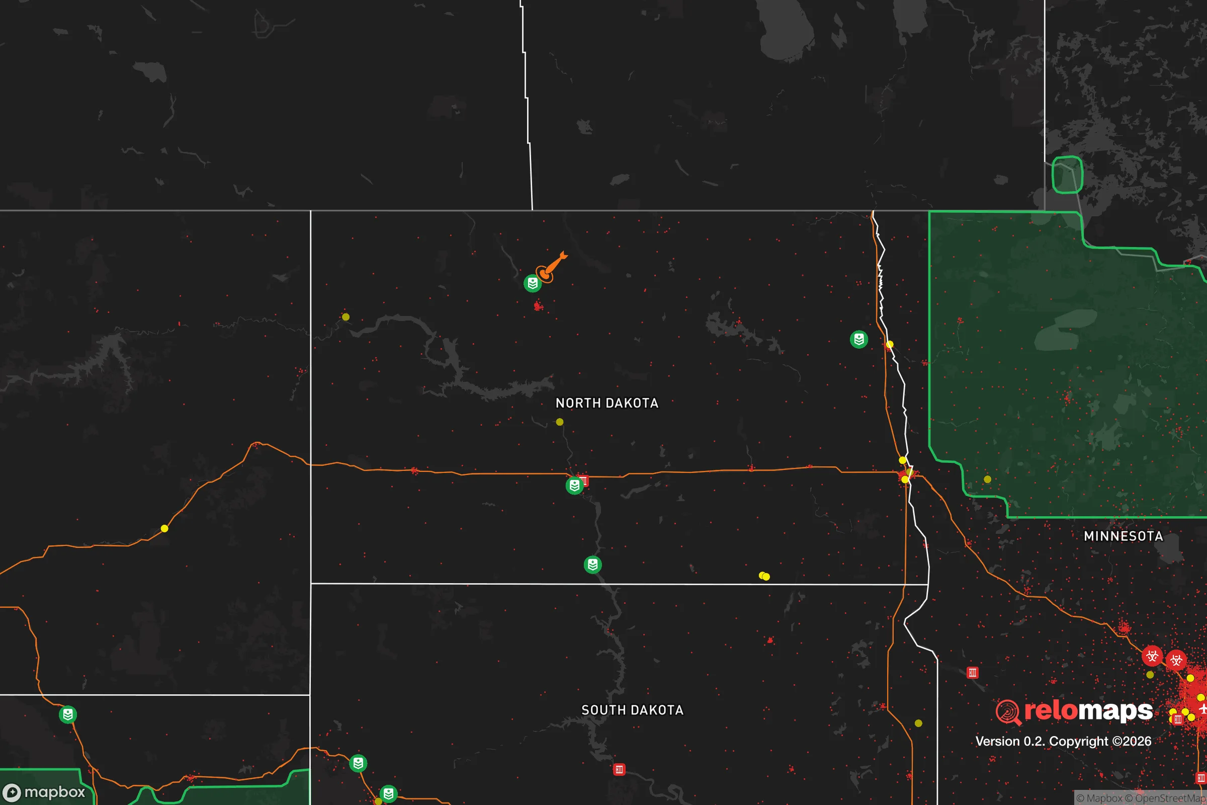
Important Note: For informational purposes only. This does not mean nothing bad ever happens in the green zones. Please use common sense. This is based on public data and modeled with AI. We tried to take a conservative approach but mistakes happen. We update this regularly as new information becomes available.
Solar Generator Recommendations
Backup power matters more here than in safer locations. We've picked three solar generators across budgets and capacity tiers — start with the budget unit if you only need a few essentials, or step up if you want to run a fridge and HVAC for days at a time.

Jackery Portable Power Station Explorer 300
Budget OptionPower on the Go: Weighing only 11 lbs, it's convenient to set up and store with book-sized foldable solar panels

BLUETTI Portable Power Station AC180
Designed for both indoor and outdoor scenarios, AC180 is highly capable as it has a robost capacity and continuous output power.

EF ECOFLOW DELTA Pro Ultra Power Station
Upgraded PickEcoFlow DELTA Pro Ultra is a whole-home energy system designed to grow with your family. Integrated with the Smart Home Panel 2, it scales to meet your evolving energy needs — keeping your home powered, intelligent, and secure through every stage of life.
We earn a commission, at no additional cost to you.
Strategic Assessment Analysis
Devils Lake, North Dakota, offers a strategic relocation option for those prioritizing resilience and self-sufficiency in an increasingly uncertain world. Its remote location in the northern plains, combined with a low population density and a deeply conservative, self-reliant culture, makes it a strong candidate for those seeking to distance themselves from the vulnerabilities of major metropolitan areas. The area's history of weathering both economic cycles and natural challenges—like the persistent lake flooding—has forged a community that is practical, resourceful, and not easily rattled by external shocks.
Geographic isolation and natural buffer zones for long-term security
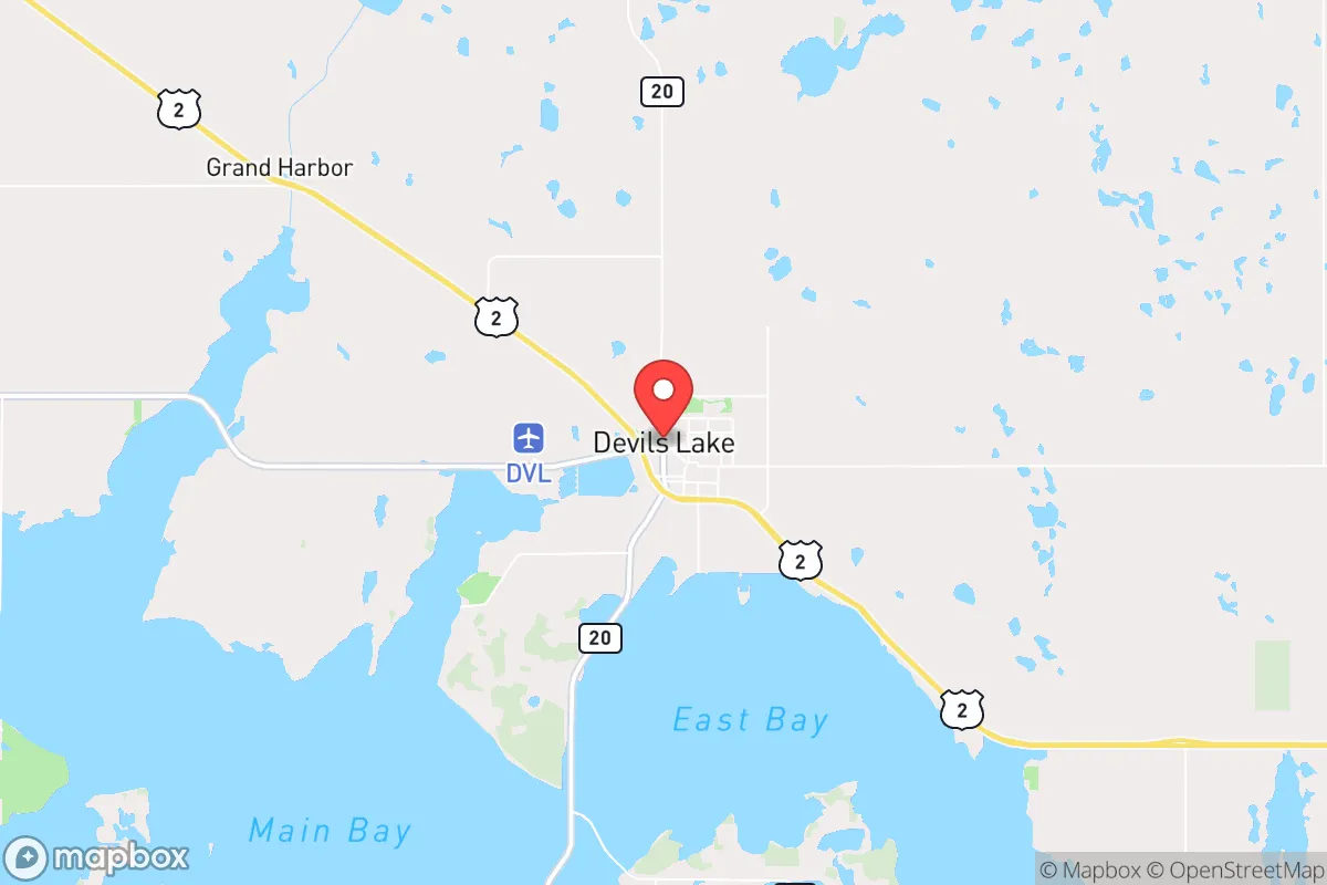
Devils Lake sits in a geographic sweet spot for preppers: it is far enough from any major population center to avoid the immediate fallout of a cascading crisis, yet it remains connected to essential supply routes via U.S. Highway 2 and North Dakota Highway 20. The nearest large city is Grand Forks, roughly 90 miles east, which itself is a modest-sized metro area. Fargo is about 150 miles southeast, and the Canadian border is less than an hour north. This isolation provides a natural buffer against the spread of civil unrest, disease outbreaks, or the chaos that often follows a major disaster in dense urban zones. The surrounding landscape is flat, open agricultural land with few natural choke points, but the sheer distance and lack of strategic targets in the region mean that Devils Lake is unlikely to be a destination for displaced populations or a target for any coordinated disruption. The area's position in the Red River Valley also offers access to some of the most productive farmland in the country, a critical asset for long-term food security.
Exposure risks, fallout proximity, and what to watch for
The primary risk in Devils Lake is not man-made but natural: the lake itself. The Devils Lake Basin has experienced dramatic flooding cycles, with water levels rising over 30 feet since the early 1990s, inundating thousands of acres and threatening infrastructure. While mitigation efforts like the Devils Lake Outlet have stabilized levels, the area remains in a long-term hydrological cycle that requires monitoring. For a prepper, this means choosing a homesite above the 1,460-foot elevation contour is non-negotiable. On the man-made risk side, the region is not near any major nuclear power plants or high-profile military installations that would be primary targets in a conflict. The closest potential fallout-relevant landmarks are the Grand Forks Air Force Base (about 90 miles east) and the Minot Air Force Base (about 130 miles west). While these are strategic assets, the prevailing winds in the region are from the west and northwest, meaning any airborne contamination from Minot would likely move eastward, away from Devils Lake. The Grand Forks base is far enough that a direct ground-zero event would not threaten the area, though a major conflict could still cause secondary disruptions to supply chains and communications. The real exposure risk is economic: the area's reliance on agriculture and energy extraction means a national economic collapse would hit hard, but the local barter economy and community networks are strong enough to provide a cushion.
Practical resilience: food, water, energy, and defensibility on the northern plains
For a relocator serious about self-sufficiency, Devils Lake delivers on the basics. Water is abundant—the lake itself is a massive freshwater source, though it is brackish and requires treatment for drinking. The area sits atop the Dakota Aquifer, and many rural properties have access to shallow wells with good yields. Food production is straightforward: the growing season is short (about 120 frost-free days), but the soil is rich glacial till, perfect for potatoes, root vegetables, and cold-hardy grains. Local farmers are accustomed to selling direct, and the Devils Lake Farmers Market is a reliable source for bulk purchases. Energy is a strong point—North Dakota is a net energy exporter, and the local grid is fed by coal, natural gas, and wind. For off-grid setups, solar works well in the summer (long daylight hours) but requires battery storage for the dark winters; small wind turbines are a practical supplement. Defensibility is a mixed bag. The open terrain offers long sightlines, making it hard for anyone to approach unseen, but it also offers little cover. A rural property with a good perimeter and a clear field of fire is ideal. The local culture is armed and self-reliant—North Dakota has some of the most permissive gun laws in the country, and the sheriff's office in Ramsey County is responsive but not overbearing. The community is small enough that strangers are noticed quickly, which acts as a natural security system. The biggest practical challenge is winter: temperatures can drop to -30°F with wind chills below -50°F. A well-insulated home with a backup heat source (wood or propane) and a four-wheel-drive vehicle with winter tires are not optional—they are survival essentials.
The overall strategic picture for Devils Lake is one of trade-offs. You trade away the convenience of urban amenities, the cultural diversity of a big city, and the economic opportunities of a growing metro for a high degree of physical security, a like-minded community of practical conservatives, and a landscape that can sustain you if the systems fail. It is not a place for everyone—the winters are brutal, the isolation can be oppressive, and the economic base is narrow. But for a relocator whose primary goal is to be out of harm's way, with access to land, water, and a community that values self-reliance over government dependency, Devils Lake is a solid, under-the-radar choice. It is not a bug-out location; it is a live-in location where you can build a life that is prepared for whatever comes next.
* Values derived from national, state, county, city and local statistics and may differ in a specific area. Last updated: 2026-04-19T08:58:25.000Z
Narrative content on this page is AI-generated and may contain mistakes. Verify any details that matter before acting on them.
ReloMaps may earn a commission from affiliate links at no extra cost to you.