Photo: Wikipedia
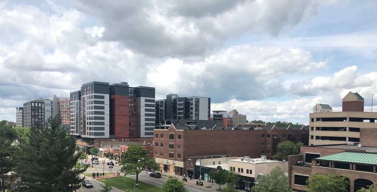
Strategic Assessment of East Lansing, MI
Meaningful friction. Expect exposure to either population pressure, blast zones, or natural disaster risk. Consider buying a retreat property.
What does the Strategic Assessment tell us?
Our Strategic Assessment grades tactical survivability of an area. Major population centers, military targets, fallout zones, natural disasters, and border exposure all drive risk — lower exposure means a more defensible position in a crisis.
This is heavily inspired by Joel Skousen's Strategic Relocation book. Highly recommended you checkout the book ($)What does this tell us?
Our Strategic Assessment grades tactical survivability of an area. Major population centers, military targets, fallout zones, natural disasters, and border exposure all drive risk — lower exposure means a more defensible position in a crisis.
This is heavily inspired by Joel Skousen's Strategic Relocation book. Highly recommended you checkout the book ($)Strategic Pillars

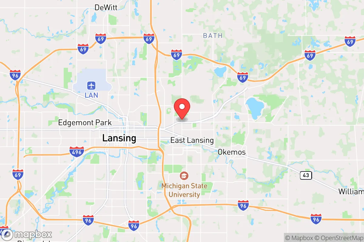
Key Distances
Regional Safe Places
Below is our recommended "safe zones" in Michigan and the surrounding area based on our strategic heuristics. For most people, it's unrealistic to live in a “safe zone” full-time due to work, family or other personal reasons. They tend to be more rural. However, many of these areas are perfect for second homes and retreat properties that double as a vacation home or even a short-term rental.


Important Note: For informational purposes only. This does not mean nothing bad ever happens in the green zones. Please use common sense. This is based on public data and modeled with AI. We tried to take a conservative approach but mistakes happen. We update this regularly as new information becomes available.
Solar Generator Recommendations
Backup power matters more here than in safer locations. We've picked three solar generators across budgets and capacity tiers — start with the budget unit if you only need a few essentials, or step up if you want to run a fridge and HVAC for days at a time.

Jackery Portable Power Station Explorer 300
Budget OptionPower on the Go: Weighing only 11 lbs, it's convenient to set up and store with book-sized foldable solar panels

BLUETTI Portable Power Station AC180
Designed for both indoor and outdoor scenarios, AC180 is highly capable as it has a robost capacity and continuous output power.

EF ECOFLOW DELTA Pro Ultra Power Station
Upgraded PickEcoFlow DELTA Pro Ultra is a whole-home energy system designed to grow with your family. Integrated with the Smart Home Panel 2, it scales to meet your evolving energy needs — keeping your home powered, intelligent, and secure through every stage of life.
We earn a commission, at no additional cost to you.
Strategic Assessment Analysis
East Lansing offers a mixed strategic picture for the conservative prepper: it sits in a region with strong natural resource buffers—the Great Lakes and abundant farmland—but its immediate proximity to a major state university and the state capital of Lansing introduces significant population-density risks and political friction points. The area’s resilience hinges on its location within Michigan’s Lower Peninsula, roughly 90 miles from Detroit and 60 miles from Lake Michigan, giving you a decent geographic cushion against coastal fallout zones while still being within a day’s drive of critical supply routes. For a relocator weighing civic unrest, mass casualty events, and long-term sustainability, East Lansing is a location that demands careful trade-off analysis—it’s not a bunker, but it’s not a dead zone either.
Geographic position and natural advantages for long-term survival
East Lansing sits in Ingham County, which is part of Michigan’s “thumb” region—a landscape defined by glacial moraines, rivers, and some of the most productive agricultural soil in the country. The area’s natural advantages start with water: the Red Cedar River runs through the city, and the nearby Grand River watershed provides surface water access, though you’ll want to treat it heavily. More importantly, the region sits atop the Saginaw-Michigan Basin aquifer, which means groundwater is generally accessible at reasonable depths (50–150 feet) for private wells—a critical factor if municipal systems fail. The climate is temperate with four distinct seasons, which supports year-round food production in greenhouses or cold frames, and the surrounding farmland grows corn, soybeans, and wheat in volume. For a prepper, the ability to tap into local agricultural networks—farmers’ markets, U-pick operations, and direct-from-farm bulk purchases—is a real advantage. The terrain is mostly flat to gently rolling, which makes it defensible in a conventional sense (no steep chokepoints) but also means you’ll need to think about line-of-sight and cover if things go kinetic. The biggest natural plus is the Great Lakes themselves: Lake Michigan and Lake Huron are both within a two-hour drive, providing a massive freshwater reserve and a potential evacuation route by water if roads become impassable. However, East Lansing itself is not on a major lake, so you’re reliant on local wells or surface water for daily needs.
Risks, exposures, and proximity to fallout-relevant landmarks
This is where the analysis gets serious. East Lansing’s biggest vulnerability is its proximity to Michigan State University (MSU), a massive public university with over 50,000 students and 11,000 faculty and staff. In a civic unrest scenario—think widespread protests, supply chain collapse, or a mass casualty event—that population density becomes a liability. MSU’s campus is a natural gathering point, and the student population is overwhelmingly left-leaning, which could create friction zones if political tensions escalate. The city itself has a population of about 48,000, but the broader Lansing-East Lansing metro area pushes 500,000 people. That’s a lot of mouths to feed if the grocery store shelves go empty. Additionally, Lansing is the state capital, which means it’s a target for any coordinated disruption—protests, infrastructure attacks, or even a targeted strike. The Michigan State Capitol building, the Governor’s residence, and state agency offices are all within a 10-minute drive of East Lansing. If you’re worried about civil unrest, you’re living next to a bullseye. On the industrial side, there are no nuclear power plants within 50 miles (the closest is Fermi 2 near Detroit, about 90 miles east), but there are chemical plants and rail lines running through the area that could be secondary hazards. The CSX and Grand Elk Railroad lines carry freight through the region, including hazardous materials—a derailment or sabotage event could contaminate local water or air. Finally, the area is not in a major earthquake or hurricane zone, but tornadoes are a real threat; Michigan averages about 15 tornadoes per year, and Ingham County has seen F2-level events. Flooding along the Red Cedar is also a periodic issue, especially in spring.
Practical resilience for a relocator: food, water, energy, and defensibility
For a single individual or family looking to set up a resilient homestead, East Lansing’s suburban character is both a help and a hindrance. Food security is the strongest point: the surrounding agricultural region means you can buy bulk grains, beans, and livestock feed directly from farms within a 20-mile radius. The East Lansing Farmers Market runs from May to October and offers local meat, eggs, and produce, but for year-round resilience, you’ll want to establish relationships with farms in nearby towns like Williamston, Mason, or Okemos. Many of these farms sell quarter or half beef, pork, and chicken shares—ideal for a deep freezer setup. Water security requires planning: if you’re in the city limits, you’re on municipal water from the Lansing Board of Water & Light, which draws from the Saginaw-Michigan Basin aquifer. That system is vulnerable to power outages and contamination. A private well is the gold standard, but most residential lots in East Lansing are too small for a well and septic system—you’d need to look at the rural fringe, like in Delhi Township or Alaiedon Township, where lot sizes are 1–5 acres. Energy resilience is middling: the grid is served by Consumers Energy and Lansing BWL, both of which have had reliability issues during ice storms and heat waves. Solar is viable—Michigan gets about 4.5 peak sun hours per day—but the tree canopy in East Lansing is dense, so rooftop solar may be shaded. A backup generator (propane or dual-fuel) is almost mandatory for any serious prepper. Defensibility is the weak link: East Lansing is a grid-pattern suburb with open neighborhoods, lots of glass, and limited natural cover. Your best bet for a defensible property is to buy on the outskirts—think a house with a basement (for tornado and security shelter), a fenced yard, and a clear line of sight to the street. The local police department is responsive but small (about 60 officers), and in a widespread event, you’re on your own. The Ingham County Sheriff’s Office covers the rural areas, but response times can be 20–30 minutes. For medical emergencies, Sparrow Hospital in Lansing is a Level 1 trauma center, but in a mass casualty event, that facility will be overwhelmed.
Overall, East Lansing is a conditional recommendation for the conservative prepper. If you’re willing to live on the rural fringe, invest in a well, solar, and a generator, and keep a low profile, the agricultural resources and water access make it a viable long-term location. But the proximity to MSU and the state capital means you’re living next to two major flashpoints for civil unrest. The area’s political climate is heavily blue—Ingham County voted +28 for Biden in 2020—so you’ll be a cultural minority, which can be a security concern if things turn ugly. For a single individual who can stay mobile and maintain a low profile, it’s workable. For a family with kids, the school system (East Lansing Public Schools) is good academically, but the social environment is left-leaning, which may clash with conservative values. The strategic bottom line: East Lansing offers strong natural buffers and food security, but the human geography—dense, politically charged, and target-rich—makes it a location you’ll need to harden significantly. If you’re looking for a place to ride out the storm, this isn’t a bunker; it’s a base camp that requires constant vigilance.
* Values derived from national, state, county, city and local statistics and may differ in a specific area. Last updated: 2026-05-03T06:45:08.000Z
Narrative content on this page is AI-generated and may contain mistakes. Verify any details that matter before acting on them.
ReloMaps may earn a commission from affiliate links at no extra cost to you.