Photo: Wikipedia
Strategic Assessment of Eastport, ME
Meaningful friction. Expect exposure to either population pressure, blast zones, or natural disaster risk. Consider buying a retreat property.
What does the Strategic Assessment tell us?
Our Strategic Assessment grades tactical survivability of an area. Major population centers, military targets, fallout zones, natural disasters, and border exposure all drive risk — lower exposure means a more defensible position in a crisis.
This is heavily inspired by Joel Skousen's Strategic Relocation book. Highly recommended you checkout the book ($)What does this tell us?
Our Strategic Assessment grades tactical survivability of an area. Major population centers, military targets, fallout zones, natural disasters, and border exposure all drive risk — lower exposure means a more defensible position in a crisis.
This is heavily inspired by Joel Skousen's Strategic Relocation book. Highly recommended you checkout the book ($)Strategic Pillars

Key Distances
Regional Safe Places
Below is our recommended "safe zones" in Maine and the surrounding area based on our strategic heuristics. For most people, it's unrealistic to live in a “safe zone” full-time due to work, family or other personal reasons. They tend to be more rural. However, many of these areas are perfect for second homes and retreat properties that double as a vacation home or even a short-term rental.


Important Note: For informational purposes only. This does not mean nothing bad ever happens in the green zones. Please use common sense. This is based on public data and modeled with AI. We tried to take a conservative approach but mistakes happen. We update this regularly as new information becomes available.
Solar Generator Recommendations
Backup power matters more here than in safer locations. We've picked three solar generators across budgets and capacity tiers — start with the budget unit if you only need a few essentials, or step up if you want to run a fridge and HVAC for days at a time.

Jackery Portable Power Station Explorer 300
Budget OptionPower on the Go: Weighing only 11 lbs, it's convenient to set up and store with book-sized foldable solar panels

BLUETTI Portable Power Station AC180
Designed for both indoor and outdoor scenarios, AC180 is highly capable as it has a robost capacity and continuous output power.

EF ECOFLOW DELTA Pro Ultra Power Station
Upgraded PickEcoFlow DELTA Pro Ultra is a whole-home energy system designed to grow with your family. Integrated with the Smart Home Panel 2, it scales to meet your evolving energy needs — keeping your home powered, intelligent, and secure through every stage of life.
We earn a commission, at no additional cost to you.
Strategic Assessment Analysis
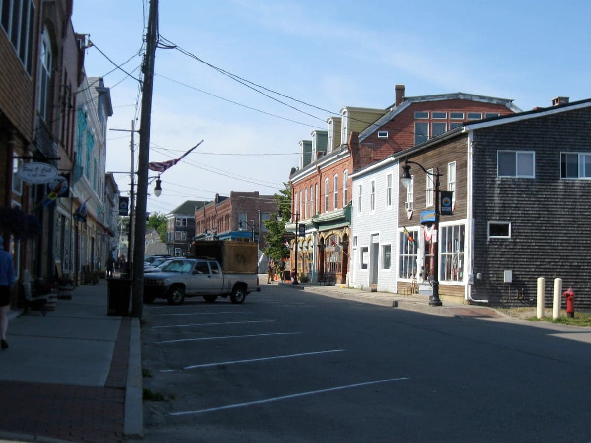
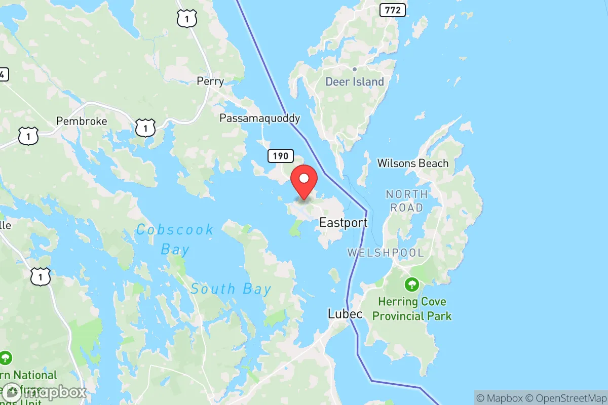
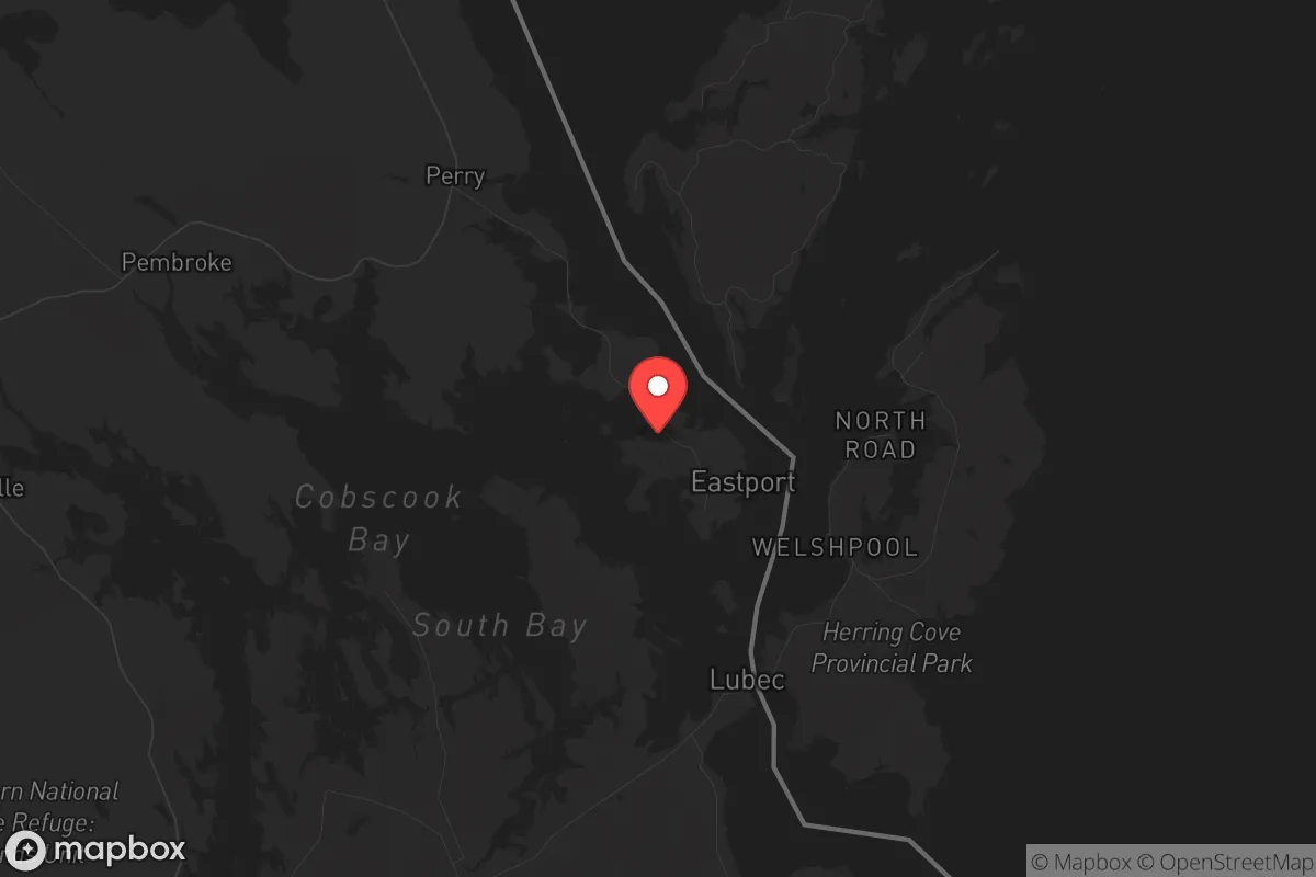
Eastport, Maine, presents a unique strategic proposition for those prioritizing resilience and self-sufficiency in an increasingly uncertain world. As the easternmost city in the United States, its geographic isolation from major population centers and critical infrastructure offers a significant buffer against the cascading effects of civic unrest, grid collapse, or mass casualty events. While no location is without risk, Eastport’s combination of natural resources, limited access points, and distance from primary fallout targets makes it a serious candidate for a long-term relocation strategy, provided you understand its specific vulnerabilities and plan accordingly.
Geographic position and natural advantages for long-term security
Eastport sits on Moose Island in Passamaquoddy Bay, connected to the mainland by a single causeway—the only road in and out. This chokepoint is a double-edged sword, but from a defensive standpoint, it offers an inherent layer of security that few towns can match. In a scenario of widespread civil disorder, controlling that single point of entry becomes a manageable task for a prepared community. The surrounding waters of the Bay of Fundy, with the world’s highest tides, create a dynamic maritime environment that discourages casual approach by water and provides a natural barrier against ground-based threats.
The area’s natural advantages extend beyond defensibility. Eastport sits adjacent to the Quoddy Head State Park and the Cobscook Bay region, a vast network of forested coastline and tidal estuaries. This provides immediate access to timber for fuel and construction, abundant marine life including lobster, scallops, and groundfish, and a climate that supports cold-weather survival skills. The region’s low population density—Washington County has roughly 31,000 people spread over 2,500 square miles—means that in a crisis, competition for resources would be far less intense than in suburban or urban environments. For a relocator, the ability to hunt, fish, and forage within walking distance of a defensible home base is a tangible asset that cannot be overstated.
Risks, exposures, and proximity to fallout-relevant landmarks
No strategic assessment is complete without a clear-eyed look at the threats. Eastport’s primary risk is its proximity to the Canadian border—specifically, the city of Saint John, New Brunswick, roughly 70 miles to the northeast. Saint John is home to the Point Lepreau Nuclear Generating Station, a CANDU reactor that, while generally well-regarded, represents a potential radiological hazard in the event of a catastrophic failure or targeted attack. Prevailing winds in the region are typically from the west and northwest, which would carry fallout toward the Gulf of Maine rather than directly over Eastport, but a shift in weather patterns could change that calculus. A prudent prepper would factor in a 50-mile evacuation or shelter-in-place radius for any nuclear incident.
Another concern is the region’s economic and logistical dependence on a single bridge and causeway. A deliberate act of sabotage, a major storm event, or a simple accident could sever Eastport’s connection to the mainland for days or weeks. The town’s population of roughly 1,200 means it lacks the redundant infrastructure of a larger city. Additionally, while Eastport is far from major military or government targets—no ICBM silos, no major defense contractors, no major ports of entry for the U.S. military—it is within 100 miles of the Loring Air Force Base (now a commercial and industrial park) and the Portsmouth Naval Shipyard in Kittery, Maine. These are not primary targets in a full-scale exchange, but they are not zero-risk either. The broader region’s reliance on tourism and fishing also means that a prolonged economic disruption would hit hard, making self-sufficiency not just a preference but a necessity.
Practical resilience for a relocator: food, water, energy, and defensibility
For a relocator serious about long-term survival, Eastport offers several concrete advantages. Water is abundant—the region receives roughly 45 inches of rainfall annually, and numerous freshwater streams and ponds dot the island and mainland. A simple rainwater catchment system or a hand-pump well on a property would provide a reliable supply, unlike arid regions where water is the first crisis. Food production is viable but requires adaptation. The growing season is short (roughly 120 frost-free days), and the soil is rocky and acidic. However, raised beds, cold frames, and a focus on cold-hardy crops like potatoes, kale, and root vegetables can yield a meaningful harvest. The real food security lies in the sea: the Passamaquoddy Bay is one of the most productive marine ecosystems on the East Coast. A family with a small boat, a few lobster traps, and knowledge of clam flats can put protein on the table year-round.
Energy independence is achievable but requires upfront investment. The region is off the natural gas grid, and heating oil is the primary fuel for most homes. A wood stove or a modern pellet boiler is essential—firewood is plentiful on the mainland, but you’ll need a chainsaw, a truck, and the physical capacity to process it. Solar panels are viable, though the region’s frequent cloud cover (especially from November to March) means you’ll need battery storage and a backup generator. Wind is a strong secondary option; the coastal winds are consistent, and small-scale turbines can supplement solar during the dark months. Defensibility is the standout feature. The single causeway, combined with the island’s rugged shoreline, means that a small, organized group could effectively control access. The town’s layout—a compact downtown with residential areas on the periphery—allows for a perimeter that can be monitored. The local population is small and tight-knit, which reduces the risk of internal chaos but also means that newcomers must invest time in building trust and relationships to be part of any mutual-aid network.
The overall strategic picture for a conservative relocator
Eastport is not a bug-out location for a weekend; it is a long-term relocation for those willing to trade convenience for security. The trade-offs are real: limited medical facilities (the nearest hospital is in Calais, 25 miles away), harsh winters with heavy snow and ice, and a local economy that offers few high-paying jobs. For a conservative-leaning individual or family who values self-reliance, community cohesion, and distance from the chaos of urban centers, these are acceptable costs. The area’s political culture leans independent and libertarian—Maine’s Second Congressional District is one of the few rural districts that consistently votes against federal overreach, and the local population is skeptical of outside interference. This aligns well with a prepper mindset that prioritizes local control and mutual aid over government dependency.
In a worst-case scenario—a major economic collapse, a pandemic, or a breakdown of civil order—Eastport’s isolation becomes its greatest asset. It is far enough from the major fallout zones of Boston, New York, and Washington D.C. to avoid the immediate shockwaves of a mass casualty event. Its natural resources, defensible geography, and small, self-reliant population make it one of the few places in the eastern United States where a prepared individual could realistically maintain a sustainable, independent existence. The key is to arrive before the crisis, build relationships, and invest in the infrastructure—wood heat, water storage, food production, and community ties—that will make the difference when the grid goes dark. Eastport is not a paradise; it is a strategic outpost. For those who understand the difference, it is worth a serious look.
* Values derived from national, state, county, city and local statistics and may differ in a specific area. Last updated: 2026-05-01T17:31:35.000Z
Narrative content on this page is AI-generated and may contain mistakes. Verify any details that matter before acting on them.
ReloMaps may earn a commission from affiliate links at no extra cost to you.