
Photo: Wikipedia
Strategic Assessment of Edmond, OK
Meaningful friction. Expect exposure to either population pressure, blast zones, or natural disaster risk. Consider buying a retreat property.
What does the Strategic Assessment tell us?
Our Strategic Assessment grades tactical survivability of an area. Major population centers, military targets, fallout zones, natural disasters, and border exposure all drive risk — lower exposure means a more defensible position in a crisis.
This is heavily inspired by Joel Skousen's Strategic Relocation book. Highly recommended you checkout the book ($)What does this tell us?
Our Strategic Assessment grades tactical survivability of an area. Major population centers, military targets, fallout zones, natural disasters, and border exposure all drive risk — lower exposure means a more defensible position in a crisis.
This is heavily inspired by Joel Skousen's Strategic Relocation book. Highly recommended you checkout the book ($)Strategic Pillars

Key Distances
Regional Safe Places
Below is our recommended "safe zones" in Oklahoma and the surrounding area based on our strategic heuristics. For most people, it's unrealistic to live in a “safe zone” full-time due to work, family or other personal reasons. They tend to be more rural. However, many of these areas are perfect for second homes and retreat properties that double as a vacation home or even a short-term rental.
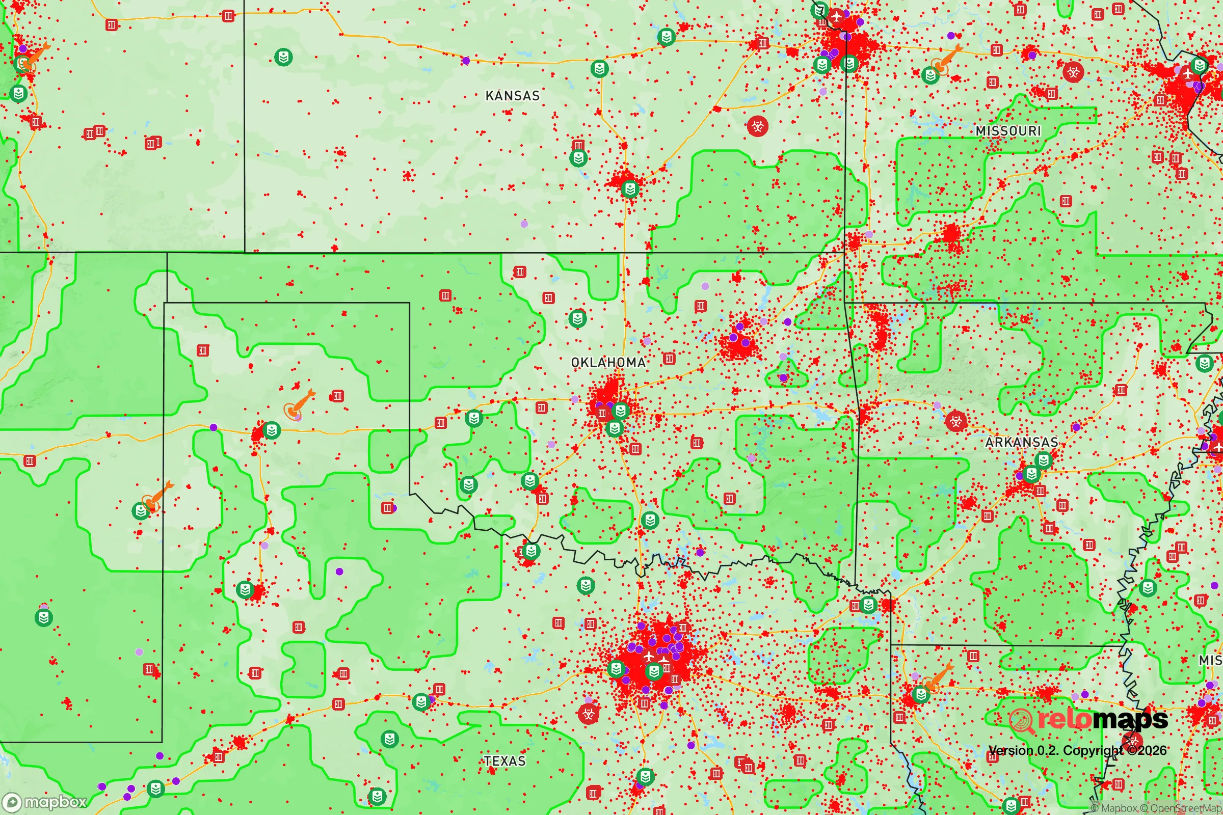
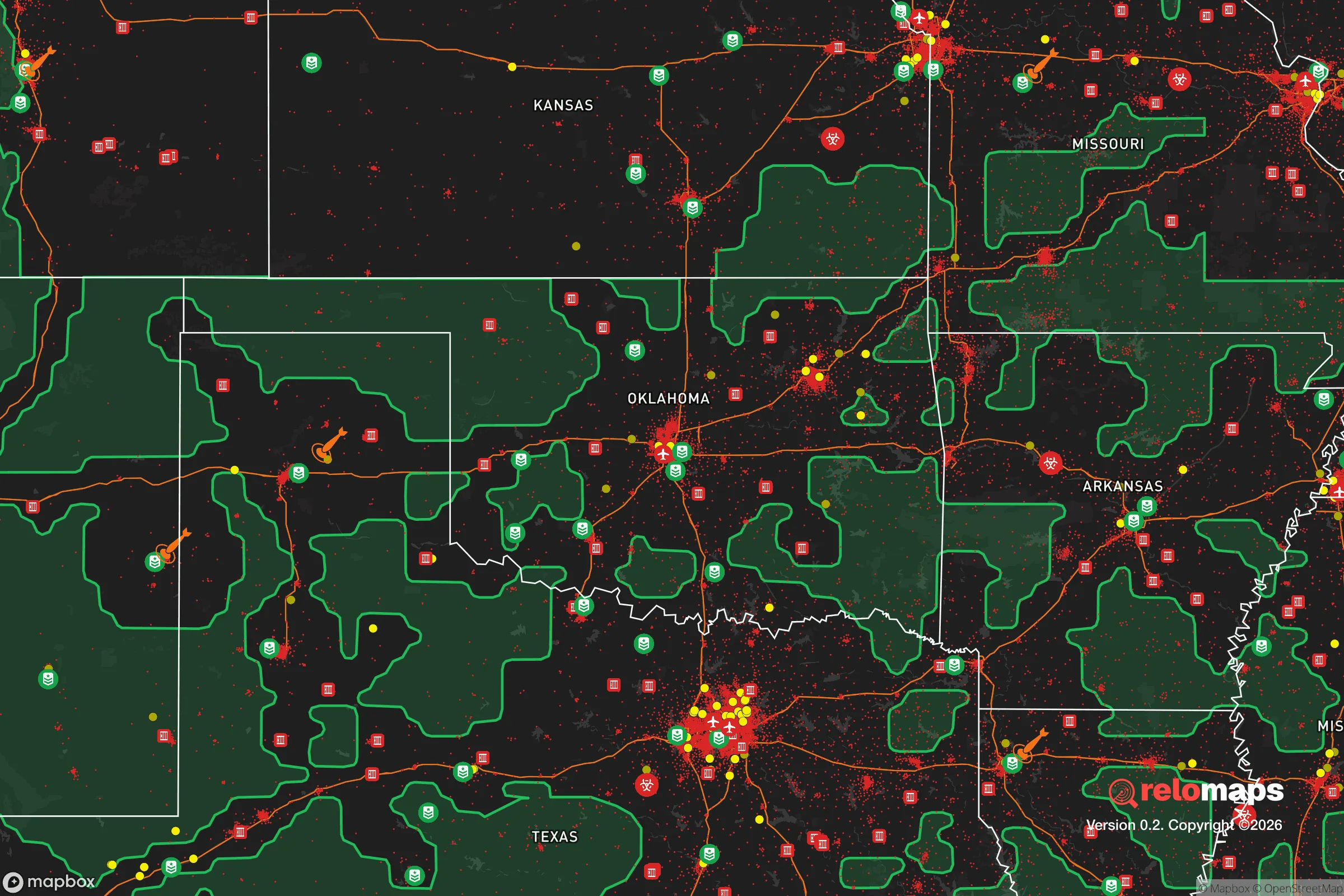
Important Note: For informational purposes only. This does not mean nothing bad ever happens in the green zones. Please use common sense. This is based on public data and modeled with AI. We tried to take a conservative approach but mistakes happen. We update this regularly as new information becomes available.
Solar Generator Recommendations
Backup power matters more here than in safer locations. We've picked three solar generators across budgets and capacity tiers — start with the budget unit if you only need a few essentials, or step up if you want to run a fridge and HVAC for days at a time.

Jackery Portable Power Station Explorer 300
Budget OptionPower on the Go: Weighing only 11 lbs, it's convenient to set up and store with book-sized foldable solar panels

BLUETTI Portable Power Station AC180
Designed for both indoor and outdoor scenarios, AC180 is highly capable as it has a robost capacity and continuous output power.

EF ECOFLOW DELTA Pro Ultra Power Station
Upgraded PickEcoFlow DELTA Pro Ultra is a whole-home energy system designed to grow with your family. Integrated with the Smart Home Panel 2, it scales to meet your evolving energy needs — keeping your home powered, intelligent, and secure through every stage of life.
We earn a commission, at no additional cost to you.
Strategic Assessment Analysis
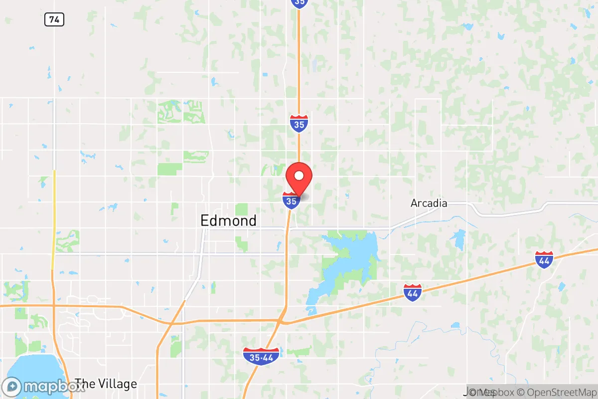
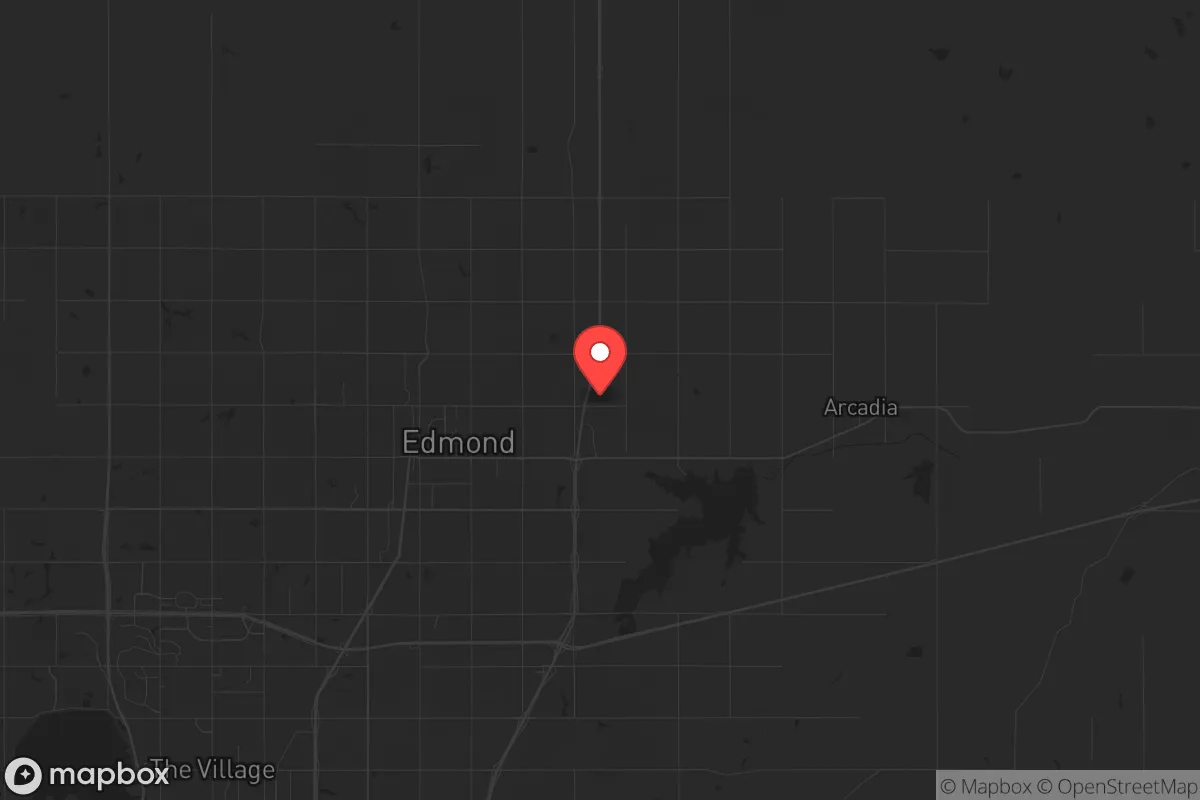
Edmond, Oklahoma, sits in a strategic sweet spot that resilience-minded relocators should take seriously: close enough to Oklahoma City for infrastructure and employment, yet far enough north to offer genuine buffer from the worst-case urban collapse scenarios. The city’s position along the I-35 corridor gives it both advantages and liabilities, but for a conservative-leaning individual or family prioritizing self-sufficiency and security, Edmond’s combination of strong local governance, relatively low crime, and access to rural escape routes makes it a defensible base of operations. The key is understanding where the real risks lie and whether the trade-offs align with your preparedness goals.
Geographic position and natural advantages for long-term security
Edmond sits at the northern edge of the Oklahoma City metro, roughly 15 miles from downtown OKC but with a distinct suburban-rural interface that hardens its strategic value. The city is built on relatively flat terrain with good drainage, which reduces flood risk compared to areas closer to the Canadian River. More importantly, Edmond’s northern and eastern boundaries quickly give way to open farmland and small towns like Guthrie and Stillwater — terrain that offers multiple overland escape routes if I-35 becomes a chokepoint during civil unrest or a mass evacuation event. The area’s aquifer, the Garber-Wellington, provides a reliable groundwater source that many residents tap via private wells, a critical advantage if municipal water systems are compromised. Winters are cold enough to discourage prolonged grid-down scenarios but not severe enough to make off-grid heating impossible; summers are hot but manageable with passive cooling strategies. For a prepper, the natural advantages here are modest but real: no hurricane storm surge, no wildfire corridors, no seismic risk, and a climate that supports year-round gardening with proper planning.
Risks, exposures, and proximity to fallout-relevant landmarks
The most significant risk for Edmond relocators is its proximity to Tinker Air Force Base, roughly 25 miles south-southeast. Tinker is a major strategic asset for the U.S. military, housing the Air Force Sustainment Center and the 552nd Air Control Wing. In a conflict scenario involving strategic strikes, Tinker is a high-priority target. Edmond sits outside the most likely blast and thermal zones for a ground burst at Tinker, but fallout patterns depend on wind direction — prevailing winds from the south would carry contamination northward, directly over Edmond. The city is also within 30 miles of the Oklahoma City federal complex, including the Murrah Building site and multiple federal offices, which could be focal points for civil unrest or secondary attacks. On the plus side, Edmond has no nuclear power plants within 100 miles, no major chemical storage facilities, and no large-scale refineries. The primary exposure is military-target related, not industrial. For a survivalist, this means Edmond is a viable option only if you have a plan for the first 72 hours post-event — either sheltering in place with adequate filtration or executing a pre-planned northern evacuation route toward Kansas or the Ozarks.
Practical resilience for a relocator: food, water, energy, and defensibility
Edmond’s residential zoning is predominantly single-family homes on lots ranging from a quarter-acre to several acres, especially in the northern parts of the city near Arcadia and the Turner Turnpike. This lot size allows for substantial gardening, rainwater catchment, and even small livestock in many areas — though city ordinances restrict chickens and goats within most subdivisions, so check HOA rules carefully. Water resilience is above average: the city’s water comes from Lake Arcadia and the Garber-Wellington aquifer, and many older homes have private wells that can be reactivated. For energy, Edmond Electric is a municipal utility with a good reliability record, but grid-down scenarios are a real concern. Solar panels with battery storage are increasingly common, and the city’s building codes do not prohibit off-grid setups. Natural gas is widely available for heating and cooking, which is a plus for those who want to avoid propane dependency. Defensibility is mixed: Edmond’s street grid is mostly suburban cul-de-sacs and arterials, which can be easily blocked or monitored by a determined group. However, the city’s low overall crime rate (violent crime is roughly 60% below the national average) means that in a slow-burn collapse scenario, neighbors are more likely to cooperate than compete. The biggest practical weakness is food supply — Edmond has no major agricultural processing within the city limits, and grocery stores rely on just-in-time delivery. A serious prepper will need to establish relationships with local farmers in Logan and Payne counties to the north, or invest in substantial long-term storage.
The overall strategic picture for Edmond is one of calculated trade-offs. It is not a remote redoubt — you are 20 minutes from a major metro area and 30 minutes from a high-value military target. But for a conservative relocator who wants to maintain professional employment, access to good schools, and a community that leans heavily Republican (Edmond voted roughly 65% for Trump in 2020), while still having a realistic plan for civil unrest or a mass casualty event, Edmond offers a workable middle ground. The key is to treat it as a base camp, not a fortress: invest in a well, solar backup, a reliable vehicle with a full tank, and a bug-out route that heads north before the I-35 corridor locks up. If you are willing to accept that no suburban location is truly safe from the fallout of a collapsing empire, Edmond gives you the tools to ride out the storm — provided you have the discipline to prepare before the headlines turn ugly.
* Values derived from national, state, county, city and local statistics and may differ in a specific area. Last updated: 2026-04-25T13:48:55.000Z
Narrative content on this page is AI-generated and may contain mistakes. Verify any details that matter before acting on them.
ReloMaps may earn a commission from affiliate links at no extra cost to you.