
Photo: Wikipedia
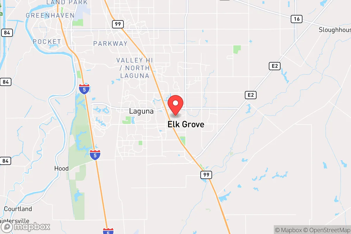
Strategic Assessment of Elk Grove, CA
Multiple tactical vulnerabilities. Population density, target proximity, or disaster risk are likely compounding. A retreat property and exit planning is required.
What does the Strategic Assessment tell us?
Our Strategic Assessment grades tactical survivability of an area. Major population centers, military targets, fallout zones, natural disasters, and border exposure all drive risk — lower exposure means a more defensible position in a crisis.
This is heavily inspired by Joel Skousen's Strategic Relocation book. Highly recommended you checkout the book ($)What does this tell us?
Our Strategic Assessment grades tactical survivability of an area. Major population centers, military targets, fallout zones, natural disasters, and border exposure all drive risk — lower exposure means a more defensible position in a crisis.
This is heavily inspired by Joel Skousen's Strategic Relocation book. Highly recommended you checkout the book ($)Strategic Pillars

Key Distances
Regional Safe Places
Below is our recommended "safe zones" in California and the surrounding area based on our strategic heuristics. For most people, it's unrealistic to live in a “safe zone” full-time due to work, family or other personal reasons. They tend to be more rural. However, many of these areas are perfect for second homes and retreat properties that double as a vacation home or even a short-term rental.


Important Note: For informational purposes only. This does not mean nothing bad ever happens in the green zones. Please use common sense. This is based on public data and modeled with AI. We tried to take a conservative approach but mistakes happen. We update this regularly as new information becomes available.
Solar Generator Recommendations
Backup power matters more here than in safer locations. We've picked three solar generators across budgets and capacity tiers — start with the budget unit if you only need a few essentials, or step up if you want to run a fridge and HVAC for days at a time.

Jackery Portable Power Station Explorer 300
Budget OptionPower on the Go: Weighing only 11 lbs, it's convenient to set up and store with book-sized foldable solar panels

BLUETTI Portable Power Station AC180
Designed for both indoor and outdoor scenarios, AC180 is highly capable as it has a robost capacity and continuous output power.

EF ECOFLOW DELTA Pro Ultra Power Station
Upgraded PickEcoFlow DELTA Pro Ultra is a whole-home energy system designed to grow with your family. Integrated with the Smart Home Panel 2, it scales to meet your evolving energy needs — keeping your home powered, intelligent, and secure through every stage of life.
We earn a commission, at no additional cost to you.
Strategic Assessment Analysis
Elk Grove, California, presents a complex strategic picture for the conservative-leaning prepper or survivalist. On the surface, it’s a sprawling Sacramento suburb with solid infrastructure and a growing tax base, but its location within the volatile Central Valley and proximity to major state and federal targets introduces significant risk. The city’s resilience is a double-edged sword: it benefits from agricultural abundance and water access, yet it sits within a region that could become a primary chokepoint during a major crisis. For a relocator seeking long-term security, Elk Grove demands a clear-eyed assessment of its natural advantages versus its exposure to fallout from both natural disasters and man-made events.
Geographic position and natural advantages for long-term survival
Elk Grove’s geographic position offers a few genuine strategic assets. It sits at the southern edge of the Sacramento metropolitan area, roughly 15 miles south of the state capital, placing it in a zone that is neither deep urban nor fully rural. The city is flanked by the Cosumnes River to the south and the Sacramento River to the west, providing surface water sources that are critical for independent water collection and small-scale agriculture. The surrounding Sacramento-San Joaquin Delta is one of the most fertile agricultural regions in the world, meaning that even in a disrupted supply chain scenario, local food production capacity is high. The area’s Mediterranean climate—hot, dry summers and mild, wet winters—supports year-round gardening and livestock grazing, a major plus for a self-reliant household. Additionally, Elk Grove’s elevation is low (around 40 feet), but it avoids the floodplain of the Sacramento River proper, reducing the risk of catastrophic inundation compared to nearby communities like West Sacramento or Rio Linda. For a prepper, the ability to tap into local water, grow food, and maintain moderate temperatures without extreme cold or heat is a tangible advantage.
Risks, exposures, and proximity to fallout-relevant landmarks
The downsides are significant and cannot be glossed over. Elk Grove’s proximity to Sacramento—a major state government hub, transportation corridor, and potential target for civil unrest or infrastructure attack—is a primary concern. In a scenario involving mass casualty events, civil unrest, or a coordinated attack on government centers, Elk Grove lies directly in the path of any evacuation or chaos radiating from the capital. Interstate 5 and Highway 99, both major north-south arteries, run through or near the city, making them natural chokepoints for movement and potential targets for disruption. The city is also within 100 miles of Travis Air Force Base (a major military logistics hub) and the Port of Sacramento, both of which could become focal points during a national emergency. Furthermore, Elk Grove sits in the seismically active Central Valley; while not on a major fault line, the region is susceptible to strong shaking from earthquakes on the San Andreas or Hayward faults, which could damage infrastructure and disrupt supply chains. The area’s reliance on the Delta levees for water delivery is another vulnerability—a major earthquake or sabotage could cut off the state’s water supply, impacting Elk Grove directly. For a survivalist, the concentration of government, military, and transportation assets within a 50-mile radius creates a high-probability zone for secondary effects like refugee flows, resource scarcity, and law enforcement overreach.
Practical resilience for a relocator: food, water, energy, and defensibility
On the practical side, Elk Grove offers a mixed bag for a relocator building a resilient homestead. Water access is the strongest point: the Cosumnes River and local groundwater are viable for well drilling, though permits and costs vary. Many newer subdivisions rely on municipal water from the Sacramento County Water Agency, which is vulnerable to system failure, but older neighborhoods and rural pockets have private wells. Food production is feasible—the soil is rich, and the growing season is long (March through November), allowing for substantial vegetable gardens, fruit trees, and even small livestock like chickens or goats, provided zoning allows. The city’s agricultural roots mean that local farmers’ markets and bulk food suppliers are available, reducing dependence on long-distance supply chains. Energy independence is more challenging. The grid is reliable in normal times but is part of the larger California power system, which has faced rolling blackouts during heat waves and wildfire risk. Solar panels are a viable option, with net metering available, but battery storage is essential for off-grid capability. Natural gas is common for heating and cooking, but a propane backup system is advisable. Defensibility is the weakest link. Elk Grove is a sprawling, low-density suburb with many cul-de-sacs and open spaces, but it lacks natural defensive terrain like hills or forests. The city’s layout—grid-like streets with multiple entry points—makes it difficult to secure a perimeter. A relocator would need to prioritize a property on a dead-end road, near a greenbelt, or with a large lot that allows for fencing and setback. The local law enforcement presence is adequate for routine matters, but during a widespread crisis, response times would likely stretch thin. For a family, the schools are decent (Elk Grove Unified School District is one of the largest in the state), and the community is generally family-oriented, which can be a social asset for mutual aid networks.
The overall strategic picture for Elk Grove is one of calculated risk. It offers genuine survival advantages—water, fertile land, a moderate climate, and a relatively stable suburban environment—that make it a viable base for a prepared individual or family. However, its location within the Sacramento orbit and the broader California infrastructure network introduces exposure to the very events a prepper seeks to avoid: civil unrest, government overreach, and cascading infrastructure failures. For a conservative relocator who values self-reliance and community but is willing to accept some proximity to urban risks in exchange for agricultural potential, Elk Grove is a reasonable middle-ground option. It is not a remote bug-out location, but it can be made to work with the right property, a solid water and energy plan, and a network of like-minded neighbors. The key is to treat Elk Grove as a base of operations, not a fortress—and to have a secondary plan for relocation if the situation deteriorates beyond the local capacity to cope.
* Values derived from national, state, county, city and local statistics and may differ in a specific area. Last updated: 2026-04-24T15:51:10.000Z
Narrative content on this page is AI-generated and may contain mistakes. Verify any details that matter before acting on them.
ReloMaps may earn a commission from affiliate links at no extra cost to you.