
Photo: Wikipedia
Strategic Assessment of Enosburg Falls, VT
Meaningful friction. Expect exposure to either population pressure, blast zones, or natural disaster risk. Consider buying a retreat property.
What does the Strategic Assessment tell us?
Our Strategic Assessment grades tactical survivability of an area. Major population centers, military targets, fallout zones, natural disasters, and border exposure all drive risk — lower exposure means a more defensible position in a crisis.
This is heavily inspired by Joel Skousen's Strategic Relocation book. Highly recommended you checkout the book ($)What does this tell us?
Our Strategic Assessment grades tactical survivability of an area. Major population centers, military targets, fallout zones, natural disasters, and border exposure all drive risk — lower exposure means a more defensible position in a crisis.
This is heavily inspired by Joel Skousen's Strategic Relocation book. Highly recommended you checkout the book ($)Strategic Pillars

Key Distances
Regional Safe Places
Below is our recommended "safe zones" in Vermont and the surrounding area based on our strategic heuristics. For most people, it's unrealistic to live in a “safe zone” full-time due to work, family or other personal reasons. They tend to be more rural. However, many of these areas are perfect for second homes and retreat properties that double as a vacation home or even a short-term rental.


Important Note: For informational purposes only. This does not mean nothing bad ever happens in the green zones. Please use common sense. This is based on public data and modeled with AI. We tried to take a conservative approach but mistakes happen. We update this regularly as new information becomes available.
Solar Generator Recommendations
Backup power matters more here than in safer locations. We've picked three solar generators across budgets and capacity tiers — start with the budget unit if you only need a few essentials, or step up if you want to run a fridge and HVAC for days at a time.

Jackery Portable Power Station Explorer 300
Budget OptionPower on the Go: Weighing only 11 lbs, it's convenient to set up and store with book-sized foldable solar panels

BLUETTI Portable Power Station AC180
Designed for both indoor and outdoor scenarios, AC180 is highly capable as it has a robost capacity and continuous output power.

EF ECOFLOW DELTA Pro Ultra Power Station
Upgraded PickEcoFlow DELTA Pro Ultra is a whole-home energy system designed to grow with your family. Integrated with the Smart Home Panel 2, it scales to meet your evolving energy needs — keeping your home powered, intelligent, and secure through every stage of life.
We earn a commission, at no additional cost to you.
Strategic Assessment Analysis
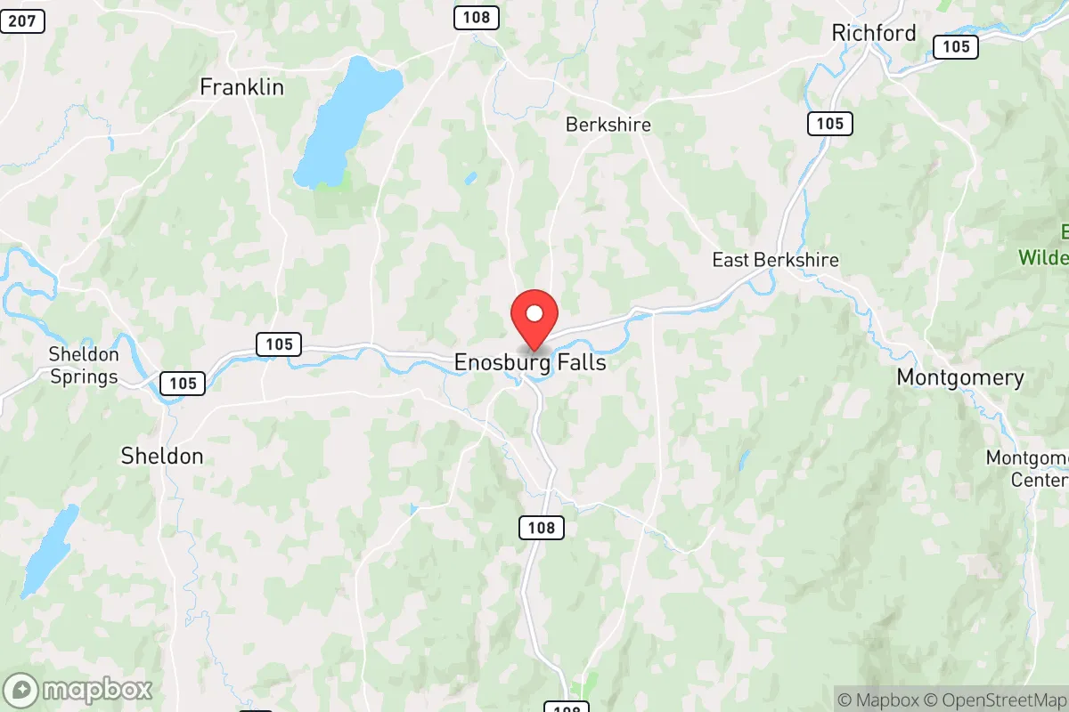
Enosburg Falls, Vermont, offers a strategic resilience profile that stands apart from the typical New England relocation target, largely because it sits in a quiet corner of the state that most people overlook. Located in Franklin County, roughly 15 miles from the Canadian border and 40 miles from Burlington, this village of about 1,400 people benefits from being far enough from major population centers to avoid the immediate chaos of a collapse event, yet close enough to access critical resources if planned correctly. The area’s low population density, agricultural base, and distance from high-value targets like military installations or major infrastructure hubs make it a defensible fallback position for those prioritizing self-sufficiency and long-term survival over convenience.
Geographic position and natural advantages for long-term security
Enosburg Falls sits in the Missisquoi River valley, surrounded by the Green Mountains to the east and the Lake Champlain basin to the west, creating a natural buffer zone that limits easy access from multiple directions. The village itself is tucked away from major interstate highways—I-89 is about 30 miles southeast, and the nearest four-lane road is US Route 7, which runs north-south through the Champlain Valley. This isolation is a double-edged sword: it makes the area harder to reach for looters or refugees fleeing urban centers, but it also means supply chains will be among the first to fail in a crisis. The surrounding terrain is a mix of rolling hills, hardwood forests, and dairy farmland, providing ample cover, firewood, and potential for off-grid living. The Missisquoi River itself is a reliable water source, though it’s not large enough to attract industrial traffic or military interest. The Canadian border, just a short drive north, offers an escape route if things go truly sideways, but it also means you’re within a few hours of Montreal—a city of 4.3 million that could become a source of instability if civil unrest spreads north. The key advantage here is that Enosburg Falls is not on any obvious path of retreat or attack; it’s a backwater in the best sense of the word.
Risks, exposures, and proximity to fallout-relevant landmarks
No location is without vulnerabilities, and Enosburg Falls has a few that a serious prepper needs to weigh. The most immediate concern is the proximity to the Vermont Yankee nuclear plant in Vernon, about 120 miles south—well outside the immediate blast zone, but within the fallout plume radius for a major accident or attack. More pressing is the Plattsburgh Air Force Base, now a civilian airport, but still a potential target for any adversary looking to disrupt the Northeast’s air defense network; it’s about 35 miles west across Lake Champlain. The lake itself is a strategic chokepoint—if the bridges or ferries are compromised, movement between Vermont and New York becomes difficult, which could trap residents or cut off escape routes. The village also sits within 50 miles of the Highgate Springs border crossing, a major port of entry that could become a flashpoint during a national emergency. On the positive side, there are no major military bases, nuclear silos, or chemical plants within a 30-mile radius, and the nearest large city—Burlington—is small enough (population 45,000) that it wouldn’t generate the kind of mass exodus you’d see from Boston or New York. The real risk is less about direct attack and more about being caught in the ripple effects of a broader collapse: food shortages, fuel disruptions, and the slow bleed of law and order as rural resources get strained by urban refugees.
Practical resilience for a relocator: food, water, energy, and defensibility
For someone serious about self-reliance, Enosburg Falls offers a strong baseline, but it requires work. The agricultural land is fertile and well-watered, with over 30 dairy farms in Franklin County alone, meaning local food production is already established. The growing season is short—about 120 days—but the soil is good for root vegetables, hay, and pasture. Water is abundant: the Missisquoi River runs through town, and most properties have access to wells or springs, though you’ll want to test for agricultural runoff from nearby farms. Energy is a mixed bag. The grid is rural and prone to outages from winter storms, but that also means locals are accustomed to backup generators and wood heat. Solar potential is decent—Vermont gets about 4.5 peak sun hours per day in summer—but winter cloud cover and snow accumulation can cut production by half. Wood is the most reliable fuel source; the surrounding forests are thick with maple, birch, and oak, and a cord of seasoned firewood runs about $300 if you don’t want to cut your own. Defensibility is where this location shines. The village is compact, with a single main road (VT-108) running through it, and the surrounding hills provide natural observation points. The nearest police station is in Enosburg Center, about 3 miles away, and the Franklin County Sheriff’s Office is in St. Albans, 15 miles south. In a crisis, you’re largely on your own, which is exactly what a prepper wants. The local population is small and tight-knit, mostly farmers and tradespeople who are already self-sufficient—not the kind of folks who will panic and flee. That said, the community is not particularly armed compared to rural areas in the South or West; Vermont has relatively lax gun laws, but the culture is more hunting-focused than tactical. You’ll want to bring your own security setup and keep a low profile.
The overall strategic picture for Enosburg Falls is one of calculated trade-offs. It’s not a fortress, and it’s not a bunker—it’s a working-class rural village that happens to sit in a sweet spot of isolation, resources, and low strategic value. If you’re looking to ride out a period of civil unrest, economic collapse, or a major disaster, this area gives you a solid foundation: clean water, arable land, defensible terrain, and a population that won’t draw attention. The downsides are real—short growing season, winter severity, and the ever-present risk of being caught in the fallout from events in Montreal or Burlington—but they’re manageable with proper planning. For a conservative-minded relocator who values freedom, self-reliance, and distance from the chaos of urban centers, Enosburg Falls is a viable option that doesn’t require a million-dollar budget or a pre-built compound. It’s a place where you can build your own resilience, quietly and without fanfare, while the rest of the world burns. Just make sure you bring a good chainsaw, a solid water filtration system, and a willingness to shovel snow for six months out of the year.
* Values derived from national, state, county, city and local statistics and may differ in a specific area. Last updated: 2026-04-30T08:10:15.000Z
Narrative content on this page is AI-generated and may contain mistakes. Verify any details that matter before acting on them.
ReloMaps may earn a commission from affiliate links at no extra cost to you.