Photo: Wikipedia
Strategic Assessment of Fallon, NV
Workable tactical position. Some exposure to population density or targets, but generally defensible in a crisis.
What does the Strategic Assessment tell us?
Our Strategic Assessment grades tactical survivability of an area. Major population centers, military targets, fallout zones, natural disasters, and border exposure all drive risk — lower exposure means a more defensible position in a crisis.
This is heavily inspired by Joel Skousen's Strategic Relocation book. Highly recommended you checkout the book ($)What does this tell us?
Our Strategic Assessment grades tactical survivability of an area. Major population centers, military targets, fallout zones, natural disasters, and border exposure all drive risk — lower exposure means a more defensible position in a crisis.
This is heavily inspired by Joel Skousen's Strategic Relocation book. Highly recommended you checkout the book ($)Strategic Pillars

Key Distances
Regional Safe Places
Below is our recommended "safe zones" in Nevada and the surrounding area based on our strategic heuristics. For most people, it's unrealistic to live in a “safe zone” full-time due to work, family or other personal reasons. They tend to be more rural. However, many of these areas are perfect for second homes and retreat properties that double as a vacation home or even a short-term rental.
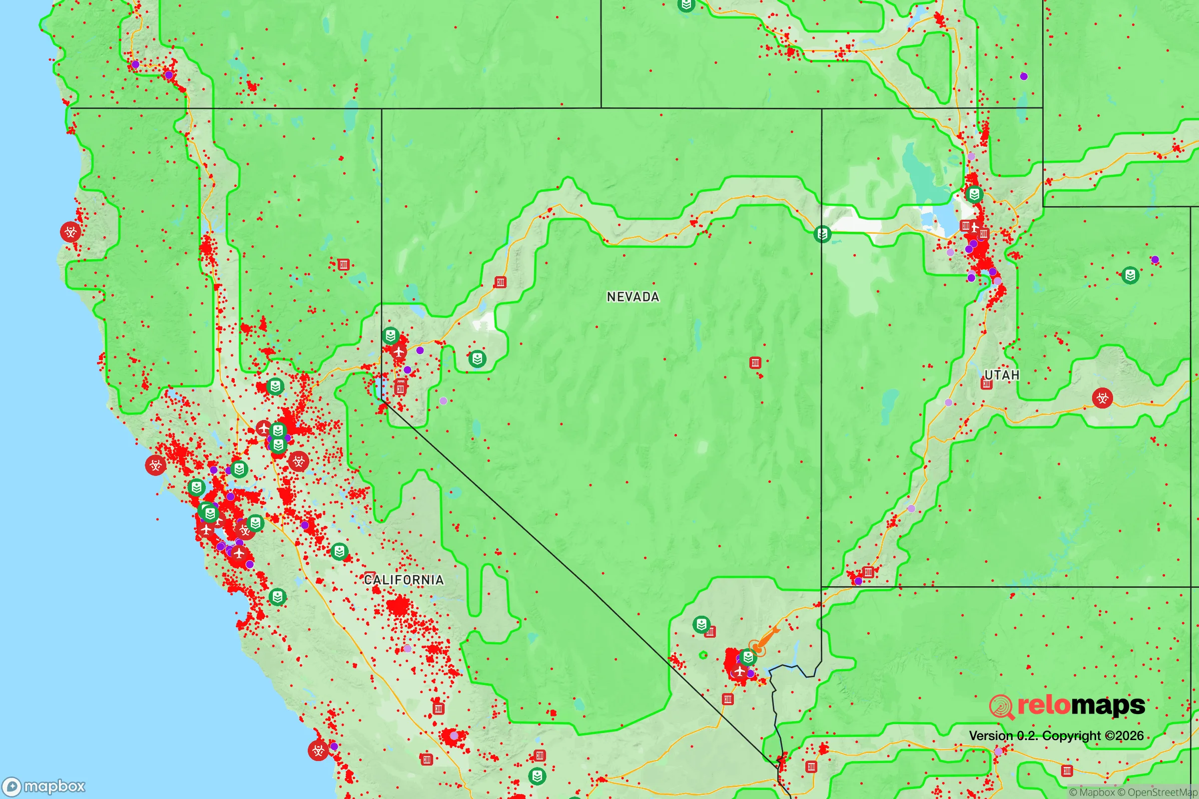
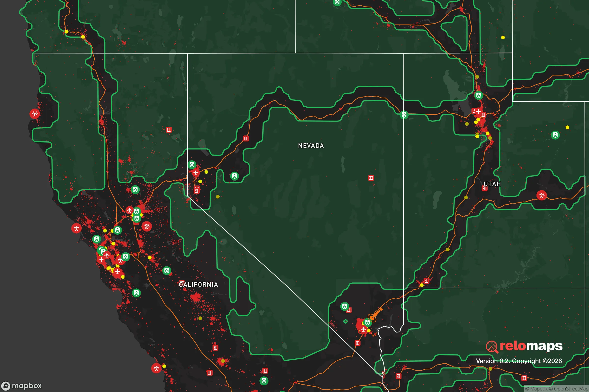
Important Note: For informational purposes only. This does not mean nothing bad ever happens in the green zones. Please use common sense. This is based on public data and modeled with AI. We tried to take a conservative approach but mistakes happen. We update this regularly as new information becomes available.
Solar Generator Recommendations
Backup power matters more here than in safer locations. We've picked three solar generators across budgets and capacity tiers — start with the budget unit if you only need a few essentials, or step up if you want to run a fridge and HVAC for days at a time.

Jackery Portable Power Station Explorer 300
Budget OptionPower on the Go: Weighing only 11 lbs, it's convenient to set up and store with book-sized foldable solar panels

BLUETTI Portable Power Station AC180
Designed for both indoor and outdoor scenarios, AC180 is highly capable as it has a robost capacity and continuous output power.

EF ECOFLOW DELTA Pro Ultra Power Station
Upgraded PickEcoFlow DELTA Pro Ultra is a whole-home energy system designed to grow with your family. Integrated with the Smart Home Panel 2, it scales to meet your evolving energy needs — keeping your home powered, intelligent, and secure through every stage of life.
We earn a commission, at no additional cost to you.
Strategic Assessment Analysis
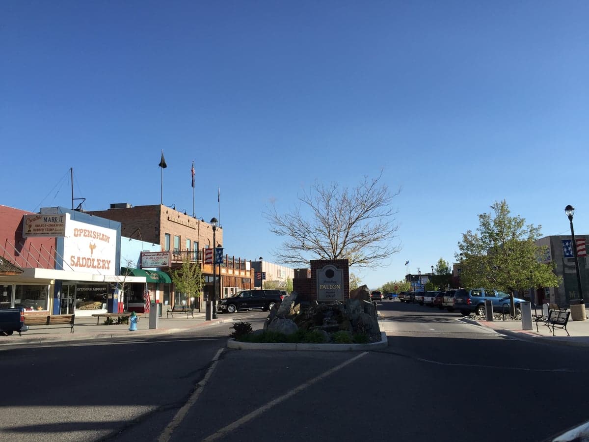
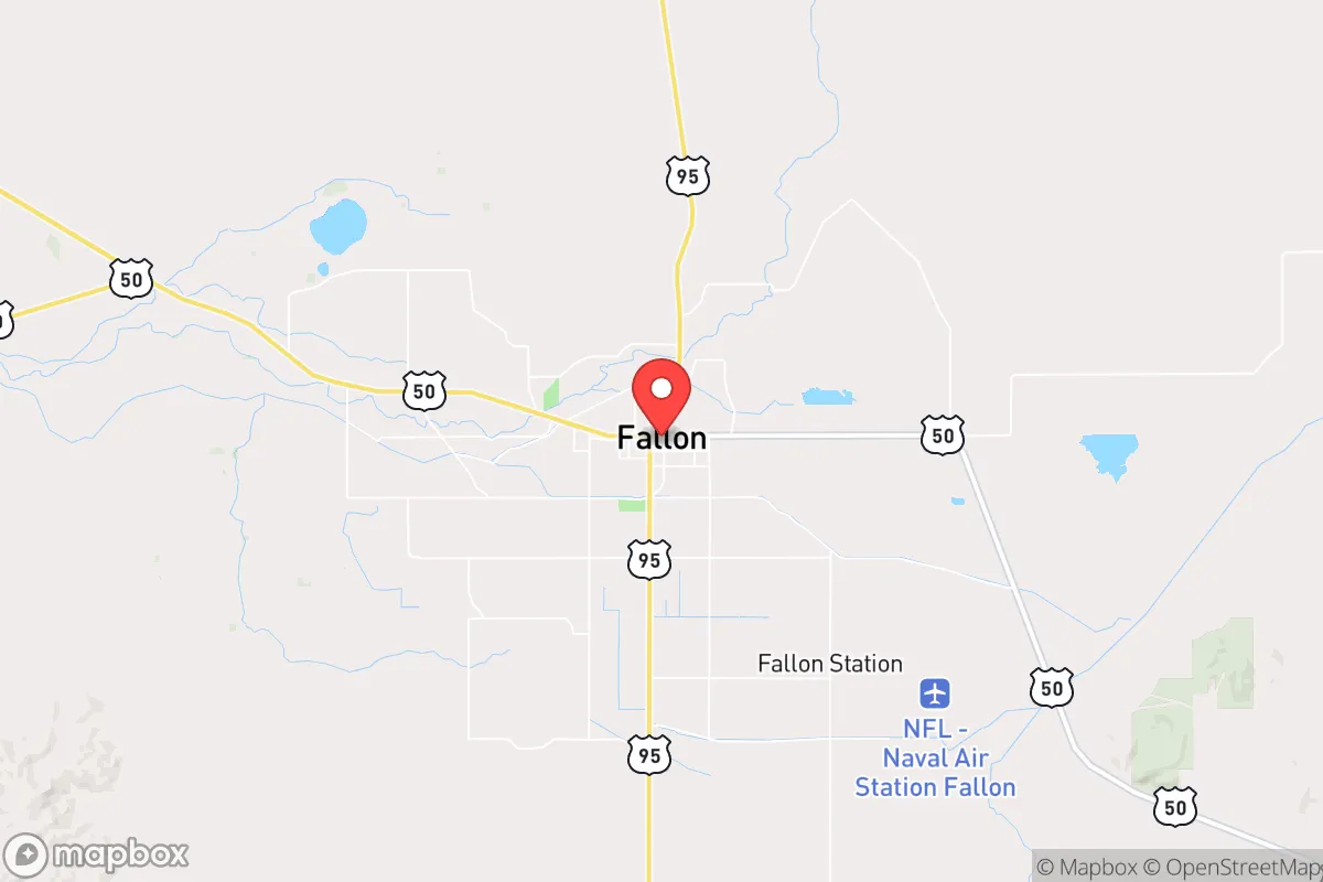
Fallon, Nevada, sits in a unique strategic pocket that offers genuine resilience advantages for those thinking seriously about long-term preparedness. Located roughly 60 miles east of Reno and 90 miles from the Sierra Nevada crest, this agricultural and military community provides a rare combination of defensible geography, local food production, and institutional stability that many western towns lack. For a relocator weighing civic unrest, supply chain disruptions, or larger-scale disasters, Fallon presents a mixed but ultimately favorable picture—provided you understand its specific exposures and work around them.
Geographic position and natural advantages for long-term stability
Fallon’s location in the Lahontan Valley gives it a genuine strategic asset: water. The Truckee-Carson Irrigation District delivers surface water from the Sierra snowpack to the surrounding farmland, making this one of the few reliably irrigated areas in the Great Basin. The Carson River runs through the valley, and the nearby Lahontan Reservoir provides a significant buffer against drought years. For a prepper mindset, water security is the single most important factor in any relocation decision, and Fallon has it in spades compared to most of the interior West. The surrounding geography also offers natural defensibility. The Stillwater Range to the east and the Desatoya Mountains to the southeast create a basin that limits approach corridors, while the vast expanse of the Black Rock Desert to the north provides a buffer against population pressure from that direction. The valley floor itself is flat and open, which means good line-of-sight for communications and observation, but also limited natural cover—a trade-off worth noting. Winters are cold but manageable, with average January highs around 45°F and lows in the teens, while summers are hot and dry, topping 90°F regularly. The climate supports year-round gardening with season extension techniques, and the growing season runs roughly April through October, which is longer than many high-elevation western locations.
Risks, exposures, and proximity to fallout-relevant landmarks
No strategic assessment of Fallon is honest without addressing the elephant in the room: Naval Air Station Fallon, home of the TOPGUN program. The base is a high-value military target in any conflict scenario involving peer adversaries, and its presence fundamentally changes the risk calculus for anyone living in the area. The base sits just southeast of town, and while the immediate blast radius of a precision strike would be limited to the installation itself, the secondary effects—electromagnetic pulse, fallout patterns, and the likelihood of evacuation or martial law—would affect the entire valley. Fallon is also roughly 120 miles from the Nevada National Security Site (the former nuclear test site) and about 150 miles from the Yucca Mountain repository. These are not imminent dangers, but they are permanent features of the regional risk landscape. On the plus side, Fallon is far enough from major population centers to avoid the worst of civil unrest scenarios. Reno’s metro area of roughly 500,000 people is an hour’s drive west, but the intervening geography—the Pah Rah Range and the Truckee River canyon—creates a natural choke point. In a collapse scenario, the flow of refugees from the west would be funneled through the I-80 corridor, which is easily monitored and, if necessary, controlled. The same cannot be said for the open desert to the east and south, which presents a different kind of vulnerability: unmonitored approach routes for those traveling overland from the I-80 corridor or US-95. Fallon’s position as a regional transportation hub (US-50, US-95, and Alt-95 all converge here) is a double-edged sword—good for supply movement, bad for perimeter security.
Practical resilience for a relocator: food, water, energy, and defensibility
Fallon’s agricultural base is its strongest practical asset for long-term resilience. The valley produces alfalfa, wheat, barley, and hay, along with significant dairy and cattle operations. There are also smaller-scale vegetable farms and a farmers’ market that operates seasonally. For a relocator looking to establish food security, the availability of irrigation water and fertile soil means that serious gardening or small-scale farming is viable, unlike in much of the arid West where water rights are a legal and practical nightmare. The local food co-op and several independent grocers provide supply-chain redundancy beyond the standard big-box stores. Water infrastructure is the real standout. The Truckee-Carson Irrigation District delivers water to approximately 60,000 acres of farmland, and the system is managed by a local board that prioritizes agricultural users. In a prolonged grid-down scenario, gravity-fed irrigation from the reservoir system would continue to function as long as the canals remain intact. Domestic wells are common in outlying areas, and the water table in the valley is relatively shallow—typically 50 to 150 feet—making hand-pump or solar-powered well access feasible for those who plan ahead. Energy resilience is more mixed. NV Energy provides grid power, and the area gets abundant solar radiation—over 300 sunny days per year—making photovoltaic systems highly effective. However, the flat terrain means wind is a factor, and small-scale wind turbines can be a useful supplement. Natural gas is available in town, but propane is the standard for rural properties, so pre-positioning storage is wise. Defensibility at the property level is straightforward: the open terrain means that a well-placed home with clear sightlines and a good perimeter fence offers significant advantages. The local culture is heavily military and agricultural, which translates to a high percentage of residents who are armed, trained, and community-oriented. The Churchill County Sheriff’s Office is professional and well-funded, and the local emergency management office runs regular exercises. For a relocator, the social fabric here is a genuine asset—people know their neighbors, and the “live and let live” ethos of rural Nevada means that preparedness activities are not viewed with suspicion.
The overall strategic picture for Fallon is one of qualified optimism. The water and food advantages are real and rare in the Great Basin. The military presence is a risk, but it also brings infrastructure, medical resources, and a population that is not going to panic in a crisis. The distance from major cities provides a buffer against the worst of civil unrest, while the transportation links keep supply lines open. For a relocator with a conservative, self-reliant mindset, Fallon offers a workable balance of risk and reward—provided you accept that no location is perfect, and that preparation, not location alone, is what ultimately determines outcomes. If you are looking for a place where you can dig in, grow your own food, and rely on a community that values competence over convenience, Fallon deserves a serious look.
* Values derived from national, state, county, city and local statistics and may differ in a specific area. Last updated: 2026-04-24T14:07:16.000Z
Narrative content on this page is AI-generated and may contain mistakes. Verify any details that matter before acting on them.
ReloMaps may earn a commission from affiliate links at no extra cost to you.