Photo: Wikipedia
Strategic Assessment of Fernley, NV
Workable tactical position. Some exposure to population density or targets, but generally defensible in a crisis.
What does the Strategic Assessment tell us?
Our Strategic Assessment grades tactical survivability of an area. Major population centers, military targets, fallout zones, natural disasters, and border exposure all drive risk — lower exposure means a more defensible position in a crisis.
This is heavily inspired by Joel Skousen's Strategic Relocation book. Highly recommended you checkout the book ($)What does this tell us?
Our Strategic Assessment grades tactical survivability of an area. Major population centers, military targets, fallout zones, natural disasters, and border exposure all drive risk — lower exposure means a more defensible position in a crisis.
This is heavily inspired by Joel Skousen's Strategic Relocation book. Highly recommended you checkout the book ($)Strategic Pillars

Key Distances
Regional Safe Places
Below is our recommended "safe zones" in Nevada and the surrounding area based on our strategic heuristics. For most people, it's unrealistic to live in a “safe zone” full-time due to work, family or other personal reasons. They tend to be more rural. However, many of these areas are perfect for second homes and retreat properties that double as a vacation home or even a short-term rental.
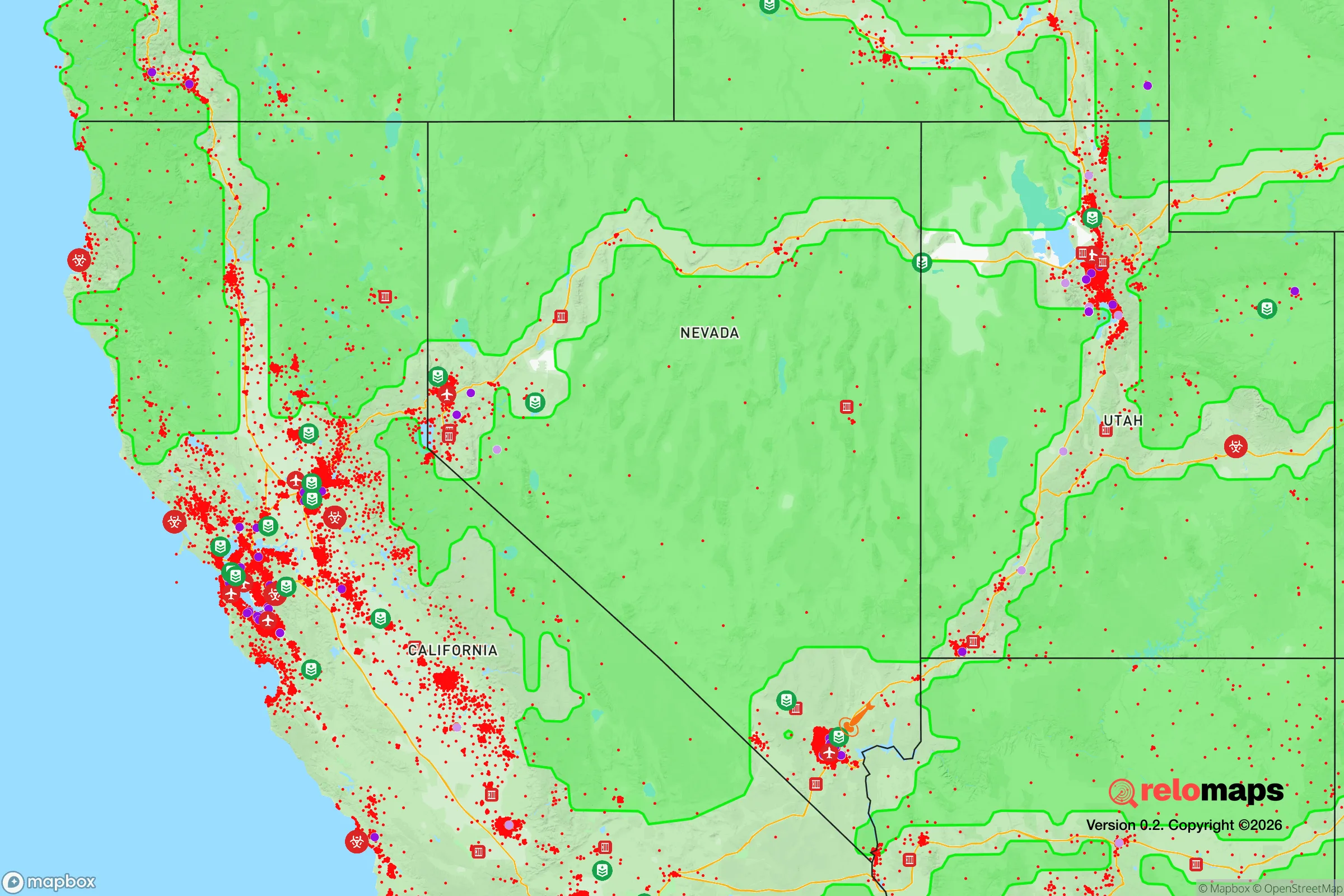
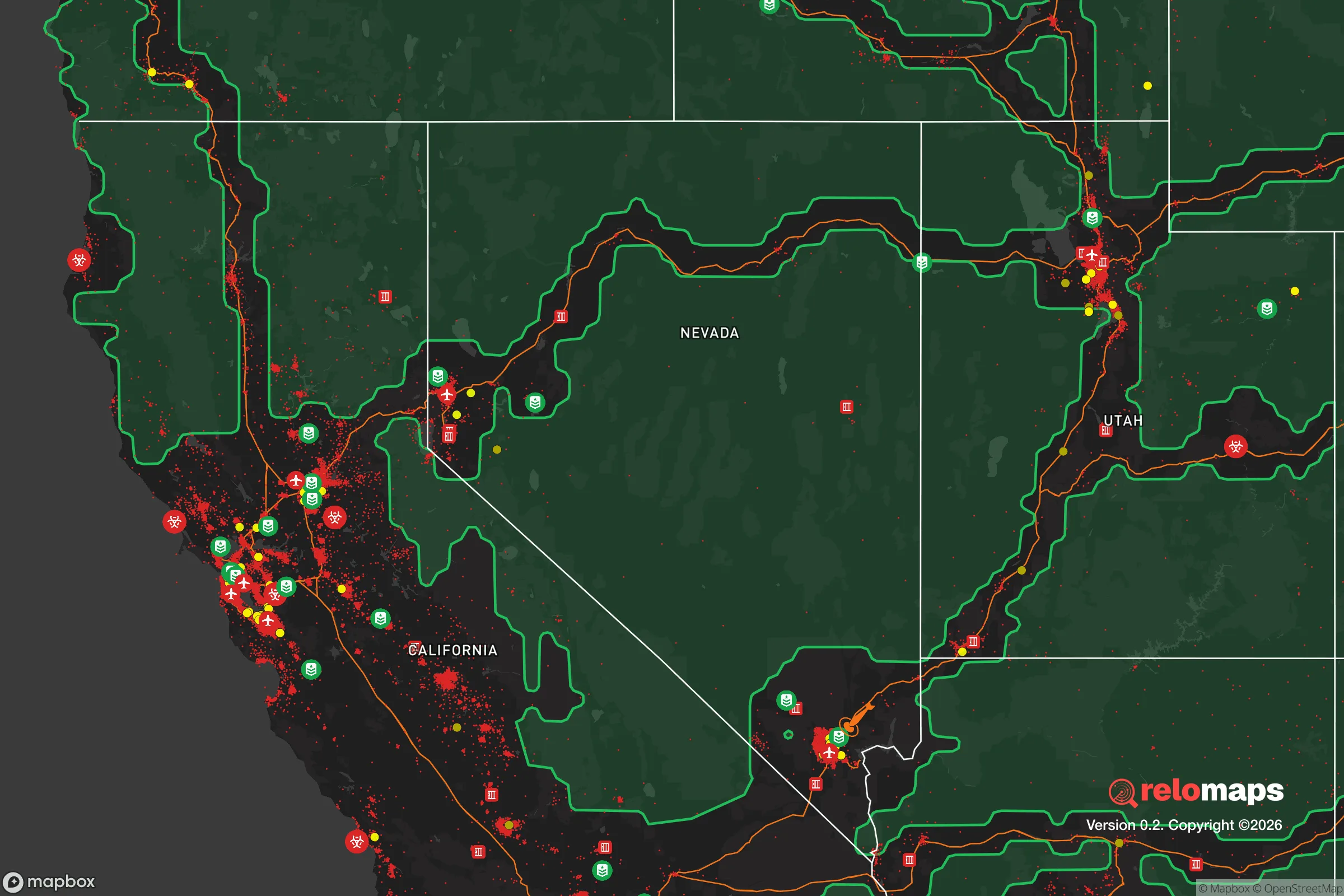
Important Note: For informational purposes only. This does not mean nothing bad ever happens in the green zones. Please use common sense. This is based on public data and modeled with AI. We tried to take a conservative approach but mistakes happen. We update this regularly as new information becomes available.
Solar Generator Recommendations
Backup power matters more here than in safer locations. We've picked three solar generators across budgets and capacity tiers — start with the budget unit if you only need a few essentials, or step up if you want to run a fridge and HVAC for days at a time.

Jackery Portable Power Station Explorer 300
Budget OptionPower on the Go: Weighing only 11 lbs, it's convenient to set up and store with book-sized foldable solar panels

BLUETTI Portable Power Station AC180
Designed for both indoor and outdoor scenarios, AC180 is highly capable as it has a robost capacity and continuous output power.

EF ECOFLOW DELTA Pro Ultra Power Station
Upgraded PickEcoFlow DELTA Pro Ultra is a whole-home energy system designed to grow with your family. Integrated with the Smart Home Panel 2, it scales to meet your evolving energy needs — keeping your home powered, intelligent, and secure through every stage of life.
We earn a commission, at no additional cost to you.
Strategic Assessment Analysis
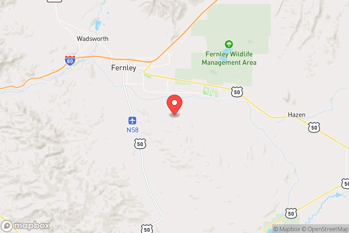
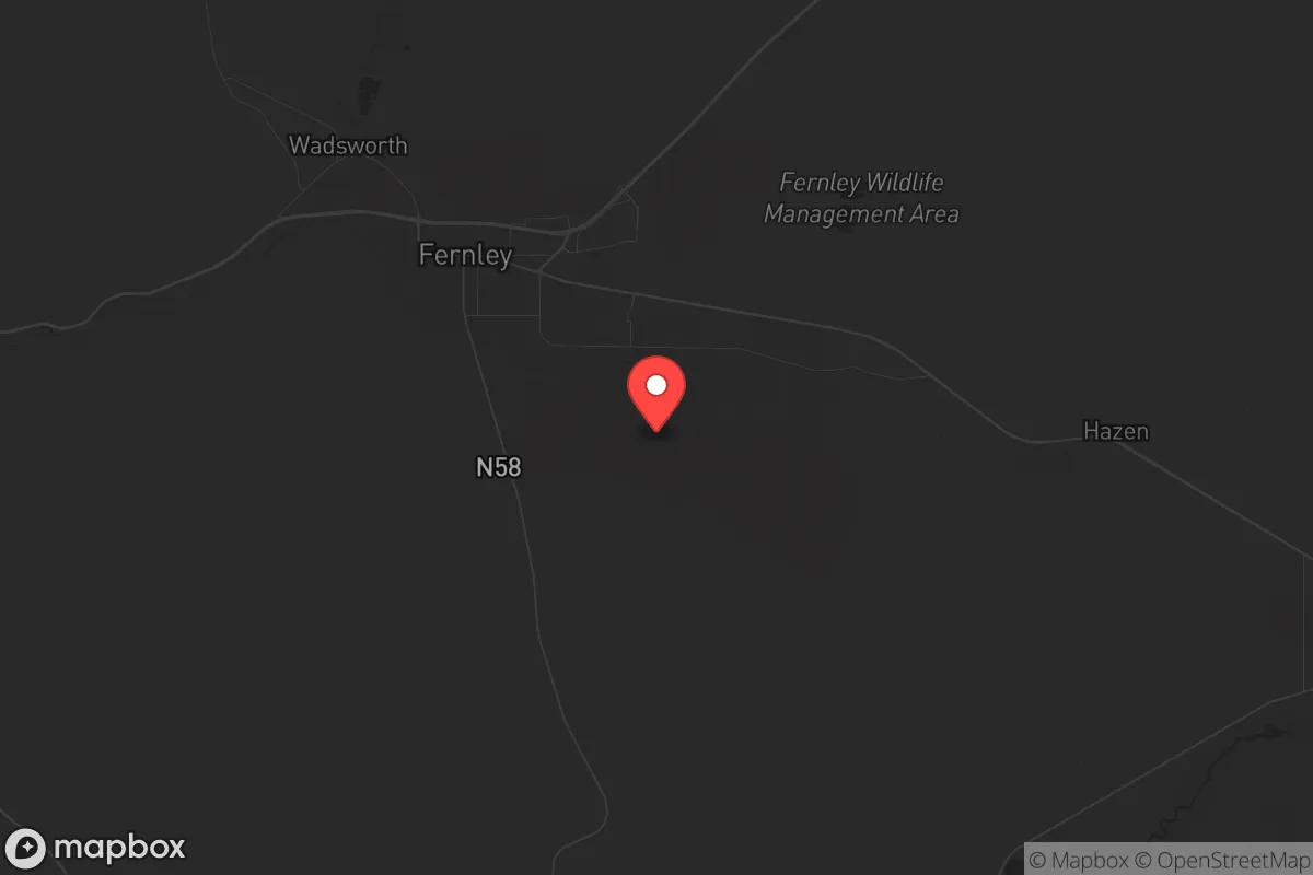
Fernley, Nevada, sits in a unique strategic pocket that offers genuine resilience advantages for those prioritizing preparedness, but it demands a clear-eyed assessment of both its strengths and its liabilities. Located roughly 30 miles east of Reno along Interstate 80, this small city of about 20,000 residents occupies a transitional zone between the Sierra Nevada foothills and the high desert of the Great Basin. For a relocator with a survivalist or prepper mindset, Fernley provides a blend of relative isolation from major urban centers, access to critical transportation corridors, and a climate that supports off-grid living—but it also sits within striking distance of several high-value targets and faces real environmental and logistical risks that cannot be ignored.
Geographic position and natural advantages for long-term survival
Fernley’s location is its primary strategic asset. The city lies on the eastern edge of the Truckee River Canyon, where the river emerges from the Sierra Nevada and spreads into the Lahontan Valley. This position gives residents access to a reliable surface water source—the Truckee River—which is a rarity in the arid Great Basin. The surrounding terrain is open sagebrush steppe with low rolling hills, offering decent line-of-sight visibility and limited natural cover for any approaching threat. The area’s elevation, around 4,200 feet, provides a moderate four-season climate with cold winters and hot, dry summers, which is manageable for year-round habitation without the extreme temperature swings found deeper in the basin. The soil is alkaline and rocky, but with proper amendment, small-scale agriculture is possible, especially with access to irrigation from the Truckee Canal system. The region’s low population density—Lyon County has roughly 60,000 people spread over 2,000 square miles—means that in a collapse scenario, competition for resources would be less intense than in the Reno-Sparks metro area. Fernley’s position also places it along the Union Pacific Railroad mainline and I-80, which are critical for any long-term supply movement, though these same corridors could become chokepoints or targets.
Risks, exposures, and proximity to fallout-relevant landmarks
The most significant strategic liability for Fernley is its proximity to several high-consequence targets. The city lies roughly 30 miles east of Reno, which is a regional transportation and logistics hub with an international airport, major interstate junctions, and a significant population center. In a major conflict or terrorist event, Reno would be a likely target for conventional or asymmetric attack. More concerning is Fernley’s location relative to the Hawthorne Army Depot, approximately 90 miles southeast, which stores a substantial portion of the U.S. military’s conventional ammunition reserves. While 90 miles provides some buffer, prevailing winds in the region are from the west and southwest, meaning any airborne contamination from a strike on Hawthorne could potentially drift toward the Fernley area. Additionally, the nearby Nevada National Security Site (formerly the Nevada Test Site), about 100 miles northwest, and the Hawthorne depot represent fixed infrastructure that could be targeted in a broader conflict. The city itself has no major military or industrial facilities that would make it a primary target, but its position along I-80 means it could become a transit corridor for displaced populations fleeing the Reno-Sparks area. The Truckee River, while a water asset, also creates a natural funnel for movement, and the limited number of bridges and crossings could become bottlenecks or defensive chokepoints. The region is also seismically active—the 2008 Wells earthquake (magnitude 6.0) and the 2020 Monte Cristo earthquake sequence (magnitude 6.5) remind us that the Walker Lane seismic zone runs through western Nevada, and a major quake could disrupt infrastructure, including the Truckee Canal and the I-80 corridor.
Practical resilience for a relocator: food, water, energy, and defensibility
For a relocator serious about self-sufficiency, Fernley offers a mixed but workable baseline. Water is the most critical factor, and the Truckee River is a perennial surface water source, though it is heavily allocated for agricultural and municipal use. A private well is the gold standard here—groundwater in the Fernley area is generally available at depths of 100-300 feet, but yields vary and the aquifer is not as prolific as in the Carson Valley. Rainwater catchment is possible but limited, with annual precipitation averaging only 5-7 inches. The Truckee Canal, which diverts water from the river for irrigation, runs through the area and could be a secondary source, but it is vulnerable to disruption. For food production, the growing season is short (about 120-150 frost-free days), but cold-hardy crops like potatoes, carrots, kale, and grains can be grown. The soil requires significant amendment with compost and organic matter, and irrigation is mandatory. Livestock, particularly goats, sheep, and poultry, are viable, and the open range allows for grazing, though water access is the limiting factor. Energy resilience is strong: Nevada has abundant solar resources, and Fernley averages over 250 sunny days per year. A solar array with battery storage can provide reliable off-grid power, though winter cloud cover and snow can reduce output. Wind is also a resource, with consistent afternoon breezes, but small-scale wind turbines are less reliable. Defensibility is moderate. The terrain is open, which limits ambush opportunities but also provides clear fields of fire. The city itself is compact, with a grid-like street layout that is easy to patrol but offers limited natural cover. The surrounding rural areas offer better defensibility, with isolated homesteads on large parcels (5-40 acres common) that provide standoff distance. The local population is predominantly conservative and rural, with a strong hunting and firearms culture, which means a relocator would find like-minded neighbors and a community that values self-reliance. The Lyon County Sheriff’s Office is professional but thinly stretched, so in a prolonged crisis, residents would largely be on their own.
The overall strategic picture for Fernley is one of calculated trade-offs. It offers genuine advantages—reliable surface water, low population density, strong solar potential, and a community that leans toward self-sufficiency—that make it a viable base for a prepared relocator. However, these come with real risks: proximity to Reno and the I-80 corridor, vulnerability to seismic events, and the potential for fallout from strikes on Hawthorne or the Nevada Test Site. For a single individual or family willing to invest in a well, solar power, and a defensible rural property, Fernley provides a solid foundation for long-term resilience. The key is to avoid the town itself and instead secure land to the east or south, away from the I-80 corridor and the river valley, where isolation and defensibility are higher. If you can manage the trade-offs and prepare for the specific risks, Fernley is a credible option in the Great Basin—but it is not a sanctuary. It is a forward operating base that requires constant vigilance and preparation.
* Values derived from national, state, county, city and local statistics and may differ in a specific area. Last updated: 2026-04-30T01:27:57.000Z
Narrative content on this page is AI-generated and may contain mistakes. Verify any details that matter before acting on them.
ReloMaps may earn a commission from affiliate links at no extra cost to you.