 Popular
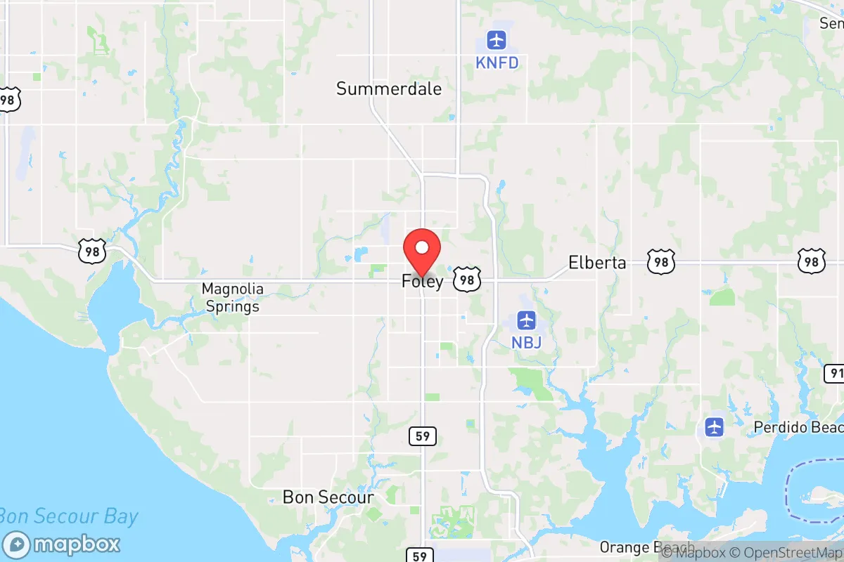
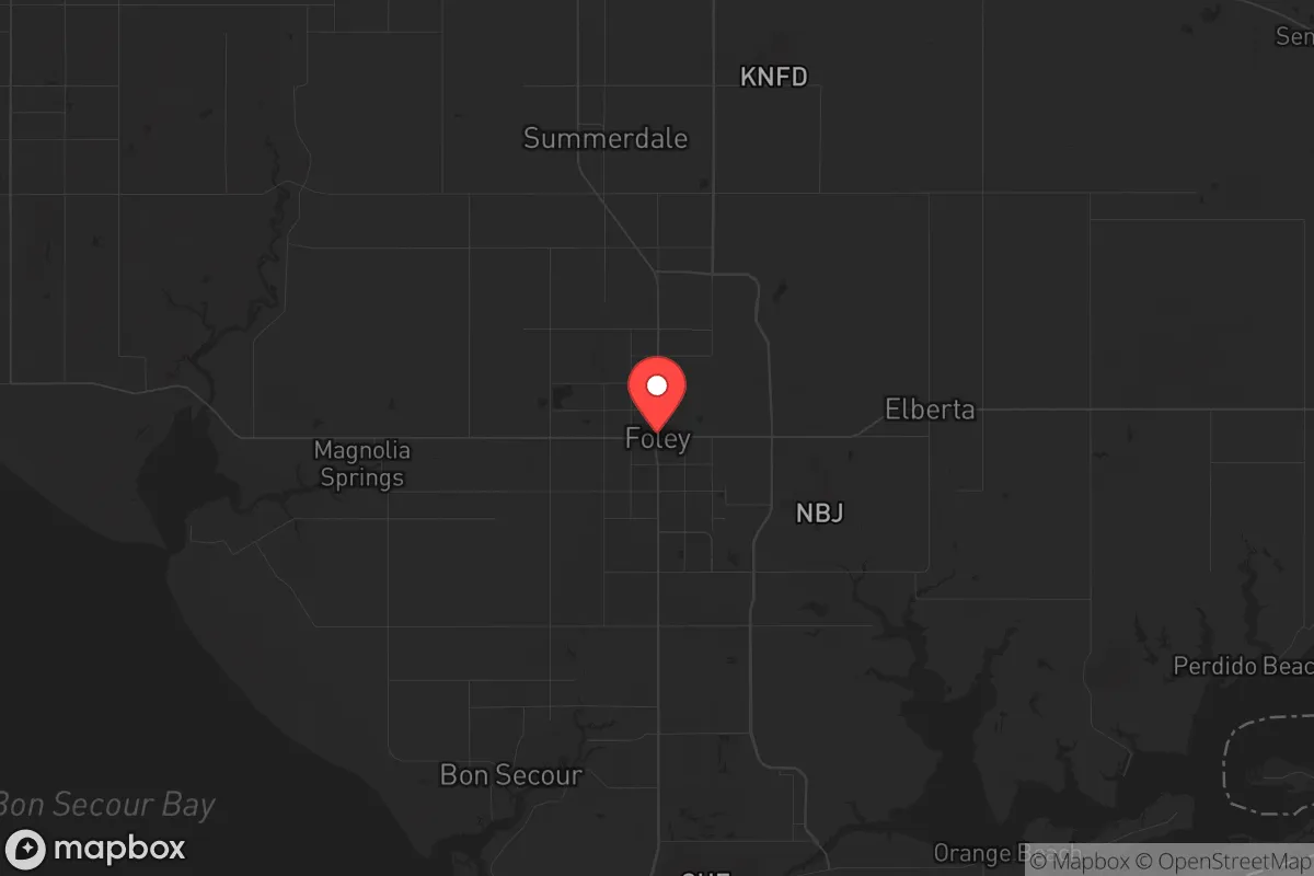
Photo: Wikipedia
Strategic Assessment of Foley, AL
Meaningful friction. Expect exposure to either population pressure, blast zones, or natural disaster risk. Consider buying a retreat property.
What does the Strategic Assessment tell us?
Our Strategic Assessment grades tactical survivability of an area. Major population centers, military targets, fallout zones, natural disasters, and border exposure all drive risk — lower exposure means a more defensible position in a crisis.
This is heavily inspired by Joel Skousen's Strategic Relocation book. Highly recommended you checkout the book ($)What does this tell us?
Our Strategic Assessment grades tactical survivability of an area. Major population centers, military targets, fallout zones, natural disasters, and border exposure all drive risk — lower exposure means a more defensible position in a crisis.
This is heavily inspired by Joel Skousen's Strategic Relocation book. Highly recommended you checkout the book ($)Strategic Pillars

Key Distances
Regional Safe Places
Below is our recommended "safe zones" in Alabama and the surrounding area based on our strategic heuristics. For most people, it's unrealistic to live in a “safe zone” full-time due to work, family or other personal reasons. They tend to be more rural. However, many of these areas are perfect for second homes and retreat properties that double as a vacation home or even a short-term rental.
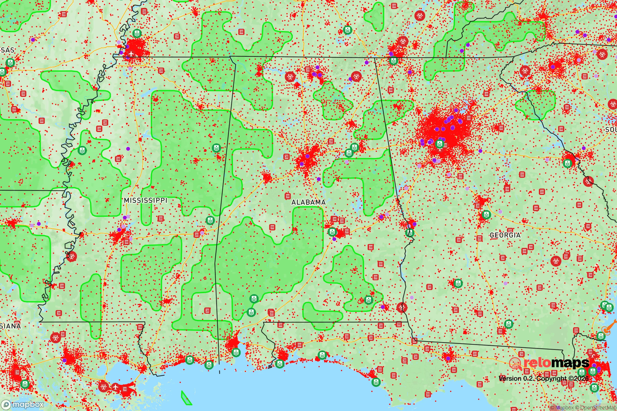
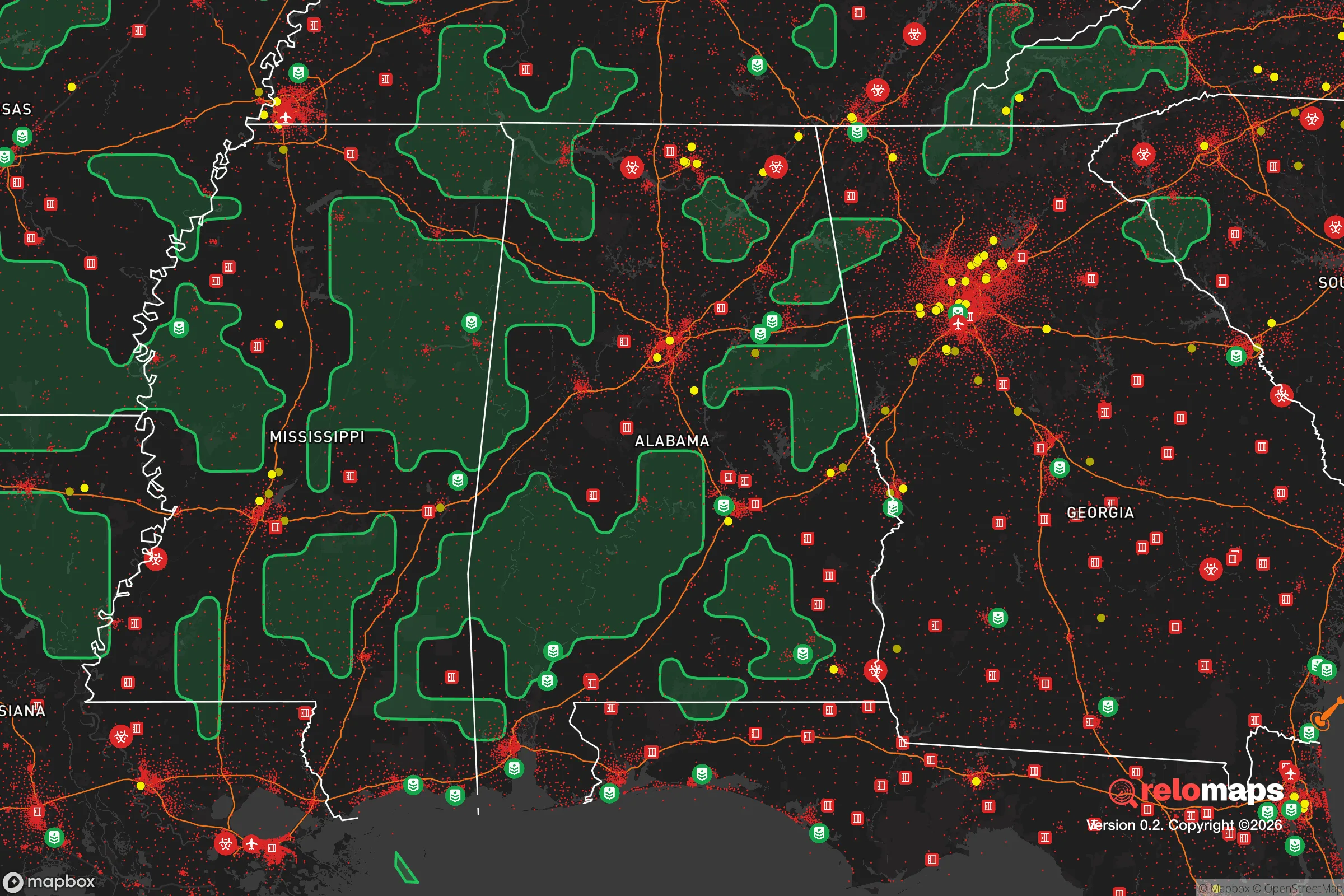
Important Note: For informational purposes only. This does not mean nothing bad ever happens in the green zones. Please use common sense. This is based on public data and modeled with AI. We tried to take a conservative approach but mistakes happen. We update this regularly as new information becomes available.
Solar Generator Recommendations
Backup power matters more here than in safer locations. We've picked three solar generators across budgets and capacity tiers — start with the budget unit if you only need a few essentials, or step up if you want to run a fridge and HVAC for days at a time.

Jackery Portable Power Station Explorer 300
Budget OptionPower on the Go: Weighing only 11 lbs, it's convenient to set up and store with book-sized foldable solar panels

BLUETTI Portable Power Station AC180
Designed for both indoor and outdoor scenarios, AC180 is highly capable as it has a robost capacity and continuous output power.

EF ECOFLOW DELTA Pro Ultra Power Station
Upgraded PickEcoFlow DELTA Pro Ultra is a whole-home energy system designed to grow with your family. Integrated with the Smart Home Panel 2, it scales to meet your evolving energy needs — keeping your home powered, intelligent, and secure through every stage of life.
We earn a commission, at no additional cost to you.
Strategic Assessment Analysis
Foley, Alabama, sits in a unique strategic pocket along the Gulf Coast that offers a blend of natural buffer and logistical access, making it a serious contender for those prioritizing resilience in an uncertain future. Its position roughly 30 miles west of Pensacola and 45 miles east of Mobile places it outside the immediate blast radius of those major metropolitan centers, yet close enough to tap into their resources when needed. The area’s flat, pine-dominated terrain and proximity to the Gulf of Mexico provide both advantages and distinct vulnerabilities that a prepper-minded relocator must weigh carefully.
Geographic position and natural advantages for long-term security
Foley’s location on the Baldwin County peninsula is defined by water on three sides—the Gulf to the south, Mobile Bay to the west, and the Intracoastal Waterway cutting through the city itself. This geography creates a natural chokepoint: the only land routes in and out are via US-98, AL-59, and I-10, which can be monitored or controlled if needed. The surrounding landscape is predominantly rural farmland and state forest, with the Bon Secour National Wildlife Refuge and Gulf State Park providing undeveloped buffer zones to the south. For a relocator, this means limited avenues of approach for any unwanted traffic, but also limited escape routes if a coastal evacuation is ordered. The area’s elevation averages just 80 feet above sea level, which is a concern for storm surge but not for most inland flooding. The soil is sandy and drains quickly, which aids in water management and gardening, though it requires amendment for serious crop production. The climate is humid subtropical, with a growing season that stretches from March to November—enough to sustain year-round food production with season extension techniques like hoop houses or cold frames.
Risks, exposures, and proximity to fallout-relevant landmarks
The most immediate threat to Foley is its exposure to hurricane landfalls. The Gulf Coast is a hurricane highway, and Baldwin County has been struck by major storms—Hurricane Sally in 2020 caused widespread flooding and power outages lasting over a week in some areas. Storm surge from a Category 3 or higher could inundate low-lying parts of Foley, particularly near the Intracoastal Waterway and the Bon Secour River. Flood insurance is mandatory in many zones, and the National Flood Insurance Program maps show significant portions of the city in Zone AE (high risk). Beyond weather, the proximity to Mobile and Pensacola introduces risks tied to civil unrest or infrastructure collapse. Both cities have populations over 200,000 and are connected by I-10, a major evacuation and supply corridor. In a mass casualty event or grid-down scenario, Foley could see a surge of refugees from those urban centers, straining local resources. The city itself has a population of roughly 22,000, with Baldwin County at about 240,000—small enough to maintain community cohesion but large enough to have a hospital (South Baldwin Regional Medical Center) and a police force. There are no nuclear power plants within 100 miles, but the nearby Naval Air Station Pensacola and the Mobile Aerospace complex are potential targets in a conflict scenario. The prevailing winds from the south would carry fallout inland, but Foley’s coastal position means it would be downwind of any Gulf-based incident only under specific conditions.
Practical resilience for a relocator: food, water, energy, and defensibility
For a relocator focused on self-sufficiency, Foley offers a mixed bag. The water table is high—typically 10 to 20 feet deep—and many rural properties have shallow wells that produce potable water with minimal treatment. The city’s municipal water comes from groundwater wells and the Perdido River, but in a prolonged outage, a hand pump on a shallow well can provide a reliable backup. The sandy soil is not ideal for traditional row crops, but raised beds with compost and biochar can produce vegetables, and the long growing season allows for multiple harvests. Citrus, figs, and muscadine grapes grow well here, and the Gulf provides a protein source via fishing and crabbing. Energy resilience is a challenge: the local grid is vulnerable to storm damage, and underground utilities are rare. Solar is viable—the area averages 220 sunny days per year—but net metering policies in Alabama are less favorable than in some states, and battery storage is essential for off-grid capability. Propane is widely available for cooking and heating, and wood-burning stoves are common in rural homes. Defensibility is moderate: the flat terrain offers few natural defensive positions, but the network of rural roads and dead-end streets in subdivisions like the Foley area’s many golf-course communities can be barricaded. The Baldwin County Sheriff’s Office has a strong presence, and the local population leans conservative, with a high rate of firearm ownership and a culture of mutual aid among neighbors. Community resilience is high—churches and civic groups organize disaster response, and the Foley Volunteer Fire Department is well-regarded. The biggest practical gap is food storage: the humid climate makes long-term dry storage difficult without climate-controlled spaces, and the local grocery supply chain is dependent on I-10 trucking, which could be disrupted.
The overall strategic picture for Foley is one of calculated trade-offs. It offers a defensible coastal position with good water access, a supportive community, and a climate that supports year-round food production, but it carries real exposure to hurricanes, storm surge, and potential refugee flows from nearby cities. For a relocator willing to invest in flood mitigation, backup power, and a well, Foley can function as a viable retreat that balances isolation with access to medical care and supply routes. It is not a bug-out location for a total collapse scenario—the lack of elevation and single evacuation corridor are liabilities—but for those preparing for civil unrest, economic disruption, or regional disasters, it provides a solid foundation with room for growth. The key is to buy property above the flood zone, establish a well and solar array early, and build relationships with the local prepper and homesteading community before the next crisis hits. Foley is a place to dig in, not to run from.
* Values derived from national, state, county, city and local statistics and may differ in a specific area. Last updated: 2026-04-19T18:51:31.000Z
Narrative content on this page is AI-generated and may contain mistakes. Verify any details that matter before acting on them.
ReloMaps may earn a commission from affiliate links at no extra cost to you.