Photo: Wikipedia
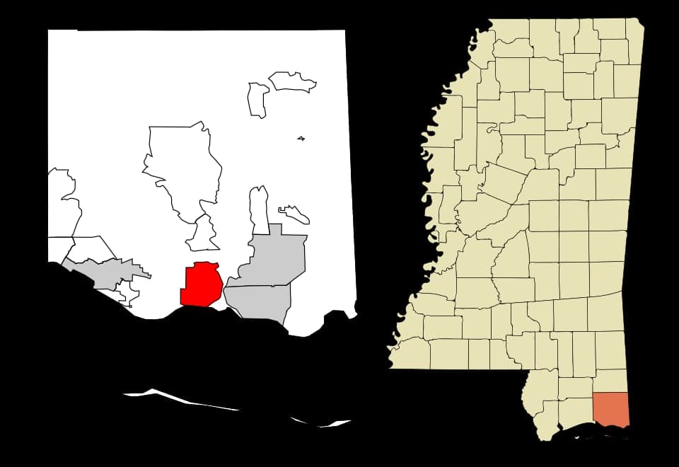
Strategic Assessment of Gautier, MS
Meaningful friction. Expect exposure to either population pressure, blast zones, or natural disaster risk. Consider buying a retreat property.
What does the Strategic Assessment tell us?
Our Strategic Assessment grades tactical survivability of an area. Major population centers, military targets, fallout zones, natural disasters, and border exposure all drive risk — lower exposure means a more defensible position in a crisis.
This is heavily inspired by Joel Skousen's Strategic Relocation book. Highly recommended you checkout the book ($)What does this tell us?
Our Strategic Assessment grades tactical survivability of an area. Major population centers, military targets, fallout zones, natural disasters, and border exposure all drive risk — lower exposure means a more defensible position in a crisis.
This is heavily inspired by Joel Skousen's Strategic Relocation book. Highly recommended you checkout the book ($)Strategic Pillars

Key Distances
Regional Safe Places
Below is our recommended "safe zones" in Mississippi and the surrounding area based on our strategic heuristics. For most people, it's unrealistic to live in a “safe zone” full-time due to work, family or other personal reasons. They tend to be more rural. However, many of these areas are perfect for second homes and retreat properties that double as a vacation home or even a short-term rental.
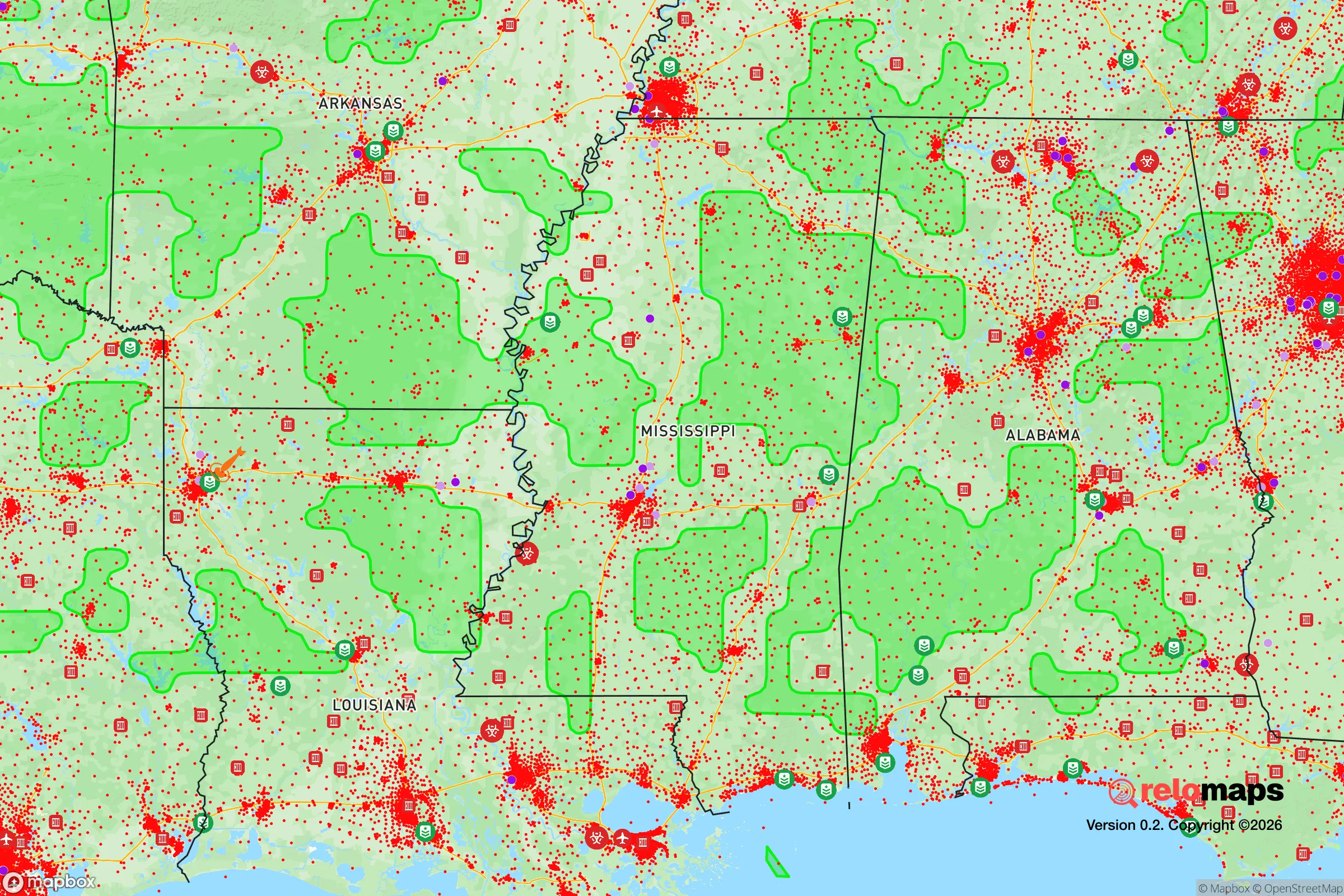
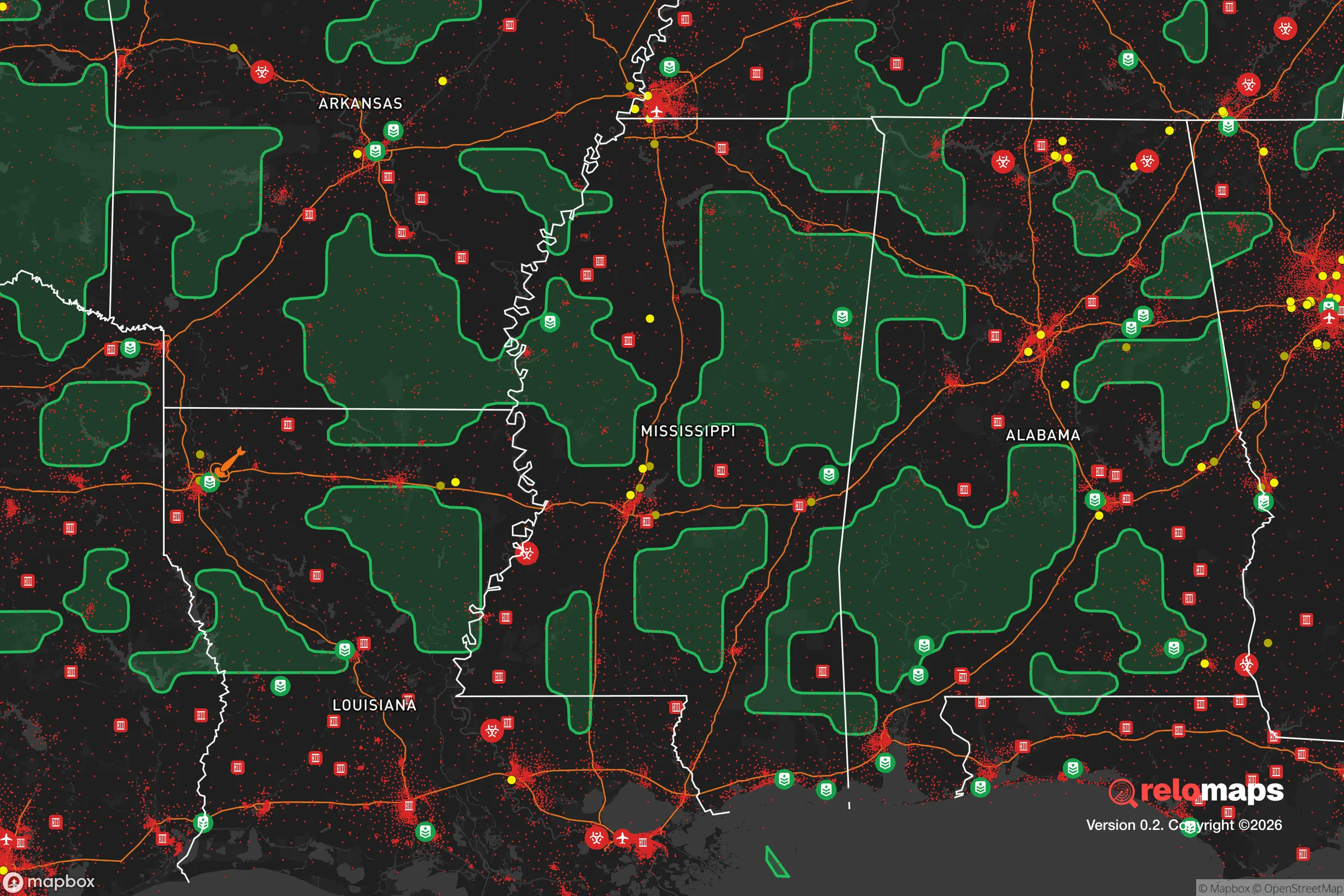
Important Note: For informational purposes only. This does not mean nothing bad ever happens in the green zones. Please use common sense. This is based on public data and modeled with AI. We tried to take a conservative approach but mistakes happen. We update this regularly as new information becomes available.
Solar Generator Recommendations
Backup power matters more here than in safer locations. We've picked three solar generators across budgets and capacity tiers — start with the budget unit if you only need a few essentials, or step up if you want to run a fridge and HVAC for days at a time.

Jackery Portable Power Station Explorer 300
Budget OptionPower on the Go: Weighing only 11 lbs, it's convenient to set up and store with book-sized foldable solar panels

BLUETTI Portable Power Station AC180
Designed for both indoor and outdoor scenarios, AC180 is highly capable as it has a robost capacity and continuous output power.

EF ECOFLOW DELTA Pro Ultra Power Station
Upgraded PickEcoFlow DELTA Pro Ultra is a whole-home energy system designed to grow with your family. Integrated with the Smart Home Panel 2, it scales to meet your evolving energy needs — keeping your home powered, intelligent, and secure through every stage of life.
We earn a commission, at no additional cost to you.
Strategic Assessment Analysis
Gautier, Mississippi, sits in a position that demands a hard look from anyone serious about long-term strategic relocation. Located in Jackson County along the Gulf Coast, this town of roughly 18,000 offers a mix of geographic insulation and practical access that makes it a credible option for those prioritizing resilience over convenience. The area’s flat, pine-forested terrain, proximity to the Pascagoula River, and distance from major population centers create a baseline of survivability that many coastal towns simply cannot match. But the picture is not without serious trade-offs, and understanding both the natural advantages and the real risks is essential before making any move.
Geographic position and natural advantages for long-term security
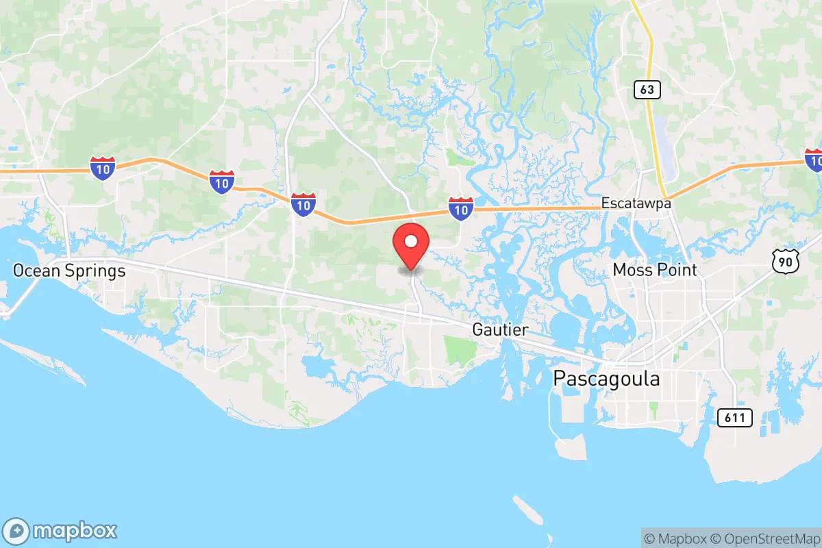
Gautier’s location is its strongest card. It sits roughly 35 miles east of Biloxi and 40 miles west of Mobile, Alabama, placing it far enough from those urban cores to avoid the worst of any civil unrest or mass casualty event that might originate there. The town is not a primary target for any strategic strike—there are no major military bases, no major ports, and no critical infrastructure that would draw a first-wave attack. The surrounding Jackson County is sparsely populated outside of the Pascagoula and Ocean Springs corridors, meaning that in a crisis, Gautier offers a buffer zone of rural space that can be used for retreat, resupply, or simply staying out of sight. The Pascagoula River, one of the last free-flowing river systems in the lower 48, provides a reliable freshwater source and a natural barrier to the east. The Gulf of Mexico is 10 miles south, offering saltwater access for fishing and desalination if needed, but the town itself is elevated enough to avoid the worst of storm surge—most of Gautier sits at 10 to 20 feet above sea level, which is a significant advantage over lower-lying areas like Biloxi or Gulfport.
Risks, exposures, and proximity to fallout-relevant landmarks
No strategic analysis is honest without naming the dangers. Gautier’s biggest exposure is its proximity to the Chevron Pascagoula Refinery, located about 15 miles southeast in Pascagoula. This is one of the largest oil refineries on the Gulf Coast, processing over 300,000 barrels of crude per day. In a major disaster—whether natural or man-made—a refinery fire, explosion, or chemical release could produce a toxic plume that would drift northwest toward Gautier depending on wind direction. The same applies to the Ingalls Shipbuilding facility in Pascagoula, which builds and repairs U.S. Navy warships. While that facility is a potential target in a conflict scenario, it also means that the area around it could see military activity, checkpoints, or evacuation orders. Hurricane risk is real: the Gulf Coast is hit by a major hurricane roughly once every 10 to 15 years, and Gautier is not immune to wind damage or flooding from heavy rain. The 2005 Hurricane Katrina storm surge reached inland to parts of Jackson County, though Gautier itself saw mostly wind and flood damage rather than catastrophic surge. Tornadoes are a secondary threat, with the area averaging 20 to 30 tornado warnings per year. Finally, the town’s location on Highway 90 and near Interstate 10 means that in a mass evacuation scenario, those routes will clog quickly. Anyone relying on those roads to escape a coastal threat should have a secondary plan—preferably a boat or a backroad route north through George County.
Practical resilience for a relocator: food, water, energy, and defensibility
For a prepper or survivalist, Gautier offers a mixed bag. The good news: the Pascagoula River and its tributaries provide abundant freshwater, and the area’s long growing season (roughly 250 days per year) means that a well-planned garden can produce food from March through November. The soil is sandy loam, which drains well but requires amendment for heavy vegetable production. Hunting is viable—white-tailed deer, wild hogs, and waterfowl are common in the surrounding national forests and wildlife management areas, including the nearby Pascagoula River Wildlife Management Area and the DeSoto National Forest to the north. Fishing in the river and the Gulf is excellent year-round. The bad news: the local power grid is vulnerable to hurricane damage, and outages can last days or weeks after a major storm. Anyone serious about resilience should invest in a solar array with battery storage, a backup generator, and a well with a hand pump or solar pump. The town’s water supply comes from the Jackson County Utility Authority, which draws from groundwater wells—this is generally reliable, but a prolonged power outage could disrupt pumping. Defensibility is moderate: Gautier is a suburban-style town with a mix of single-family homes on lots ranging from a quarter-acre to several acres. The lack of natural chokepoints or high ground makes it harder to secure a perimeter, but the dense pine forests and winding bayous offer cover and concealment. A property with a long driveway, a creek or pond, and a clear line of sight to the road is ideal. The local law enforcement presence is the Jackson County Sheriff’s Office and the Gautier Police Department, both of which are professional but understaffed relative to the area’s size—in a crisis, you cannot count on rapid response.
The overall strategic picture for Gautier is one of cautious viability. It is not a hardened bunker location, nor is it a remote mountain retreat. What it offers is a middle ground: a place with enough natural resources, distance from major targets, and community infrastructure to ride out a moderate crisis, but with enough exposure to refinery hazards and hurricane risk that it demands serious preparation. For a conservative-minded relocator who values self-reliance, community ties, and access to water and food, Gautier is worth a serious look—provided you go in with eyes open, a solid plan, and the gear to handle what the Gulf Coast can throw at you. The key is not to treat it as a final destination, but as a base of operations from which you can adapt, move, or hold as the situation demands. In a world where the only certainty is uncertainty, that kind of flexibility is the real strategic asset.
* Values derived from national, state, county, city and local statistics and may differ in a specific area. Last updated: 2026-04-30T05:52:41.000Z
Narrative content on this page is AI-generated and may contain mistakes. Verify any details that matter before acting on them.
ReloMaps may earn a commission from affiliate links at no extra cost to you.