
Photo: Gower Brown via Unsplash
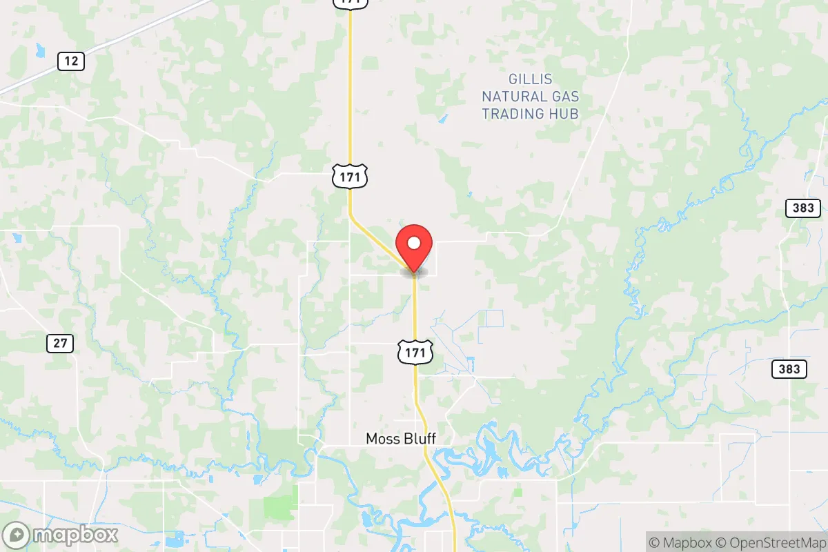
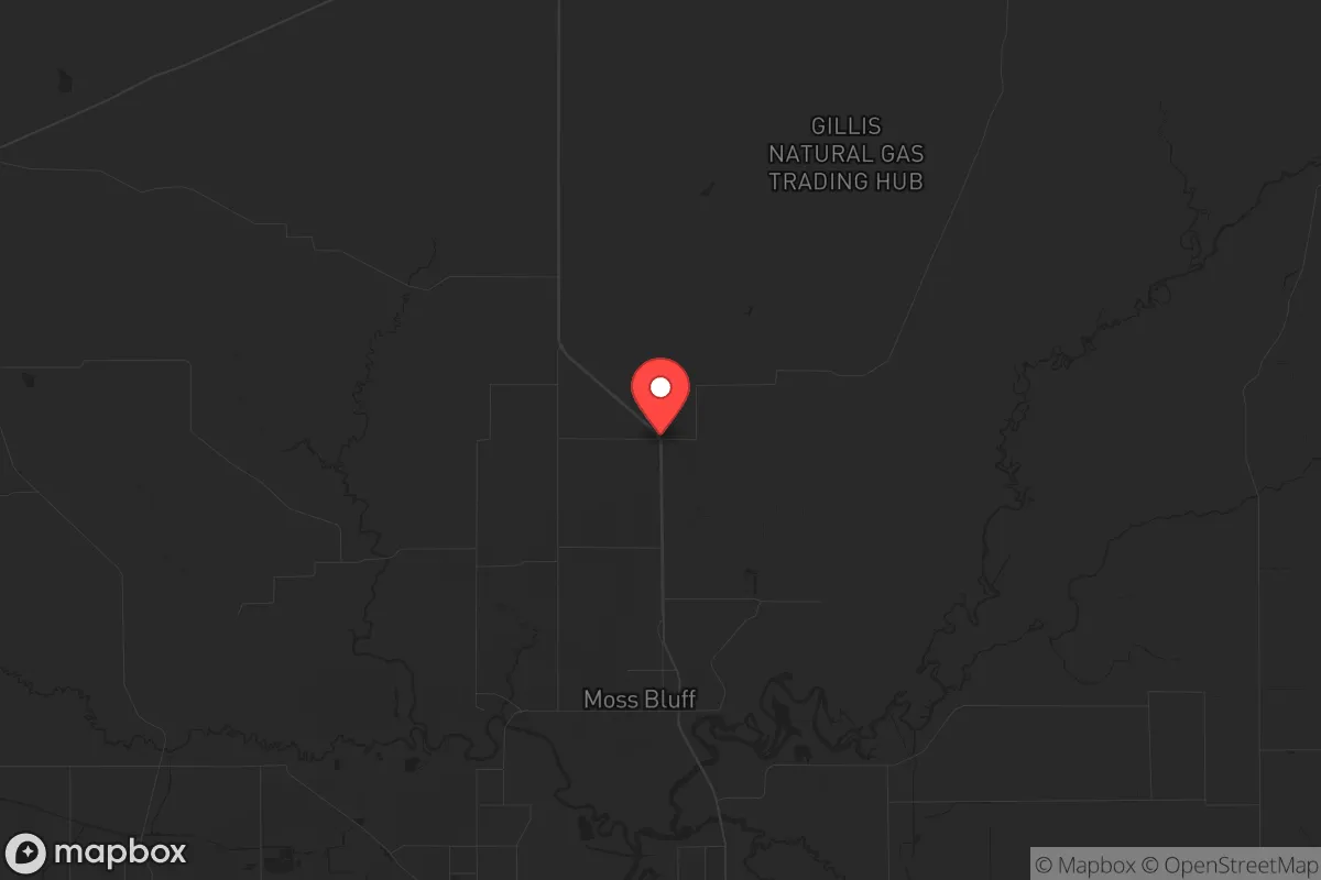
Strategic Assessment of Gillis, LA
Workable tactical position. Some exposure to population density or targets, but generally defensible in a crisis.
What does the Strategic Assessment tell us?
Our Strategic Assessment grades tactical survivability of an area. Major population centers, military targets, fallout zones, natural disasters, and border exposure all drive risk — lower exposure means a more defensible position in a crisis.
This is heavily inspired by Joel Skousen's Strategic Relocation book. Highly recommended you checkout the book ($)What does this tell us?
Our Strategic Assessment grades tactical survivability of an area. Major population centers, military targets, fallout zones, natural disasters, and border exposure all drive risk — lower exposure means a more defensible position in a crisis.
This is heavily inspired by Joel Skousen's Strategic Relocation book. Highly recommended you checkout the book ($)Strategic Pillars

Key Distances
Regional Safe Places
Below is our recommended "safe zones" in Louisiana and the surrounding area based on our strategic heuristics. For most people, it's unrealistic to live in a “safe zone” full-time due to work, family or other personal reasons. They tend to be more rural. However, many of these areas are perfect for second homes and retreat properties that double as a vacation home or even a short-term rental.

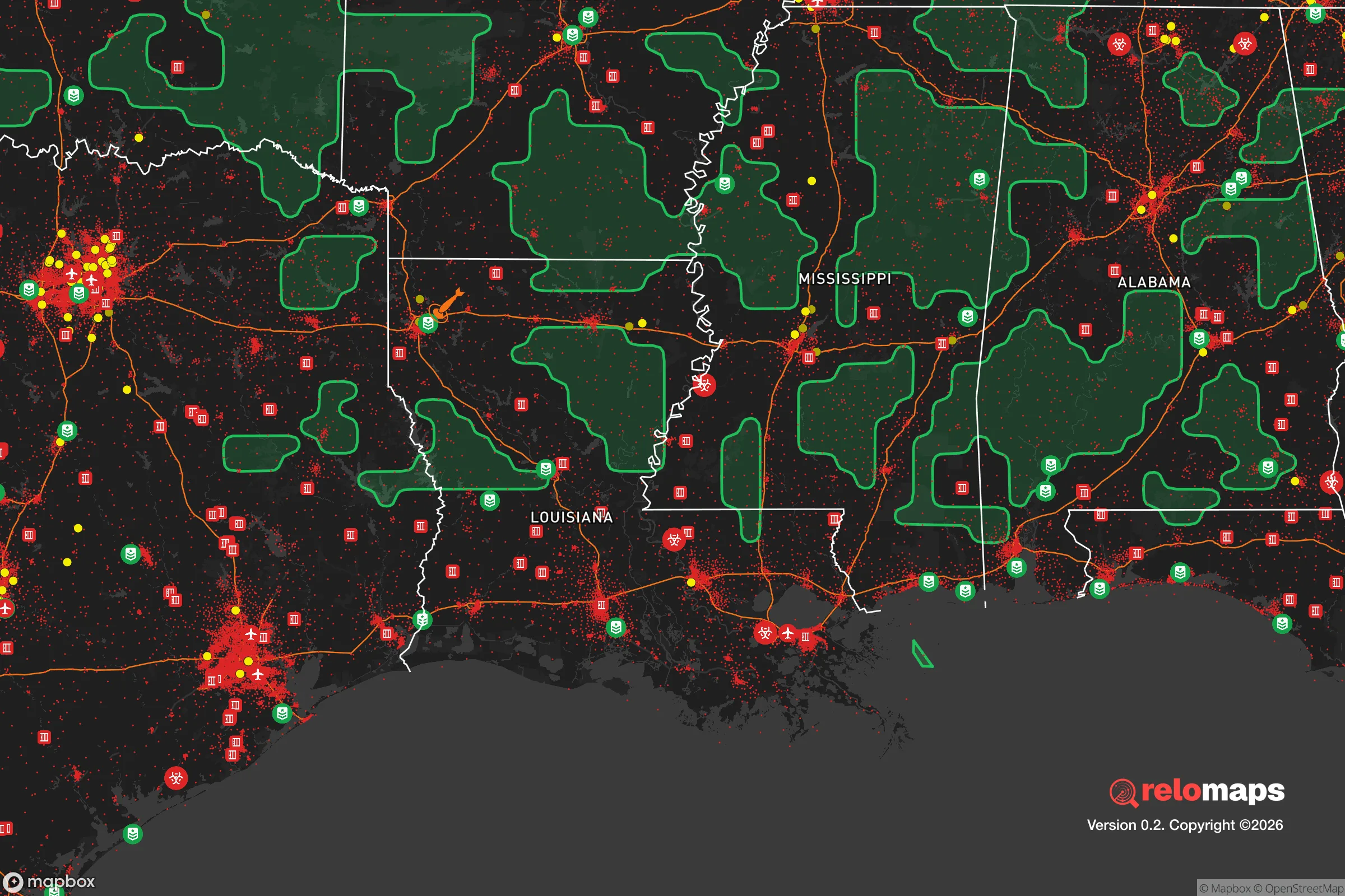
Important Note: For informational purposes only. This does not mean nothing bad ever happens in the green zones. Please use common sense. This is based on public data and modeled with AI. We tried to take a conservative approach but mistakes happen. We update this regularly as new information becomes available.
Solar Generator Recommendations
Backup power matters more here than in safer locations. We've picked three solar generators across budgets and capacity tiers — start with the budget unit if you only need a few essentials, or step up if you want to run a fridge and HVAC for days at a time.

Jackery Portable Power Station Explorer 300
Budget OptionPower on the Go: Weighing only 11 lbs, it's convenient to set up and store with book-sized foldable solar panels

BLUETTI Portable Power Station AC180
Designed for both indoor and outdoor scenarios, AC180 is highly capable as it has a robost capacity and continuous output power.

EF ECOFLOW DELTA Pro Ultra Power Station
Upgraded PickEcoFlow DELTA Pro Ultra is a whole-home energy system designed to grow with your family. Integrated with the Smart Home Panel 2, it scales to meet your evolving energy needs — keeping your home powered, intelligent, and secure through every stage of life.
We earn a commission, at no additional cost to you.
Strategic Assessment Analysis
Gillis, Louisiana, offers a surprisingly resilient position for those prioritizing strategic relocation, combining deep-water access with a low-profile, rural setting that avoids the direct blast zones of major metropolitan targets. Located in Calcasieu Parish, roughly 10 miles southeast of Lake Charles and 40 miles from the Gulf of Mexico, this unincorporated community sits at a crossroads of critical infrastructure and natural isolation. For a prepper or survivalist assessing long-term viability, Gillis presents a mixed but workable picture: it is close enough to essential resources to sustain a self-reliant lifestyle, yet far enough from the highest-risk urban centers to provide a meaningful buffer against the initial chaos of a major disruption.
Geographic position and natural advantages for long-term security
Gillis sits on the western edge of the Atchafalaya Basin, a vast swamp and wetland system that acts as a natural barrier to overland movement from the east. This geography is a double-edged sword: it limits access for potential threats but also complicates evacuation routes. The area is part of the Chenier Plain, a low-lying coastal region with rich soil and abundant freshwater sources, including the Calcasieu River and its tributaries. The proximity to the Gulf Intracoastal Waterway (GIWW) provides a strategic water route for transport or resupply, though it also means the area is a known corridor for industrial barge traffic. The local climate is humid subtropical, with mild winters and long growing seasons—ideal for year-round food production. The region's natural bayous and marshes offer excellent concealment and foraging opportunities, but they also demand a high level of local knowledge to navigate safely. For a relocator, the key advantage is the ability to leverage these waterways for both sustenance and defensive positioning, provided you invest in shallow-draft watercraft and learn the local hydrology.
Risks, exposures, and proximity to fallout-relevant landmarks
The most significant risk for Gillis is its location within the "Chemical Corridor" of Louisiana, a dense concentration of petrochemical refineries, LNG terminals, and industrial plants stretching from Baton Rouge to the Gulf. The Lake Charles area alone hosts major facilities operated by Citgo, Phillips 66, and Sasol, all within a 15- to 25-mile radius of Gillis. A major industrial accident, terrorist attack, or wartime strike on these facilities could produce toxic plumes, fires, and secondary explosions that would render large swaths of the region uninhabitable for weeks. Additionally, the Calcasieu Ship Channel and the GIWW are high-value targets for any adversary seeking to disrupt U.S. energy exports. The fallout danger is not nuclear in the traditional sense, but chemical and industrial—a scenario that demands a robust filtration system and a pre-planned evacuation route to the north or west. On the positive side, Gillis is far enough from New Orleans (200 miles east) and Houston (150 miles west) to avoid the direct blast and fallout zones of a nuclear detonation in those cities, though secondary effects like refugee flows and supply chain collapse would still reach the area within days. The nearby Cameron Parish coast is also vulnerable to hurricane storm surge, with Category 4 or 5 storms capable of pushing water 20 miles inland, so any property must be elevated and flood-hardened.
Practical resilience for a relocator: food, water, energy, and defensibility
For a prepper focused on practical self-sufficiency, Gillis offers several concrete advantages. Water is abundant—the Calcasieu River and numerous bayous provide surface water, but it requires treatment due to industrial runoff and saltwater intrusion during droughts. A well drilled to the Chicot Aquifer (200-400 feet deep) yields clean, reliable water, but you must test for local contaminants. Food production is viable: the growing season runs from March to November, and the soil, while sandy in places, supports vegetables, citrus, and pecans. Local hunting for deer, wild hogs, and waterfowl is excellent, and fishing in the river and nearby Gulf is productive year-round. Energy independence is achievable with solar panels (average 5-6 peak sun hours per day) and a backup propane generator, though the humid climate accelerates equipment corrosion. The area's low population density (roughly 1,500 people in the Gillis ZIP code) means fewer eyes on your property, but also fewer neighbors to form a mutual-aid network. Defensibility is moderate: the flat terrain offers limited natural cover, but the network of canals, levees, and tree lines can be used to create chokepoints. The nearest law enforcement is in Lake Charles, a 15-minute drive, so response times in a crisis will be slow. A relocator should prioritize a property with a clear line of sight to the main approach road, a reinforced perimeter, and a plan for waterborne escape via the bayous. The local culture is heavily Cajun and Creole, with a strong tradition of hunting, fishing, and self-reliance—this is not a community that will look kindly on outsiders who fail to integrate, so building rapport with neighbors is a strategic necessity, not a social nicety.
The overall strategic picture for Gillis is one of calculated trade-offs. It offers a genuine off-grid lifestyle with access to water, food, and energy resources that many inland locations lack, and its distance from major cities provides a meaningful buffer against the worst of a national collapse. However, the industrial infrastructure in the Lake Charles corridor is a persistent vulnerability that cannot be ignored—a single major event could force a permanent relocation. For a conservative-leaning relocator who values self-reliance and is willing to invest in robust filtration, flood mitigation, and community integration, Gillis is a viable option. It is not a fortress, but it is a defensible homestead in a region where the old ways of living off the land are still practiced and respected. The key is to treat it as a base of operations, not a final redoubt, and to have a secondary location prepped further north or west for when the industrial risks become untenable. In a world where the grid is fragile and the cities are powder kegs, Gillis offers a quiet, productive corner of America that rewards preparation and patience.
* Values derived from national, state, county, city and local statistics and may differ in a specific area. Last updated: 2026-04-23T04:52:30.000Z
Narrative content on this page is AI-generated and may contain mistakes. Verify any details that matter before acting on them.
ReloMaps may earn a commission from affiliate links at no extra cost to you.