Photo: Wikipedia
Strategic Assessment of Hagerstown, MD
Meaningful friction. Expect exposure to either population pressure, blast zones, or natural disaster risk. Consider buying a retreat property.
What does the Strategic Assessment tell us?
Our Strategic Assessment grades tactical survivability of an area. Major population centers, military targets, fallout zones, natural disasters, and border exposure all drive risk — lower exposure means a more defensible position in a crisis.
This is heavily inspired by Joel Skousen's Strategic Relocation book. Highly recommended you checkout the book ($)What does this tell us?
Our Strategic Assessment grades tactical survivability of an area. Major population centers, military targets, fallout zones, natural disasters, and border exposure all drive risk — lower exposure means a more defensible position in a crisis.
This is heavily inspired by Joel Skousen's Strategic Relocation book. Highly recommended you checkout the book ($)Strategic Pillars

Key Distances
Regional Safe Places
Below is our recommended "safe zones" in Maryland and the surrounding area based on our strategic heuristics. For most people, it's unrealistic to live in a “safe zone” full-time due to work, family or other personal reasons. They tend to be more rural. However, many of these areas are perfect for second homes and retreat properties that double as a vacation home or even a short-term rental.


Important Note: For informational purposes only. This does not mean nothing bad ever happens in the green zones. Please use common sense. This is based on public data and modeled with AI. We tried to take a conservative approach but mistakes happen. We update this regularly as new information becomes available.
Solar Generator Recommendations
Backup power matters more here than in safer locations. We've picked three solar generators across budgets and capacity tiers — start with the budget unit if you only need a few essentials, or step up if you want to run a fridge and HVAC for days at a time.

Jackery Portable Power Station Explorer 300
Budget OptionPower on the Go: Weighing only 11 lbs, it's convenient to set up and store with book-sized foldable solar panels

BLUETTI Portable Power Station AC180
Designed for both indoor and outdoor scenarios, AC180 is highly capable as it has a robost capacity and continuous output power.

EF ECOFLOW DELTA Pro Ultra Power Station
Upgraded PickEcoFlow DELTA Pro Ultra is a whole-home energy system designed to grow with your family. Integrated with the Smart Home Panel 2, it scales to meet your evolving energy needs — keeping your home powered, intelligent, and secure through every stage of life.
We earn a commission, at no additional cost to you.
Strategic Assessment Analysis
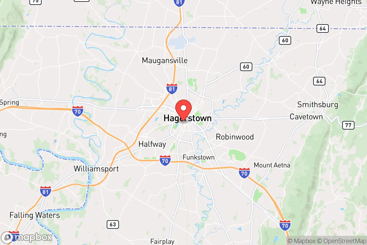
Hagerstown, Maryland, sits in a geographic sweet spot that offers genuine strategic depth for those thinking seriously about resilience, but it also carries real exposure risks that demand clear-eyed assessment. Located 70 miles west of Baltimore and 75 miles northwest of Washington, D.C., the city anchors Washington County in the Appalachian foothills, placing it far enough from major population centers to avoid the worst of any urban collapse scenario, yet close enough that secondary effects—refugee flows, supply chain disruptions, and electromagnetic pulse (EMP) fallout—are not hypotheticals but probabilities. For a conservative-leaning relocator weighing self-sufficiency against proximity to resources, Hagerstown presents a mixed but workable picture: the natural terrain, water access, and agricultural base are genuine assets, but the city's position along the I-81 corridor and near critical infrastructure like the Fort Detrick biodefense lab and the Baltimore-Washington metropolitan area's power grid nodes introduces vulnerabilities that cannot be ignored.
Geographic position and natural advantages for long-term survival
Hagerstown's location in the Great Appalachian Valley gives it a defensive topography that flatland cities simply lack. The city sits at the confluence of the Potomac River's north and south forks, with the Blue Ridge Mountains to the east and the Allegheny Mountains to the west, creating natural chokepoints and defensible ridgelines. This terrain makes Hagerstown less susceptible to the kind of unrestrained urban sprawl that characterizes the I-95 corridor, and it provides multiple escape routes into the deeper wilderness of western Maryland, Pennsylvania, and West Virginia. The area's karst geology—limestone bedrock with natural springs and caves—offers water security that many Mid-Atlantic locations cannot match; the Washington County water table is robust, and private wells are common even in suburban developments. For a relocator thinking about grid-down scenarios, the ability to access groundwater without municipal infrastructure is a significant advantage. Additionally, the region's agricultural heritage means that local food production is not a theoretical exercise—Washington County has over 1,200 farms covering roughly 40% of its land area, with a strong Amish and Mennonite presence that maintains low-tech, horse-powered farming methods. In a prolonged disruption, these communities become de facto food distribution networks, and their cultural insularity means they are less likely to be overwhelmed by transient populations.
Risks, exposures, and proximity to fallout-relevant landmarks
The most serious strategic liability for Hagerstown is its position along the I-81 corridor, a major north-south trucking route that connects the Canadian border to Tennessee. In any mass evacuation scenario—whether from a nuclear incident at the Indian Point plant (now decommissioned but still a spent-fuel storage site), a bioweapon release from Fort Detrick in Frederick (just 20 miles southeast), or a coordinated attack on the D.C. power grid—Hagerstown becomes a natural funnel for displaced populations. The city's own infrastructure, including the Hagerstown Regional Airport and the CSX rail lines running through downtown, are secondary targets in any conflict scenario. More concerning is the proximity to the Raven Rock Mountain Complex (the "underground Pentagon") near Blue Ridge Summit, Pennsylvania, roughly 25 miles northeast. While this facility is a hardened government continuity site, its presence makes the surrounding region a potential target for any adversary seeking to decapitate U.S. command and control. Similarly, the Fort Detrick biodefense labs—which handle select agents like Ebola and anthrax—represent a dual-use risk: both as a potential target and as a source of accidental release. For the prepper mindset, these are not abstract concerns; they are concrete reasons to have a bug-out plan that moves deeper into the Alleghenies, toward places like Cumberland or the Pennsylvania Wilds, within the first 48 hours of any major event.
Practical resilience for a relocator: food, water, energy, and defensibility
For a single individual or family looking to establish a resilient homestead, Hagerstown's practical assets are strong but require deliberate investment. Water is the easiest win: the Potomac River watershed provides surface water, and the limestone aquifers mean that a drilled well (typically 100-300 feet deep) yields 10-20 gallons per minute in most of the county—enough for a household and small-scale irrigation. The growing season runs roughly April through October, with Zone 6b/7a conditions that support apples, corn, beans, squash, and hardy greens; the nearby orchards of the Catoctin Mountains are a fallback for foraging and barter. Energy resilience is more challenging: the region's tree cover is dense, making solar panels less effective without clearing, but wood heat is abundant and cheap—Washington County has over 100,000 acres of hardwood forest, and a cord of seasoned oak or hickory can be had for $200-300. Propane is widely available through local co-ops, and many rural properties already have buried tanks. Defensibility is mixed: the city itself is a typical small city with grid streets and limited chokepoints, but the surrounding rural areas—particularly along the ridges west of town—offer excellent line-of-sight and natural barriers. Properties on the slopes of South Mountain or near the Greenbrier State Park area provide both seclusion and access to the Appalachian Trail corridor for egress. The biggest practical gap is medical resilience: the Meritus Medical Center is a solid regional hospital, but it is a single point of failure for trauma care, and the nearest Level 1 trauma center is in Baltimore or D.C.—both problematic in a crisis. Stockpiling antibiotics, trauma kits, and establishing relationships with local holistic practitioners or the Amish community's natural medicine knowledge is advisable.
The overall strategic picture for Hagerstown is one of calculated trade-offs. It is not a remote redoubt like the Idaho panhandle or the Montana Rockies, but it offers a realistic balance of access and isolation for someone who cannot or will not relocate to the deep wilderness. The city's conservative lean—Washington County voted +24 for Trump in 2020, and the local culture is heavily gun-friendly, church-oriented, and skeptical of federal overreach—means that a like-minded relocator will find social cohesion rather than hostility. The presence of the Hagerstown Police Department and the Washington County Sheriff's Office, both of which maintain active community policing and have mutual-aid agreements with neighboring counties, provides a baseline of order that many urban refugees will lack. The key is to treat Hagerstown as a base of operations rather than a final destination: establish a primary residence with well, garden, and wood heat, but maintain a secondary cache or bug-out location 30-50 miles west in the Alleghenies. In a world where the Baltimore-D.C. axis is a primary risk vector, Hagerstown is close enough to be useful but far enough to survive—provided you do the work before the crisis arrives.
* Values derived from national, state, county, city and local statistics and may differ in a specific area. Last updated: 2026-04-22T01:48:30.000Z
Narrative content on this page is AI-generated and may contain mistakes. Verify any details that matter before acting on them.
ReloMaps may earn a commission from affiliate links at no extra cost to you.