
Photo: Wikipedia
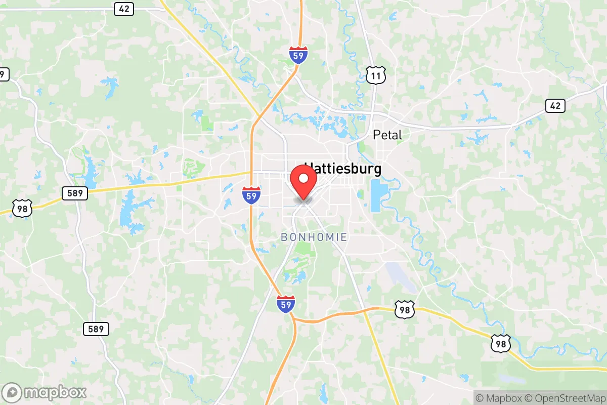
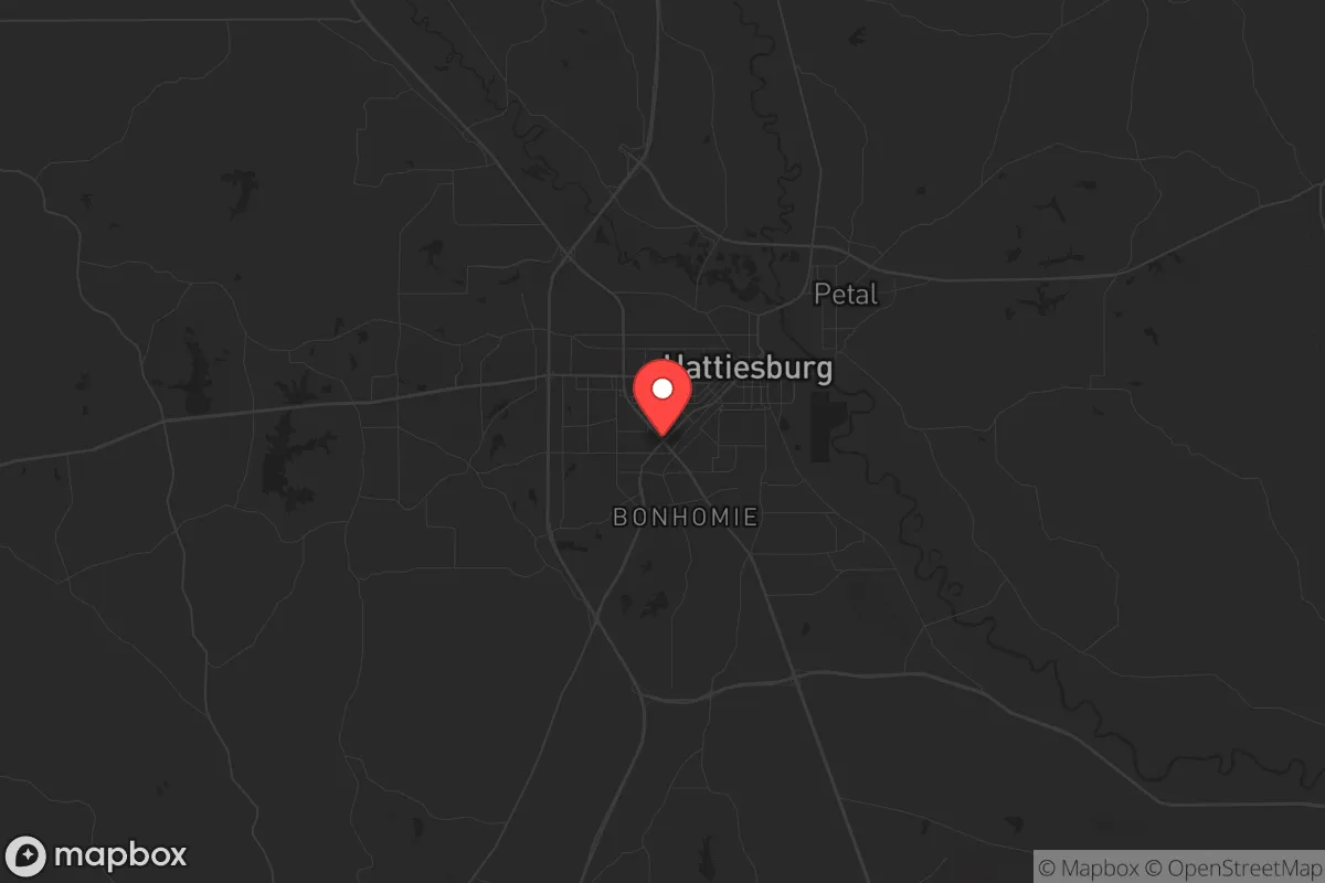
Strategic Assessment of Hattiesburg, MS
Workable tactical position. Some exposure to population density or targets, but generally defensible in a crisis.
What does the Strategic Assessment tell us?
Our Strategic Assessment grades tactical survivability of an area. Major population centers, military targets, fallout zones, natural disasters, and border exposure all drive risk — lower exposure means a more defensible position in a crisis.
This is heavily inspired by Joel Skousen's Strategic Relocation book. Highly recommended you checkout the book ($)What does this tell us?
Our Strategic Assessment grades tactical survivability of an area. Major population centers, military targets, fallout zones, natural disasters, and border exposure all drive risk — lower exposure means a more defensible position in a crisis.
This is heavily inspired by Joel Skousen's Strategic Relocation book. Highly recommended you checkout the book ($)Strategic Pillars

Key Distances
Regional Safe Places
Below is our recommended "safe zones" in Mississippi and the surrounding area based on our strategic heuristics. For most people, it's unrealistic to live in a “safe zone” full-time due to work, family or other personal reasons. They tend to be more rural. However, many of these areas are perfect for second homes and retreat properties that double as a vacation home or even a short-term rental.
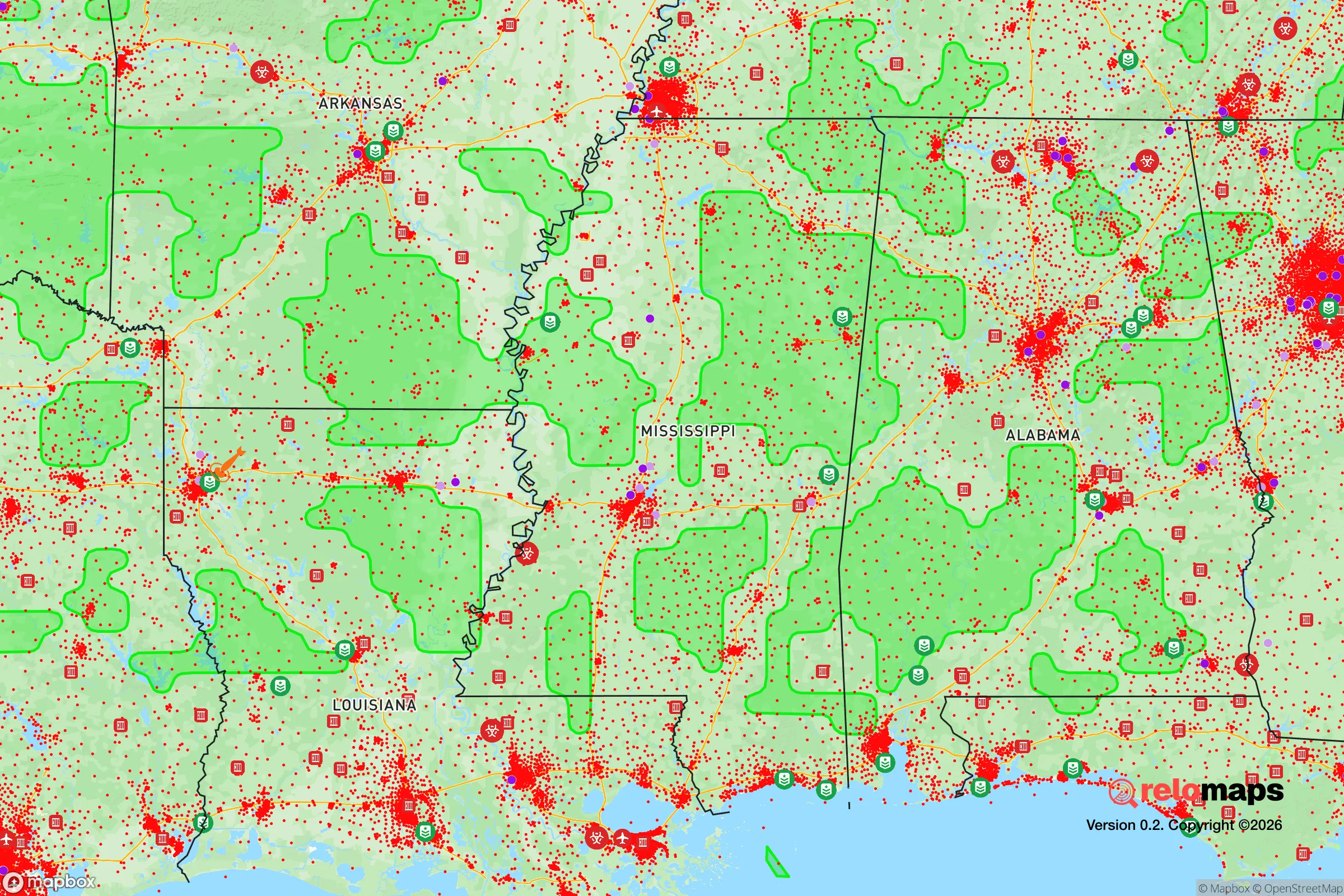
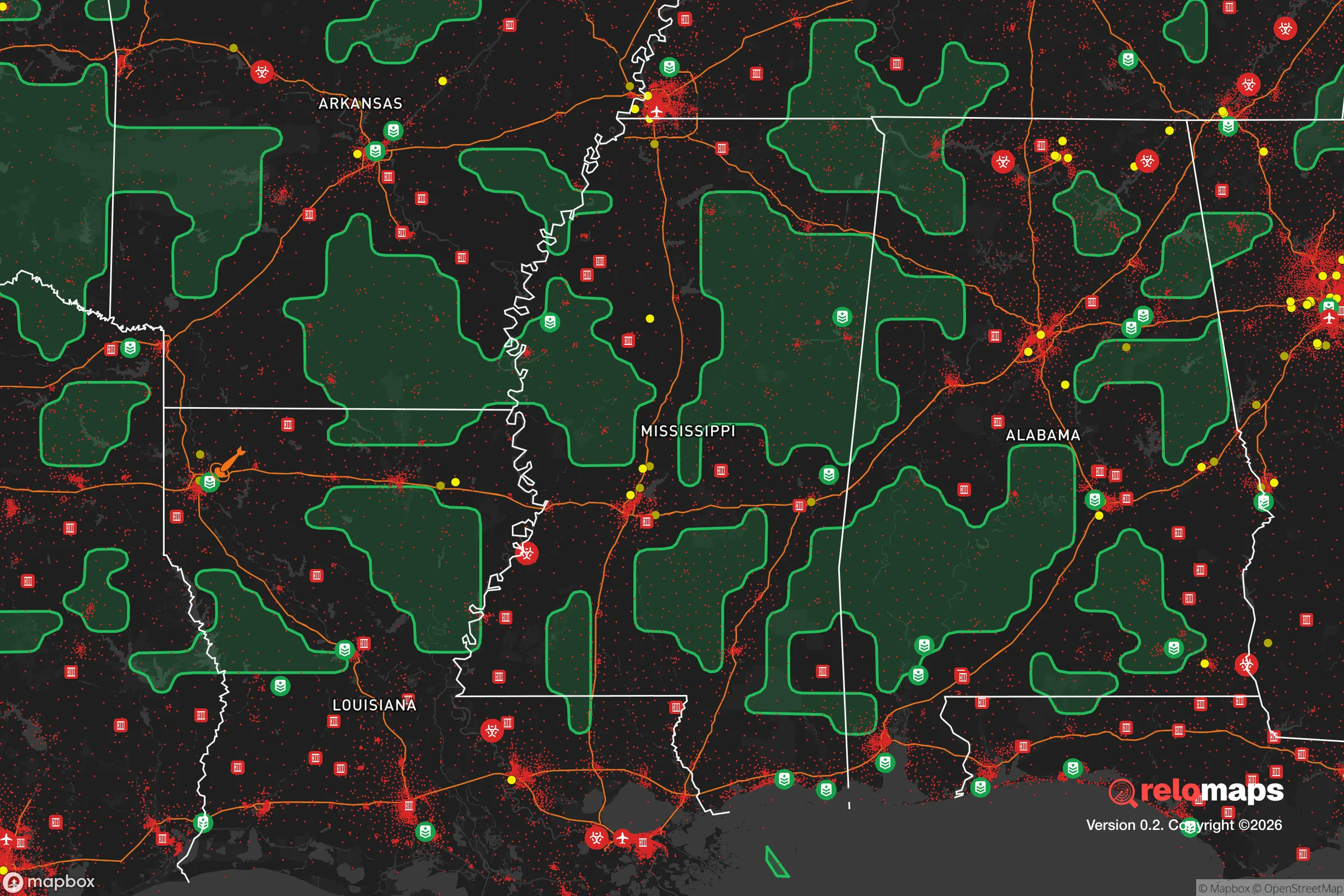
Important Note: For informational purposes only. This does not mean nothing bad ever happens in the green zones. Please use common sense. This is based on public data and modeled with AI. We tried to take a conservative approach but mistakes happen. We update this regularly as new information becomes available.
Solar Generator Recommendations
Backup power matters more here than in safer locations. We've picked three solar generators across budgets and capacity tiers — start with the budget unit if you only need a few essentials, or step up if you want to run a fridge and HVAC for days at a time.

Jackery Portable Power Station Explorer 300
Budget OptionPower on the Go: Weighing only 11 lbs, it's convenient to set up and store with book-sized foldable solar panels

BLUETTI Portable Power Station AC180
Designed for both indoor and outdoor scenarios, AC180 is highly capable as it has a robost capacity and continuous output power.

EF ECOFLOW DELTA Pro Ultra Power Station
Upgraded PickEcoFlow DELTA Pro Ultra is a whole-home energy system designed to grow with your family. Integrated with the Smart Home Panel 2, it scales to meet your evolving energy needs — keeping your home powered, intelligent, and secure through every stage of life.
We earn a commission, at no additional cost to you.
Strategic Assessment Analysis
Hattiesburg, Mississippi, offers a surprisingly strong strategic position for those prioritizing resilience and self-sufficiency in an uncertain future. Its location—roughly 70 miles from the Gulf Coast and 90 miles from the Louisiana border—places it outside the immediate blast and fallout zones of major strategic targets like New Orleans, Mobile, or the Pascagoula shipyards, while still providing access to critical supply chains and regional infrastructure. The city’s nickname, “The Hub City,” reflects its historical role as a railroad and highway crossroads, which in a crisis scenario means multiple egress routes and the potential for decentralized supply lines. For a conservative-leaning relocator concerned with civic unrest, natural disasters, or societal breakdown, Hattiesburg’s mix of rural surroundings, a modest population of roughly 46,000, and a deeply rooted Southern culture of self-reliance makes it a credible base for long-term preparedness.
Geographic position and natural advantages for long-term security
Hattiesburg sits in the Pine Belt region, a heavily forested area that provides natural cover, timber resources, and a relatively low population density compared to the Mississippi Delta or coastal zones. The city is built on the Leaf River, which feeds into the Pascagoula River system—one of the last free-flowing river systems in the lower 48 states. This means reliable freshwater access for those who know how to tap it, plus ample opportunities for hunting, fishing, and foraging in the DeSoto National Forest, which lies just south of the city. The terrain is gently rolling, not mountainous, which limits defensibility in a conventional sense but also avoids the isolation and logistical headaches of remote mountain retreats. The climate is humid subtropical, with mild winters and long growing seasons—ideal for year-round food production. The region’s clay-loam soils, while not perfect for large-scale agriculture, support gardens, orchards, and livestock with proper management. For a relocator thinking in terms of decades, Hattiesburg’s natural endowment is a solid B+.
Risks, exposures, and proximity to fallout-relevant landmarks
No strategic assessment is honest without weighing the downsides. Hattiesburg’s primary risk is its proximity to the Gulf Coast, which makes it vulnerable to hurricane storm surge and inland flooding—though the city itself sits at about 160 feet above sea level, so surge is not a direct threat. The bigger concern is the cascading effects of a major hurricane: power grid failure, supply chain disruption, and an influx of evacuees from coastal cities like Biloxi, Gulfport, and Mobile. In a mass casualty event or prolonged grid-down scenario, Hattiesburg could become a choke point for refugees moving north along I-59 and US-49. The city is also within 100 miles of the Mississippi River’s industrial corridor, which includes chemical plants, refineries, and the Port of Gulfport—all potential targets for sabotage or accident. On the nuclear front, the closest major strategic target is the Naval Air Station in Meridian (about 90 miles north), but Hattiesburg is far enough from any known ICBM silos or major military command centers to avoid primary blast zones. The real fallout risk comes from the Gulf Coast’s petrochemical infrastructure; a strike on the Pascagoula refinery complex could send toxic plumes inland, though prevailing winds typically push east or northeast. For the prepper, the takeaway is that Hattiesburg is not a zero-risk zone, but its risks are manageable with proper planning—unlike living in the shadow of a major city or military base.
Practical resilience for a relocator: food, water, energy, and defensibility
For the individual or family looking to build a resilient homestead, Hattiesburg offers several concrete advantages. Water is abundant: the region’s high water table means shallow wells are viable in most rural areas, and the Leaf River provides a year-round surface source. Rainwater catchment is straightforward given the 55–60 inches of annual rainfall. Food production is feasible: the growing season runs from March to November, and local soil amendments (composted pine bark, poultry litter) are cheap and available. The Pine Belt is also home to a strong hunting culture—deer, turkey, and wild hog populations are robust, and hog hunting is encouraged year-round as pest control. Energy resilience is a mixed bag. The local grid is served by Mississippi Power (a Southern Company subsidiary), which has a mixed reliability record during storms. Solar is viable, with roughly 200 sunny days per year, but tree cover in the Pine Belt can limit panel efficiency. Wood heating is a no-brainer: the region is timber country, and firewood is cheap or free if you have a chainsaw and a truck. Defensibility is where Hattiesburg shines for the prepper mindset. The city itself is not a fortress, but the surrounding rural areas—particularly to the north and east toward the Leaf River Wildlife Management Area—offer low-density, hard-to-navigate terrain. Many properties are accessed by unpaved roads, and the pine forests provide natural concealment. The local culture is heavily armed and self-reliant; Mississippi has some of the most permissive gun laws in the country, including constitutional carry and no state-level red flag laws. In a breakdown scenario, you’ll be surrounded by neighbors who think like you, not by urbanites looking for handouts. The biggest practical weakness is medical infrastructure: Hattiesburg has two hospitals (Forrest General and Merit Health Wesley), but both are regional facilities, not trauma centers. A serious injury in a grid-down scenario would mean a long drive to Mobile or Jackson.
Overall, Hattiesburg presents a compelling strategic picture for the conservative relocator who wants to be close enough to civilization to access supplies and work, but far enough to avoid the worst of urban collapse. It’s not a bug-out bunker in the mountains—it’s a working-class Southern city with a strong sense of community, a forgiving climate, and a culture that still values self-reliance. The risks are real: hurricanes, refugee flows, and the occasional chemical spill. But for someone willing to invest in a well, a solar array, and a good rifle, Hattiesburg offers a solid foundation for riding out the coming storms—both literal and societal. If you’re looking for a place where you can build a life that doesn’t depend on the federal government or the goodwill of a city council, this hub in the Pine Belt deserves a serious look.
* Values derived from national, state, county, city and local statistics and may differ in a specific area. Last updated: 2026-04-30T03:01:58.000Z
Narrative content on this page is AI-generated and may contain mistakes. Verify any details that matter before acting on them.
ReloMaps may earn a commission from affiliate links at no extra cost to you.